

- Usage in publication:
-
- Abrigo limestone*
- Modifications:
-
- Original reference
- Dominant lithology:
-
- Limestone
- Shale
- Quartzite
- AAPG geologic province:
-
- Pedregosa basin
Summary:
Abrigo limestone. Distinguished from other marine calcareous formations of Paleozoic by prevailing thin bedding, and particularly by conspicuous laminated structure produced by alternation of thin irregular sheets of chert with layers of gray limestone; the limestone layers are 2 to 3 inches thick, the chert layers usually thinner. Dominant color dark greenish yellow. Very fissile greenish yellow calcareous shales are generally characteristic feature of lower half of Abrigo. Thickness 770 feet. Rests conformably on Bolsa quartzite and is apparently conformably overlain by Martin limestone (Devonian). In Mount Martin section upper limit of Abrigo formation is defined by a bed of pure white quartzite, 8+/- feet thick. This quartzite is persistent and is always found immediately underlying the Martin limestone, which carries Devonian fossils. It apparently records the consummation of an increasing supply of sandy sediments during the later phases of deposition of Abrigo limestone and contrasts with the more purely calcareous beds of overlying Devonian formation. Age is Middle Cambrian, based on fossils identified by C.D. Walcott (trilobites, brachiopods, pteropods, etc.).
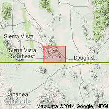
Named for exposures in Abrigo Canyon, 3 mi southwest of Bisbee, [in T. 23 S., R. 23 and 24 E., Cochise Co., AZ.]
Source: US geologic names lexicon (USGS Bull. 896, p. 10); supplemental information from GNU records (USGS DDS-6; Menlo GNULEX).
- Usage in publication:
-
- Abrigo limestone*
- Modifications:
-
- Biostratigraphic dating
- AAPG geologic province:
-
- Basin-and-Range province
Walcott, C.D., 1912, Cambrian Brachiopoda: U.S. Geological Survey Monograph, 51, pt. 1, 872 p.
Summary:
Pg. 186. Abrigo limestone. Discussion of Middle Cambrian BRACHIOPODA OBOLUS MCCONNELLI, collected about 400 feet (122 m) above the bottom of Tombstone Gulch, in Abrigo limestone (see Ransome, 1904, p. 3), in northwest suburb of Bisbee, Cochise County, Arizona.
Source: Publication; GNU records (USGS DDS-6; Menlo GNULEX).
- Usage in publication:
-
- Abrigo limestone*
- Modifications:
-
- Areal extent
- AAPG geologic province:
-
- Basin-and-Range province
Summary:
Pg. 90-91. Abrigo limestone. Analyses of Cambrian limestone from Bisbee district, southeast Arizona by W.F. Hillebrand on samples collected by F.L. Ransome.
Source: Publication; GNU records (USGS DDS-6; Menlo GNULEX).
- Usage in publication:
-
- Abrigo limestone*
- Modifications:
-
- Age modified
- Areal extent
- AAPG geologic province:
-
- Pedregosa basin
Summary:
Abrigo limestone. Extended into Tombstone district, Cochise County, Arizona. Age is Late Cambrian.
Source: Modified from GNU records (USGS DDS-6; Denver GNULEX).
- Usage in publication:
-
- Abrigo limestone*
- Modifications:
-
- Areal extent
- Biostratigraphic dating
- AAPG geologic province:
-
- Pedregosa basin
- Basin-and-Range province
Summary:
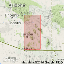
Pg. 48-51. Abrigo limestone. Fossils collected from Abrigo limestone are now classified as Upper Cambrian by Edwin Kirk and C.E. Resser; but it is possible that the higher beds may prove to be Ordovician. [Abrigo limestone said to be present in Whetstone, Dragoon, Swisshelm, Chiricahua, Tucson, Vekol, Patagonia, and Santa Catalina Mountains.]
Source: US geologic names lexicon (USGS Bull. 896, p. 10); supplemental information (in brackets) from GNU records (USGS DDS-6; Denver GNULEX).
- Usage in publication:
-
- Abrigo formation
- Modifications:
-
- Revised
- Redescribed
- Biostratigraphic dating
- AAPG geologic province:
-
- Pedregosa basin
- Basin-and-Range province
Summary:
April 30, 1936. Pg. 461-540. Abrigo formation. In type area, Bisbee district, author divided Ransome's (1904) Abrigo limestone into (descending): newly named Copper Queen limestone (Upper Cambrian), 81 feet thick [81 feet 8 inches according to GNU records (USGS DDS-6; Denver GNULEX, Aug. 23, 1984)]; Abrigo formation [restricted] (Upper Cambrian), 420 feet thick; and applied newly named Cochise formation (Middle Cambrian) to beds below CREPICEPHALUS TEXANUS and HESPERASPIS BUTLER, 200 feet thick [290? feet]. In Whetstone Mountains, author divided the Abrigo limestone into (descending): Rincon limestone (new), Abrigo formation [restricted], Cochise formation (new), and Pima sandstone (new). In Santa Catalina Mountains, divided Abrigo limestone into (descending): Peppersauce Canyon sandstone (new), Abrigo formation [restricted], Southern Belle quartzite (new), and Santa Catalina formation (new). Age is Late Cambrian.
[GNC remark (ca. 1938, US geologic names lexicon, USGS Bull. 896, p. 10): The USGS has not yet had occasion to consider these innovations.]
Source: US geologic names lexicon (USGS Bull. 896, p. 10); supplemental information from GNU records (USGS DDS-6; Denver GNULEX).

- Usage in publication:
-
- Abrigo limestone
- Modifications:
-
- Areal extent
- AAPG geologic province:
-
- Pedregosa basin
Summary:
Abrigo limestone. Present in Huachuca Mountains, Cochise County, Arizona. Age is Cambrian.
Source: Modified from GNU records (USGS DDS-6; Denver GNULEX).
- Usage in publication:
-
- Abrigo limestone
- Modifications:
-
- Age modified
- AAPG geologic province:
-
- Pedregosa basin
- Basin-and-Range province
Summary:
Abrigo limestone. Age is Middle and Late Cambrian.
[GNU staff remark (August 23, 1984): Uncertain as to whether subdivided into or equivalent to (ascending): Pima formation, Cochise formation, Peppersauce Canyon sandstone, Copper Queen formation, and Rincon limestone.]
Source: Modified from GNU records (USGS DDS-6; Denver GNULEX).
- Usage in publication:
-
- Abrigo formation*
- Modifications:
-
- Redescribed
- Areal extent
- AAPG geologic province:
-
- Pedregosa basin
Summary:
Applied name Abrigo formation, rather than Abrigo limestone. Extended into Little Dragoon Mountains, Arizona. Divided into lower, middle, and upper members. Overlies Bolsa quartzite (Cambrian); underlies Martin limestone (Devonian).
Source: Modified from GNU records (USGS DDS-6; Denver GNULEX).
- Usage in publication:
-
- Abrigo formation
- Modifications:
-
- Areal extent
- AAPG geologic province:
-
- Basin-and-Range province
Summary:
Abrigo formation. Present in Sierrita Mountains, Arizona. Age is Cambrian.
Source: Modified from GNU records (USGS DDS-6; Denver GNULEX).
- Usage in publication:
-
- Abrigo limestone
- Modifications:
-
- Areal extent
- Age modified
- Biostratigraphic dating
- AAPG geologic province:
-
- Pedregosa basin
Summary:
Abrigo limestone. Used in the unrestricted sense. Overlies Bolsa quartzite (Cambrian); underlies Morenci shale (Devonian). Section measured near Dos Cabezas, Cochise County, Arizona. Age is Cambrian and Ordovician. Contains fossils of Ordovician age.
Source: Modified from GNU records (USGS DDS-6; Denver GNULEX).
- Usage in publication:
-
- Abrigo limestone*
- Modifications:
-
- Revised
- Age modified
- Biostratigraphic dating
- AAPG geologic province:
-
- Pedregosa basin
Summary:
Pg. 8, 9, 16-20, pl. 5. Abrigo limestone. Abrigo formation (restricted) of Stoyanow (1936) is rejected. In Cochise County, Arizona, described as limestone, limestone mottled with shale, shale, sandstone, edgewise conglomerate, and a little quartzite. Thickness varies but is 770 feet at type locality. Measured sections and fossil collections (trilobites) from Little Dragoon Mountains (803 feet), Dragoon Mountains (835 feet), Swisshelm Mountains (778 feet), Whetstone Mountains (749 feet), and Tombstone Hills (844 feet), in Cochise County, Arizona, are presented. Underlies Upper Devonian Martin limestone; overlies Bolsa quartzite. Age is Middle and Late Cambrian. Report includes geologic map.
Source: US geologic names lexicon (USGS Bull. 1200, p. 13); supplemental information from GNU records (USGS DDS-6; Denver GNULEX).
- Usage in publication:
-
- Abrigo limestone
- Modifications:
-
- Revised
- AAPG geologic province:
-
- Pedregosa basin
Summary:
Restricted Abrigo limestone of Swisshelm Mountains, as measured by Gilluly (1956), to lower part. The Abrigo limestone of Jones and Bacheller (1953) near Dos Cabezas not warranted. Age is Middle Cambrian.
Source: Modified from GNU records (USGS DDS-6; Denver GNULEX).
- Usage in publication:
-
- Abrigo Formation*
- Modifications:
-
- Areal extent
- AAPG geologic province:
-
- Basin-and-Range province
Summary:
Abrigo Formation. Study area in Galiuro Mountains, Pinal County, Arizona. Author considers use of term Abrigo Formation more appropriate than Abrigo Limestone in and north of Santa Catalina Mountains. Overlies Bolsa Quartzite; underlies Martin Limestone. Thickness 529 feet. Age is Cambrian.
Source: Modified from GNU records (USGS DDS-6; Denver GNULEX).
- Usage in publication:
-
- Abrigo Formation
- Modifications:
-
- Not used
- AAPG geologic province:
-
- Basin-and-Range province
Summary:
"Cambrian rocks undifferentiated" mapped in western part of Superior 7.5-min quadrangle, Pinal County, Arizona. Upper part consists of quartzite. Lower part is poorly sorted, grayish-to-reddish-brown mudstone, arkosic sandstone, pebble conglomerate, and graywacke. Is 0 to 360 feet thick. Disconformably underlies Martin Limestone; unconformably overlies diabase (Precambrian).
Source: GNU records (USGS DDS-6; Menlo GNULEX).

- Usage in publication:
-
- Abrigo Limestone*
- Modifications:
-
- Mapped
- AAPG geologic province:
-
- Pedregosa basin
Summary:
Abrigo Limestone. Exposed in all areas of older [lower Paleozoic] rocks except in northeastern part of Dragoon quadrangle. Lower contact gradational with Bolsa quartzite. Overlain disconformably by Martin formation. Authors correlate portions of Abrigo with formations named by Stoyanow [1936]. Age of faunas range from late Middle Cambrian through early two-thirds of Late Cambrian. Most of the genera are common to the western U.S. (trilobites of CEDARIA, ELVINIA, CREPICEPHALUS zones, etc). Report includes geologic map.
Source: Modified from GNU records (USGS DDS-6; Denver GNULEX).
- Usage in publication:
-
- Abrigo Limestone*
- Modifications:
-
- Principal reference
- Revised
- AAPG geologic province:
-
- Pedregosa basin
Summary:
Pg. F8-F13, F37, F38-F40, pl. 1. Abrigo Limestone. In Mule Mountains, Stoyanow's (1936) Abrigo Formation (restricted) and Cochise Formation are rejected, and Copper Queen Limestone is revised to upper member of Abrigo Limestone. Type section of Ransome (1904) remeasured (= middle part section 6, this report, p. F38, pl. 1); total thickness 713 feet. Divided into (ascending): shaly member (Middle Cambrian), 252 feet; ribbed limestone member (Middle and Upper Cambrian), 201 feet; sandy member (Upper Cambrian, Dresbachian and Franconian), about 166 feet; and Copper Queen Limestone Member (Upper Cambrian, Franconian), about 94 feet. Conformably and gradationally overlies Bolsa Quartzite; disconformably underlies Martin Limestone (Devonian). Contact between the Abrigo (of Ransome, 1904) and overlying Martin Limestone is lowered about 70 feet on basis of lithologic correlation with fossiliferous beds in section measured in western part of Mule Mountains. Ransome (1904, p. 32) placed contact at top of pure white quartzite. Fossils identified from type section and reported on by A.R. Palmer (in Gilluly, 1956, p. 23) are keyed to remeasured Mount Martin section. Age is Middle and Late Cambrian. Report includes columnar sections, fossil lists.
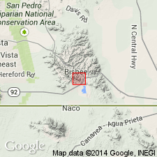
Type section: on opposite side of Escabrosa Ridge from Abrigo Canyon, on north slope of Mount Martin, in SW/4 SE/4 sec. 7, T. 23 S., R. 24 E., [Bisbee quadrangle], Cochise Co., AZ (citing Ransome, 1904, p. 31).
Source: Publication.
- Usage in publication:
-
- Abrigo Limestone*
- Modifications:
-
- Mapped
- AAPG geologic province:
-
- Basin-and-Range province
- Pedregosa basin
Summary:
Abrigo Limestone. Measured and described sections: (1) in W/2 sec. 13, T. 18 S., R. 18 E., Pima County, Arizona, 808 feet thick; and (2) in SW/4 sec. 34, T. 18 S., R. 19 E., Cochise County, Arizona, 867 feet thick.
Source: Modified from GNU records (USGS DDS-6; Denver GNULEX).
- Usage in publication:
-
- Abrigo Formation*
- Modifications:
-
- Revised
- Adopted
- AAPG geologic province:
-
- Basin-and-Range province
Summary:
Abrigo Formation. Revised in study area, in northern Santa Catalina Mountains, southeastern Arizona. Stoyanow's (1936) Peppersauce Canyon Sandstone and Abrigo Formation (restricted) are collectively referred to as Peppersauce Member, uppermost member of Abrigo, 335 feet thick. Stoyanow's Southern Belle Quartzite reduced in rank to middle member of Abrigo, 70 feet thick. Beds of Stoyanow's Santa Catalina Formation reallocated to Three C Member (new), basal member of Abrigo, 330 feet thick. Age is Middle and Late Cambrian.
Source: Changes in stratigraphic nomenclature, 1967 (USGS Bull. 1274-A, p. A2); supplemental information from GNU records (USGS DDS-6; Denver GNULEX).
- Usage in publication:
-
- Abrigo Formation*
- Modifications:
-
- Revised
- AAPG geologic province:
-
- Pedregosa basin
- Basin-and-Range province
Summary:
Abrigo Formation. Used in the unrestricted sense. Divided into lower, middle, and upper members across region. Present in Swisshelm, Little Dragoon, Dos Cabezas, northern Chiricahua, Galiuro, Santa Catalina, and Whetstone Mountains. In Swisshelm Mountains, Cochise County, Arizona, rocks previously excluded from formation by Epis and Gilbert (1957) are included in upper member. Age is Middle Cambrian and Late Cambrian (Dresbachian and Franconian). Report includes correlation chart. [The use of Abrigo in Dos Cabezas and Chiricahua Mountains later rejected by Hayes (1972).]
Source: Modified from GNU records (USGS DDS-6; Denver GNULEX).
- Usage in publication:
-
- Abrigo(?) Formation*
- Modifications:
-
- Areal extent
- AAPG geologic province:
-
- Basin-and-Range province
Summary:
Abrigo(?) Formation. Provisionally extended into Palomas Mountains, Yuma County, Arizona. Thickness 150 feet. Overlies Bolsa(?) Quartzite; underlies Martin(?) Formation. No fossils were found except for animal tracks or worm trails. Age is Cambrian.
Source: Modified from GNU records (USGS DDS-6; Denver GNULEX).
- Usage in publication:
-
- Abrigo Formation*
- Modifications:
-
- Areal extent
- AAPG geologic province:
-
- Pedregosa basin
- Basin-and-Range province
Summary:
Abrigo Formation (Abrigo Limestone only used in type area). Eastern limit of formation delineated in southeastern Arizona. Not recognized in Dos Cabezas and northern Chiricahua Mountains, replaced with Coronado Sandstone and lower part of El Paso Limestone. Divided into (descending): Copper Queen Member (revised), sandy member, middle member, and lower member. Overlies Bolsa Quartzite. Age is Middle and Late Cambrian.
Source: Modified from GNU records (USGS DDS-6; Denver GNULEX).
- Usage in publication:
-
- Abrigo Formation*
- Modifications:
-
- Areal extent
- AAPG geologic province:
-
- Basin-and-Range province
Summary:
Abrigo Formation. Small outcrops mapped near Twin Buttes, Twin Buttes 15-min quadrangle, Pima County, Arizona. Consists of quartzite, shale, and limestone. Overlies Bolsa Quartzite (Cambrian); disconformably underlies Martin Formation (Devonian). Age is Cambrian. Shown in cross section.
Source: GNU records (USGS DDS-6; Menlo GNULEX).
- Usage in publication:
-
- Abrigo Formation*
- Modifications:
-
- Overview
- AAPG geologic province:
-
- Pedregosa basin
- Basin-and-Range province
Summary:
Summary discussion. Abrigo Formation. Divided into (ascending): lower member, middle member, sandy member, and Copper Queen Member. Extensive list of fossils (trilobites, brachiopods) identified from all four members. Measured section at Brandenburg Mountain, in N/2 SW/4 sec. 7, T. 6 S., R. 17 E., northern Galiuro Mountains, Pinal County, Arizona, is described. In that section Abrigo is 603 feet thick, overlies Bolsa Quartzite and underlies Martin Formation. Correlated regionally; conditions of deposition interpreted on basis of regional correlations and sedimentary structures. Age is Middle and Late Cambrian.
Source: Modified from GNU records (USGS DDS-6; Denver GNULEX).
- Usage in publication:
-
- Abrigo Formation*
- Modifications:
-
- Mapped 1:24k
- Dominant lithology:
-
- Shale
- Siltstone
- Limestone
- Sandstone
- AAPG geologic province:
-
- Pedregosa basin
Summary:
Abrigo Formation. Brown to gray thin crinkly-bedded shale, siltstone, limestone, and some sandstone; locally contains trilobite fossils. Thickness about 250 m; varies widely because of deformation and metamorphism. Age is Middle and Late Cambrian.
Source: Publication.
- Usage in publication:
-
- Abrigo Formation*
- Modifications:
-
- Revised
- AAPG geologic province:
-
- Basin-and-Range province
GNU Staff, 1995, Draft copy of Force, E.R., Geology and mineral resources of a Tucson-to-San Manuel transect across the Santa Catalina Mountains, southeastern Arizona, IN Mineral resource studies along the Sierrita-Mogollon transect, Arizona-New Mexico, USGS Bull. 2042-A (unpublished): U.S. Geological Survey Digital Data Series, DDS-6, 1 CD-ROM., release 3
Summary:
[Early draft, unpub. ms.] Abrigo Formation. Uppermost 50+/- m removed and assigned to new informal Mt. Lemmon unit. Conformably overlies Bolsa Quartzite (Middle Cambrian); disconformably underlies Martin Formation (Upper Devonian) or Mt. Lemmon unit (Lower and/or Middle Devonian). Age is Middle and Late Cambrian.
Study area in Santa Catalina Mountains, Pima County, Arizona.
Source: Modified from GNU records (USGS DDS-6; Denver GNULEX).
For more information, please contact Nancy Stamm, Geologic Names Committee Secretary.
Asterisk (*) indicates published by U.S. Geological Survey authors.
"No current usage" (†) implies that a name has been abandoned or has fallen into disuse. Former usage and, if known, replacement name given in parentheses ( ).
Slash (/) indicates name conflicts with nomenclatural guidelines (CSN, 1933; ACSN, 1961, 1970; NACSN, 1983, 2005, 2021). May be explained within brackets ([ ]).