

- Usage in publication:
-
- Wanakah member*
- Modifications:
-
- Original reference
- Dominant lithology:
-
- Gypsum
- Shale
- Limestone
- Sandstone
- AAPG geologic province:
-
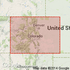
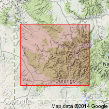
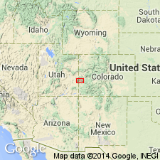
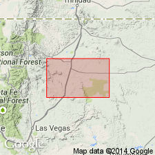
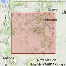
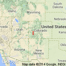
- San Juan Mountains province
Summary:
Pg. 172. Wanakah member of Morrison formation. Basal member of Morrison formation in Ouray district, southwestern Colorado. Thickness 124.9 feet. Divisible into 3 lithologic units (descending): (1) shale division (the basal "McElmo" of Cross), 47 feet; (2) sandstone ("Upper La Plata" of Cross), 19 feet; (3) basal shale, limestone, and breccia (the "Pony Express beds," called by miners "Pony Express limestone" and "Pony Express contact"), 58.5 feet. Rests on Upper(?) Jurassic sandstone and underlies the thick sandstone member of the Morrison. Age is Late Jurassic.
Named from exposures in Wanakah mine, Ouray district, southwestern CO.
Source: US geologic names lexicon (USGS Bull. 896, p. 2270).
- Usage in publication:
-
- Wanakah marl member*
- Modifications:
-
- Revised
- Reference
- AAPG geologic province:
-
- Paradox basin
- San Juan basin
Summary:
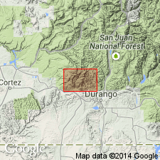
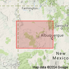
As a member in the lower part of the Morrison formation, is restricted to a 50 to 100 ft unit of sandy concretionary marl and massive yellow-white sandstone above the Bilk Creek sandstone member of the Morrison and beneath the newly named Junction Creek sandstone member of the Morrison. Lower contact raised to top of a 1 1/2 to 2 ft bed of red carnelian sandstone. A lower limestone or gypsum beneath the Bilk Creek formerly considered to be the basal member of the Wanakah is reassigned as the Pony Express limestone member (new) of the Morrison. Wanakah member of Morrison formerly included rocks above the Entrada sandstone and beneath an unnamed shale and sandstone sequence in the upper part of the Morrison. Measured sections at Animas City Mountain [near Durango], La Plata Co, CO in the San Juan basin, on the San Miguel River opposite the mouth of Bilk Creek, San Miguel Co, and at Uravan, Montrose Co, CO, at Dunton, Dolores Co, McElmo Canyon, Montezuma Co, CO in the Paradox basin. Questionably identified on the Dry Cimarron River, Union Co, NM on the Sierra Grande uplift. Of Late Jurassic age.
Source: GNU records (USGS DDS-6; Denver GNULEX).
- Usage in publication:
-
- Wanakah formation*
- Modifications:
-
- Revised
- AAPG geologic province:
-
- San Juan basin
- Paradox basin
Summary:
Some rocks previously assigned as the basal members of the Morrison formation in some reports and to the lower part of the La Plata sandstone in other reports are reassigned in this report to the Wanakah formation. As thus revised, the Wanakah includes rocks above the Entrada sandstone and beneath the Junction Creek sandstone (removed from Morrison formation; raised to formation rank) and is divided (ascending) into the Pony Express limestone member, Bilk Creek sandstone member, and a marl member. Wanakah has been mapped (geologic map) as an undivided unit along the east edge of the area, and in the southwest and west part of the area in La Plata Co, CO in the San Juan basin and in adjoining Montezuma Co, CO in the Paradox basin. Nomenclature chart. Ranges between 25 to 150 ft thick. Measured section. Late Jurassic age.
Source: GNU records (USGS DDS-6; Denver GNULEX).
- Usage in publication:
-
- Wanakah formation*
- Modifications:
-
- Revised
- AAPG geologic province:
-
- Las Vegas-Raton basin
Summary:
Lies conformably above Ocate sandstone (new) and beneath Morrison formation. Measured sections. Geologic map. Present east of Ocate anticline and in subsurface in SW1/4 SW1/4 sec 15, T23N, R24E, Mora Co, NM in Las Vegas-Raton basin. Fragments of jasper commonly occur. Many beds are wedge or lens shaped. Has an average thickness of 25 ft. In eastern part of area is indistinguishable from overlying Morrison formation. May be locally absent. Assigned to Jurassic.
Source: GNU records (USGS DDS-6; Denver GNULEX).
- Usage in publication:
-
- Wanakah formation*
- Modifications:
-
- Not used
Summary:
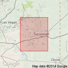
Beds above the Entrada sandstone and below the Morrison formation in the Tucumcari-Sabinoso area, Quay and San Miguel Cos, NM in the Palo Duro basin, are assigned to the newly named Bell Ranch Formation. The new formation replaces use of Wanakah formation, the name formerly applied to these beds.
Source: GNU records (USGS DDS-6; Denver GNULEX).
- Usage in publication:
-
- Wanakah Formation*
- Modifications:
-
- Revised
- AAPG geologic province:
-
- Piceance basin
- Paradox basin
Summary:
Divided into: 1) Pony Express Limestone Member at base, a discontinuous 1-4 ft thick, fetid, pelletal to aphanitic, silty gray limestone; 2) middle part of interbedded gypsum, friable gypsiferous sandstone, and soft gypsiferous mudstone; 3) Junction Creek Sandstone Member, a discontinuous, fine-grained, friable, highly cross-bedded light-gray to light-yellowish-gray eolian sandstone; 4) and an upper part of light-gray silty mudstone containing thin beds of gray, in part algal, limestone in Piceance and Paradox basins. Inclusion of Junction Creek as a member is a redefinition of the Junction Creek and the Wanakah. Assigned to the Late Jurassic.
Source: GNU records (USGS DDS-6; Denver GNULEX).
- Usage in publication:
-
- Wanakah Formation*
- Modifications:
-
- Areal extent
- AAPG geologic province:
-
- Paradox basin
Summary:
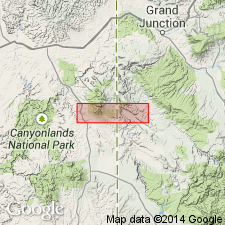
Geographically extended into San Juan Co, southeast UT in the Paradox basin. Name applied to all Middle Jurassic rocks of the San Rafael Group that lie above the Entrada Sandstone. Unconformably underlies Upper Jurassic Morrison Formation. Cross sections. Of Middle Jurassic age.
Source: GNU records (USGS DDS-6; Denver GNULEX).
- Usage in publication:
-
- Wanakah Formation*
- Modifications:
-
- Areal extent
- AAPG geologic province:
-
- Paradox basin
Summary:
Overlies and laterally replaces Entrada Sandstone. Recognized on cross sections in the Paradox basin between Stevens Canyon, CO to area between White Rock and Casa Colorado Rock, UT east of Dry Valley and rte 163 where it tongues into Slick Rock Member of Entrada. Divisible into the middle and upper members separated by the bed at Black Steer Knoll. Unconformably underlies Salt Wash Member of Morrison Formation. The unconformity is designated the J-5. The bed at Black Steer Knoll is a prominent double sandstone ledge 13 m thick in the western Dry Valley. The bed thins northward and eastward from the valley; it commonly overhangs the middle member; it can be recognized on these sections as far as Wilson, UT where it forms the bed 1.5 m below the top of the Entrada. Middle Jurassic age.
Source: GNU records (USGS DDS-6; Denver GNULEX).
- Usage in publication:
-
- Wanakah Formation*
- Modifications:
-
- Areal extent
- AAPG geologic province:
-
- Paradox basin
- Piceance basin
Summary:
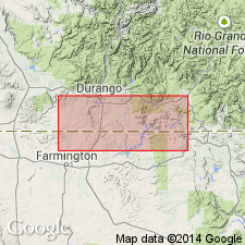
Term Summerville Formation previously applied to some beds in report area are reassigned to the Tidwell unit or lower part of the Morrison Formation where they lie above the J-5 unconformity, or to the Wanakah Formation where they lie below the J-5 unconformity. Summerville truncated beneath the J-5 32 km northwest of Moab, UT. Summerville does not extend into eastern UT or western CO. Wanakah mapped in eastern part of report area in Paradox and eastern part of Piceance basins.
Source: GNU records (USGS DDS-6; Denver GNULEX).
- Usage in publication:
-
- Wanakah Formation*
- Modifications:
-
- Revised
- AAPG geologic province:
-
- San Juan basin
Summary:
Divided into the Todilto Limestone Member and an upper unnamed clastic member in the Chama basin of the San Juan basin of north-central NM. Assigned to the Middle Jurassic.
Source: GNU records (USGS DDS-6; Denver GNULEX).
- Usage in publication:
-
- Wanakah Formation
- Modifications:
-
- Not used
Summary:
Not used in map area (Las Vegas-Raton basin and Sierra Grande uplift). Rocks between Exeter Sandstone (rather than Entrada Sandstone) below and Morrison Formation above assigned to Bell Ranch Formation.
Source: GNU records (USGS DDS-6; Denver GNULEX).
- Usage in publication:
-
- Wanakah Formation*
- Modifications:
-
- Reference
- Revised
- AAPG geologic province:
-
- Black Mesa basin
- San Juan basin
Summary:
Replaces use of Summerville Formation in northwest NM, San Juan basin and northeast AZ, Black Mesa basin, where it is divisible into the Todilto Limestone Member (stratigraphic rank changed from formation and assigned to Wanakah as its basal member), Beclabito and Horse Mesa Members (both new names). Definition followed in this report is that of Baker and others (1947) and Imlay (1952). Todilto is equivalent to the Pony Express Member of CO, lower sandstone of Beclabito is equivalent to Bilk Creek Member of CO. Horse Mesa correlates with the lower unit of Junction Creek Sandstone of CO. Reference section established at Horse Mesa, AZ and NM in sec 17, T38N, R31E, and secs 26, 27, T19N, R21W where all three members are present. Overlies Entrada Sandstone; underlies Bluff Sandstone Member of Morrison Formation; intertongues with Cow Springs Sandstone. Assigned a Middle Jurassic age. Lower part intertongues with and is replaced by Entrada in southeast UT.
Source: GNU records (USGS DDS-6; Denver GNULEX).
- Usage in publication:
-
- Wanakah Formation*
- Modifications:
-
- Revised
- AAPG geologic province:
-
- San Juan basin
Summary:
Middle Jurassic Wanakah Formation of San Rafael Group divided into the Todilto Limestone Member (base), Beclabito Member, and the newly named Mesita Member (top) in the Acoma Sag area of Cibola Co, NM, San Juan basin. Rocks assigned to Mesita in this report have been assigned to the Bluff, Cow Springs, and Zuni Sandstones and to the sandstone at Mesita in earlier reports. Mesita is equivalent to, but does not connect with Horse Mesa Member, upper member of Wanakah to northwest in San Juan basin. Wanakah overlies Entrada Sandstone and underlies eolian facies of Recapture Member of Morrison Formation. Measured section; cross section; nomenclature chart.
Source: GNU records (USGS DDS-6; Denver GNULEX).
- Usage in publication:
-
- Wanakah Formation*
- Modifications:
-
- Overview
- AAPG geologic province:
-
- San Juan basin
Summary:
Trace fossils and a nonmarine mollusk have been found in 15-20 ft of the upper member of Wanakah Formation at several localities in the southern part of the Chama basin, NM. Upper member overlies the Todilto Limestone Member, underlies the Morrison Formation, and is of Middle Jurassic, middle and late Callovian age. Is correlated to the Pine Butte Member of the Sundance Formation of northwest CO and WY, and to the Curtis and Summerville Formations of UT. Presence of the nonmarine mollusk indicates lacustrine environment for the upper part of the upper member. Upper member consists of basal diamictite that contains angular clasts one inch to one ft diameter of limestone, sandstone, or quartzite in a sandstone matrix, middle sandstone with lesser amount of mudstone and siltstone, and an upper thick- to thin-bedded, ripple-laminated sandstone with thin, gray to brown, sandy mudstone and limestone that are as much as 55 ft thick. Sandstone is generally very fine to fine grained, well-sorted, subround, calcite or anhydrite mixed with calcite and barite cement.
Source: GNU records (USGS DDS-6; Denver GNULEX).
- Usage in publication:
-
- Wanakah Formation*
- Modifications:
-
- Areal extent
- Overview
- AAPG geologic province:
-
- Paradox basin
Summary:
Name extended to area of Kane Springs, San Juan Co, UT to Uravan, Montrose Co, CO, Paradox basin. Rocks here assigned to Wanakah or Tidwell Member of Morrison Formation have been previously assigned to Summerville Formation (not used) by other workers. [Rocks assigned to Summerville by other workers in area of Slick Rock, San Miguel Co, CO to Uravan, CO in Paradox basin are also included with Wanakah or Tidwell Member of Morrison Formation by O'Sullivan (1989, USGS OC-133).] Much of Summerville is truncated beneath J-5 unconformity about 20 mi northwest of Moab, UT (northwest of study area). Wanakah overlies Entrada Sandstone and basal part laterally interfingers with Entrada through beds K and L and the bed at Long Park. Wanakah ranges in thickness from 3-95 ft though is absent at West Coyote, UT; thickens eastward from West Coyote. Where thick, Wanakah divided into (ascending) siltstone, middle, and upper members. Bed at Mesa Creek of Wanakah replaces most of siltstone member from Sunrise Canyon (measured section 13) to La Sal Creek A (measured section 7). Middle Jurassic age.
Source: GNU records (USGS DDS-6; Denver GNULEX).
- Usage in publication:
-
- Wanakah Formation*
- Modifications:
-
- Areal extent
- AAPG geologic province:
-
- Paradox basin
- San Juan basin
Summary:
Wanakah Formation unconformably overlies Entrada Sandstone. In AZ, it and NM is divided into (ascending): Todilto Limestone, Beclabito Horse Mesa Members. In adjacent southwest CO, it is divided into (ascending): Pony Express Limestone, Bilk Creek, and an upper member. Pony Express = Todilto, Bilk Creek and the upper member = Beclabito. The basal unit (of 3) of Junction Creek Sandstone = Horse Mesa. Isopach maps of The Members and = rocks shows interval present throughout report area (NM, CO, UT, AZ; San Juan, Black Mesa, and Paradox basins. Todilto (and Pony Express) may be thick as 120 ft; was deposited in a large restricted marine basin. The Beclabito (and Bilk and upper member) also present throughout area described above (isopach map); may be 150+ ft thick; is a marginal marine and sabkha deposit. The Horse Member (and lower unit of Junction Creek) are also present over area described above, may be as thick as 80 ft; is of lacustrine origin. Middle Jurassic age.
Source: GNU records (USGS DDS-6; Denver GNULEX).
- Usage in publication:
-
- Wanakah Formation*
- Modifications:
-
- Overview
- Reference
- AAPG geologic province:
-
- Piceance basin
- Paradox basin
- San Juan Mountains province
Summary:
Wanakah Formation of San Rafael Group. Unconformably underlies Morrison Formation; separated by J-5 unconformity. Overlies Entrada Sandstone of San Rafael Group.
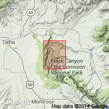
Ranges between 45 and 125 ft thick in report area. Divided into the (ascending): Pony Express Limestone Member (2-59 ft thick), Bilk Creek Sandstone Member (20-33 ft thick), and the beds at Sawpit (a newly used informal term for the upper red to red-brown sandstone and siltstone, 15-62 ft thick). The beds at Sawpit were referred to as the marl member of the Wanakah Formation in earlier reports. The descriptive term marl is inappropriate for the beds. Gypsum present in beds at Sawpit. Is the upper formation of the San Rafael in the report area. Conformably overlies Entrada Sandstone of San Rafael Group and unconformably underlies Morrison Formation. Reference section 59.6 ft thick designated and measured on east-facing cliffs bordering the Gunnison River western Black Canyon, Montrose Co. Cross sections. Areal extent map; formation extends from the vicinity of the Black Canyon of the Gunnison in Delta Co in the Piceance basin, south across eastern Montrose and San Miguel Cos in the Paradox basin, and in Ouray Co in the San Juan Mountain province. Nomenclature charts. Of Callovian, Middle Jurassic age.
Source: GNU records (USGS DDS-6; Denver GNULEX).
- Usage in publication:
-
- Wanakah Formation*
- Modifications:
-
- Revised
- AAPG geologic province:
-
- Piceance basin
Summary:
Some of the nomenclature assigned to Jurassic rocks in the western Black Canyon at the Smith Fork of the Gunnison River, Gunnison Co., CO, Piceance basin is revised. Rocks previously assigned to the upper part of the Wanakah Formation are reassigned to the lower part of the Morrison Formation of Late Jurassic age. In previous reports on this area, Wanakah was thought to underlie Salt Wash Member of Morrison. In this report, the name Tidwell Member of Morrison is applied to the former upper Wanakah. Tidwell is divisible into (ascending): bed A, lower gypsiferous beds, and upper beds. Tidwell overlies beds of Sawpit at top of Wanakah beneath the J-3 unconformity and underlies Salt Wash Member. The unit "bed at Smith Fork" which lies in the middle part of the upper beds of the Tidwell replaces use of name Junction Creek Sandstone for the 73 ft thick, gray to white, fine grained, cross-bedded sandstone. The bed at Smith Fork pinches out southward; it is not present at South Smith Fork measured section; it dips under younger rocks less than 1 mi east of Smith Fork measured section. Cross section.
Source: GNU records (USGS DDS-6; Denver GNULEX).
For more information, please contact Nancy Stamm, Geologic Names Committee Secretary.
Asterisk (*) indicates published by U.S. Geological Survey authors.
"No current usage" (†) implies that a name has been abandoned or has fallen into disuse. Former usage and, if known, replacement name given in parentheses ( ).
Slash (/) indicates name conflicts with nomenclatural guidelines (CSN, 1933; ACSN, 1961, 1970; NACSN, 1983, 2005, 2021). May be explained within brackets ([ ]).