- Usage in publication:
-
- Three Forks shales*
- Modifications:
-
- Original reference
- Dominant lithology:
-
- Shale
- Limestone
- AAPG geologic province:
-
- Montana folded belt
Summary:
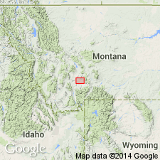
Three Forks shales. In Three Forks region consists of (descending): (1) yellow laminated sandstone, 25 feet; (2) dark bluish-drab or black argillaceous limestones, 45 feet; (3) highly fossiliferous green, purple, and black argillaceous and calcareous shale, 70 feet; (4) grayish-brown compact, close-grained limestone, 15 to 20 feet; (5) reddish and brownish-yellow calcareous and argillaceous shales, 65 feet. Rests on Jefferson limestone and underlies Madison limestone. [Recognized throughout Montana, western Wyoming, southeastern Idaho, and northern Utah.] Age is Late Devonian.
[Named for fine development of formation at junction of three forks of Missouri River, near Three Forks, Montana. In some areas the formation becomes so calcareous that it is called Threeforks limestone. ca. 1936, spelled Threeforks by the USGS.]
Source: US geologic names lexicon (USGS Bull. 896, p. 2144).
- Usage in publication:
-
- Three Forks shale
- Modifications:
-
- Areal extent
- AAPG geologic province:
-
- Central Montana uplift
Summary:
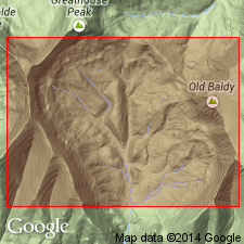
Three Forks shale. In Half Moon Pass section, Fergus County, Montana, is 250 feet thick. Disconformably overlies Dry Creek shale; underlies Madison limestone. Contains poorly preserved corals tentatively considered Late Devonian age.
Source: Modified from GNU records (USGS DDS-6; Denver GNULEX).
- Usage in publication:
-
- Three Forks shale
- Modifications:
-
- Revised
- AAPG geologic province:
-
- Montana folded belt
Summary:
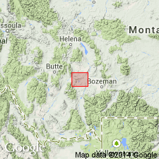
Pg. 14, 17 (fig. 4). Three Forks shale. Stratigraphically restricted at top to exclude about 60 feet of yellow sandstone herein named Sappington sandstone.
Source: US geologic names lexicon (USGS Bull. 1200, p. 3876-3877).
- Usage in publication:
-
- Three Forks limestone*
- Modifications:
-
- Areal extent
- AAPG geologic province:
-
- Idaho Mountains province
Summary:
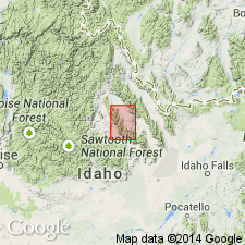
Pg. 1095, 1110-1111, pl. 1. Three Forks limestone. Described in Borah Peak quadrangle, Idaho, where it is about 250 feet thick, overlies Grand View dolomite and underlies Milligen formation. Age is Late Devonian.
Source: US geologic names lexicon (USGS Bull. 1200, p. 3876-3877).
- Usage in publication:
-
- Three Forks formation
- Modifications:
-
- Revised
- [Principal reference]
- AAPG geologic province:
-
- Montana folded belt
Summary:
Pg. 1421. Three Forks formation. Consists of dark brown dolomitic shale and shaly dolomite at base, green plastic (probably in part bentonitic) shale interbedded with fossiliferous black limestone in the middle, and yellow-weathering sandy limestone and calcareous sandstone at top. Sandy zone at top was named Sappington sandstone by Berry and assigned to the Mississippian because of distinctive SYRINGOTHYRIS. However, it can be demonstrated that the normal shale facies of the Three Forks, bearing typical CYRTOSPIRIFER, is interbedded with the sandy facies bearing SYRINGOTHYRIS, and that the sandy facies grades laterally into typical shale of the Three Forks. Writers consider Sappington sandstone a local member of the Three Forks. Thickness at Logan 150 feet. Overlies Jefferson formation; underlies Lodgepole limestone of Madison group. Recommended that term Potlatch be used in subsurface in preference to Three Forks and Jefferson in Sweetgrass arch area.
[Type section:] north side of Gallatin River at Logan, in sec. 24, T. 2 N., R. 2 E., Gallatin Co., MT.
Source: Publication; US geologic names lexicon (USGS Bull. 1200, p. 3876-3877).
- Usage in publication:
-
- Three Forks shale
- Modifications:
-
- Areal extent
- Overview
- AAPG geologic province:
-
- Montana folded belt
Summary:
Extends into extreme southwest MT, south of Boulder batholith and west of Yellowstone National Park within parts of Beaverhead, Madison, and Gallatin Cos, MT, Montana folded belt province. Sappington member occurs in upper part. No complete exposures found; partial exposures indicate unit conformably overlies Jefferson formation; underlies Madison group. Thickness at measured section at Arrowhead Mountain, Centennial Range, Beaverhead Co, is 221 ft. Isopach map of Devonian. Correlation chart. Cross section. Late Devonian age.
Source: GNU records (USGS DDS-6; Denver GNULEX).
- Usage in publication:
-
- Three Forks shale
- Modifications:
-
- Areal extent
- Overview
- AAPG geologic province:
-
- Bighorn basin
Summary:
Extended into Bighorn Mountains, Big Horn Co, WY, Bighorn basin. Three Forks is over 125 ft thick at measured section in Cottonwood Canyon (sec 34, T57N, R93W). In uppermost black fissile shales conodonts ICRIODUS and APATHAGNOTHUS are found along with spores tentatively assigned to SPORANGITES. Correlation with Devonian rocks at nearby localities is shown on plate 1. Isopach map of post-Beartooth Butte formation shown on plate 2. Stratigraphic chart. Overlies Jefferson? limestone; underlies Madison limestone. Late Devonian age.
Source: GNU records (USGS DDS-6; Denver GNULEX).
- Usage in publication:
-
- Three Forks formation
- Modifications:
-
- Revised locally
- AAPG geologic province:
-
- Montana folded belt
Summary:
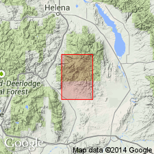
Pg. 1388-1390 (table 1), 1396-1399. Three Forks formation [restricted locally]. In vicinity of Sacajawea Peak, Montana, consists of (ascending): (1) greenish-yellow to red, hackly shale containing limonite nodules and calcareous siltstone breccias, 85 to 95 feet, [previously considered upper part of Jefferson, see Sloss and Laird, 1947]; (2) yellow-brown, medium- to thick-bedded, massive, ledge-forming limestone containing numerous calcite veinlets, 20 feet; and (3) pale yellow-brown to gray, thin-bedded, calcareous siltstone or silty limestone, includes in lower and upper parts green shale, and at top a persistent gray limestone, 45 feet. Total thickness 155 to 156 feet. Separated from overlying Sappington formation by disconformity; [lower boundary of the Sappington is here extended several feet downward to include beds which others call Three Forks.] Underlain by Jefferson formation. Age is Devonian.
Source: Publication.
- Usage in publication:
-
- Three Forks shale*
- Modifications:
-
- Age modified
- Areal extent
- AAPG geologic province:
-
- Montana folded belt
Summary:
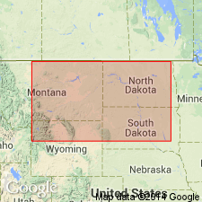
Extended into area of southern Elkhorn Mountains, Montana folded belt province. Exposed along flanks of anticline and related structures in Devils Fence quad, Jefferson and Broadwater Cos, MT; also outcrops near Elkhorn, Jefferson Co. Conformably overlies Jefferson dolomite; conformably underlies Lodgepole limestone of Madison group. Thickness is 300-375 ft. Geologic maps; composite section; generalized stratigraphic section; list of Upper Devonian fauna. In places is intruded by diorite porphyry sills and small composite or hybrid intrusive bodies. Assigned Late Devonian and Mississippian age [presumably based on fossils and stratigraphic position].
Source: GNU records (USGS DDS-6; Denver GNULEX).
- Usage in publication:
-
- Three Forks formation*
- Modifications:
-
- Revised
- Reference
- Areal extent
- Dominant lithology:
-
- Shale
- Siltstone
- AAPG geologic province:
-
- Central Montana uplift
- Sweetgrass arch
- Williston basin
Summary:
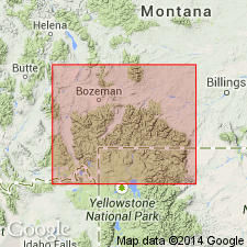
Revised in subsurface of Williston basin in that Three Forks formation: 1) overlies Birdbear formation (new) of Jefferson group (rank raised); 2) lower contact placed at base (rather than top) of an unnamed breccia and associated shale unit that thins eastward and rises stratigraphically from base to middle Three Forks by interfingering; and 3) the unnamed unit and some anhydrite beds are a tongue of upper Potlatch anhydrite of western MT recognized at base of Three Forks east of 111 deg meridian designated Potlatch member of Three Forks. Standard [reference] subsurface section designated as interval between 10,076 and 10,310 ft in Mobil Producing Co. No. 1 Birdbear well in C SE NW1/4 sec 22, T149N, R91W, Dunn Co, ND, Williston basin, where formation consists of olive, red-green and gray shale that may be dolomitic, anhydritic, silty and olive to red siltstone that may be very fine grained, dolomitic, shaly, conglomeratic, white anhydrite beds near base. Gray quartzitic sandstone (Sanish sand of informal use) at top. Changes to red dolomitic anhydritic shale and siltstone to east. Cross section, correlation chart, E-log characteristics areal limits figures. Overlain by Bakken formation. Of Late Devonian age in report area. Extends into Central Montana uplift and Sweetgrass arch.
Source: GNU records (USGS DDS-6; Denver GNULEX).
- Usage in publication:
-
- Three Forks formation
- Modifications:
-
- Revised
- Overview
- AAPG geologic province:
-
- Montana folded belt
Summary:
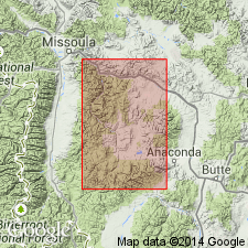
In western portion of study area Three Forks divided into Potlatch member in lower part and green shale member in upper part. In eastern portion Three Forks consists only of a carbonate member. Study area includes southern part of Montana folded belt province. Eastward pinchout of Potlatch occurs from a few miles east of Bridger Range extending south-southwest toward West Yellowstone. East-west facies change occurs in Three Forks along line from north-center of area to northern part of Bridger Range then southwest toward Ennis and southern end of Gravelly Range. West of line upper part of unit consists mostly of fissile calcareous gray-green shale; east of line upper part consists mostly of thin-bedded, dense to fine-grained, yellow-brown to gray, argillaceous limestone interbedded with calcareous shale or siltstone partings. Farther east upper part consists of thin-bedded, fine-grained to dense, orange dolomite with thin gray-green shale partings. Three Forks is absent in southern part of Beartooth Mountains and in most of Yellowstone Park. Overlies Jefferson formation; disconformably underlies Sappington formation. Isopach maps of Potlatch and green shale and carbonate members. Several measured sections in cross sections. Devonian age.
Source: GNU records (USGS DDS-6; Denver GNULEX).
- Usage in publication:
-
- Three Forks Formation?
- Modifications:
-
- Areal extent
- AAPG geologic province:
-
- Montana folded belt
Summary:
Tentatively extends unit into northwest part of Garnet Range in west-central MT, Montana folded belt province. In easternmost part of mapped area, upper 150 ft of Jefferson Formation is covered with float of orange-yellow calcareous siltstone which may be Three Forks. Upper part of covered section in fault contact with overlying Madison Limestone. Stratigraphic chart. Late Devonian (Cassadagan) age.
Source: GNU records (USGS DDS-6; Denver GNULEX).
- Usage in publication:
-
- Three Forks Formation*
- Modifications:
-
- Areal extent
- AAPG geologic province:
-
- Montana folded belt
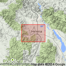
Summary:
Maps unit in northern Boulder batholith area in Lewis and Clark and Jefferson Cos, MT in Montana folded belt province. Outcrops trend northwest-southeast from northwestern to central part of mapped area, then trends easterly to southeastern edge of map. Consists of a lower green shale, 240 ft thick; limestone, 25-50 ft thick; blue-black shale, 35-90 ft thick; and an upper light-colored scapholite-diopside calc-hornfels, 50 ft thick, probably contact-metamorphic equivalent of Sappington Sandstone Member of Three Forks Formation. Conformably overlies Upper Devonian Jefferson Formation; underlies Mississippian Madison Group. Green shale contains fossils belonging to Platyclymenia Stage (fourth of six stages of Late Devonian). Late Devonian and Early Mississippian age. Fossil list.
Source: GNU records (USGS DDS-6; Denver GNULEX).
- Usage in publication:
-
- Three Forks shale*
- Modifications:
-
- Overview
- AAPG geologic province:
-
- Montana folded belt
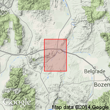
Summary:
Is the same unit as Peale's (1893) Three Forks shales. Outcrops rare. Geologic map. A section 400 ft thick measured in sec 10, T1N, R1W. A section 400 ft thick measured in sec 1, T2N, R1E. A section 350 ft thick measured in sec 9, T1S, R1W. Lies above Jefferson dolomite and below Lodgepole limestone. Is very fossiliferous--brachiopods, cephalopods, ostracodes, crinoids, bryozoans. Regarded as Late Devonian and Early Mississippian age. Is of shallow water nearshore origin. Geologic map shows it in Gallatin, Jefferson, and Broadwater Cos, MT in the Montana folded belt province.
Source: GNU records (USGS DDS-6; Denver GNULEX).
- Usage in publication:
-
- Three Forks Shale
- Modifications:
-
- Revised
- Overview
- AAPG geologic province:
-
- Montana folded belt
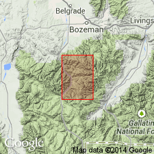
Summary:
Divided into two informal members, Potlatch member in lower part and carbonate member in upper part. [In previous report (McMannis, 1962), which included area of this report, author did not refer to Potlatch as an informal unit]. Area of report is within Montana folded belt province. Thickness of Potlatch ranges from 90-130 ft except where tectonically thinned to 50 ft on Squaw Creek [now Storm Castle Creek] near Timber Butte. Thickness of carbonate member ranges from 25 ft on Moose Creek and Mount Blackmore to about 60 ft at Dudley Creek and Squaw Creek. Conformably overlies Jefferson Limestone with sharp contact; disconformably underlies Sappington Formation. Mapped with other Upper Devonian units including Maywood Formation, Jefferson Limestone and Sappington Formation.
Source: GNU records (USGS DDS-6; Denver GNULEX).
- Usage in publication:
-
- Three Forks Shale*
- Modifications:
-
- Overview
- AAPG geologic province:
-
- Montana folded belt
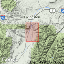
Summary:
Mapped mainly in north half of quad, Park Co, MT, Montana folded belt province. Conformably overlies Jefferson Dolomite; conformably underlies limestones of Madison Group. No thickness specified. Late Devonian and Early Mississippian age.
Source: GNU records (USGS DDS-6; Denver GNULEX).
- Usage in publication:
-
- Three Forks Formation*
- Modifications:
-
- Principal reference
- Revised
- AAPG geologic province:
-
- Central Montana uplift
- Montana folded belt
- Sweetgrass arch
- Williston basin
- Yellowstone province
Summary:
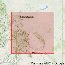
Pg. N7+; 1962, Billings Geol. Soc. Gdbk., 13th Ann. Field Conf., p. 47-50. Three Forks Formation. Divided into (ascending): (1) Logan Gulch Member, chiefly yellowish-gray and grayish-red argillaceous limestone breccia and shale breccia, 111 feet; (2) Trident Member, chiefly greenish-gray, light-olive-gray, and yellowish-gray calcareous to slightly calcareous fossiliferous clay shale, 73 feet; and (3) Sappington Member, siltstone, shale, and limestone, 57 feet. Total thickness 241 feet. Overlies Jefferson Formation; unconformably underlies the Lower Mississippian "dark shale unit" or, where absent, Lodgepole Formation. Age is Late Devonian to Early Mississippian.
Type section: on north bank of Gallatin River at Logan, in SW/4 SE/4 sec. 25, T. 2 N., R. 2 E., [Logan 7.5-min quadrangle], Gallatin Co., MT.
Source: Publication; Changes in stratigraphic nomenclature, 1964 (USGS Bull. 1224-A, p. A14).
- Usage in publication:
-
- Three Forks Formation
- Modifications:
-
- Areal extent
- AAPG geologic province:
-
- Great Basin province
- Green River basin
- Idaho Mountains province
- Montana folded belt
- Snake River basin
- Wasatch uplift
- Yellowstone province
Summary:
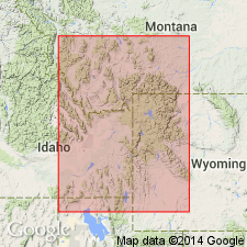
Pg. 2568 (fig. 1), 2570 (fig. 2), 2594-2599. Three Forks Formation. Recognized in southwestern Montana and western Wyoming (absent in west-central Wyoming). Includes (descending) Sappington, Trident, and Logan Gulch Members of Sandberg (1965). Lies above Jefferson Formation. Separated from overlying Lodgepole Formation by the "dark shale unit." [Age is considered Late Devonian to earliest Mississippian (earliest Famennian to earliest Tournaisian); see fig. 2 and p. 2599 (this report), Sandberg, 1963 (USGS Prof. Paper 475-C, art. 64, p. C17-C20) and Gutschick and others, 1962 (Billings Geol. Soc. Gdbk., 13th Ann. Field Conf., p. 79-89).]
Logan Gulch is earliest Famennian, CHEILOCERAS-Stufe (TO II) zone, Trident is middle Famennian, PLATYCLYMENIA-Stufe (TO III-IV) zone; Trident and Logan Gulch Members = Beirdneau Formation of northeastern Utah and southeastern Idaho. Sappington is late Famennian, CLYMENIA (TO V) and WOCKLUMERIA (TO VI) zones, and Tournaisian, lower part of GATTENDORFIA (CU I) zone; = Leatham Formation of northeastern Utah and southeastern Idaho.
Source: Publication.
- Usage in publication:
-
- Three Forks Formation*
- Modifications:
-
- Overview
- Areal extent
- AAPG geologic province:
-
- Bighorn basin
- Central Montana uplift
- Green River basin
- Montana folded belt
- Wind River basin
- Yellowstone province
Summary:
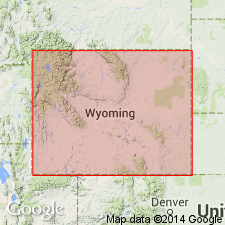
Consists of Sappington, Trident and Logan Gulch Members, in descending order. Cross section shows southeast truncation from Logan, MT to southeast flank of Beartooth Mountains, WY by regional unconformity beneath dark shale unit of Devonian and Mississippian age. In WY consists mostly of Logan Gulch with overlying Trident extending only several miles into northwest corner of State; Sappington is truncated in area of Gallatin Range, MT. Figure 2 shows eastern limit extending from west of Billings, MT south through Gros Ventre Range, WY. Occurs in Central Montana uplift, Montana folded belt and Yellowstone provinces and Bighorn, Wind River and Greater Green River basins. Measured sections of Logan Gulch only. At section in Beartooth Mountains, Logan Gulch is 15 ft thick; 56 ft thick at section in Absaroka Range. Conformably overlies Birdbear Member of Jefferson Formation; unconformably underlies Devonian and Mississippian dark shale unit. Correlation chart. Late Devonian age throughout most of area (extends into Early Mississippian age where upper part of Sappington is present in MT).
Source: GNU records (USGS DDS-6; Denver GNULEX).
- Usage in publication:
-
- Three Forks Formation*
- Modifications:
-
- Biostratigraphic dating
- Overview
- AAPG geologic province:
-
- Central Montana uplift
- Montana folded belt
Summary:
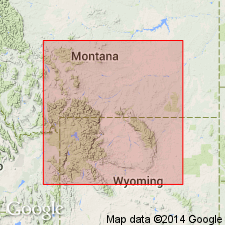
Underlies increasingly older beds of Madison eastward. The upper member, Sappington Member, of latest Devonian and earliest Mississippian age underlies upper tongue of Cottonwood Canyon Member (new) of Lodgepole Limestone in southern MT in Montana folded belt province and Central Montana uplift. Trident Member middle member of Three Forks of Late Devonian age underlies upper tongue of Cottonwood Canyon Member of Madison Limestone in southern MT and northern MT. Eastward in northern WY the Trident, then the Logan Gulch Member, basal member of Three Forks of Late Devonian age underlies the lower tongue of the Cottonwood Canyon Member of the Madison. Sappington Member correlates with lower part and lower tongue of Cottonwood Canyon Member of Madison. Conodont zones described in Trident and Sappington.
Source: GNU records (USGS DDS-6; Denver GNULEX).
- Usage in publication:
-
- Three Forks Formation*
- Modifications:
-
- Overview
- AAPG geologic province:
-
- Montana folded belt
- Sweetgrass arch
Summary:
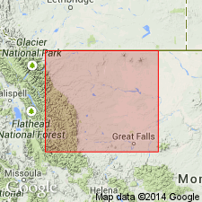
Sappington Member of Three Forks Formation is mapped in southern Sweetgrass arch (parts of Teton and Cascade Cos) and in eastern Montana folded belt province (Lewis and Clark Co). Sappington is continuous with a unit to the north in Glacier, Toole, Liberty, Pondera, and Teton Cos, MT in Sweetgrass arch that is called Exshaw Formation (a Canadian term adopted in this report). The Sappington and Exshaw correlate with the Bakken Formation of Williston basin of MT and ND. These three units are of Devonian and Mississippian age.
Source: GNU records (USGS DDS-6; Denver GNULEX).
- Usage in publication:
-
- Three Forks Limestone*
- Modifications:
-
- Overview
- AAPG geologic province:
-
- Idaho Mountains province
Summary:
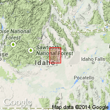
Mapped as narrow northwest striking exposure in northeastern part of quad, north of Mackay, Custer Co, ID, Idaho Mountains province. Consists of argillaceous limestone and calcareous shale, in part yellow. No thickness given. Overlies Grand View Dolomite; underlies Milligen Formation. Assigned Late Devonian age.
Source: GNU records (USGS DDS-6; Denver GNULEX).
- Usage in publication:
-
- Three Forks Formation*
- Modifications:
-
- Mapped
- AAPG geologic province:
-
- Sweetgrass arch
Summary:
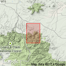
Three Forks Formation. Includes tentatively identified members (not separately mapped): Sappington(?), pale-red to light-brown thin-bedded to platy siltstone and a few thin light-brown dolomite beds, about 25 feet; Trident(?), light-gray to green massive calcareous claystone, about 15 feet; and Logan Gulch(?), light-gray to green thin-bedded to platy sandstone and a few layers of light-gray dolomite, about 30 feet thick. Unconformably lies below Mississippian Madison Group; lies above Jefferson Dolomite. Age is Late Devonian to Early Mississippian.
Source: Publication.
- Usage in publication:
-
- Three Forks Formation*
- Modifications:
-
- Overview
- AAPG geologic province:
-
- Montana folded belt
- Sweetgrass arch
Summary:
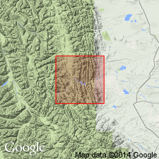
Mapped undivided with underlying Jefferson Formation in this report; separately mapped in Sawtooth Ridge (GQ-381), Patricks Basin (GQ-453), Arsenic Peak (GQ-597) and Castle Reef (GQ-711) quads. Exposed in Wagner Basin, Home Gulch, west side of Mortimer Gulch, Palmer Flats and West Fork of Beaver Creek, along east face of ridge which extends north from Allan Mountain through upper reaches of Grouse Creek, in upper reaches of South Fork of Deep Creek and on southwest end of Slategoat Mountain. Thickness is variable; locally thins to 50 ft in northern part of study area and ranges up to 589 ft at southwest end of Slategoat Mountain. Conformably overlies Birdbear Member (rank reduced in GQ-381 and subsequent mapping by Mudge) of Jefferson; unconformably underlies Allan Mountain Limestone. Geologic map; correlation chart; measured sections; fossil list. Contains Famennian (Late Devonian) brachiopod PUGNOIDES MINUTUS. Late Devonian age in southern part of area, but also contains 2-3 ft of Early Mississippian age rocks in northern part of area.
Source: GNU records (USGS DDS-6; Denver GNULEX).
- Usage in publication:
-
- Three Forks Formation*
- Modifications:
-
- Areal extent
- AAPG geologic province:
-
- Montana folded belt
- Snake River basin
Summary:
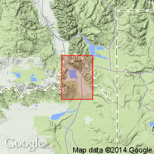
Occurs in Henrys Lake Mountains, Gallatin Co, MT, Montana folded belt province and Fremont Co, ID, Snake River basin. Unit is 115 ft thick. Unconformably overlies Jefferson Formation; unconformably underlies Madison Group. Assigned Late Devonian and Early Mississippian age.
Source: GNU records (USGS DDS-6; Denver GNULEX).
- Usage in publication:
-
- Three Forks Formation*
- Modifications:
-
- Biostratigraphic dating
- AAPG geologic province:
-
- Idaho Mountains province
- Montana folded belt
- Sweetgrass arch
Summary:
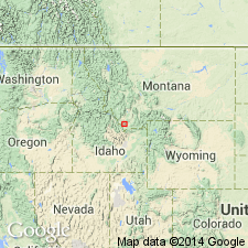
Divided into the Logan Gulch (22 m thick) and the overlying Sappington (4 m thick) Members in a composite stratigraphic section near Monarch in the Little Belt Mountains, Cascade Co, MT on the Sweetgrass arch. Evidence for Mississippian age of Sappington has not been found. Assigned to the Famennian in the Monarch section. Sappington considered Late Devonian and Mississippian? (a change from the previous designation of Late Devonian and Early Mississippian). Sappington is in the Upper POLYGNATHOS STYRIACUS, Middle BISPATHODUS COSTATUS, and SIPHONODELLA PRAESULCATA conodont zones. Thickness and lithofacies maps of Trident Member which extends from ID in the Idaho Mountains province across western MT in the Montana folded belt province and the Sweetgrass arch, and of the Sappington Member which has an areal extent similar to the Trident.
Source: GNU records (USGS DDS-6; Denver GNULEX).
- Usage in publication:
-
- Three Forks Formation*
- Modifications:
-
- Overview
- AAPG geologic province:
-
- Montana folded belt
Summary:
Underlies (in fault contact) Paine Limestone (raised in rank), basal formation of Tendoy Group (new name) in the Tendoy Mountains, southwest MT in the Montana folded belt province. Is a sequence of shallow-water carbonate and terrigenous rocks. All three members, (ascending order: Logan Gulch, Trident, and Sappington) can be identified in the Bell-McKenzie Divide section (T11S, R10W), Beaverhead Co, MT. Is of Late Devonian age.
Source: GNU records (USGS DDS-6; Denver GNULEX).
For more information, please contact Nancy Stamm, Geologic Names Committee Secretary.
Asterisk (*) indicates published by U.S. Geological Survey authors.
"No current usage" (†) implies that a name has been abandoned or has fallen into disuse. Former usage and, if known, replacement name given in parentheses ( ).
Slash (/) indicates name conflicts with nomenclatural guidelines (CSN, 1933; ACSN, 1961, 1970; NACSN, 1983, 2005, 2021). May be explained within brackets ([ ]).

