

- Usage in publication:
-
- Summerville formation*
- Modifications:
-
- Named
- Dominant lithology:
-
- Mudstone
- Sandstone
- AAPG geologic province:
-
- Paradox basin
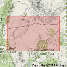
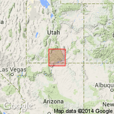
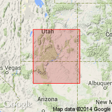
Summary:
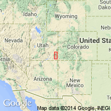
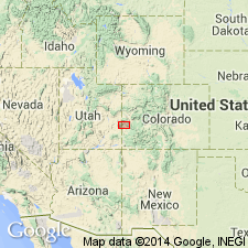
Named for exposures on Summerville Point, near head of Summerville Wash, Emery Co, UT as the youngest of four formations of the San Rafael group. Type section measured at Summerville Point, near head of Summerville Wash, northern San Rafael Swell. Has a greater areal extent than the underlying Curtis formation (new). Is found in the Waterpocket Fold, in the Henry Mountains, throughout the region from the Swell to the Dolores River, Co, in Paradox basin. Consists of thin alternating beds of chocolate-colored gypsiferous mudstone and well laminated sandstone, with some red clay near the base. Is 163 ft thick at type. Increases in thickness to south to 331 ft at Drunk Man's Point. Thins east to 55 ft at Salt Valley and 90 ft thick near Dolores River where the Curtis is missing, and the Summerville overlies the Entrada sandstone (new). Unconformably underlies Morrison formation. Was deposited in shallow, quiet water, probably in the arm of the sea. Is unfossiliferous. Probably of [Late] Jurassic age.
Source: GNU records (USGS DDS-6; Denver GNULEX).
- Usage in publication:
-
- Summerville formation*
- Modifications:
-
- Areal extent
- AAPG geologic province:
-
- Plateau sedimentary province
- Paradox basin
Summary:
Extended south to the Kaiparowits region, Plateau sedimentary province from its original area in the San Rafael Swell, Paradox basin. Mapped in Kane and Garfield Cos. Is one of four formations--Carmel formation (first use), Entrada sandstone, Curtis and Summerville formations (listed in ascending order)--of the San Rafael group. Assigned to the Upper Jurassic. Measured sections.
Source: GNU records (USGS DDS-6; Denver GNULEX).
- Usage in publication:
-
- Summerville formation*
- Modifications:
-
- Areal extent
- AAPG geologic province:
-
- Black Mesa basin
- Plateau sedimentary province
- San Juan basin
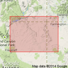
Summary:
Pg. 3 (fig. 2), 39-42, strat. sections, pls. 1, 3. Summerville formation of San Rafael group. Described in Navajo country. Throughout the area it is divisible into an upper sandy facies and a lower silty facies, similar to type locality. Overlies Entrada sandstone in central part of area and Todilto limestone in eastern part. In some places, underlies Bluff sandstone (here considered upper formation of San Rafael group); in eastern, northern, and western parts of area, tongues and grades laterally into Cow Springs sandstone. Thickness 57 to 213 feet. Unit here assigned to Summerville has been assigned to Wanakah by other workers. Correlation of Summerville from San Rafael Swell to Bluff, Utah, is well established. From Bluff, the formation is traceable throughout eastern part of Navajo country and is here correlated with the "buff shale and brown-buff sandstone members of Morrison formation" (Kelley and Wood, 1946, USGS Oil and Gas Inv. Prelim. Map 47) in Laguna-Lucero area of New Mexico. Age is Late Jurassic.
Source: Publication; US geologic names lexicon (USGS Bull. 1200, p. 3766-3767).
- Usage in publication:
-
- Summerville Formation
- Modifications:
-
- Revised
- AAPG geologic province:
-
- Plateau sedimentary province
Summary:
A marginal facies of Summerville Formation of San Rafael Group in Kane Co, UT, Plateau sedimentary province, named White Point Sandstone Member of Summerville. Rocks of the White Point were mapped as undifferentiated part of Summerville, as part of Salt Wash Member of Morrison Formation, and as Bluff Sandstone in earlier reports. White Point overlies Escalante Member (new) of Entrada. [Probably Late Jurassic age.]
Source: GNU records (USGS DDS-6; Denver GNULEX).
- Usage in publication:
-
- Summerville Formation
- Modifications:
-
- Not used
Summary:
Term not used in San Juan Co, UT. All of the Summerville is beveled out eastward by an unconformity at base of Upper Jurassic Morrison Formation, and is absent in the Moab area. Name Wanakah Formation extended from southwest CO to southeast UT. Wanakah represents all the Middle Jurassic rocks above the Entrada Sandstone and below the Morrison. Wanakah is equivalent to parts of San Rafael Group that are older than the type Summerville.
Source: GNU records (USGS DDS-6; Denver GNULEX).
- Usage in publication:
-
- Summerville Formation
- Modifications:
-
- Not used
Summary:
Term Summerville Formation previously applied to some beds in report area are reassigned to the Tidwell unit or lower part of the Morrison Formation, where they lie above the J-5 unconformity, or to the Wanakah Formation where they lie below the J-5 unconformity. Summerville truncated beneath the J-5 32 km northwest of Moab, UT. Summerville does not extend into eastern UT or western CO.
Source: GNU records (USGS DDS-6; Denver GNULEX).
- Usage in publication:
-
- Summerville Formation*
- Modifications:
-
- Revised
- AAPG geologic province:
-
- Paradox basin
Summary:
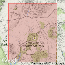
As the upper formation of the San Rafael Group, upper contact modified in that Summerville unconformably underlies Tidwell Member, the basal member of the Morrison Formation over a large area in the San Rafael Swell, UT and east to area near the Green River, UT in the Paradox basin. The unconformity, called the J-5, is both angular and erosional, and is recognized as a widespread break at the base of the Morrison. Selection of the unconformity as the upper Summerville contact follows Gilluly who recognized that type of contact relationship in the Swell in 1929. Tidwell is a slope-forming unit above Summerville and beneath the Salt Wash Member of the Morrison that was included by some of the earlier workers as part of the Summerville. Nomenclature chart. Section measured at Duma Point, sec 30, T23S, R18E, Grand Co, UT where Summerville is 7.6 m thick. Summerville is truncated beneath the J-5 near Dubinky well, just east of Duma Point. Of Middle Jurassic age.
Source: GNU records (USGS DDS-6; Denver GNULEX).
- Usage in publication:
-
- Summerville Formation*
- Modifications:
-
- Areal extent
- AAPG geologic province:
-
- Paradox basin
Summary:
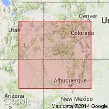
Discontinued as a name in San Juan basin of northwest NM and in the Black Mesa basin of northeast AZ for Middle Jurassic rocks between the Entrada Sandstone and the Morrison Formation. Name Wanakah Formation replaces name Summerville and will be applied to these rocks in the above listed area. Term Summerville restricted to San Rafael Swell area, Emery Co, UT, Paradox basin.
Source: GNU records (USGS DDS-6; Denver GNULEX).
- Usage in publication:
-
- Summerville Formation*
- Modifications:
-
- Revised
- Areal extent
- Overview
- AAPG geologic province:
-
- Paradox basin
Summary:
Recognized as upper formation of San Rafael Group between Colorado River and San Rafael Swell, UT, Paradox basin. Divided into chocolate (base) and brick-red (top) members. May correlate entirely or in part with newly named Romana Sandstone of Kaiparowits basin, Kane Co, UT. May be a correlative of Redwater Shale Member of Sundance Formation of WY. Overlies Curtis Formation of San Rafael Group. Unconformably (J-5) underlies Tidwell Member (new) of Morrison Formation. Chocolate member is a shallow-water, hypersaline marine unit. Brick-red member deposited mostly in overbank floodplain and mudflat environment. Of Middle Jurassic age, but could be early to middle Oxfordian, or Late Jurassic if it correlates with Redwater. Correlation chart.
Source: GNU records (USGS DDS-6; Denver GNULEX).
- Usage in publication:
-
- Summerville Formation
- Modifications:
-
- Not used
Summary:
Not used in study area which extends from Kane Springs, San Juan Co, UT to Uravan, Montrose Co, CO, Paradox basin. Rocks that have been assigned to Summerville by other workers are, in this report, included with Wanakah Formation or Tidwell Member of Morrison Formation. Much of Summerville is truncated beneath J-5 unconformity about 20 mi northwest of Moab, UT (northwest of study area). [Summerville also not used in report area of Slick Rock, San Miguel Co, CO to Uravan, CO in Paradox basin (O'Sullivan, 1989, USGS OC-133)].
Source: GNU records (USGS DDS-6; Denver GNULEX).
For more information, please contact Nancy Stamm, Geologic Names Committee Secretary.
Asterisk (*) indicates published by U.S. Geological Survey authors.
"No current usage" (†) implies that a name has been abandoned or has fallen into disuse. Former usage and, if known, replacement name given in parentheses ( ).
Slash (/) indicates name conflicts with nomenclatural guidelines (CSN, 1933; ACSN, 1961, 1970; NACSN, 1983, 2005, 2021). May be explained within brackets ([ ]).