The National Geologic Map Database is migrating to a new infrastructure. We apologize for any service disruptions during this process.
|
|---|


- Usage in publication:
-
- Milburn-Strawn series
- Modifications:
-
- Overview
- Dominant lithology:
-
- Clay
- Shale
- Limestone
- Coal
- AAPG geologic province:
-
- Bend arch
Summary:
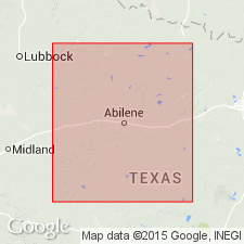
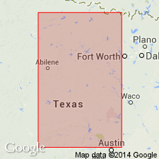
Pl. 3, p. lxvi. Milburn-Strawn series. [=Milburn shales of Tarr (1890) and Strawn division of Cummins (1891).] Alternating clays and shales and thin-bedded limestones, with fire clay and coal, overlying Richland-Gordon sandstones and underlying Brownwood-Ranger series. Study area in central basin, approximately from Colorado River north to Red River, north-central Texas. Age is Carboniferous (Coal Measures).
Source: US geologic names lexicon (USGS Bull. 896, p. 2075-2076); supplemental information from GNU records (USGS DDS-6; Denver GNULEX).
- Usage in publication:
-
- Strawn division
- Modifications:
-
- Original reference
- Dominant lithology:
-
- Shale
- Sandstone
- Conglomerate
- AAPG geologic province:
-
- Bend arch
- Fort Worth syncline
Summary:
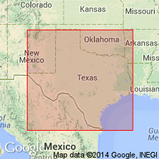
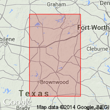
Pg. 361-398. Strawn division, 3rd from base of 6 divisions of Carboniferous "Coal Measures." Shales, sandstones, and conglomerates, 3,000 feet thick, unconformably overlying Millsap division and underlying Canyon division. Top of coal No. 1, when present, is base. Age is Carboniferous (Coal Measures). Found only in northern part of Carboniferous area. Carboniferous area of Texas stretches from below Colorado River northward to Red River, average width about 75 miles; comprises Brazos coal field (north) and Colorado coal field (south), separated by Cretaceous rocks.
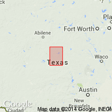
Named from town of Strawn in Palo Pinto Co., TX, where well exposed.
Source: US geologic names lexicon (USGS Bull. 896, p. 2075-2076).

- Usage in publication:
-
- Strawn division
- Modifications:
-
- Revised
- AAPG geologic province:
-
- Bend arch
- Llano uplift
Summary:
Pg. 371-387. Strawn division, 2nd from base of 5 Carboniferous divisions of Cummins (1891). Consists of beds of sharp grained, moderately hard, evenly textured sandstone, alternating with beds of blue clay. Conglomerates and shales are not abundant, and limestones are of rare occurrence. Divided into (descending) Ricker, Indian Creek, Antelope Creek, Comanche Creek, Wilbarger Creek, Buffalo Creek, Rough Creek, Hanna Valley, Cottonwood Creek, Spring Creek, Brown Creek, Big Valley, Bull Creek, Horse Creek clays and shales, Fox Ford, Bed No. 8, Shadrick Mill, Elliott Creek, Burnt Branch, and Lynch Creek beds. Overlies Bend division and underlies Canyon division with Coral limestone at base. Age is Pennsylvanian.
Source: Publication; US geologic names lexicon (USGS Bull. 1200, p. 3750-3752).
- Usage in publication:
-
- Strawn division
- Modifications:
-
- Revised
- AAPG geologic province:
-
- Bend arch
Summary:
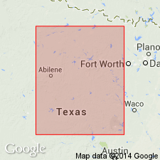
Strawn division. Most complete sections can be traced in valley of Colorado River and in valley of Brazos River between Mineral Wells and Millsap, Palo Pinto County. Consists of shale, thick sandstones, conglomerates, and a few lenticular limestones. Shales are quite fossiliferous. Sandstones grade laterally into shale or conglomerate over short distances making it impossible to correlate with any exactness beds of Brazos River area with those of Colorado River area. Brazos section is thicker; individual beds of conglomerate and sandstone are more massive, coarser grained, and more numerous. In both sections, basal beds of Strawn and Millsap pinch out northwestward, so that younger beds progressively overlap older strata. Unconformably overlies Middle Pennsylvanian Millsap division (includes beds between Smithwick shales and top of limestone members exposed in Parker County). Underlies Upper Pennsylvanian Canyon division. Age is Late Pennsylvanian. Report area in Brazos River Valley, north-central Texas.
Source: Modified from GNU records (USGS DDS-6; Denver GNULEX).

- Usage in publication:
-
- Strawn group
- Strawn division
- Modifications:
-
- Revised
Summary:
In 1893 (Texas Geol. Survey, 4th Ann. Rpt, pt. 1) Cummins and N.F. Drake transferred "Millsap division" to the Strawn, and stated that it rested unconformably on Bend division. The USGS abandoned "Millsap" (conflict) in 1912, ans has since included these beds in the Strawn, as have nearly all geologists since 1893. F.B. Plummer, however, in 1919 (AAPG Bull., v. 3, p. 132-145) excluded †Millsap from the Strawn and stated (under heading Millsap division): Although in 1912 the Texas Geol. Survey dropped name Millsap for the lower series of limestones and shales beneath the typical Strawn sands and conglomerates, it now seems best to restore this name, as the 3 lower limestones are found to contain a fauna quite different from overlying Strawn beds.
Source: US geologic names lexicon (USGS Bull. 896, p. 2075-2076).

- Usage in publication:
-
- Strawn group
- Modifications:
-
- Revised
- AAPG geologic province:
-
- Bend arch
- Fort Worth syncline
- Llano uplift
- Strawn basin
Summary:
Pg. 18-42; Univ. Texas Bull., no. 2132, p. 59-86. Strawn group. In Brazos River Valley, divided into Mineral Wells formation (above) and Millsap formation (below, including all beds beneath coal No. 1), but stated that fauna of latter beds, although not large, appears to be more closely related to that of Bend group than to that of Mineral Wells formation, and is sufficiently distinct to justify recognition of Millsap as a distinct formation of Strawn group. R.C. Moore, 1929 (AAPG Bull., v. 13, p. 888), continued to recognize Millsap as a distinct formation. Unconformably underlies Palo Pinto limestone, and in places, CAMPOPHYLLUM bed or Rochelle conglomerate bed (all of Canyon group). Unconformably overlies Bend group. Mapped in Parker, Hood, Erath, Eastland, and Comanche Cos., Brazos River Valley; and in Brown, Lampasas, Mills, and San Saba Cos., Colorado River Valley. Brazos and Colorado River valleys separated by Cretaceous overlap [Callahan Divide area]. Age is Pennsylvanian.
Source: Publication; US geologic names lexicon (USGS Bull. 896, p. 2075-2076); supplemental information from GNU records (USGS DDS-6; Denver GNULEX).

- Usage in publication:
-
- Strawn group*
- Modifications:
-
- Revised
Summary:
Pg. 105, 109. Strawn group. Revised the definition of the Strawn by including it, at the top, the Capps limestone, and he divided it into Meral Wells formation restricted, Garner formation, and Millsap Lake formation (=†Millsap of previous reports). This definition was adopted by the USGS in 1935.
Source: US geologic names lexicon (USGS Bull. 896, p. 2075-2076).
- Usage in publication:
-
- Strawn
- Modifications:
-
- Revised
Summary:
Drew top of Strawn at base of Capps limestone and Rochelle conglomerate, both of which they included in Graford formation.
Source: US geologic names lexicon (USGS Bull. 896, p. 2075-2076).
- Usage in publication:
-
- Strawn group
- Modifications:
-
- Overview
Summary:
As now [ca. 1938] generally recognized the Strawn group underlies Canyon group and unconformably overlies Smithwick shale, and it is now classified by USGS as of Allegheny age.
Source: US geologic names lexicon (USGS Bull. 896, p. 2075-2076).

- Usage in publication:
-
- Strawn group
- Modifications:
-
- Revised
- AAPG geologic province:
-
- Bend arch
Summary:
Pg. 91-94, pl. 8. In this report [Brown and Coleman Counties, Texas], Capps limestone is treated as member of Mineral Wells formation, upper formation of Strawn group. Age is Middle Pennsylvanian.
Source: US geologic names lexicon (USGS Bull. 1200, p. 3750-3752).

- Usage in publication:
-
- Strawn series
- Modifications:
-
- Revised
- AAPG geologic province:
-
- Bend arch
Summary:
Pg. 66 (fig. 1), 87-89. Strawn series. Proposed to use term for deposits occurring above unconformity at top of Smithwick group (rank raised) and related beds of Lampasas series (new) and below unconformity or disconformity which separates Lake Pinto sand (Whitt group, Canyon series) from East Mountain shale (Lone Camp group (new), Strawn series) at Mineral Wells, Palo Pinto County, Texas. This places upper boundary above highest occurrence of MESOLOBUS and FUSULINA, which characterize the Des Moines but are absent in overlying Missouri series of northern Midcontinent. This upper boundary falls within Mineral Wells formation of earlier reports. Term Mineral Wells formation dropped. As defined herein, series comprises (ascending) Millsap Lake and Lone Camp groups. Age is Pennsylvanian. Report includes stratigraphic chart.
Source: US geologic names lexicon (USGS Bull. 1200, p. 3750-3752); supplemental information from GNU records (USGS DDS-6; Denver GNULEX).
- Usage in publication:
-
- Strawn series
- Modifications:
-
- Revised
Summary:
Pg. 206-211. Strawn series. Lampasas-Strawn series boundary placed at disconformity between Dennis Bridge limestone and overlying conglomerate. As thus restricted, Strawn series of Brazos River section is about 2,000 feet thick. Comprises Millsap Lake group below and Lone Camp group above. Overlies Kickapoo Creek group (new) of Lampasas series. Age is Pennsylvanian. [Some reports place Kickapoo Creek group in Strawn Series.]
Source: Publication; US geologic names lexicon (USGS Bull. 1200, p. 3750-3752).
- Usage in publication:
-
- Strawn group
- Modifications:
-
- Revised
- AAPG geologic province:
-
- Bend arch
Summary:
Pg. 46 (fig. 38), 47-48. Strawn group. Concluded that lower Brownwood of Brown County is probably of late Strawn age and upper Brownwood is early Canyon. Hence, base of conglomerate separating these two parts of Brownwood shale should be regarded as Canyon-Strawn contact. This would increase Strawn interval in Brown County by about 125 feet at expense of the Canyon. Believed that Canyon-Strawn contact in Palo Pinto County should be at base of Turkey Creek sandstone. Turkey Creek sandstone is immediately overlain by Keechi Creek shale near top of which TRITICITES (post-Strawn age) has been found.
Source: US geologic names lexicon (USGS Bull. 1200, p. 3750-3752).
- Usage in publication:
-
- Strawn series
- Modifications:
-
- Biostratigraphic dating
- AAPG geologic province:
-
- Bend arch
Summary:
Pg. 1515-1524. Strawn series. Strawn-Canyon boundary, placed at prominent surfaces as paleontologic evidence allows, is drawn at top of Capps limestone in Colorado River Valley, at top of Village Bend limestone ("boulder beds") in Comanche and Eastland Counties, and at base of Lake Pinto sandstone in northeastern part of Brazos River Valley. Zonation based on fusulinids is best criterion for defining boundary. Strawn series is characterized by genus FUSULINA, Canyon series by TRITICITES. Age is Middle Pennsylvanian.
Source: US geologic names lexicon (USGS Bull. 1200, p. 3750-3752).
- Usage in publication:
-
- Strawn group*
- Modifications:
-
- Revised
- AAPG geologic province:
-
- Bend arch
Summary:
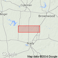
Pg. 58-62, pl. 27. Strawn group. Sandstone and shale beds that constitute Strawn group in Colorado River Valley were first called Richland sandstone by Tarr (Texas Geol. Survey 1st Ann. Rpt., 1890). These and correlative beds in Brazos River Valley were called Richland-Gordon sandstones by Dumble (1890). Drake (1893) separated these rocks into 20 units or "beds" and numbered those of Strawn group, from bottom to top, 4 to 23. Only Drake's name for upper unit, The Ricker, is in common use today, but that name has been restricted to prominent sandstone at base of Drake's Ricker bed. Drake referred these units to Strawn division of Cummin's (Texas Geol. Survey 2d Ann. Rpt., 1891) which he considered to include all rocks above Bend division and below his Coral limestone bed, the Capps limestone of later authors. Plummer and Moore (Univ. Texas Bull., no. 2132, 1922) considered Strawn in Colorado River Valley to be equivalent to their Mineral Wells and Millsap formations of Brazos River Valley. They limited Strawn group to rocks that overlie Smithwick shale of Bend group and underlie Rochelle conglomerate. This placed Drake's Coral limestone bed, named Capps limestone lentil by Plummer and Moore, in Canyon group. The Capps was thought to overlie Rochelle conglomerate and was regarded as part of Brownwood shale member of Graford formation. Sellards (Univ. Texas Bull., no. 3232, v. 1, 1933) transferred Capps back to Strawn group and considered it upper member of Mineral Wells formation. Rocks of Strawn group in Brazos River Valley have been studied in detail and classified into units. Strawn group in present report [Brown and Coleman Counties, Colorado River Valley] represents only upper part of group elsewhere. Term Strawn group is used herein for all rocks in Colorado River Valley between top of Smithwick shale of Bend group and base of Brownwood shale member of Graford formation of Canyon group. Term Mineral Wells not used in this area. The Strawn becomes thinner from central Brown County, where it is reported to be 1,100 feet thick in wells, to 500 feet in north-central Coleman County, and from 1,235 feet in northern Brown County to about 250 feet in southwestern Brown County and southeastern Coleman County. Group includes (ascending) Ricker Station limestone of Cheney (1949), Ricker sandstone member of Nickell (1938), and Capps limestone lentil of Plummer and Moore (1922). Age is Middle Pennsylvanian.
Source: US geologic names lexicon (USGS Bull. 1200, p. 3750-3752).
For more information, please contact Nancy Stamm, Geologic Names Committee Secretary.
Asterisk (*) indicates published by U.S. Geological Survey authors.
"No current usage" (†) implies that a name has been abandoned or has fallen into disuse. Former usage and, if known, replacement name given in parentheses ( ).
Slash (/) indicates name conflicts with nomenclatural guidelines (CSN, 1933; ACSN, 1961, 1970; NACSN, 1983, 2005, 2021). May be explained within brackets ([ ]).