The National Geologic Map Database is migrating to a new infrastructure. We apologize for any service disruptions during this process.
|
|---|


- Usage in publication:
-
- Skull Creek shale member*
- Modifications:
-
- Named
- Dominant lithology:
-
- Shale
- AAPG geologic province:
-
- Powder River basin
Summary:
Named as the basal member of the Graneros shale (also called formation) for exposures along Skull Creek southeast of Osage, Weston Co, WY in the Powder River basin. No type locality designated. Stratigraphic chart. Overlies Upper Cretaceous Dakota sandstone. Underlies Newcastle sandstone member of Graneros. Has been called Thermopolis shale by drillers. Consists of about 200 ft of dark blue-gray shale. Upper part weathers to a soft gray mud. Lower part breaks into thin hard plates. Calcareous concretions throughout. Thin lenses of impure calcareous material that weathers to cone-in-cone structure. Of Late Cretaceous age.
Source: GNU records (USGS DDS-6; Denver GNULEX).
- Usage in publication:
-
- Skull Creek shale member*
- Modifications:
-
- Areal extent
- Overview
- AAPG geologic province:
-
- Williston basin
- Powder River basin
Summary:
Name extended along west side of Black Hills, northeastern WY and southeastern MT in Powder River and Williston basins as a member of Graneros shale. Overlain by Newcastle member; underlain by Fall River sandstone. A formation in Colorado group. Late Cretaceous in age.
Source: GNU records (USGS DDS-6; Denver GNULEX).
- Usage in publication:
-
- Skull Creek shale*
- Modifications:
-
- Revised
- Age modified
- AAPG geologic province:
-
- Williston basin
- Powder River basin
- Chadron arch
Summary:
Rank raised to formation in chart showing standard Cretaceous sequence in northern Great Plains [Black Hills region, SD, WY, and MT in Powder River and Williston basins and on Chadron arch]. Excluded from Colorado group. Overlain unconformably by Newcastle sandstone; underlain conformably by Fall River formation. Early Cretaceous (Albian) in age.
Source: GNU records (USGS DDS-6; Denver GNULEX).
- Usage in publication:
-
- Skull Creek shale
- Modifications:
-
- Revised
- AAPG geologic province:
-
- Powder River basin
- Williston basin
- Chadron arch
Summary:
Revised--assigned to Skull Creek group (newly designated) together with overlying Newcastle sandstone. Underlain by Fall River sandstone of Inyan Kara group. Has a microfauna common to that of Newcastle sandstone. Lists 12 Foraminifera genera. Early Cretaceous in age.
Source: GNU records (USGS DDS-6; Denver GNULEX).
- Usage in publication:
-
- Skull Creek shale*
- Modifications:
-
- Overview
- AAPG geologic province:
-
- Denver basin
Summary:
Area of report is Front Range of Rocky Mountains, Denver basin. Correlation with other Cretaceous units in Powder River basin of northeast WY, Wind River basin of central WY, and Denver basin of southeast WY, northeast and south-central CO shown on fig. 19.
Source: GNU records (USGS DDS-6; Denver GNULEX).
- Usage in publication:
-
- Skull Creek shale
- Modifications:
-
- Overview
- AAPG geologic province:
-
- Chadron arch
- Powder River basin
Summary:
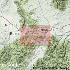
Lists and discusses distribution of microfaunas collected from Thermopolis and Skull Creek shales in Bighorn, Wind River, and Powder River basins and on Chadron arch, including outcrops in the Black Hills in Crook, Weston, and Niobrara Cos, WY in Powder River basin, and in Fall River, SD on Chadron arch. Faunas found in the upper portion of the lower part of Thermopolis shale are common to the Skull Creek shale in the Black Hills. The entire Skull Creek shale in southernmost Black Hills [at Hot Springs, Fall River Co, SD] correlates with only the upper shale unit of the lower part of Thermopolis shale in the Bighorn basin. Early Cretaceous in age.
Source: GNU records (USGS DDS-6; Denver GNULEX).
- Usage in publication:
-
- Skull Creek Shale
- Modifications:
-
- Areal extent
- Overview
- AAPG geologic province:
-
- Williston basin
- Powder River basin
- Sweetgrass arch
- Central Montana uplift
- Montana folded belt
Summary:
Name applied to a black shale with thin lenticular sandstone at the base and top over a large area of western ND and SD, northeast WY, and eastern and central MT in the Williston basin, Powder River basin, Sweetgrass arch, Central Montana uplift, and eastern Montana folded belt province. Term applied both as a stratigraphic and as a lithofacies unit name. Overlies First Cat Creek Sandstone in central and southern MT. Overlies Fall River Sandstone, an equivalent of the First Cat Creek, in the Black Hills and Williston basin. Disconformably underlies Mowry Shale undivided at most localities, Dynneson Sandstone Member of Mowry in Williston basin, and Bow Island Sandstone Member of Mowry in north-central MT. Sandstone at the top of the Skull Creek in central MT and WY is the Birdhead Sandstone Member. As used in this report, Birdhead extended over a larger area than has been done previously. The equivalent of the Birdhead in the Black Hills, in the Powder River basin, and southeast MT, is the Newcastle Sandstone Member of the Mowry; Newcastle is restricted to these three areas. Bentonite beds one inch to 5 ft thick, clay ironstone and cone-in-cone concretions, and sandstone dikes occur in the formation. Fossils (ammonites, forams, fish remains) listed. Cross sections. Nomenclature chart. Isopach map. Of middle and late Albian, Early Cretaceous age.
Source: GNU records (USGS DDS-6; Denver GNULEX).
- Usage in publication:
-
- Skull Creek Shale
- Modifications:
-
- Areal extent
- AAPG geologic province:
-
- Denver basin
Summary:
Geographically extended from the Black Hills area, as 1 of 4 formations of the Lower Cretaceous Dakota Group, to the northern Front Range foothills between Loveland and Boxelder Creek (sec. 9, T. 10 N., R. 69 W.), Larimer County, Colorado, in the Denver basin. Rocks were formerly assigned to unnamed part of South Platte Formation, which is restricted to area south of Boulder, Colorado, in this report. Wyoming nomenclature used north of Boulder, Colorado. Overlies Plainview Formation (raised in rank) of Dakota Group. Underlies Muddy Sandstone (extended from central Wyoming). Correlates with Thermopolis Shale of Bighorn basin and with Glencairn [Shale Member] of Purgatoire [Formation] of south central Colorado. Report includes orrelation chart.
Source: Modified from GNU records (USGS DDS-6; Denver GNULEX).
- Usage in publication:
-
- Skull Creek Shale
- Modifications:
-
- Areal extent
- AAPG geologic province:
-
- Sioux uplift
- Williston basin
- Chadron arch
Summary:
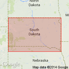
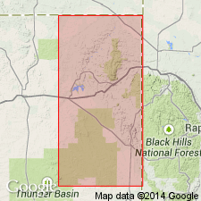
Thickness ranges from maximum of 315 ft in northwest SD to zero in eastern SD. Is not present in subsurface farther east than Douglas Co, SD on the Sioux uplift. Fig. 10 is isopach map of Skull Creek Shale for SD. Age is Early Cretaceous.
Source: GNU records (USGS DDS-6; Denver GNULEX).
- Usage in publication:
-
- Skull Creek Shale*
- Modifications:
-
- Reference
- Dominant lithology:
-
- Shale
- Siltstone
- AAPG geologic province:
-
- Powder River basin
Summary:
Correlates with middle shale member of Thermopolis Shale of Livingston area. Reference section designated in SW1/4 sec 25, T49N, R83W near Buffalo, Johnson Co, WY, Powder River basin, measured by Mapel (1959). Composed of gray to black shale and tan to light gray calcareous thin-bedded siltstone. 174 ft 6 in thick. Some beds bentonitic. Overlies Fall River Formation; underlies Mowry Shale. Of Early Cretaceous, late Albian age. Correlation chart.
Source: GNU records (USGS DDS-6; Denver GNULEX).
- Usage in publication:
-
- Skull Creek Shale*
- Modifications:
-
- Biostratigraphic dating
- Geochronologic dating
- AAPG geologic province:
-
- Powder River basin
Summary:
Biotite-bearing bentonite collected along northwest flank of Black Hills uplift [eastern Powder River basin], WY from bottom of formation yields date of 104.4 m.y. Bentonite lies near base of HAPLOPHRAGMOIDES GIGAS foraminiferal zone. H. GIGAS Zone is younger than the GASTROPLITES Zone. The GASTROPLITES fauna is of basal late Albian age based on occurrence of G. CANTIANUS in the DIPLOCERAS CRISTATUM Subzone. Therefore, the middle-late Albian boundary is older than 104 m.y. Age is late Albian at bottom of unit.
Source: GNU records (USGS DDS-6; Denver GNULEX).

- Usage in publication:
-
- Skull Creek Shale*
- Modifications:
-
- Areal extent
- AAPG geologic province:
-
- Powder River basin
- Williston basin
Summary:
Identified in the subsurface of the Powder River basin in northeast WY and southeast MT (Big Horn and Powder River Cos) and in the subsurface of the Williston basin of southeast MT (Carter Co). Overlies "Dakota silt" (a driller's term). Unconformably underlies Muddy Sandstone. Of Early Cretaceous age. [Shown on 22 cross sections in the OC series.]
Source: GNU records (USGS DDS-6; Denver GNULEX).
For more information, please contact Nancy Stamm, Geologic Names Committee Secretary.
Asterisk (*) indicates published by U.S. Geological Survey authors.
"No current usage" (†) implies that a name has been abandoned or has fallen into disuse. Former usage and, if known, replacement name given in parentheses ( ).
Slash (/) indicates name conflicts with nomenclatural guidelines (CSN, 1933; ACSN, 1961, 1970; NACSN, 1983, 2005, 2021). May be explained within brackets ([ ]).