

- Usage in publication:
-
- Rondout waterlime
- Modifications:
-
- Named
- Dominant lithology:
-
- Limestone
- AAPG geologic province:
-
- Appalachian basin
Summary:
Named Rondout waterlime for Rondout Co., NY. Underlies Manlius limestone and overlies Salina beds. Named for the fine development in extensive cement quarries at and near Rondout. Middle formation of Cayugan group. Age is considered Silurian.
Source: GNU records (USGS DDS-6; Reston GNULEX).
- Usage in publication:
-
- Rondout Formation*
- Modifications:
-
- Revised
- AAPG geologic province:
-
- Appalachian basin
Summary:
Rondout Formation used in area of report (northeastern Pennsylvania, New Jersey, and southeasternmost New York). Divided into (in ascending order) Duttonville Member (new), Whiteport Dolomite Member, and Mashipacong Member (new). Age is Late Silurian and Early Devonian.
Source: Changes in stratigraphic nomenclature, 1967 (USGS Bull. 1274-A, p. A17).
- Usage in publication:
-
- Rondout Formation
- Modifications:
-
- Revised
- AAPG geologic province:
-
- Appalachian basin
Summary:
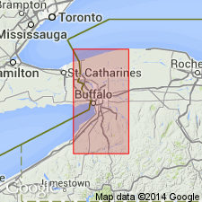
Name Orrs Mills Member of Rondout Formation is here proposed for strata overlying the Clove Brook Member of the Decker Formation and underlying the Duttonville and Whiteport Members of the Rondout at Cornwall, New York. Rocks were included in the upper part of the Decker Ferry Formation by Kummel and Weller (1902) and called Cobleskill and Decker Ferry Limestones by Hartnagel (1907). Lower two-thirds of the Orrs Mills is composed of olive gray to brown slightly dolomitic and calcareous shale. Upper third is medium-dark gray argillaceous sublithographic dolomite and dolomitic shale. Poorly developed slaty cleavage. Upper third contains abundant coral and is correlative with the biostromal limestone of the Decker Formation at Nearpass Quarry. Unit is present exclusively in the Green Pond-Schunemunk Mountain outlier of southeastern NY. Laterally replaces that portion of the Clove Brook Member of the Decker Formation above the hematitic marker. Only known occurrence is near Cornwall where thickness is probably 25 to 27 ft. Age is Late Silurian and Early Devonian (Cayugan and Helderbergian).
Source: GNU records (USGS DDS-6; Reston GNULEX).
- Usage in publication:
-
- Rondout Formation
- Modifications:
-
- Areal extent
- AAPG geologic province:
-
- Appalachian basin
Summary:
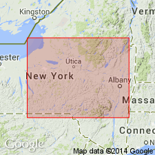
Author restricts term Rondout Formation or Group to its type area in southeastern NY. Portions of the Bertie Group of northwestern NY and CAN may correlate with part or all of the Rondout, but the lithologies and sequences observed in the area from the Niagara Peninsula to Albany are not equivalent. Cobleskill of western NY, assigned to Rondout by several previous workers, is here assigned as Formation to Bertie Group.
Source: GNU records (USGS DDS-6; Reston GNULEX).
- Usage in publication:
-
- Rondout Formation
- Modifications:
-
- Overview
- AAPG geologic province:
-
- Appalachian basin
Summary:
Rondout and Decker Formations are mapped undivided in the report area, but are discussed separately in the text. Upper part of the Rondout formation is medium-dark-gray, very fine- to fine-grained, medium-bedded, argillaceous limestone. The middle part is medium-gray argillaceous dolomite, which is medium-bedded, massive to laminated, and locally forms deep desiccation columns; weathers grayish-orange. Basal beds consist of medium- to dark-gray, very fine- to medium-grained limestone, medium-bedded. Total thickness approximately 40 ft. Lower contact with Decker Formation is abrupt, marked by first occurrence of quartz sandstone. Underlies Coeymans Formation. Silurian-Devonian boundary is within the middle part of the unit according to Denkler and Harris (1988).
Source: GNU records (USGS DDS-6; Reston GNULEX).
- Usage in publication:
-
- Rondout Formation*
- Modifications:
-
- Age modified
- Biostratigraphic dating
- AAPG geologic province:
-
- Appalachian basin
Summary:
Age of Rondout Formation refined to late Pridolian and early Lochkovian. Conodont species OULODUS ELEGANS restricts lower part of Rondout to Late Silurian. Silurian-Devonian boundary placed in middle of Rondout based on work by Denkler and Harris (1988).
Source: GNU records (USGS DDS-6; Reston GNULEX).
For more information, please contact Nancy Stamm, Geologic Names Committee Secretary.
Asterisk (*) indicates published by U.S. Geological Survey authors.
"No current usage" (†) implies that a name has been abandoned or has fallen into disuse. Former usage and, if known, replacement name given in parentheses ( ).
Slash (/) indicates name conflicts with nomenclatural guidelines (CSN, 1933; ACSN, 1961, 1970; NACSN, 1983, 2005, 2021). May be explained within brackets ([ ]).