


- Usage in publication:
-
- Pikeville formation
- Modifications:
-
- First used
- Dominant lithology:
-
- Shale
- Coal
- AAPG geologic province:
-
- Appalachian basin
Summary:
Breathitt Formation is informally elevated to group rank and subdivided into the following eight informal formations: Pocahontas, Bottom Creek, Alvy Creek, Grundy, Pikeville, Hyden, Four Corners, and Princess formations. Pikeville formation is here informally named and subdivided into Betsie Shale Member (revised), Little Blue Gem coal bed, informal member F, Lower Elkhorn coal bed, Crummies shale member (informally named), Upper Elkhorn No. 1 coal bed, informal member G, Upper Elkhorn No. 2 coal bed, informal member H, Upper Elkhorn No. 3 coal, Dwale shale member (here informally named), Darby coal bed, Elkins Fork shale member (here informally named), and Amburgy coal bed. [Revisions made in this paper are strongly contested by C. Rice and other USGS scientists who work in this area (oral commun., 9/3/93).]
Source: GNU records (USGS DDS-6; Reston GNULEX).

- Usage in publication:
-
- Pikeville Formation
- Modifications:
-
- Principal reference
- Dominant lithology:
-
- Sandstone
- Shale
- AAPG geologic province:
-
- Appalachian basin
Summary:
Pg. 9 (fig. 5), 18, App. 2 (p. 33-35). Pikeville Formation of Breathitt Group. Mostly sandstone and shale. Includes (descending) Amburgy, Williamson, Upper Elkhorn, and Pond Creek (=Lower Elkhorn) coals, and Betsie Shale Member at base. Thickness <1,100 feet (<340 m). Overlies Grundy Formation (new); underlies Kendrick Shale Member of Hyden Formation (new). Age is Pennsylvanian. Formal nomenclature presented in this report for units occurring in KY has been accepted by the Kentucky Stratigraphic Nomenclature Committee. Units that occur largely outside KY are considered informal.
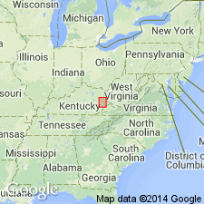
[Type locality:] "Model City" roadcut near Pikeville, Pike Co., eastern KY (see Chesnut and Cobb, Stop 24, IN Cecil and Eble, eds., 1989, Carbonif. geol. eastern U.S., AGU Field Trip Gdbk. T143, p. 78-80). Extends into northern TN and southwestern WV.
Reference section (subsurface): USGS No. 1 diamond drillhole, just south of Pikeville in Dorton quadrangle, Pike Co., eastern KY.
Source: Publication.
- Usage in publication:
-
- Pikeville Formation
- Modifications:
-
- Areal extent
- AAPG geologic province:
-
- Appalachian basin
Summary:
Fluvio-deltaic Pikeville, Hyden, and Four Corners Formations of the Breathitt Group in eastern KY represent three superimposed 3rd-order composite sequences, their unconformable boundaries corresponding with maximum flooding. The Breathitt is up to 950 m thick in eastern KY and comprises delta-plain facies of siltstone, clay-rich shale, sandstone, coal, siderite, and rare limestone. Calculated average ages of the base and the top are 323 Ma and 303 Ma. The four major marine members at the bases of the Pikeville, Hyden, Four Corners, and Princess Formations (Betsie, Kendrick, Magoffin, and Stoney Fork) are estimated to occur at 2.5 Ma intervals, which equates with the 3rd-order cyclicity of Vail and others (1977).
Source: GNU records (USGS DDS-6; Reston GNULEX).
For more information, please contact Nancy Stamm, Geologic Names Committee Secretary.
Asterisk (*) indicates published by U.S. Geological Survey authors.
"No current usage" (†) implies that a name has been abandoned or has fallen into disuse. Former usage and, if known, replacement name given in parentheses ( ).
Slash (/) indicates name conflicts with nomenclatural guidelines (CSN, 1933; ACSN, 1961, 1970; NACSN, 1983, 2005, 2021). May be explained within brackets ([ ]).