The National Geologic Map Database is migrating to a new infrastructure. We apologize for any service disruptions during this process.
|
|---|


- Usage in publication:
-
- Ophir formation*
- Modifications:
-
- Original reference
- Dominant lithology:
-
- Sandstone
- Shale
- Limestone
- AAPG geologic province:
-
- Great Basin province
Summary:
Pg. 25-27. Ophir formation. Name proposed by B.S. Butler, for the shales (locally slates), with a little sandstone and intercalated limestone beds, overlying Tintic quartzite as here restricted and underlying Teutonic limestone in the ranges of central Utah. Thickness 159 to 475+/- feet. Lower part of these beds (100 to 190 feet) was included in Tintic quartzite as originally defined, but Tintic is herein restricted to the massive quartzites. [Age is Early and Middle Cambrian.]
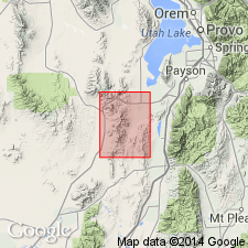
Named from exposures at Ophir, eastern Toole Co., central northern UT. Well exposed in Tintic district and Oquirrh Mountains region, central northern UT.
[GNC remark (ca. 1936, US geologic names lexicon, USGS Bull. 896, p. 1554): In USGS 19th Ann. Rpt., pt. 3, 1899, p. 620, footnote, G.W. Tower, Jr., and G.O. Smith stated that in Tintic folio the Cambrian †Robinson quartzite would be named Ophir formation, to avoid duplication of names. In Tintic folio, however, the Cambrian †Robinson quartzite was renamed Tintic quartzite, and Ophir formation was not used.]
Source: US geologic names lexicons (USGS Bull. 896, p. 1554; USGS Bull. 1200, p. 2839-2840).
- Usage in publication:
-
- Ophir formation*
- Modifications:
-
- Revised
- Overview
- AAPG geologic province:
-
- Great Basin province
Summary:
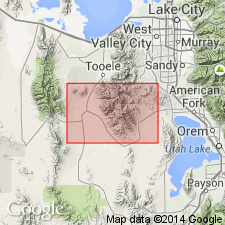
Revised in that the Ophir transitionally underlies the newly named Middle Cambrian Hartmann limestone; upper contact placed at top of highest shale. Conformably overlies Lower Cambrian Tintic quartzite; base of Ophir placed at base of lowest 1 ft thick shale (ort schist). Mapped (geologic map) north of town of Ophir, T5S, R4W, Tooele Co, UT in the Great Basin province. Section 319.5 ft thick measured at Ophir where formation consists of: basal sequence 30.5 ft thick of thinly laminated, green-gray quartzose schist and gray quartzite; a middle sequence 182 ft thick of gray (fresh), white (weathered) shale; and an upper sequence 107 ft thick of dense, blue-gray limestone and gray shale. The shales may be thinly laminated to poorly laminated, and blocky. The limestones are irregularly mottled. Cross section; stratigraphic table. Is of Early and Middle Cambrian age. Fossils collected less than 50 ft above the base.
Source: GNU records (USGS DDS-6; Denver GNULEX).
- Usage in publication:
-
- Ophir shale*
- Modifications:
-
- Mapped 1:25k
- Dominant lithology:
-
- Shale
- Limestone
- AAPG geologic province:
-
- Wasatch uplift
Summary:
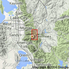
Mapped in western, central, and southern part of study area in Wasatch Mountains of north-central UT, Salt Lake and Utah Cos, Wasatch uplift. Consists of lower shale, middle limestone, and upper shale members. Cross sections, measured sections; generalized section. Thickness is about 420 ft. Lower shale, about 240 ft thick, is dark olive-green to dull bluish-green with reddish-brown iron oxide coating on weathered surfaces. Middle limestone member, about 80 ft thick, is a well defined siliceous limestone. Upper shale member, [thickness presumably about 100 ft], is pale brownish or greenish gray where unweathered, which is rarely seen; where weathered, is yellowish brown; contains iron-bearing carbonate. Overlies Tintic quartzite with transitional contact; underlies Maxfield limestone. Assigned Early and Middle Cambrian age based on earlier paleontologic work by Walcott.
Source: GNU records (USGS DDS-6; Denver GNULEX).
- Usage in publication:
-
- Ophir shale
- Modifications:
-
- Overview
- AAPG geologic province:
-
- Uinta uplift
Summary:
Name applied to a thin (20 ft thick--too thin to be separately mapped) brown micaceous shale and quartzite unit mapped with the overlying Tintic quartzite in western Uinta Mountains, Summit Co, UT on the Uinta uplift. Trilobite fragments indicate a Cambrian age. Unconformably underlies the Pinyon Peak? [formation].
Source: GNU records (USGS DDS-6; Denver GNULEX).
- Usage in publication:
-
- Ophir formation
- Modifications:
-
- Revised
- AAPG geologic province:
-
- Paradox basin
- San Juan basin
- Black Mesa basin
Summary:
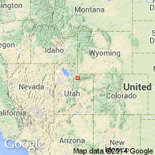
Ophir formation revised in that it unconformably underlies the newly named Aneth formation in the subsurface of southeast UT. Aneth formerly part of an unnamed Devonian sequence. Ophir recognized in the subsurface of Paradox basin in southeast UT and southwest CO, San Juan basin in northeast NM, and Black Mesa basin in northeast AZ.
Source: GNU records (USGS DDS-6; Denver GNULEX).

- Usage in publication:
-
- Ophir formation*
- Modifications:
-
- Overview
- AAPG geologic province:
-
- Wasatch uplift
Summary:
Extends in scattered exposures from Eureka to Gardison Ridge, Ts9 and 10S, Rs2 and 3W, Utah Co, UT on the Wasatch uplift. Has been penetrated in underground workings in East Tintic district. Subdivided into lower shale, middle limestone, and upper shale members. Contains an early Middle Cambrian fauna (trilobites); entire formation assigned to Middle Cambrian. Correlation with other units discussed. Geologic map. Correlation diagrams.
Source: GNU records (USGS DDS-6; Denver GNULEX).
For more information, please contact Nancy Stamm, Geologic Names Committee Secretary.
Asterisk (*) indicates published by U.S. Geological Survey authors.
"No current usage" (†) implies that a name has been abandoned or has fallen into disuse. Former usage and, if known, replacement name given in parentheses ( ).
Slash (/) indicates name conflicts with nomenclatural guidelines (CSN, 1933; ACSN, 1961, 1970; NACSN, 1983, 2005, 2021). May be explained within brackets ([ ]).