

- Usage in publication:
-
- Newland limestone*
- Modifications:
-
- Original reference
- Dominant lithology:
-
- Limestone
- AAPG geologic province:
-
- Northern Rocky Mountain region
Summary:
Pg. 199-215. Newland limestone. Hard limestones, dark bluish gray on fresh fracture, and buff to straw color on weathering. Thickness 2,000 feet. Underlies Greyson shales and overlies Chamberlain shales.
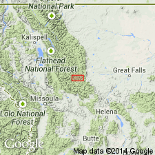
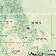
Type locality: on Newland Creek, 10 mi north of White Sulphur Springs, Meagher Co., between Big Belt and Little Belt Mountains, western central MT.
Source: US geologic names lexicon (USGS Bull. 896, p. 1486).
- Usage in publication:
-
- Newland limestone
- Modifications:
-
- Overview
- AAPG geologic province:
-
- Northern Rocky Mountain region
Summary:
Used as a formation of Belt series in Phillipsburg area, Granite Co, MT in the Northern Rocky Mountain region. Correlated with lower part of Siyeh limestone in Stonewall and Arrastre Creeks, Salmon Lake, and Glacier Park areas, MT; with Helena limestone of Prickly Pear Creek, east of Belt Mountains; and Wallace limestone of Missoula area, MT. Correlation chart. Of Algonkian age.
Source: GNU records (USGS DDS-6; Denver GNULEX).
- Usage in publication:
-
- Newland limestone*
- Modifications:
-
- Areal extent
- AAPG geologic province:
-
- Northern Rocky Mountain region
Summary:
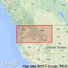
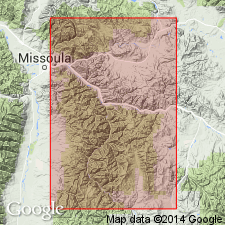
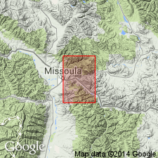
Is one of three roughly equivalent formations--Newland, Siyeh, and Wallace limestones--in the Piegan group of Belt series. Used in preference to Wallace within report area, Missoula Co, MT in the Northern Rocky Mountain region, even though Clapp and Deiss (1931) used Wallace within the area. Wallace now accepted in vicinity of St. Regis, MT, 60 mi northwest of Bonner quad. Is oldest unit in quad. Overlain by Miller Peak argillite (revised and redefined), basal unit of Missoula group. Occurs in west and southwest part of area. Precise thickness not known, but thought to be at least 4,000 ft thick. Composed of tan or gray, argillaceous, laminated limestone interbedded with very dark gray argillite. A few stromatolites. Of Precambrian age. Geologic map. Stratigraphic chart.
Source: GNU records (USGS DDS-6; Denver GNULEX).
- Usage in publication:
-
- Newland Limestone
- Modifications:
-
- Overview
- AAPG geologic province:
-
- Northern Rocky Mountain region
Summary:
Coarse-grained arkose and conglomerate of the LaHood Formation crop out in a narrow zone from the northern half of the Bridger Range to and across the Highland Mountains, in Northern Rocky Mountain region, Jefferson Co, MT. These rocks grade northward into fine-grained carbonate, argillite, siltite, and quartzite of Belt Series of the Northern Rocky Mountain region. Belt rocks included are Neihart Quartzite, Chamberlain Shale, Prichard Formation, Newland Limestone of Meagher Co, and lower part of Greyson Shale. Newland is of Precambrian age.
Source: GNU records (USGS DDS-6; Denver GNULEX).
- Usage in publication:
-
- Newland Limestone
- Modifications:
-
- Overview
- AAPG geologic province:
-
- Northern Rocky Mountain region
Summary:
Helena Formation of Helena area, Siyeh Formation of Glacier National Park, and the Newland Limestone of the Bonner area, all of the Northern Rocky Mountain region of the Precambrian Belt Supergroup, are thought to be lateral equivalents. Geologic map.
Source: GNU records (USGS DDS-6; Denver GNULEX).

- Usage in publication:
-
- Newland Limestone*
- Modifications:
-
- Overview
- AAPG geologic province:
-
- Northern Rocky Mountain region
Summary:
Used in Neihart area, Northern Rocky Mountain region, as the upper formation of the lower Belt. [Does not correlate with the Helena]. Stratigraphic position and correlation with other Precambrian formations of the Belt Supergroup of the Northern Rocky Mountain region, and in the Purcell Supergroup of Alberta and British Columbia, Canada shown on figures 4, 5, and 8.
Source: GNU records (USGS DDS-6; Denver GNULEX).

- Usage in publication:
-
- Newland Limestone*
- Modifications:
-
- Geochronologic dating
- AAPG geologic province:
-
- Northern Rocky Mountain region
Summary:
Pg. 20, geologic time scale (inside front cover). Newland Limestone [Middle Proterozoic] of Belt Supergroup. Sample from a biotite gabbro sill that intrudes formation, in SE/4 sec. 9, T. 11 N., R. 1 E., Hellgate Gulch quadrangle, Broadwater County, Montana, yielded a K-Ar age of 826 +/-41 Ma (pyroxene with minor biotite) [Precambrian Y to Z]. Sill belongs to a widespread group of mafic dikes and sills which give early Proterozoic Z to late Proterozoic Y ages. Age calculated using decay constants of Steiger and Jager, 1977 (Earth Planet. Sci. Letters, v. 36, p. 359-362).
Source: Publication.
- Usage in publication:
-
- Newland Formation*
- Modifications:
-
- Contact revised
- AAPG geologic province:
-
- Northern Rocky Mountain region
Summary:
Lower contact revised; within study area Newland overlies newly named Moose Formation of lower Belt of Belt Supergroup. Study area is in Highland Mountains, Silver Bow Co, MT, Northern Rocky Mountain region. At type Moose, Moose-Newland contact is gradational over a 34 m transition zone above Moose; base of Newland is placed at base of lowest laterally continuous flaggy argillaceous siltite that displays typical Newland bedding; underlies Greyson Shale with abrupt contact. At Soap Gulch and Camp Creek, Moose-Newland contact is sharp. Hydrothermally altered limestone marks top of Newland at Soap Gulch; at Camp Creek, Newland-Greyson are interlayered over an interval of more than 225 m; at Table Mountain Newland-Greyson are interlayered over 160 m. Schematic cross section (fig. 2); correlation diagram (fig. 3). Middle Proterozoic age.
Source: GNU records (USGS DDS-6; Denver GNULEX).
For more information, please contact Nancy Stamm, Geologic Names Committee Secretary.
Asterisk (*) indicates published by U.S. Geological Survey authors.
"No current usage" (†) implies that a name has been abandoned or has fallen into disuse. Former usage and, if known, replacement name given in parentheses ( ).
Slash (/) indicates name conflicts with nomenclatural guidelines (CSN, 1933; ACSN, 1961, 1970; NACSN, 1983, 2005, 2021). May be explained within brackets ([ ]).