The National Geologic Map Database is migrating to a new infrastructure. We apologize for any service disruptions during this process.
|
|---|


- Usage in publication:
-
- Muddy sandstone*
- Modifications:
-
- Overview
Summary:
Correlation with other Cretaceous units in Powder River basin of northeast WY, Wind River basin of central WY and Denver basin in southeast WY, northeast and south-central CO shown on fig 19.
Source: GNU records (USGS DDS-6; Denver GNULEX).
- Usage in publication:
-
- Muddy Sandstone
- Modifications:
-
- Areal extent
- Revised
- AAPG geologic province:
-
- Denver basin
Summary:
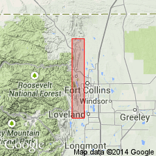
Geographically extended from central Wyoming, as a formation of Lower Cretaceous Dakota Group, to the northern Front Range foothills, between Loveland and Boxelder Creek (sec. 9, T. 10 N., R. 69 W.), Larimer County, Colorado, Denver basin. Name applied to rocks formerly called first sandstone of South Platte Formation of Dakota Group and "J" sandstone. Divided into Fort Collins (base) and Horsetooth (top) Members, both newly named. Overlies Skull Creek Shale (extended from Black Hills). Underlies Mowry Shale (replacement term for lower part, Benton Formation). Decreases from 72 feet thick, near Boulder, to a feather edge west of Berthoud. Ranges from 10 to 150 feet thick. Fort Collins Member is a shallow-water marine deposit. Horsetooth Member is a shoal-water delta or alluvial-plain deposit. Correlates with Newcastle Sandstone of Bighorn basin; basal part has same trace fossils as those found in basal part of Newcastle. Report includes correlation chart.
Source: Modified from GNU records (USGS DDS-6; Denver GNULEX).
- Usage in publication:
-
- Muddy Sandstone Member*
- Modifications:
-
- Overview
- AAPG geologic province:
-
- Denver basin
- Green River basin
Summary:
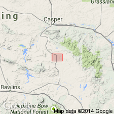
Thermopolis and Mowry Shales mapped as a single unit in the southeast part of the Shirley basin western Albany Co (Denver basin) and eastern Carbon Co (Greater Green River basin), WY. Basal Thermopolis lies conformably above the Cloverly Formation. The upper Mowry underlies the Frontier Formation. Rocks of the Thermopolis consist of: 1.) basal gray to black carbonaceous shale about 60 ft thick of marine origin, 2.) the Muddy Sandstone Member about 14 ft thick, 3.) a brown-gray, thin-bedded, fine grained, silty sandstone interbedded with thin bedded siltstone and shale 50 ft thick, that has a 2 ft thick lignite bed at top, and 4.) a 60 ft thick interval of sandy siltstone and shale interbedded with "typical" Mowry siliceous shale. Unit 4 is arbitrarily considered to be upper Thermopolis. Unit 3 is poorly indurated and makes poor outcrops; it is of paladal origin. Some of the buff to gray thin-bedded sandstone beds of the Muddy are ripple marked. The 110 ft of gray, dense or siliceous, laminated shale with fish scales and interbedded 2-3 ft thick bentonite beds are the Mowry, this sequence very resistant to erosion forms long narrow ridges. Stratigraphic chart. Cretaceous age.
Source: GNU records (USGS DDS-6; Denver GNULEX).
- Usage in publication:
-
- Muddy Sandstone*
- Modifications:
-
- Revised
- AAPG geologic province:
-
- Williston basin
Summary:
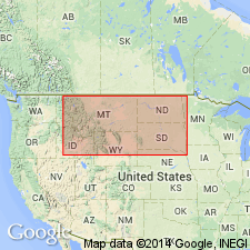
Muddy Sandstone. The Muddy Sandstone Member of Thermopolis Shale is raised to formation rank in Montana, and by geographic extension, in North Dakota and South Dakota. Thermopolis Shale geographically restricted from Montana; Muddy Sandstone Member of Thermopolis Shale remains in good usage in Wyoming. Correlates with the Vaughn Member of Blackleaf Formation of Sweetgrass arch, northwestern Montana, and the Newcastle Sandstone of the Black Hills uplift.
Source: Changes in stratigraphic nomenclature, 1975 (USGS Bull. 1422-A, p. A28-A29, A66-A67).
- Usage in publication:
-
- Muddy Sandstone*
- Modifications:
-
- Overview
- AAPG geologic province:
-
- Montana folded belt
Summary:
Name applied to two yellowish-green, cross-bedded, thin-bedded sandstones separated by mudstone that lie above the shale member of the Thermopolis Shale and beneath the Vaughn Member of the Mowry Shale. Is part of the nomenclature used east of the Ruby River, Beaverhead Co, MT in the Montana folded belt province. Ranges from 50 to 115 ft thick. Is equivalent to rocks assigned to the upper part of the Flood Member of the Blackleaf Formation on the west of the Ruby River. Rocks assigned to Muddy in this report have been variously assigned to the Aspen? Formation, Muddy? Sandstone Member of the Thermopolis Shale, Colorado Formation. Muddy is of Albian, Early Cretaceous age. Columnar section.
Source: GNU records (USGS DDS-6; Denver GNULEX).
- Usage in publication:
-
- Muddy Sandstone*
- Modifications:
-
- Revised
- Areal extent
- AAPG geologic province:
-
- Montana folded belt
Summary:
Revised in that Muddy Sandstone unconformably underlies the Vaughn Member which is newly assigned to the Mowry Shale in the Greenhorn, Madison, Gallatin, and Gravelly Ranges, Beartooth and Centennial Mountains of southwest MT in Montana folded belt province. Use of Muddy in these mountain ranges represents the western limit of the use of the name. The axis of the Ruby River valley which separates the Snowcrest Range from the Greenhorn and Gravelly Range is the arbitrary location of the nomenclature change. The rocks equivalent to the Muddy to the west are in the upper part of the Flood Member and, to the northwest, the Taft Hill Member of the Blackleaf Formation. Conformably overlies Thermopolis Shale. Nomenclature chart. Of Albian, Early Cretaceous age.
Source: GNU records (USGS DDS-6; Denver GNULEX).

- Usage in publication:
-
- Muddy Sandstone*
- Modifications:
-
- Areal extent
- AAPG geologic province:
-
- Powder River basin
Summary:
Identified throughout the subsurface of the Powder River basin in MT and WY where it overlies Skull Creek Shale unconformably and underlies Mowry Shale. Of Early Cretaceous age. [This nomenclature shown on 22 cross sections in this OC series.]
Source: GNU records (USGS DDS-6; Denver GNULEX).
For more information, please contact Nancy Stamm, Geologic Names Committee Secretary.
Asterisk (*) indicates published by U.S. Geological Survey authors.
"No current usage" (†) implies that a name has been abandoned or has fallen into disuse. Former usage and, if known, replacement name given in parentheses ( ).
Slash (/) indicates name conflicts with nomenclatural guidelines (CSN, 1933; ACSN, 1961, 1970; NACSN, 1983, 2005, 2021). May be explained within brackets ([ ]).