

- Usage in publication:
-
- Morrison formation*
- Modifications:
-
- Original reference
- Dominant lithology:
-
- Clay
- Marl
- Sandstone
- AAPG geologic province:
-
- Denver basin
Summary:
[The formation was named by Eldridge in this Monograph (Chapter II, Mesozoic geology, p. 51-151), within the area of which is its type locality; but Pikes Peak folio, by Whitman Cross, in which the formation was also described was published in 1894, before the publication of the Monograph.]
Morrison formation. Throughout Denver region and for much of distance along east base of Rocky Mountains in Colorado, the Jura is essentially a formation of fresh-water marls, of average thickness of 200+/- feet. Its upper limit is sharply defined by Dakota sandstone, while the brown and pink sandstone closing the Trias as clearly marks its lower limit. To this formation has been assigned the name Morrison, from the town [near Denver] near which it is typically developed. The marls are green, drab, or gray, and carry in lower two-thirds numerous lenticular bodies of limestone of characteristic drab color and a texture compact and even throughout. About 20 feet above base occurs a persistent band of alternating limestones and sandstones, or all sandstones, 10 to 15 feet thick. At Morrison the top member of underlying Wyoming formation, consists of 15 to 25 feet of persistent sandstone, fine-grained, often massive, pink and brown. The clays of lower two-thirds are remarkable for their reptilian remains and from the dominating form have been designated "ATLANTOSAURUS clays." The upper third is generally a succession of sandstones and marls, of which the sandstones predominate. The most important sandstone occurs just above the "ATLANTOSAURUS CLAYS," is very persistent, and from contained Saurian remains has been called Saurian sandstone. It varies in thickness between 5 and 35 feet, and in its distance below the Dakota from 10 to 125 feet, although usually from 50 to 80 feet. The Morrison appears to be unconformable with the underlying Wyoming formation [now divided into (descending) Lykins formation, Lyons sandstone, Ingleside formation, and Fountain formation.]
Source: US geologic names lexicon (USGS Bull. 896, p. 1423-1424).
- Usage in publication:
-
- Morrison formation
- Modifications:
-
- Revised
- AAPG geologic province:
-
- Denver basin
Summary:
Pg. 183-188. Morrison formation. Type section of Morrison redefined. Strata originally assigned to Morrison formation include some that are equivalent to an older formation (Sundance of Jurassic) and others at top which contain fossil plants of Upper Cretaceous type. Section at Morrison comprises 10 units (numbered in descending order 1-10). Units 1-5 are Dakota group, 265 feet thick. Units 6 and 7 are Morrison formation, 160 feet thick. Units 8-10 are Sundance formation, 17 feet thick. According to G.L. Cannon, who accompanied writer [Lee] and who assisted in work on Denver Monograph [27], Nos. 1-3 of section were regarded as the two sandstones of the Dakota and the shale as the "Dakota fire clay." Other geologists have followed this usage, and when the "lower Dakota" and shale above it a few miles farther south were correlated with Purgatoire, No. 3 of Morrison section was regarded as Lower Cretaceous. No. 4 (100 feet thick) of section is part of Morrison as originally defined yet it contains fossil plants which Knowlton described as belonging to "Dakota flora." Unit 5 (10 feet thick) is conglomeratic sandstone (Saurian conglomerate) containing dinosaur bones and pebbles of quartz and jasper; sharply separated from underlying shale.
Source: US geologic names lexicon (USGS Bull. 1200, p. 2595-2605).
- Usage in publication:
-
- Morrison formation
- Modifications:
-
- Revised
- AAPG geologic province:
-
- Denver basin
Summary:
Pg. 17, pl. 1. At Morrison, Colorado, type locality of Morrison formation, rocks were once assigned to this formation which do not belong there --at base 17 feet or more of orange sandstone which is now known to be unconformable with overlying Morrison and underlying Lykins, and at top nearly 200 feet of beds younger than Morrison. Reasons for revision of type section were given by Lee (1920), but thicknesses given in present paper should replace those previously published. Age is Cretaceous(?).
Source: US geologic names lexicon (USGS Bull. 1200, p. 2595-2605).
- Usage in publication:
-
- Morrison formation*
- Modifications:
-
- Revised
- AAPG geologic province:
-
- San Juan Mountains province
Summary:
Pg. 171-173. Morrison formation. Described in Ouray district, Colorado. Comprises the middle limestone and upper sandstone members of the "La Plata sandstone" of Cross and entire thickness of "McElmo" formation as these two formations are defined by Cross and Howe in Ouray folio. Thickness 700 to 750 feet. Comprises a basal limestone, sandstone, and shale member, herein named Wanakah, a middle sandstone member, and an upper shale member. Underlies Dakota(?) sandstone; overlies Upper(?) Jurassic sandstone. Age is [Early] Cretaceous(?).
Source: US geologic names lexicon (USGS Bull. 1200, p. 2595-2605).
- Usage in publication:
-
- Morrison formation
- Modifications:
-
- Revised
- AAPG geologic province:
-
- Black Mesa basin
- Paradox basin
- Piceance basin
- San Juan basin
Summary:
Pg. 9-10, 32-44, 58-63, charts. Morrison formation. Discussion of correlation of Jurassic formations of parts of Utah, Arizona, New Mexico, and Colorado. Morrison formation is interpreted as including, besides the more usual variegated mudstones (McElmo formation of many authors), in New Mexico the Todilto limestone and beds heretofore called "Navajo" sandstone (Zuni sandstone of Dutton) and to Colorado beds formerly assigned to middle and upper La Plata sandstone by Cross and others. Age of Morrison has for many years been topic for debate, and literature bearing on it has been extensive. Mook (1916, New York Acad. Sci. Ann. Rpt., v. 27) listed over 200 papers describing or discussing the formation, not includeing those of purely descriptive paleontology and considerable numbers have been added since 1916. Several writers have assigned to beds here included in Morrison formation an age widely different in one area from that assigned in another area. For example, the Morrison (of present report) of southeastern Utah has been called "Early Jurassic," while the Morrison (of present report) of northeastern Utah has been called on a later page of same paper "Late Jurassic." Present writers see no basis for such separation but consider formation everywhere of essentially same age --late Late Jurassic. Discussion of history of nomenclature.
Source: US geologic names lexicon (USGS Bull. 1200, p. 2595-2605).

- Usage in publication:
-
- Morrison formation*
- Modifications:
-
- Overview
Summary:
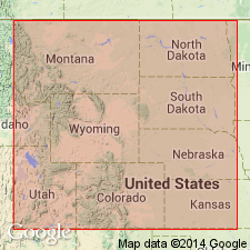
Morrison formation. Recognized in Colorado, northern New Mexico and northeastern Arizona, eastern Utah, Wyoming, western South Dakota, central southern Montana (Stillwater-Rosebud Counties region), western Oklahoma, and western Kansas(?). Age is Late Jurassic.
In western South Dakota, Wyoming, and as far south in eastern Colorado as Loveland, the Morrison formation is underlain by marine Sundance formation, of [Late] Jurassic age. The age of the Morrison was long questioned, some geologists considering it [Late] Jurassic, others considering it [Early] Cretaceous. The USGS now [ca. 1938] classifies it as [Late] Jurassic, although for many years it classified it as [Early] Cretaceous(?).
Source: US geologic names lexicon (USGS Bull. 896, p. 1423-1424).
- Usage in publication:
-
- Morrison formation
- Modifications:
-
- Revised
- AAPG geologic province:
-
- Paradox basin
Summary:
Pg. 58-59, 36 (table), pls. Morrison formation. In San Juan country, Utah, subdivided into (ascending) Bluff sandstone, Recapture shale, Westwater Canyon sandstone, and Brushy Basin shale members (all new). Thickness as much as 1,415 feet. Overlies Summerville(?) formation of San Rafael group; underlies Dakota(?) sandstone. Age is [Late] Jurassic.
Source: US geologic names lexicon (USGS Bull. 1200, p. 2595-2605).
- Usage in publication:
-
- Morrison formation*
- Modifications:
-
- Revised
- AAPG geologic province:
-
- Paradox basin
- San Juan basin
Summary:
Pg. 1751-1765. Morrison formation. In La Plata Mountains, Colorado, comprises (ascending) Pony Express limestone, Bilk Creek sandstone (new), Wanakah marl (restricted), and Junction Creek sandstone (new) members. Overlies Entrada sandstone. [Age is Late Jurassic.]
Source: US geologic names lexicon (USGS Bull. 1200, p. 2595-2605).
- Usage in publication:
-
- Morrison formation
- Modifications:
-
- Principal reference
- Revised
- Dominant lithology:
-
- Sandstone
- Shale
- Clay
- Limestone
- AAPG geologic province:
-
- Denver basin
Summary:
Pg. 1097-1114. Morrison formation. Revised type section proposed. Subdivided into six lithologic units. Basal sandstone unit, 7 feet of buff massive locally cross-bedded coarse- to medium-grained calcareous sandstone, conglomeratic in lower part; north from type locality unit thicknes to at least 30 feet. Gray and red shale unit, represents lower 55 feet of Morrison. Gray clay and limestone unit, an interbedded series of gray clays and gray lithographic freshwater limestones, 49.75 feet thick. Gray shale and sandstone unit, 51.5 feet thick. Red shale unit 36.75 feet thick; most highly colored interval in formation. Sandstone and shale unit 76.5 feet thick; variegated sandy shales, maroon most prevalent, constitute about 30 percent of interval. Formation, as herein described, is cartographic unit between Dakota sandstone as originally defined by Eldridge (1896) and strata assigned to probable Sundance by Lee (1920) which have in part been assigned to Ralston formation (new). Morrison, as defined in present report, is considered Jurassic. There has been controversy regarding position of Morrison-Dakota boundary. Lee (1920), in a somewhat confusing paper, redefined Morrison at its type locality. It appears that in his reconsideration he erroneously interpreted Eldridge’s Morrison-Dakota boundary to be somewhat stratigraphically higher than Eldridge had originally indicated. Consequently, Lee proposed that the contact be lowered to Eldridge’s original boundary. Later Lee (1927) reexamined Dakota and Morrison formations near Morrison, Colorado. In this work, he designated the lowest Dakota unit as the "Lower Sandstone" (10 to 40 feet) and described it as "massive, conglomeratic." This boundary corresponds to that proposed in present report. As herein defined, the Morrison lies with apparent disconformity below conglomeratic phase of Dakota as defined by Eldridge (1896) and Lee (1927) and overlies disconformably the red, sandy shales assigned by various workers to Lykins formation. At some localities, basal sandstone of Morrison is in juxtaposition with strata that have been correlated by Lee (1920) with Sundance (Jurassic) and which have been included in Ralston formation. [Age is Jurassic.]
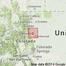
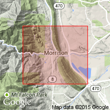
Type section: along north side of West Alameda Parkway roadcut, 2 mi north of town of Morrison, in SE/4 sec. 23, T. 4 S., R. 70 W., [approx. Lat. 39 deg. 41 min. 08 sec. N., Long. 105 deg. 11 min. 06 sec. W., Morrison 7.5-min quadrangle], Jefferson Co., CO. [Additional locality information from USGS GNIS database, ACME Mapper 2.0, Montana State Univ. Graphical Locator, accessed August 6, 2011.]
Source: US geologic names lexicon (USGS Bull. 1200, p. 2595-2605).
- Usage in publication:
-
- Morrison formation
- Modifications:
-
- Revised
- AAPG geologic province:
-
- Montana folded belt
- Sweetgrass arch
Summary:
Pg. 1269-1270, 1290. Morrison formation. In Sweetgrass arch, Montana, the Ellis is raised to group rank to include (ascending) Sawtooth, Rierdon, and Swift formations. Overlying Ellis group are continental beds of [Late] Jurassic and [Early] Cretaceous age. Thickness ranges from 348 feet in Flat Coulee oil field on north side of Sweetgrass Hills to about 1,300 feet along Rocky Mountain front near Craig. Beds are divisible into three major rock units. Lowest unit consists chiefly of fine-grained rocks, largely clay shale and mudstone, dense gray limestone, and fine- to very fine-grained gray and brown sandstones. Dominant color greenish-gray. Unit is as much as 310 feet thick and rests conformably on Swift formation. Along Little Belt Mountains and west to Craig, top of unit is either coal bed or black carbonaceous clay and mudstone. Charophyte oogonia and ostracods from lower part of unit show definite Morrison (Jurassic) affinities. This unit is assigned to Morrison formation and the two overlying units to Kootenai. West of Kevin-Sunburst dome, the Kootenai rests unconformably on Morrison, Swift, and Rierdon formations. An understanding of this unconformity is important in interpretation of Morrison-Kootenai beds.
Source: US geologic names lexicon (USGS Bull. 1200, p. 2595-2605).
- Usage in publication:
-
- Morrison formation*
- Modifications:
-
- Biostratigraphic dating
- AAPG geologic province:
-
- Central Montana uplift
- Montana folded belt
- Sweetgrass arch
Summary:
Morrison formation. Discussion of fossil plants and Jurassic-Cretaceous boundary in Montana and Alberta, Canada. Cobban’s (1945) studies demonstrate presence of erosional interval that marks unconformity between Morrison and older Jurassic formations and a basal sandstone or conglomerate of Kootenai formation in vicinity of Cut Bank, [Glacier County], Montana. Extended southeast toward Great Falls and Lewiston, this horizon corresponds with a level at or just above the coal bed that occurs in basal part of unit now known as Kootenai in Montana (originally named Yellowstone formation and then Dakota sandstone by Weed [1899, USGS Geol. Atlas, Folio 45]). This coal is 75 feet, more or less, above stratum that Fisher (1909) and Calvert (1909) considered to be top of Morrison, the 75-foot sequence consisting of unfossiliferous soft greenish or reddish sandy shale. In Montana, the Morrison (called Cascade formation by Weed, 1899), as defined by Fisher and Calvert, is practically barren of plant fossils throughout most of its sequence. Among lower and middle strata are beds of platy marly limestone that contains oogonia of alga, CHARA. If the Morrison be enlarged to include the 75 feet, more or less, of basal beds hitherto referred to the Kootenai, that is, all the greenish shales and coal, with its associated dark shale, up to the unconformity of Cobban, then a small florule of ferns, cycads, and conifers becomes available for comparison with the flora found in the overlying strata. This enlarged Morrison is most likely equivalent in whole or in large part to Kootenay of Canada; and Kootenai of the United States corresponds in large part with lower Blairmore of Canada.
[See also Fisher and Calvert entries under "Additional 1900-1930 references."]
Source: US geologic names lexicon (USGS Bull. 1200, p. 2595-2605).
- Usage in publication:
-
- Morrison formation*
- Modifications:
-
- Revised
- AAPG geologic province:
-
- Paradox basin
- San Juan basin
Summary:
Pg. 9 (table), 30. Morrison formation, in La Plata district, Colorado, is restricted to strata above Junction Creek sandstone which is herein given formation rank, and below Dakota(?) sandstone. As restricted, consists of interbedded varicolored shale and lenticular sandstone; thickness 400 to 625 feet. The Wanakah, formerly included in Morrison is also given formation rank and includes Pony Express limestone and Bilk Creek sandstone as members. These latter units were considered members of Morrison by Goldman and Spencer (1941). Age is Late Jurassic.
Source: US geologic names lexicon (USGS Bull. 1200, p. 2595-2605); supplemental information from GNU records (USGS DDS-6; Denver GNULEX).
- Usage in publication:
-
- Morrison formation*
- Modifications:
-
- Revised
- AAPG geologic province:
-
- Anadarko basin
Summary:
Name restricted to variegated shale, clay, marl and sandstone above Entrada sandstone and below Cheyenne sandstone member of Purgatoire formation. Name was applied in earlier reports on this area to rocks now recognized as Morrison and the overlying Purgatoire formation. Crops out in deep canyons in southwest part of county and along Freezeout and Two Butte Creeks. Southeastern limit shown on map. Ranges between 125 and 225 ft thick. Composed mostly of gray, red, green and maroon marl, siltstone, clay, and shale. Also includes sandstone, limestone, and conglomerate. Sandstone is brown, thin, hard, lenticular, very fine to fine grained, and cemented by calcium carbonate, limonite, silica. Thin beds of limestone are dense, compact, argillaceous, gray. Conglomerate has pebbles of quartz, chert or chalcedony that are subangular, subround to round. Has distinctive chert layers. Petrified wood in many places. Of Late Jurassic age.
Source: GNU records (USGS DDS-6; Denver GNULEX).
- Usage in publication:
-
- Morrison formation
- Modifications:
-
- Revised
- AAPG geologic province:
-
- San Juan basin
Summary:
Pg. 15-18; New Mexico Geol. Soc. Field Conf. Gdbk., no. 2, p. 13. Morrison formation. In Thoreau quadrangle, McKincley and Valencia Counties, New Mexico, Morrison formation comprises (ascending) Chavez member (new), Prewitt sandstone member (new), and Brushy Basin shale member. Overlies Thoreau formation (new); underlies Dakota(?) formation. [Age is Jurassic.]
Source: US geologic names lexicon (USGS Bull. 1200, p. 2595-2605).
- Usage in publication:
-
- Morrison formation*
- Modifications:
-
- Areal extent
- AAPG geologic province:
-
- Anadarko basin
- Black Mesa basin
- Denver basin
- Green River basin
- Las Vegas-Raton basin
- North Park basin
- Orogrande basin
- Palo Duro basin
- Paradox basin
- Piceance basin
- Plateau sedimentary province
- San Juan basin
- San Luis basin
- Uinta basin
- Wasatch uplift
Summary:
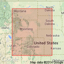
Morrison formation has been recognized over most of Western Interior of United States; except where removed by erosion. It is present over all of Colorado, eastern Utah, northwestern New Mexico, and part of northeastern Arizona. Over most of Western Interior, the Morrison has not been divided into members. In western Colorado, eastern Utah, northeastern Arizona, and northwestern New Mexico, formation can be separated into lower and upper part, each of which has two members. Arbitrary line separating undifferentiated Morrison of central Colorado from subdivided Morrison to the west extends irregularly from northwestern Colorado to south-central Colorado. This line is approximately the limit of recognizable Salt Wash member. Lower part consists solely of Salt Wash member in most of eastern Utah and western Colorado and solely of Recapture member in most of northeastern Arizona and northwestern New Mexico. These members interfinger and grade into each other over a broad area, in vicinity of Four Corners. Upper part of Morrison consists of Westwater Canyon and Brushy Basin members. Westwater Canyon member constitutes lower unit of upper part in southern part of region of study. Brushy Basin member is present over most of region of study. East of arbitrary line marking limits of recognizable Salt Wash the Morrison is undifferentiated. Area of undifferentiated Morrison includes all central and eastern Colorado and extends eastward into western Kansas to a subsurface pinchout of formation. This area includes type section of formation, near Morrison, Colorado, where formation is nearly 300 feet thick (section described by Waldschmidt and LeRoy, 1944). Northward from type section into Wyoming, the Morrison can be divided roughly into three units: lower unit of thin-bedded gray shale and limestone with charophyte oogonia and ostracods, a medial unit of cross-bedded sandstone and conglomerate with dinosaurian remains, and an upper unit of variegated shale. West of type section, in central Colorado basin, the Morrison consists of claystone beds with thin intercalated limestone and sandstone beds. Dense limestones are abundant in this area but are lenticular and cannot be correlated with type section. Formation thins over crest of Uncompahgre uplift. Base of Morrison defined in Colorado Plateau region as base of terrestrial fluvial Jurassic deposits overlying beds of marine or marginal marine San Rafael group. Detailed criteria for selecting contact vary from one area to another. Lower Cretaceous beds overlie Morrison in Colorado, eastern Utah, small area in northeastern Arizona, and northern New Mexico. In the past, these beds have been included in either Morrison formation or Dakota sandstone, depending on basis of their characteristics and affinities in different areas. In southeastern Colorado and northeastern New Mexico, the Purgatoire separates the Morrison and Dakota. In north-central Colorado, beds usually called Dakota probably contain equivalents of Lower Cretaceous Cloverly of Wyoming. In Four Comers area and northward through western Colorado and easternmost Utah, Burro Canyon formation has been recognized as separate formation of Early Cretaceous age. In central Utah, the Cedar Mountain formation (Stokes, 1944) forms widespread Lower Cretaceous unit. No field evidence for major disconformity has been recognized at base of Lower Cretaceous strata.
Source: US geologic names lexicon (USGS Bull. 1200, p. 2595-2605).
- Usage in publication:
-
- Morrison formation*
- Modifications:
-
- Revised
- AAPG geologic province:
-
- Denver basin
Summary:
Pg. 23-26. Morrison fm. In N. Front Range foothills, CO, the Morrison underlies Lytle fm. of Dakota gp. Morrison-Lytle contact is indefinite in many places because (1) congl. beds are not persistently present at base of Lytle, and (2) rocks in upper pt. of Morrison are similar to those in the Lytle. Both the new and old type secs. of Morrison have indefinite upper contacts. Not all 6 informal units recognized by Waldschmidt and LeRoy in new type sec. can be identified away from Alameda Pkwy. sec., and a more generalized subdiv. of Morrison is necessary for N. Front Range foothills. [Waldschmidt and LeRoy's] 2 middle units make up most characteristic pt. of Morrison, a light- to greenish-gray marl and clayst. with intercalated thin ls. beds and a few thin calc. ss. lenses. This zone occupies 100 ft. or more of the Morrison throughout Front Range foothills and incl. dinosaur-bearing beds as well as beds containing freshwater molluscan fauna (Yen, 1952, USGS PP 233-B). Above these undoubted Morrison strata, the sequence locally consists of dominantly red variegated silty clayst. with lenses of ss., the whole too variable laterally to permit division into useful subunits. At many locs., discontinuous lenses of congl. occur approx. at contact of the dominantly red variegated beds and the underlying greenish-gray beds. The Lytle is similar to upper dominantly red variegated zone of Morrison and differs only in its local predominance of ss. and congl. ss., in the somewhat lighter hues of its variegated beds, and in composition of its congls.
3 principal types of strat. relationships are present at Morrison-Lytle contact along Front Range. Most obvious is formed where a thick congl. ss. lens of the Lytle rests uncon. on greenish-gray clayst. and marl of undoubted Morrison. 2nd type is formed by basal congl. ss. lens in the Lytle resting with obvious uncon. on some pt. of the dominantly red variegated clay and ss. in upper Morrison. Exposures of this type of contact present on scarp of hogback S. of Eldorado Spr., in Turkey Creek gap S. of Morrison, on scarp of hogback N. of Deer Cr., and at other places throughout hogback btw. Boulder and Indian Cr. 3rd type of contact is a variation of 2nd type to which contact itself is obscure because entire sequence of beds btw. disconf. at top of Lytle and greenish-gray clayst. of undoubted Morrison consists of alternating lenses of ss., or congl. ss., and variegated clayst. Indefinite contacts can be seen in Denver and Salt Lake RR cut at Plainview, in Eldridge’s type Morrison at Morrison, and in new type Morrison exposure in Alameda Pkwy. roadcut. At Plainview, 5 massive ss. units, 4 of them congl. to varying deg., lie btw. disconf. at top of Lytle and greenish-gray Morrison. Lateral tracing from Eldorado Spr. sec., where base of Lytle is clear cut, indicates that 2nd lens from top in Plainview cut is in the correct relative position to be basal lens of Lytle. Indefinite contact btw. Morrison and Lytle in both old and new type secs. of Morrison raises question of where its upper contact was orig. placed. Eldridge's (1896) definition of Morrison did not incl. measured sec. and his description of upper limit has been interpreted in dif. ways. Lee's idea that Eldridge incl. plant-bearing beds of Dakota in his orig. description of the Morrison has been accepted by many geologists (Stokes, 1944; Reeside, 1952); Waldschmidt and LeRoy (1944) contend that Lee misinterpreted Eldridge and that Morrison-Dakota contact as defined by Eldridge is acceptable. Lee placed Morrison-Dakota contact at base of ledge-forming ss. capping Dakota hogback at Morrison, a horizon above middle of gray sh.-bearing pt. of Dakota gp. in this area. In terms of nomenclature introduced in present rpt., this horizon is base of Kassler ss. mbr. of South Platte fm. (both new) of Dakota gp.
Comparison of relative thicknesses of units described by Eldridge demonstrates that he could not have incl. any of plant-bearing Dakota in his type Morrison. Eldridge gives avg. thickness of 200 ft. for the Morrison; consequently the pt. of fm. he refers to as "upper 3rd" can be expected to be about 60 or 70 ft. thick. In sec. measured by writer [Waage] at Morrison, 65 ft. of variegated clay and ss., including a weakly congl. ss., lie btw. the dominantly greenish-gray Morrison and the probable base of the Lytle. Actually, the Morrison is about 270 ft. thick at type loc., not 200, but even a 3rd of this larger figure would not make upper 3rd of the Morrison more than 100 ft. thick. If Lee's interpretation is applied to sec. at Morrison, "upper 3rd" of Morrison is 228 ft. thick, and fm. as a whole is btw. 350 and 300 ft., about double Eldridge's figure. By Lee's interpretation, the overlying Dakota, said by Eldridge to be btw. 225 and 300 ft. thick, is only 78 ft. Lee (1920) revised Eldridge's type Morrison sec., placing upper contact under the so-called Saurian ss. which marked base of upper 3rd of Eldridge's Morrison. His stated reason for this revision was that no obvious break was found in the sec. btw. the plant horizon and the Saurian congl. In Turkey Cr. sec. 1.8 mi. S. of type Morrison, Lee (1927) placed his Morrison-Dakota contact at base of Lytle, apparently unaware that the break he had chosen as the contact at Morrison lay some 98 ft. strat. below. Throughout the foothills region Lee (1927) confused the 2 congls. in zones in question and consistently placed his Morrison-Dakota contact at base of most obvious congl. zone, apparently unaware that more than 1 zone existed. It is most likely that the Morrison-Lytle contact of present rpt. corresponds to Eldridge's Morrison-Dakota contact. Waldschmidt and LeRoy (1944), in recommending a new type sec. for the Morrison, recognize that Lee (1920) misinterpreted Eldridge's Morrison-Dakota bdry. They believe that Lee corrected this error in a subsequent paper. Lee's 1927 work offers somewhat more accurate sec. than the estimated sec. presented in his 1920 work, but the 2 secs. are obviously much the same and can be matched to show that Lee did not change the position of his Morrison-Dakota contact in his 1927 work. Consequently, top of Morrison as defined by Eldridge (1896) and as redefined by Lee (1927) is in different strat. position, Lee's being at base of the congl. zone in upper 3rd of Eldridge's Morrison. New type sec. of Morrison is better exposed than Eldridge's type sec., but upper contact is equally obscure. None of the many thin ss. lenses btw. disconf. at top of Lytle and greenish-gray clayst. of Morrison contain pebbles of chert and qtzite., Waldschmidt and LeRoy have chosen base of uppermost massive ss. lens in the Lytie as top of their Morrison, but this ledge thins out into variegated clayst. a short distance N. of roadcut. Chert and qtzite. pebble congl., presumably at base of Lytle, crop out locally along hogback N. of the pkwy. and, when followed laterally toward the roadcut, apparently grade into congl. ss. that lies btw. 35 and 55 ft. below Morrison-Dakota contact chosen by Waldschmidt and LeRoy.
Beds btw. the disconf. that marks the top of Lytle fm. and the greenish-gray clayst. of undoubted Morrison are highly lenticular and variable in thickness and lithology. They contain 2 horizons at which congl. lenses are locally common. Upper one of these has the thicker and more persistent congl. lenses, and the unconf. at their base is herein taken as Morrison-Lytle contact. It is believed that this contact corresponds to the Morrison-Dakota contact of Eldridge. Throughout most of N. foothills the local congl. lenses at base of Lytle crop out near enough to one another so that position of Morrison-Lytle contact can be interpolated btw. them. Where it is not possible to recognize the contact over a large area, it is expedient to map the Lytle with the Morrison as an undiff. unit.
Source: Modified from US geologic names lexicon (USGS Bull. 1200, p. 2595-2605).
- Usage in publication:
-
- Morrison formation
- Modifications:
-
- Overview
- AAPG geologic province:
-
- Chadron arch
- Powder River basin
Summary:
Reports on clay mineralogy of four stratigraphic sections: two in Crook Co, WY in Powder River basin, and one each in Custer and Fall River Cos, SD on Chadron arch. Illite is the predominant clay mineral, kaolinite is abundant, and montmorillonite is rare. Clay-mineral assemblages could not be used as a basis for subdividing the formation. Mineralogy is consistent with deposition in a nonmarine environment.
Source: GNU records (USGS DDS-6; Denver GNULEX).
- Usage in publication:
-
- Morrison formation*
- Modifications:
-
- Biostratigraphic dating
- AAPG geologic province:
-
- Chadron arch
- Powder River basin
Summary:
Lists charophytes collected from the Morrison formation in MT, SD, WY, CO, and UT, including two localities in the Black Hills--one near Devils Tower, Crook Co, WY in Powder River basin, and the other near Edgemont, Fall River Co, SD on Chadron arch. Assigned a Late Jurassic (Kimmeridgian) age on basis of these and other collections from localities in MT, WY, CO, and UT.
Source: GNU records (USGS DDS-6; Denver GNULEX).
- Usage in publication:
-
- Morrison formation*
- Modifications:
-
- Biostratigraphic dating
- AAPG geologic province:
-
- Chadron arch
- Powder River basin
- Williston basin
Summary:
Discusses distribution of ostracodes collected from Morrison formation (75 samples at 24 localities) in Crook and Weston Cos, WY and in Meade, Custer, and Fall River Cos, SD in Powder River and Williston basins and on Chadron arch. Describes fauna and concludes that the ostracode assemblages differ from those in the superjacent Lakota formation. Particularly significant is the absence from the Morrison of the notched genera in the subfamily CYPRIDEINAE. Ostracodes described previously as from Morrison formation in the Black Hills are actually from overlying Lakota formation. Late Jurassic (Kimmeridgian and Portlandian) in age.
Source: GNU records (USGS DDS-6; Denver GNULEX).
- Usage in publication:
-
- Morrison formation*
- Modifications:
-
- Revised
- AAPG geologic province:
-
- Paradox basin
Summary:
Brushy Basin member of Morrison formation is composed of green bentonitic mudstone, gray, fine-grained sandstone, and gray yellow claystone of flood-plain origin in the Paradox basin. It is overlain conformably by a conglomerate and conglomeratic sandstone assigned to the Burro Canyon formation. This conglomerate and sandstone is named Karla Kay conglomerate member. Morrison-Burro Canyon contact described in measured sections at several localities. Entire Brushy Basin and overlying Burro Canyon formation described in measured section in Tozer Gulch tributary of McElmo Canyon, sec 30, T36N, R18W, Montezuma Co, CO. Karla Kay thought to be a series of channel-fillings that represent a change from the fluviatile Brushy Basin. Lack of bentonite in overlying Burro Canyon suggests decrease in igneous activity after Morrison time. Mudstones of Morrison have hard frothy crusts; those of Burro Canyon have hackly-weathered surfaces. Cross section. Late Jurassic age.
Source: GNU records (USGS DDS-6; Denver GNULEX).

- Usage in publication:
-
- Morrison formation*
- Modifications:
-
- Areal extent
- AAPG geologic province:
-
- Bighorn basin
- Central Montana uplift
- Denver basin
- Sweetgrass arch
- Williston basin
Summary:
ADDITIONAL REFERENCES FOR THE MORRISON (ca. 1900-1960):
Source: US geologic names lexicon (USGS Bull. 1200, p. 2595-2605).

- Usage in publication:
-
- Morrison formation
- Modifications:
-
- Revised
- AAPG geologic province:
-
- Bighorn basin
Summary:
Upper contact revised in area between Red Dome, Carbon Co, MT to Hyattville, Big Horn Co, WY in the Bighorn basin. Morrison is overlain by the Pryor conglomerate member of the Cloverly between Red Dome and Sykes Mountain where Pryor pinches out. South of Sykes Mountain, the Morrison is overlain by the newly named Little Sheep mudstone member of the Cloverly formation. The upper contact south of Sykes Mountain is at base of lowest beds with volcanic debris or beds that have pebbles or granules of black chert. Therefore some of the variegated clays, coaly beds, and conglomeratic sandstones assigned by some to the Morrison are included in the Cloverly in this report. Ranges from 130 to 280 ft thick. Nomenclature chart. Includes the earliest-formed nonmarine sedimentary rocks, conformably above the marine Sundance formation. Consists of: interlensed calcareous quartz sandstone; green mudstone and shale; some limestone; and some red-banded mudstone.
Source: GNU records (USGS DDS-6; Denver GNULEX).
- Usage in publication:
-
- Morrison Formation*
- Modifications:
-
- Biostratigraphic dating
- AAPG geologic province:
-
- Central Montana uplift
- Chadron arch
- Powder River basin
- Williston basin
Summary:
Suggests a possible extension of time equivalents of Salt Wash Member of Morrison Formation of the Colorado Plateau to the north as far as Fergus Co, MT in Central Montana uplift, and to the Black Hills of WY and SD in Williston and Powder River basins and on Chadron arch on basis of the occurrence of the distinctive zonal ostracode species THERIOSYNOECUM WYOMINGENSE (Branson, 1935). Lists ostracodes and charophytes collected from 16 localities in MT, WY, SD, and CO. Late Jurassic (probably Kimmeridgian) in age.
Source: GNU records (USGS DDS-6; Denver GNULEX).
- Usage in publication:
-
- Morrison Formation
- Modifications:
-
- Revised
- AAPG geologic province:
-
- San Juan basin
Summary:
Revised in McKinley Co, NM in the San Juan basin, in that the name Brushy Basin Member is replaced by the newly named Casamero Member of the Morrison. Morrison is divided into Chavez (base), Prewitt (middle), and Casamero (top) Members. Morrison overlies Thoreau Formation and underlies Dakota Formation. About 400 to 450 ft of Morrison is exposed on the north flank of the Zunis. Morrison sediments suggestive of moderately energetic nonmarine environment. [Jurassic age implied.]
Source: GNU records (USGS DDS-6; Denver GNULEX).

- Usage in publication:
-
- Morrison Formation*
- Modifications:
-
- Geochronologic dating
- AAPG geologic province:
-
- Paradox basin
Summary:
Pg. 11-12, 24, geologic time scale (inside front cover). Morrison Formation (Jurassic). Samples from sandstones in Salt Wash and Brushy Basin Members, in Slick Rock district and Disappointment Valley, Hamm Canyon, Horse Range Mesa, and Dawson Draw quadrangles, San Miguel County, Colorado, yielded Pb-alpha ages from 755 +/-85 Ma to 555 +/-60 Ma (zircon) [Precambrian Y to Cambrian]; published and discussed by Shawe and others (1968). Sample from sandstone in Westwater Canyon Member, at Haystack Butte, Bluewater quadrangle, McKinley County, New Mexico, yielded a Pb-alpha age of 480 +/-55 Ma [Cambrian to Ordovician]; published by Cadigan (1967). Ages do not reflect age of sandstones (Jurassic) but age inherited from source rocks. Ages recalculated using decay constants of Steiger and Jager, 1977 (Earth Planet. Sci. Letters, v. 36, p. 359-362). [See also entries under individual members.]
Source: Publication.
- Usage in publication:
-
- Morrison Formation*
- Modifications:
-
- Revised
- AAPG geologic province:
-
- Black Mesa basin
- Paradox basin
Summary:
Only lower part of Upper Jurassic Morrison Formation discussed. The Bluff, originally a member of the Morrison and later a formation in the San Rafael Group, is removed from the San Rafael, reduced in rank, and reassigned to the Morrison as its basal member. Bluff was formerly thought to tongue into or to grade into the San Rafael. This report demonstrates that the Bluff pinches out into the Morrison and that it is separated from the underlying San Rafael by an unconformity. The unconformity is marked by appearance of coarse to very coarse grains in basal part of formation. The unconformity shows little relief. Bluff can be recognized throughout southeast UT and northeast AZ, Paradox and Black Mesa basins. Cross sections.
Source: GNU records (USGS DDS-6; Denver GNULEX).
- Usage in publication:
-
- Morrison Formation
- Modifications:
-
- Revised
- AAPG geologic province:
-
- Chadron arch
- Williston basin
Summary:
Unkpapa Sandstone reduced in rank and assigned to Morrison as its basal member. Unkpapa is interpreted to be eolian facies of the mostly fluvial Morrison. Study area is Black Hills, Williston basin and Chadron arch, SD. Thicknesses of Morrison and Unkpapa are complementary; where Unkpapa is not present, Morrison averages about 100 ft thick; where Unkpapa is present thickness of Morrison is reduced or absent. Conformably overlies Redwater Shale Member of Sundance Formation; where main body overlies Unkpapa, contact may be gradational or disconformable. Underlies Lakota Formation either gradationally or disconformably. Measured sections; stratigraphic column; generalized cross section. Assigned Kimmeridgian and Portlandian (Late Jurassic) age.
Source: GNU records (USGS DDS-6; Denver GNULEX).
- Usage in publication:
-
- Morrison Formation*
- Modifications:
-
- Revised
- AAPG geologic province:
-
- Sweetgrass arch
Summary:
Unconformably underlies Cut Bank Sandstone Member, extended geographically into Sawtooth Range, Teton Co, MT on Sweetgrass arch, where it is assigned to the newly named Mount Pablo Formation. Eroded prior to Cut Bank deposition in Badger Creek area. Retained as Late Cretaceous age.
Source: GNU records (USGS DDS-6; Denver GNULEX).
- Usage in publication:
-
- Morrison Formation*
- Modifications:
-
- Revised
- AAPG geologic province:
-
- Paradox basin
- Piceance basin
Summary:
Lower boundary of Morrison is the J-5 unconformity. Term Summerville Formation previously applied to some beds reassigned in this report to Tidwell unit or lower part of Morrison Formation, if they lie above J-5 unconformity, or to Wanakah Formation if they lie below the J-5 unconformity. Summerville truncated beneath the J-5 32 km northwest of Moab, UT; does not extend into eastern UT or western CO. Some geologists have placed lower Morrison contact within unit assigned to Tidwell in this report. Area covers southwest CO (Paradox and southern Piceance basins) and southeast UT (Paradox basin). Late Jurassic age.
Source: GNU records (USGS DDS-6; Denver GNULEX).
- Usage in publication:
-
- Morrison Formation
- Modifications:
-
- Age modified
- AAPG geologic province:
-
- Paradox basin
Summary:
Fission-track data give an age of 105.7 +/-7.1 m.y. for bentonites directly below Buckhorn Conglomerate Member of Cedar Mountain Formation; an age of 134.7 +/-5.5 m.y. 15 m below Buckhorn; an age of 133.8 +/-9.3 m.y. 25 m below Buckhorn; and 134.3 +/-6.7 m.y. 30 m below Buckhorn [suggesting that the Upper Jurassic-Lower Cretaceous boundary is within, rather than at the top of, Morrison Formation]. In Paradox basin.
Source: GNU records (USGS DDS-6; Denver GNULEX).
- Usage in publication:
-
- Morrison Formation*
- Modifications:
-
- Revised
- AAPG geologic province:
-
- Paradox basin
- Piceance basin
Summary:
Basal Morrison contact placed at an unconformity, the J-5, which represents a major regional break in the Western Interior. The contact is angular and erosional, and occurs 4.8 m to 28.6 m below Salt Wash Member. The intervening member is called Tidwell Member of Morrison. Tidwell is identifiable in UT and CO from the San Rafael Swell east to Bridgeport and Uravan. Near Glenwood Springs Salt Wash wedges out and Tidwell merges with the rest of Morrison. Gilluly (1929) recognized the unconformity. Others have selected this contact, or one somewhere between it and the base of the channel sandstone sequence, the salt Wash Member. The underlying formation in east-central UT is Summerville Formation of San Rafael Group. Is of Late Jurassic age. Present in Paradox and Piceance basins.
Source: GNU records (USGS DDS-6; Denver GNULEX).
- Usage in publication:
-
- Morrison Formation
- Modifications:
-
- Revised
- AAPG geologic province:
-
- San Juan basin
Summary:
Jackpile sandstone, formerly considered an informal economic unit at the top of the Brushy Basin Member of the Upper Jurassic Morrison Formation, removed from Brushy Basin and assigned as the formal upper member of the Morrison. Upper contact of Brushy Basin is thus revised wherever Jackpile occurs in the San Juan basin of NM.
Source: GNU records (USGS DDS-6; Denver GNULEX).
- Usage in publication:
-
- Morrison? Formation
- Modifications:
-
- Not used
Summary:
Not used in Sanpete-Sevier Valley area, Sanpete and Sevier Cos, UT, Wasatch uplift. Rocks previously assigned to Morrison? of Spieker (1946) can be divided into upper and lower units. The lower unit is here assigned to Cedar Mountain Formation. The upper unit, consisting of coarse conglomerate, is either a newly recognized lithologic unit at top of Cedar Mountain Formation, a conglomeratic facies of the Indianola Group, or part Cedar Mountain and part Indianola. Unequivocal Morrison Formation is thought to pinchout west of San Rafael Swell, whereas upper unit of this report pinches out east of Sanpete-Sevier Valley area; both pinchouts are hidden beneath Wasatch Plateau. History-of-usage chart.
Source: GNU records (USGS DDS-6; Denver GNULEX).
- Usage in publication:
-
- Morrison Formation
- Modifications:
-
- Areal extent
- AAPG geologic province:
-
- Orogrande basin
Summary:
Thin wedge of Morrison Formation was identified in four measured sections in the Carthage area, south of Socorro in T5S, Socorro Co, NM in the Orogrande basin. These are the southernmost outcrops of Morrison identified in NM. Lies disconformably on Chinle Formation. Contact with overlying Dakota Sandstone is erosional; the Dakota is coarse grained and always has a scoured base. Morrison consists of fine- to medium-grained, white to pale-greenish-yellow sandstone with a kaolinitic matrix. Ranges from subarkose arenite to sublithic arenite. Presence of euhedral micas in the sandstone suggests input of volcanic ash. The thin mudstone interbeds are green gray to red purple. The mudstone is rich in kaolinite. Euhedral mica and zircon from one bed may be weathered air-fall ash. Geologic map; measured sections. These rocks assigned to Morrison on basis of stratigraphic position, lithologic similarity to Morrison elsewhere, and geographic distribution of Jurassic rocks in NM. Sequence varies between 1.09 and 3.3 m thick. These outcrops are near the depositional limits of the Morrison.
Source: GNU records (USGS DDS-6; Denver GNULEX).
- Usage in publication:
-
- Morrison Formation
- Modifications:
-
- Geochronologic dating
- Age modified
- AAPG geologic province:
-
- Paradox basin
Summary:
Samples taken from bentonites and bentonitic mudstones in Morrison Formation near Notom, Wayne Co, UT in Paradox basin show that Morrison at this locality is post-Kimmeridgian, Tithonian or Late Jurassic, Neocomian to [Barremian, Aptian,] Albian or Early Cretaceous age. Considered only Late Jurassic by most earlier workers. Fission-track data, mostly from zircon but 2 from apatite, yielded ages of 130 to 157 m.y. for most (Tidwell, Salt Wash, and lower part of Brushy Basin Members) of the Morrison, and 99 to 123 m.y. for upper part of Morrison, or upper part of Brushy Basin Member. The sedimentation rates for Tidwell, Salt Wash, and lower part of Brushy Basin were about 6.2 m/m.y., whereas the sedimentation rate for upper part of Brushy Basin was only about 0.6 m/m.y. The reduction in sedimentation rate in late Morrison time was probably related to the reduction in plutonic activity caused by slowing of collision at about 140 to 145 m.y. between the North American and Farallon plates.
Source: GNU records (USGS DDS-6; Denver GNULEX).
- Usage in publication:
-
- Morrison Formation*
- Modifications:
-
- Revised
- AAPG geologic province:
-
- San Juan basin
Summary:
Overlain unconformably by a conglomeratic sandstone, Encinal Canyon Member (new) of Dakota Sandstone in this report between El Morro National Monument and Mesa Laguna on the south and east sides of the San Juan basin. Rocks called Encinal Canyon in this report were included in Jackpile sandstone, an economic unit, in Brushy Basin Member of Morrison Formation, in Burro Canyon Formation, or in Dakota Sandstone in previous reports. Is of Late Jurassic age.
Source: GNU records (USGS DDS-6; Denver GNULEX).
- Usage in publication:
-
- Morrison Formation*
- Modifications:
-
- Revised
- AAPG geologic province:
-
- Black Mesa basin
- San Juan basin
Summary:
Basal member of Morrison above the Wanakah Formation gets younger from north to south in that: Bluff Sandstone Member overlies Horse Mesa Member (new) of the Wanakah at Toh Atin Mesa and Tsitah Wash, Apache Co, AZ, Black Mesa basin; Salt Wash Member overlies Horse Mesa from Beclabito dome south to point north of Toadlena, San Juan Co, NM, San Juan basin; and Recapture Member overlies Horse Mesa at Toadlena, San Juan Co, NM, San Juan basin and the intertongued Cow Springs Sandstone and Horse Mesa from Todilto Park and south in the basin. Assigned to the Late Jurassic.
Source: GNU records (USGS DDS-6; Denver GNULEX).
- Usage in publication:
-
- Morrison Formation*
- Modifications:
-
- Revised
- AAPG geologic province:
-
- Black Mesa basin
- Paradox basin
- Plateau sedimentary province
Summary:
Divided into: Tidwell (base, new), Salt Wash, Recapture, and Westwater Canyon Members in Black Mesa basin, AZ; Tidwell (new, at base), Salt Wash, and Fiftymile (new) or its equivalent Brushy Basin, Members in Kaiparowits basin, Plateau sedimentary province; Tidwell (base), Salt Wash, and Brushy Basin Members in the Henry basin and San Rafael Swell areas, UT, in Paradox basin. Bounded at base by J-5 unconformity. Overlies Cow Springs Member (rank and affiliation changed) of Entrada Sandstone in Black Mesa basin. Overlies Romana Sandstone (new) in Kaiparowits basin. Contact of Brushy Basin with Cedar Mountain Formation difficult to select where Buckhorn Conglomerate Member overlies Morrison. Eolian sandstones of Morrison dip northeast or east-northeast, and they can be distinguished from older sandstones of San Rafael which dip south, southeast, and west. Type Morrison resembles Tidwell.
Source: GNU records (USGS DDS-6; Denver GNULEX).
- Usage in publication:
-
- Morrison? Formation
- Modifications:
-
- Not used
Summary:
Some rocks formerly assigned by various authors to the Morrison? Formation, to the Morrison? Formation and Indianola Group, or to Cedar Mountain and Indianola Group, are named Pigeon Creek Formation. The new name will be used on the Wasatch and Gunnison Plateaus of central UT, in eastern Juab Co (Great Basin province), and from Thistle on north to Salina on south (Wasatch uplift). Pigeon Creek unconformably overlies Jurassic Twist Gulch Formation, unconformably underlies Indianola Group, and is of Neocomian, Aptian and Albian ages. Stratigraphic figures.
Source: GNU records (USGS DDS-6; Denver GNULEX).
- Usage in publication:
-
- Morrison? Formation
- Modifications:
-
- Not used
Summary:
Not used for rocks along west side if Gunnison Reservoir extending southwestward for about 5 mi to U. S. Highway 89, Sanpete Co, UT, Wasatch uplift. Name replaced by Cedar Mountain Formation and an overlying unnamed new basal unit of the Indianola Group (revised). Name Cedar Mountain used for lower part of Morrison? because of close lithologic similarity to type Cedar Mountain. Unnamed basal unit of Indianola contains palynomorphs no older than Cenomanian and limited mollusks and plants no older than early Cenomanian or late Albian and leaf prints of late Albian to early Cenomanian. Stratigraphic column. Schwans (same volume, p. 531-556) replaces Morrison? with newly named Pigeon Creek Formation.
Source: GNU records (USGS DDS-6; Denver GNULEX).
- Usage in publication:
-
- Morrison Formation*
- Modifications:
-
- Revised
- AAPG geologic province:
-
- San Juan basin
Summary:
In the southeast part of the San Juan basin of NM, the upper part of an eolian sandstone sequence formerly assigned to the upper part of the sandstone of Mesita, is reassigned as the eolian facies of the Recapture Member of Upper Jurassic Morrison Formation. The sandstone facies overlies the newly named Mesita Member (= lower part of the former sandstone of Mesita) of Wanakah Formation of the San Rafael Group. The sandstone facies underlies the fluvial facies of Recapture. Nomenclature chart; cross section.
Source: GNU records (USGS DDS-6; Denver GNULEX).
- Usage in publication:
-
- Morrison Formation
- Modifications:
-
- Geochronologic dating
- AAPG geologic province:
-
- Paradox basin
Summary:
Single-crystal, laser-fusion 40Ar/39Ar ages on plagioclase and alkali feldspar from Brushy Member range from 153-145 +/-1-2 Ma. Five samples dated are from Montezuma Creek section and one from Dinosaur National Monument, San Juan Co, UT, Paradox basin. Samples were taken at Montezuma Creek section from about 30 m to about 85 m from the base of a 105 m thick section of Brushy Basin; at Dinosaur National Monument, sample was taken about 10 m above main dinosaur-bearing layer. Age of Brushy Basin is late Kimmeridgian to Tithonian (Late Jurassic); however as no age data is from uppermost part of unit, it is possible that upper beds could be Early Cretaceous.
Source: GNU records (USGS DDS-6; Denver GNULEX).
- Usage in publication:
-
- Morrison Formation
- Modifications:
-
- Revised
- AAPG geologic province:
-
- Orogrande basin
- San Juan basin
Summary:
Lower contact of Upper Jurassic Morrison Formation revised locally in south-central NM where it overlies the newly named Upper Triassic San Pedro Arroyo Formation, upper formation of the Chinle Group (rank raised). This new terminology is to be used from the eastern edge of the Lucero uplift at Carrizo Spring to the Capitan Mountains, Lincoln, Valencia, and Socorro Cos., NM in the San Juan and Orogrande basins. Stratigraphic tables.
Source: GNU records (USGS DDS-6; Denver GNULEX).
- Usage in publication:
-
- Morrison Formation*
- Modifications:
-
- Age modified
- AAPG geologic province:
-
- San Juan basin
Summary:
Tentative correlation of Jackpile Sandstone Member of Morrison on western margin of Nacimiento uplift, San Juan basin with Burro Canyon? Formation in northeast San Juan basin (Chama basin) suggests a Late Jurassic or Early Cretaceous age for the Jackpile. Correlation based on similar lithologies, fluvial characteristics, paleocurrent directions and interfingering relationships with underlying Brushy Basin Member of Morrison. Though Burro Canyon? and Jackpile occupy same stratigraphic position between underlying Brushy Basin and overlying Dakota Sandstone, their stratigraphic relationship is uncertain. Burro Canyon? and Jackpile interval probably represents single, depositionally continuous fluvial unit. Bases of Burro Canyon? and Jackpile probably locally grade into underlying Brushy Basin suggesting conformable relationship. Burro Canyon? considered late Early Cretaceous age if it actually correlates with type Burro Canyon in southwest CO; however, no age-diagnostic fossils have been reported. Morrison may be as young as Early Cretaceous locally where Jackpile is present.
Source: GNU records (USGS DDS-6; Denver GNULEX).
- Usage in publication:
-
- Morrison Formation*
- Modifications:
-
- Revised
- AAPG geologic province:
-
- Piceance basin
Summary:
Some of the nomenclature assigned to Jurassic rocks in the western Black Canyon at the Smith Fork of the Gunnison River, Gunnison Co., CO, Piceance basin is revised. Rocks previously assigned to the upper part of the Wanakah Formation are reassigned to the lower part of the Morrison Formation of Late Jurassic age. In previous reports on this area, Wanakah was thought to underlie Salt Wash Member of Morrison. In this report, the name Tidwell Member of Morrison is applied to the former upper Wanakah. Tidwell is divisible into (ascending): bed A, lower gypsiferous beds, and upper beds, Tidwell overlies beds of Sawpit at top of Wanakah beneath the J-3 unconformity and underlies Salt Wash Member. The unit "bed at Smith Fork" which lies in the middle part of the upper beds of the Tidwell replaces use of name Junction Creek Sandstone for the 73 ft thick, gray to white, fine grained, cross-bedded sandstone. The bed at Smith Fork pinches out southward; it is not present at South Smith Fork measured section; it dips under younger rocks less than 1 mi east of Smith Fork measured section. Cross section.
Source: GNU records (USGS DDS-6; Denver GNULEX).
- Usage in publication:
-
- Morrison Formation*
- Modifications:
-
- Revised
- AAPG geologic province:
-
- Green River basin
- Uinta basin
Summary:
Revised in that the Windy Hill Member of the Sundance Formation is removed from the Sundance and reassigned as the basal member of the Morrison Formation. "The Windy Hill Member was originally called the Windy Hill Sandstone Member and included in the Sundance Formation, which is largely but not entirely a marine formation. The extensive erosion surface at the base of the Windy Hill and its interfingering relations with lower Morrison strata indicate that it is more closely related to the Morrison than to the Sundance, even though it is a marine deposit. For these reasons, the Windy Hill Sandstone Member is here removed from the Sundance Formation, the lithologic name (sandstone) is deleted for simplicity and ease of use, and the member is reassigned to the Morrison Formation as the Windy Hill Member. This stratigraphic reassignment allows a clearer understanding, not only of the stratigraphic relations of the Windy Hill and correlative units in the Morrison, but also of the genesis of beds immediately above the J-5 unconformity." Correlation chart (fig. 3) shows Windy Hill in northeast UT above the J-5 unconformity, overlying the Redwater Member (Oxfordian) of the Sundance Formation and assigns the Windy Hill to both the upper Oxfordian and lower Kimmeridgian.
Source: GNU records (USGS DDS-6; Denver GNULEX).
- Usage in publication:
-
- Morrison Formation*
- Modifications:
-
- Biostratigraphic dating
- Geochronologic dating
- AAPG geologic province:
-
- Uinta basin
Summary:
Palynomorph evidence from samples of Morrison primarily from area of Dinosaur National Monument, Uintah Co, UT (Uinta basin) indicate Morrison is no older that late Oxfordian and no younger than Tithonian (Late Jurassic). Most of Morrison was deposited during Kimmeridgian and perhaps into Tithonian. Authors found no evidence supporting an Early Cretaceous age for any Morrison strata. List and range of fossils (fig. 3). Kowallis and others (this volume) have refined the radiometric age of upper part of Brushy Basin Member to range from 147.8 +/-0.6 Ma to 150.2 +/-0.5 Ma (Tithonian).
Source: GNU records (USGS DDS-6; Denver GNULEX).
For more information, please contact Nancy Stamm, Geologic Names Committee Secretary.
Asterisk (*) indicates published by U.S. Geological Survey authors.
"No current usage" (†) implies that a name has been abandoned or has fallen into disuse. Former usage and, if known, replacement name given in parentheses ( ).
Slash (/) indicates name conflicts with nomenclatural guidelines (CSN, 1933; ACSN, 1961, 1970; NACSN, 1983, 2005, 2021). May be explained within brackets ([ ]).