

- Usage in publication:
-
- Lytle sandstone member*
- Modifications:
-
- Named
- Dominant lithology:
-
- Sandstone
- Grit
- Shale
- AAPG geologic province:
-
- Denver basin
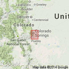
Summary:
Named for Lytle, sec 2, T17S, R67W, in valley of Turkey Creek, El Paso Co, CO in the Denver basin, as the lower member of the Purgatoire Formation. Overlies Morrison formation. Underlies Glencairn shale member (new) of Purgatoire. Rocks assigned to Purgatoire in quadrangle area were included in the Dakota sandstone in earlier reports. No type locality designated. Base of Lytle is usually a coarse, massive, siliceous sandstone with white, yellow-brown or black grains that is 15 ft or less thick. The average diameter of these grains is about one-eighth of an inch but the larger grains are an inch across. At some localities, the base of the Lytle is a fine-grained white to cream-colored sandstone 100 ft thick. Generally consists of sandstone and intercalated grit and shale beds. Has several pebbly beds that are most common in upper 50 ft. Has scattered green or red clay lenses near top. No fossils found in quad. Considered to be Early Cretaceous age. Geologic map. Stratigraphic tables. Mapped in southwest and northwest parts of quad.
Source: GNU records (USGS DDS-6; Denver GNULEX).
- Usage in publication:
-
- Lytle sandstone member*
- Modifications:
-
- Areal extent
- AAPG geologic province:
-
- Denver basin
- Las Vegas-Raton basin
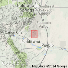
Summary:
Extended as the lower member of the Purgatoire formation south of the Colorado Springs area into Fremont and Pueblo Cos of Denver basin, and into Huerfano Co of Las Vegas-Raton basin. Is assigned an Early Cretaceous age.
Source: GNU records (USGS DDS-6; Denver GNULEX).
- Usage in publication:
-
- Lytle formation*
- Modifications:
-
- Overview
- Areal extent
- Revised
- AAPG geologic province:
-
- Denver basin
Summary:
Extended into north-central CO along the Front Range foothills in the Denver basin from south-central CO where it is a member of the Purgatoire formation and raised in stratigraphic rank as basal formation of Cretaceous Dakota group (raised in rank). Term Lytle applied to sandstone, conglomeratic sandstone, and variegated claystone disconformably above Morrison formation and disconformably below South Platte formation, also of Dakota group. Measured sections. Discussion and diagram of varied placement of Morrison-Lytle contact shown on figure 7. Classified as Early Cretaceous on basis of physical correlation with fossiliferous beds in WY. Correlation with other Cretaceous units in northeast WY in Powder River basin, Wind River basin of central WY, and Denver basin of southeast WY, northeast and south-central CO shown on fig. 19.
Source: GNU records (USGS DDS-6; Denver GNULEX).

- Usage in publication:
-
- Lytle formation*
- Modifications:
-
- Mapped 1:24k (Littleton quad, Arapahoe, Douglas, and Jefferson Cos, CO)
- Dominant lithology:
-
- Sandstone
- AAPG geologic province:
-
- Denver basin
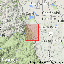
Summary:
Is Lower Cretaceous formation mapped in east-central Jefferson Co, CO (Denver basin). Outcrops in area of Deer Creek to south edge of quad. Consists of yellowish-gray conglomeratic sandstone that contains pebbles of chert and quartzite, and petrified wood; locally consists of medium-grained sandstone and lenses of claystone. Measured section (part). Unconformably overlies Morrison formation (Upper Jurassic); underlies South Platte formation (Lower Cretaceous). Thickness is about 40 ft.
Source: GNU records (USGS DDS-6; Denver GNULEX).
- Usage in publication:
-
- Lytle formation*
- Modifications:
-
- Mapped 1:24k (Kassler quad, Douglas and Jefferson Cos, CO)
- Dominant lithology:
-
- Sandstone
- Claystone
- AAPG geologic province:
-
- Denver basin
Summary:
Is Lower Cretaceous formation mapped in northwestern Douglas and southeastern Jefferson Cos, CO (Denver basin). Is mapped undivided with Lower Cretaceous South Platte formation. Outcrops as northwesterly striking, northeast dipping, narrow band along Hogback in central part of map. Described (p.94) as yellowish-gray conglomeratic sandstone containing pebbles of quartz, chert, and quartzite and logs of agatized wood; locally contains medium-grained sandstone with lenses of variegated claystone. Unconformably overlies Morrison formation (Upper Jurassic); disconformably underlies South Platte. Is 40 ft thick.
Source: GNU records (USGS DDS-6; Denver GNULEX).

- Usage in publication:
-
- Lytle Formation*
- Modifications:
-
- Mapped 1:24k (Morrison quad, Jefferson Co, CO)
- Dominant lithology:
-
- Sandstone
- Conglomerate
- AAPG geologic province:
-
- Denver basin
Summary:
Is Lower Cretaceous formation mapped in north-central Jefferson Co, CO (Denver basin). Is lower formation of Dakota Group. Outcrops occur along Hogback. Unconformably overlies Morrison Formation (Upper Jurassic); conformably underlies South Platte Formation (Lower Cretaceous) of Dakota. Described as yellowish-gray or yellowish-brown medium-to fine-grained iron stained sandstone and conglomerate. Conglomerate generally near base composed of quartz, quartzite, chert, and some petrified wood. Silicified tree trunks in upper part of formation. Thickness about 80 ft.
Source: GNU records (USGS DDS-6; Denver GNULEX).
- Usage in publication:
-
- Lytle Sandstone Member*
- Modifications:
-
- Areal extent
- AAPG geologic province:
-
- Denver basin
Summary:
Mapped with overlying Dakota Sandstone in the northeast and north-central parts of the quad in the Webster Park graben, Eightmile Park, and along the east border of the quad in Fremont Co, CO in the Denver basin. Two members recognized but not mapped. The Lytle Sandstone Member at the base contains white, fine- to coarse-grained sandstone, variegated clay, and pebbly beds 120 ft thick. The Glencairn Shale Member at the top is an olive-brown, thin-bedded sandstone, gray and black shale and clay 80 ft thick. Dakota unconformably overlies Morrison Formation. Of Early Cretaceous age.
Source: GNU records (USGS DDS-6; Denver GNULEX).
- Usage in publication:
-
- Lytle Sandstone
- Modifications:
-
- Revised
- Reference
- Areal extent
- AAPG geologic province:
-
- Sierra Grande uplift
- Palo Duro basin
Summary:
Revised in stratigraphic rank from basal member of Purgatoire Formation to formation rank. Removed from Purgatoire, a term abandoned in this report. Overlies Morrison Formation. Underlies Long Canyon Sandstone Bed (new), basal bed of Glencairn Formation. Is continuously exposed in the Dry Cimarron valley of Union Co, NM on the Sierra Grande uplift into Cimarron Co, OK in the Palo Duro basin, where it is an orange and gray sandstone and conglomerate, and pink, red, olive siltstone unit as much as 20 m thick. The sandstone is quartzose, generally fine-medium grained with abundant planar and some trough crossbeds. Clasts in the conglomerates are mostly chert pebbles up to 4 cm in diameter. Fragments of petrified wood and nondescript burrows observed. Assigned an Albian age. Correlated with Cheyenne Sandstone Member of Purgatoire Formation of earlier use. Reference section designated in NE1/4 SW1/4 SW1/4 sec 18, T15N, R2E, Cimarron Co, OK, where formation is 14.9 m thick. Other measured sections.
Source: GNU records (USGS DDS-6; Denver GNULEX).
For more information, please contact Nancy Stamm, Geologic Names Committee Secretary.
Asterisk (*) indicates published by U.S. Geological Survey authors.
"No current usage" (†) implies that a name has been abandoned or has fallen into disuse. Former usage and, if known, replacement name given in parentheses ( ).
Slash (/) indicates name conflicts with nomenclatural guidelines (CSN, 1933; ACSN, 1961, 1970; NACSN, 1983, 2005, 2021). May be explained within brackets ([ ]).