The National Geologic Map Database is migrating to a new infrastructure. We apologize for any service disruptions during this process.
|
|---|


- Usage in publication:
-
- Lakota formation*
- Modifications:
-
- First used
- Dominant lithology:
-
- Sandstone
- Shale
- Clay
- Coal
- AAPG geologic province:
-
- Williston basin
- Powder River basin
- Chadron arch
Summary:
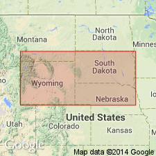
First use of name. Intent to name not stated, and no type locality designated. Area of report is Black Hills, eastern WY and western SD, Powder River and Williston basins, and on Chadron arch. Typical sections measured at 12 localities in Black Hills. Consists mainly of coarse, cross-bedded sandstones in thick masses with intercalated shales, fire clays, and local coal beds. Overlies Unkpapa sandstone or Beulah shales [Morrison Formation]. Is of Jurassic? or Early Cretaceous age.
Source: GNU records (USGS DDS-6; Denver GNULEX).
- Usage in publication:
-
- Lakota formation*
- Modifications:
-
- Overview
- Dominant lithology:
-
- Sandstone
- Shale
- Coal
Summary:
Massive, buff, coarse, cross-bedded sandstone with some intercalated shale and, locally, coal beds. Top member is dull-yellow sandstone. Thickness 200 to 300 ft. If not Jurassic, it represents earliest deposit of Lower Cretaceous. Contains local unconformities. Underlies Minnewaste limestone and unconformably overlies Jurassic Beulah shales [Morrison Formation]. Included in Dakota sandstone of early reports. Name derived from one of tribal divisions of Sioux Indians. Type locality not given. Assigned to the Early Cretaceous or the Jurassic?.
Source: GNU records (USGS DDS-6; Denver GNULEX).
- Usage in publication:
-
- Lakota sandstone*
- Modifications:
-
- Overview
- AAPG geologic province:
-
- Williston basin
Summary:
Lakota sandstone or formation of Early Cretaceous age in the Black Hills area, SD, Williston basin, resembles a sandstone in the lower part of Cloverly formation, a new unit named in the Bighorn uplift. A new name--Cloverly--defined in the uplift, rather than use of older term Lakota due to lack of evidence as to the equivalency of the two sandstones. Correlation diagram.
Source: GNU records (USGS DDS-6; Denver GNULEX).
- Usage in publication:
-
- Lakota sandstone*
- Modifications:
-
- Overview
- AAPG geologic province:
-
- Chadron arch
Summary:
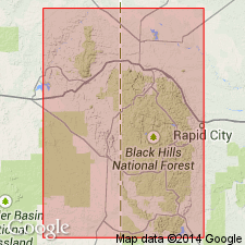
Type locality is Lakota Peak, a summit on hogback range 4 mi northwest of Hermosa, Custer Co, SD on Chadron arch. Is of Early Cretaceous age.
Source: GNU records (USGS DDS-6; Denver GNULEX).
- Usage in publication:
-
- Lakota sandstone*
- Modifications:
-
- Revised
- AAPG geologic province:
-
- Powder River basin
- Williston basin
Summary:
Assigned as basal formation in the Lower Cretaceous Inyan Kara group (new), Black Hills, SD and WY. Overlain by Fuson shale; underlain by Morrison formation.
Source: GNU records (USGS DDS-6; Denver GNULEX).
- Usage in publication:
-
- Lakota sandstone
- Modifications:
-
- Revised
- AAPG geologic province:
-
- Salina basin
Summary:
Pg. 15 (fig. 7). Lakota formation of Dakota group. Shown on columnar section as basal formation in Dakota group. Underlies Fuson shale. [Age is Early Cretaceous.]
Source: US geologic names lexicon (USGS Bull. 1200, p. 2089-2090).
- Usage in publication:
-
- Lakota sandstone*
- Modifications:
-
- Overview
- AAPG geologic province:
-
- Powder River basin
- Denver basin
Summary:
Correlation with other Cretaceous units in Powder River basin in northeast WY, Wind River basin in central WY and in Denver basin, southeast WY, northeast and south-central CO shown on fig 19.
Source: GNU records (USGS DDS-6; Denver GNULEX).
- Usage in publication:
-
- Lakota formation*
- Modifications:
-
- Revised
- Reference
- AAPG geologic province:
-
- Chadron arch
Summary:
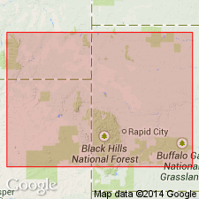
Redefined as mostly sandy sediments of varied continental facies allied lithogenetically with underlying Morrison formation, overlain unconformably by a redefined Fall River formation consisting of mostly sandy sediments of marginal marine facies. Includes, in ascending order, in the southern Black Hills: an unnamed lower part, Minnewaste limestone member, and Fuson member (the last two units previously of formational rank). Use of the name Fuson as a member of Lakota is considered permissible only where Minnewaste limestone member is present. Additional beds are added progressively at the base of the formation as it thickens eastward and southeastward in the Black Hills. The relationship of these beds to underlying Morrison formation is not completely understood, but they do not interfinger. Contact with overlying Fall River formation is a regional transgressive disconformity. Reference section 460 ft thick in secs 29, 32, and 33, T7S, R6E, Fall River Co, SD, in Fall River Canyon, 4-5 mi by road from Hot Springs, SD on the Chadron arch. Assigned to the Early Cretaceous.
Source: GNU records (USGS DDS-6; Denver GNULEX).
- Usage in publication:
-
- Lakota formation*
- Modifications:
-
- Revised
Summary:
Subdivides the Lower Cretaceous Lakota formation in the southern Black Hills into Chilson (new) and overlying Fuson members, locally separated by Minnewaste limestone member. A distinctive reddish-brown sandstone at top of Chilson member used as a marker for subdividing the formation for several mi beyond the limits of Minnewaste limestone. Chilson member pinches out in the vicinity of Inyan Kara Creek [on the western side of the Black Hills] and the Lakota formation northwest of that point consists entirely of Fuson member.
Source: GNU records (USGS DDS-6; Denver GNULEX).
- Usage in publication:
-
- Lakota Formation*
- Modifications:
-
- Overview
Summary:
Compares petrology of sandstone from Fall River, Lakota, and Morrison Formations, and Unkpapa Sandstone. Sandstone from Lakota Formation at most places characteristically well- to poorly sorted; mostly fine grained, becoming medium- to very coarse grained in some beds; mostly quartz grains, but includes abundant chert in coarser grained beds, some feldspar, rare muscovite, and schist fragments; mostly rounded zircon and tourmaline, very little garnet except in bottom part locally, no hornblende, chloritoid, or apatite at most places in 0.062-0.125 mm size fraction. Nonopaque heavy mineral suite distinguishable from suites in overlying Fall River Formation and underlying Morrison Formation and Unkpapa Sandstone. Discusses source and origin. Assigned to the Early Cretaceous.
Source: GNU records (USGS DDS-6; Denver GNULEX).
- Usage in publication:
-
- Lakota Formation*
- Modifications:
-
- Overview
Summary:
Describes lithologic variations in the Lower Cretaceous Lakota Formation in the northwestern part of the Black Hills. Numerous measured sections.
Source: GNU records (USGS DDS-6; Denver GNULEX).
- Usage in publication:
-
- Lakota Formation
- Modifications:
-
- Contact revised
- Overview
- AAPG geologic province:
-
- Powder River basin
- Williston basin
Summary:
Upper contact revised in the Powder River basin of southeast MT and northeast WY, and in the Williston basin of east MT and western SD where it underlies the newly named Liscom Creek Member, basal member of River Formation of Inyan Kara Group. This report is a study of subsurface data over the entire report area, and of surface data collected from outcrops around the Black Hills. Isopach map. Is more than 125 ft thick in small areas of MT, WY, and SD. Thins eastward from the Black Hills. Cross sections. Of Early Cretaceous age.
Source: GNU records (USGS DDS-6; Denver GNULEX).
- Usage in publication:
-
- Lakota Formation*
- Modifications:
-
- Overview
Summary:
Integrates mapping of thirteen 7 1/2-minute quads. Lakota Formation of Inyan Kara Group is composed of Chilson, Minnewaste Limestone, and Fuson Members, and ranges in thickness from 200-500 ft. Chilson and overlying Fuson Members subdivided into four sandstone-mudstone fluvial units, and a mudstone unit of probable lacustrine origin. Distribution and interrelations of the subunits discussed and shown on the accompanying geologic map. Assigned to the Early Cretaceous.
Source: GNU records (USGS DDS-6; Denver GNULEX).
- Usage in publication:
-
- Lakota Formation*
- Modifications:
-
- Age modified
- AAPG geologic province:
-
- Powder River basin
- Williston basin
- Chadron arch
Summary:
Age is Barremian or older Early Cretaceous (possibly as old as Valanginian) rather than Aptian (Sohn, 1958, WGA Guidebook, 13th Ann. Field Conf.) in the Black Hills area of SD and WY, Powder River and Williston basins and Chadron arch. Age based on ostracodes within Chilson Member of Lakota.
Source: GNU records (USGS DDS-6; Denver GNULEX).
For more information, please contact Nancy Stamm, Geologic Names Committee Secretary.
Asterisk (*) indicates published by U.S. Geological Survey authors.
"No current usage" (†) implies that a name has been abandoned or has fallen into disuse. Former usage and, if known, replacement name given in parentheses ( ).
Slash (/) indicates name conflicts with nomenclatural guidelines (CSN, 1933; ACSN, 1961, 1970; NACSN, 1983, 2005, 2021). May be explained within brackets ([ ]).