The National Geologic Map Database is migrating to a new infrastructure. We apologize for any service disruptions during this process.
|
|---|


- Usage in publication:
-
- Jangle limestone*
- Modifications:
-
- Original reference
- Dominant lithology:
-
- Limestone
- AAPG geologic province:
-
- Great Basin province
Summary:
Pg. 359-340, pls. 32, 33. Name Jangle limestones substituted for Peasley limestone of Wheeler (1940) in Pioche and Groom districts because of differences in thickness, lithologic characteristics, and possibly in formation boundaries. Subdivided into 3 units each of which consists of limestone. Lower unit, 80 feet thick, consists of dark-smoky-gray to steel-gray prominent ledge-forming limestone containing buff irregular silty partings. Lower 40 feet of this unit includes some well-bedded finely crystalline limestone beds a few inches thick; remaining 40 feet dominantly resistant calcitic poorly to fairly well-bedded limestone. Middle unit, 115 feet thick, consists of dark-gray limestone containing buff to reddish-brown silty material which is distinctive for its slope-forming character. Upper unit, 80 feet thick, consists of dark-gray to smoky-gray ledge-forming limestone containing a few silty partings and round, concentric algal masses. Thickness 275 feet where completely exposed on Jangle Ridge. Conformably overlies Chisholm shale; conformably underlies Yucca Flat formation (new). Lower boundary is at lithologic break between shale and overlying limestone. Upper contact is at break between dark-gray limestone of Jangle and lowest, light-gray limestone bed of Yucca Flat. Age is Middle Cambrian.
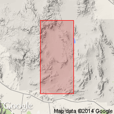
Named for outcrops on Jangle Ridge, Atomic Energy Commission, Nevada proving grounds area, Nye Co, Nevada.
[GNC remark (ca. 1966, US geologic names lexicon, USGS Bull. 1200, p. 1912): USGS classifies the Jangle Limestone as a member of the Cadiz Formation on the basis of a study now in progress.]
Source: US geologic names lexicon (USGS Bull. 1200, p. 1911-1912).
- Usage in publication:
-
- Jangle limestone member*
- Modifications:
-
- Revised
- AAPG geologic province:
-
- Great Basin province
Summary:
Jangle limestone reduced in rank to Jangle limestone member of Cadiz formation. Age of member remains Middle Cambrian. Underlies Papoose Lake member (new) of Bonanza King formation. Is upper part of Cadiz formation.
Source: GNU records (USGS DDS-6; Menlo GNULEX).
- Usage in publication:
-
- Jangle Limestone Member*
- Modifications:
-
- Revised
- AAPG geologic province:
-
- Great Basin province
Summary:
Jangle Limestone Member of Cadiz Formation changed to Jangle Limestone Member of Carrara Formation. Underlain by subunit 5; overlain by subunit 7.
Source: GNU records (USGS DDS-6; Menlo GNULEX).
- Usage in publication:
-
- Jangle Limestone Member*
- Modifications:
-
- Biostratigraphic dating
- AAPG geologic province:
-
- Great Basin province
Summary:
Conformably overlies Pahrump Hills Shale Member (new) and in part underlies Desert Range Limestone Member (new), both of Carrara Formation. Lithologies include lime mudstone, trilobite- and echinoderm-fragment wackestones, packstones, and grainstones, oolite, fenestral-fabric and laminated limestones. Includes trilobite fauna of ALBERTELLA Zone.
Source: GNU records (USGS DDS-6; Menlo GNULEX).
For more information, please contact Nancy Stamm, Geologic Names Committee Secretary.
Asterisk (*) indicates published by U.S. Geological Survey authors.
"No current usage" (†) implies that a name has been abandoned or has fallen into disuse. Former usage and, if known, replacement name given in parentheses ( ).
Slash (/) indicates name conflicts with nomenclatural guidelines (CSN, 1933; ACSN, 1961, 1970; NACSN, 1983, 2005, 2021). May be explained within brackets ([ ]).