The National Geologic Map Database is migrating to a new infrastructure. We apologize for any service disruptions during this process.
|
|---|


- Usage in publication:
-
- Inyan Kara group*
- Modifications:
-
- Named
- Dominant lithology:
-
- Sandstone
- Shale
- Conglomerate
- Lignite
- AAPG geologic province:
-
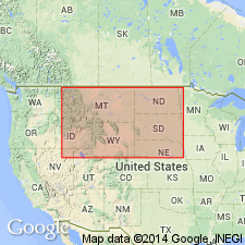
- Powder River basin
Summary:
Named from exposures along Inyan Kara Creek in the northeastern part of the Moorcroft quad, WY in Powder River basin. Includes (descending): Fall River sandstone (which was called Dakota sandstone in previous reports in the Black Hills, thereby restricting areal limits of Dakota); Fuson shale; and Lakota sandstone. Thickness 150-350 ft. An extremely variable group consisting of discontinuous beds of sandstone, sandy shale, conglomerate, lignite, and variegated siltstone. In general, though not in detail, the higher sandstones are more heavily iron stained and slabby and the lower ones lighter gray and massive. Continental fossils throughout greater part, but marine fossils in upper 20 ft. Is of Early Cretaceous age.
Source: GNU records (USGS DDS-6; Denver GNULEX).
- Usage in publication:
-
- Inyan Kara group*
- Modifications:
-
- Areal extent
- AAPG geologic province:
-
- Williston basin
Summary:
Extended name in subsurface to the Cedar Creek anticline southeast MT, and southwest ND in Williston basin. Is about 200 ft thick. Overlies Morrison formation; underlies Colorado group. Is of Early Cretaceous age.
Source: GNU records (USGS DDS-6; Denver GNULEX).
- Usage in publication:
-
- Inyan Kara group*
- Modifications:
-
- Overview
- AAPG geologic province:
-
- Powder River basin
Summary:
Divided into Fall River sandstone, and an underlying Fuson-Lakota sequence separated by a regional transgressive disconformity, in Powder River basin. Rocks above the disconformity are dominantly marine and marginally marine in origin and are related to overlying Skull Creek shale; those below are continental and related to underlying Morrison formation or Unkpapa sandstone. Assigned to the Early Cretaceous.
Source: GNU records (USGS DDS-6; Denver GNULEX).

- Usage in publication:
-
- Inyan Kara group*
- Modifications:
-
- Reference
- Revised
- AAPG geologic province:
-
- Chadron arch
Summary:
Subdivision and nomenclature of Inyan Kara group adjusted to conform to a two-fold lithologic subdivision including a redefined Fall River formation and unconformably underlying redefined Lakota formation, Fuson formation, and Minnewaste limestone, and are reduced to members of Lakota formation. Reference section for the group given in Fall River Canyon, 4-5 mi by road southeast of Hot Springs, SD, secs 29, 32, and 33, T7S, R6E, Fall River Co, SD on the Chadron arch. Is of Early Cretaceous age.
Source: GNU records (USGS DDS-6; Denver GNULEX).
- Usage in publication:
-
- Inyan Kara Group*
- Modifications:
-
- Overview
- AAPG geologic province:
-
- Chadron arch
- Powder River basin
Summary:
Compares petrology of Fall River, Lakota, and Morrison Formations and Unkpapa Sandstone. Nonopaque heavy suites in Fall River and Lakota Formations differ at most places in the proportions of rounded grains (more abundant in Lakota Formation) and in the presence in Fall River Formation of hornblende and chloritoid. Discusses source and origin. Is of Early Cretaceous age.
Source: GNU records (USGS DDS-6; Denver GNULEX).
- Usage in publication:
-
- Inyan Kara Group*
- Modifications:
-
- Overview
- AAPG geologic province:
-
- Williston basin
- Powder River basin
Summary:
Shows distribution and lithologic variation of the group and its subdivisions in western and northern Black Hills, Powder River and Williston basins. Is of Early Cretaceous age.
Source: GNU records (USGS DDS-6; Denver GNULEX).
- Usage in publication:
-
- Inyan Kara Group
- Modifications:
-
- Revised
- AAPG geologic province:
-
- Williston basin
- Powder River basin
Summary:
Consists of (ascending) Lakota and Fall River Formations. Unconformably overlies Morrison Formation. Underlies Thermopolis Shale. Revised in that the Fall River is divisible into three newly named members --the Liscom Creek, Morton, and Coyote Creek of Early Cretaceous age. Isopach map of entire group in northeast WY and southeast MT and western SD of the Williston basin. Ranges from 22 to 700 ft thick; area of maximum thickness lies between the Black Hills northwest to southeast MT. Cross sections. E-logs.
Source: GNU records (USGS DDS-6; Denver GNULEX).
- Usage in publication:
-
- Inyan Kara Group*
- Modifications:
-
- Overview
- AAPG geologic province:
-
- Chadron arch
- Powder River basin
Summary:
Compiled detailed mapping of 13 71/2-minute quadrangles showing details of stratigraphy and distribution of the group and its subdivisions in the southern Black Hills, Fall River and Custer Cos, SD and Weston Co, WY, on Chadron arch and in Powder River basin. Divided into Lakota and Fall River Formations. Lakota, at base, 200-500 ft thick, constitutes lower two-thirds of the group, and Fall River, at top, 100-160 ft thick, constitutes the upper one-third. Rocks are of continental origin and were deposited under variable depositional environments, resulting in a sequence of many rock units, each composed of several facies. Basal Lakota Formation underlain by Morrison Formation of Jurassic age in western part of mapped area, but in eastern part of area it is underlain by Unkpapa Sandstone (thought by Imlay, 1947, to be equivalent in age to Morrison). Upper, Fall River Formation overlain by Skull Creek Shale of Early Cretaceous age. Group is of Early Cretaceous age. Geologic map, cross sections.
Source: GNU records (USGS DDS-6; Denver GNULEX).
- Usage in publication:
-
- Inyan Kara Formation
- Modifications:
-
- Revised
- AAPG geologic province:
-
- Williston basin
Summary:
Assigned formational rank and made the basal formation in Dakota Group in Williston basin, western ND. Overlain by Skull Creek Formation, underlain by Morrison Formation. Is Cretaceous in age.
Source: GNU records (USGS DDS-6; Denver GNULEX).
- Usage in publication:
-
- Inyan Kara Formation
- Modifications:
-
- Overview
- AAPG geologic province:
-
- Williston basin
Summary:
Assigned formational rank in ND, except for Adams County in the southwestern part of the state where equivalent rocks are assigned to the Fall River and Lakota Formations, undivided. Overlain conformably by the Swift Formation, or by older rocks locally along the eastern side of the Williston basin. See Columns 17-19.
Source: GNU records (USGS DDS-6; Denver GNULEX).

- Usage in publication:
-
- Inyan Kara Group*
- Modifications:
-
- Areal extent
- AAPG geologic province:
-
- Powder River basin
Summary:
Identified as an undivided unit throughout the subsurface of the Powder River basin in MT and WY where it overlies Morrison Formation unconformably and underlies "Dakota silt," a driller's term. Of Early Cretaceous age. [This nomenclature shown on 22 cross sections in this OC series.]
Source: GNU records (USGS DDS-6; Denver GNULEX).
For more information, please contact Nancy Stamm, Geologic Names Committee Secretary.
Asterisk (*) indicates published by U.S. Geological Survey authors.
"No current usage" (†) implies that a name has been abandoned or has fallen into disuse. Former usage and, if known, replacement name given in parentheses ( ).
Slash (/) indicates name conflicts with nomenclatural guidelines (CSN, 1933; ACSN, 1961, 1970; NACSN, 1983, 2005, 2021). May be explained within brackets ([ ]).