

- Usage in publication:
-
- Horquilla limestone*
- Modifications:
-
- Named
- Dominant lithology:
-
- Limestone
- AAPG geologic province:
-
- Pedregosa basin
Summary:
Named as the basal formation of Naco group (rank raised) for exposures (type section) on the eastern spur of Horquilla Peak in Tombstone Hills, Cochise Co, AZ. Sections measured on Horquilla Peak and in Gunnison Hills. Occurs also in Mule, Dragoon, and Little Dragoon Mountains, and in the Gunnison and Johnny Lyon Hills in the Pedregosa basin. Consists of thin-bedded, blue-gray limestones, some thicker-bedded (6-8 ft) limestones, and a few beds of reddish-weathering, shaly limestone. Most of the limestone is dense and pink-gray on fresh fracture. The thicker beds are coarsely crystalline and consist largely of crinoid hash. Overlies Escabrosa limestone on Horquilla Peak and overlies Black Prince limestone north of Dragoon Mountains. Overlain by Earp formation (new name). Is 999 ft thick on Horquilla Peak. No section more than 1,200 ft thick. Is of Pennsylvanian age. Brachiopod, coral, and foraminifer fauna give age of Middle to middle Late Pennsylvanian. Stratigraphic sections; measured sections; fossils listed.
Source: GNU records (USGS DDS-6; Denver GNULEX).
- Usage in publication:
-
- Horquilla limestone
- Modifications:
-
- Areal extent
- AAPG geologic province:
-
- Pedregosa basin
Summary:
Horquilla limestone of Naco group. Present in Chiricahua Mountains, Cochise County, southeastern Arizona. Overlies Paradise formation; underlies Earp formation. Fossiliferous (fusulinids, CHAETETES). Age is Pennsylvanian (Morrow, Lampasas, Des Moines, Missouri).
Measured sections: (1) near Portal, in E/2 sec. 21, T. 17 S., R. 31 E., 1,605 ft thick; (2) lower part of fm, at Blue Mountain, in SW/4 sec. 20, T. 16 S., R. 31 E., 800+ ft; and 2) upper part of fm, Dunn Spring Mountain, in SW/4 sec. 23, T. 15 S., R. 30 E., 850+ ft.
Source: Modified from GNU records (USGS DDS-6; Denver GNULEX).
- Usage in publication:
-
- Horquilla limestone
- Modifications:
-
- Areal extent
- Overview
- AAPG geologic province:
-
- Pedregosa basin
Summary:
Extended to central Peloncillo Mountains, Hidalgo Co, NM in Pedregosa basin. Overlies Paradise formation. Overlain by Earp formation. Geologic map included. Sections measured in SE1/4 SE1/4 sec 22, T25S, R21W and in NW1/4 sec 3, T25S, R21W. Brachiopod, bryozoan, coral, gastropod, and crinoid fossils are prominent. Fusulinids of Morrow to Wolfcamp or Early Pennsylvanian to Early Permian are abundant. In Chiricahua Mountains, AZ, formation is Morrow to Missouri age. In Cochise Co, AZ, the formation is post-Morrow Pennsylvanian.
Source: GNU records (USGS DDS-6; Denver GNULEX).
- Usage in publication:
-
- Horquilla Limestone
- Modifications:
-
- Areal extent
- AAPG geologic province:
-
- Pedregosa basin
Summary:
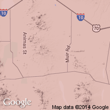
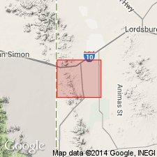
Extended to Animas Mountains, Hidalgo Co, NM in Pedregosa basin. Is of Pennsylvanian and Permian age.
Source: GNU records (USGS DDS-6; Denver GNULEX).
- Usage in publication:
-
- Horquilla Formation
- Modifications:
-
- Biostratigraphic dating
- AAPG geologic province:
-
- Pedregosa basin
Summary:
Virgilian beds at top of Horquilla grade laterally into beds in lower part of overlying Earp Formation along eastern base of Chiricahua Mountains, AZ in the Pedregosa basin. Is of Pennsylvanian age.
Source: GNU records (USGS DDS-6; Denver GNULEX).

- Usage in publication:
-
- Horquilla limestone*
- Modifications:
-
- Overview
- AAPG geologic province:
-
- Pedregosa basin
Summary:
Is the most widely exposed formation of Naco group in quad, Pedregosa basin. See geologic map. Measured section 1,595 ft thick in sec 4, T16S, R23E, described. Overlies Black Prince limestone; underlies Earp formation. Ranges from post-Morrow to Missouri, probably Virgil age or Middle to Late Pennsylvanian [age shown incorrectly on p. 9].
Source: GNU records (USGS DDS-6; Denver GNULEX).
- Usage in publication:
-
- Horquilla Limestone*
- Modifications:
-
- Age modified
- AAPG geologic province:
-
- Basin-and-Range province
Summary:
Age shown as Middle and Late Pennsylvanian in Mule Mountains, Cochise Co, AZ in Pedregosa basin. Reason for age assignment not stated.
Source: GNU records (USGS DDS-6; Denver GNULEX).
- Usage in publication:
-
- Horquilla Limestone*
- Modifications:
-
- Age modified
- AAPG geologic province:
-
- Basin-and-Range province
Summary:
Appears to be entirely of or almost entirely of Middle Pennsylvanian age in the Klondyke quad. AZ in the Basin-and-Range province. Is the only formation of Naco Group present in area. [It probably would have been better to have used the term Naco Limestone here as was done in nearby areas by Peterson (1960), Peterson(1962), Willden (1964), and later by Cornwall and others (1971) and other U.S.G.S. authors]. Fossils (lists) include brachiopods, echinoderms, corals, echinoids, bryozoans, pelecypods, gastropods. Measured sections. Geologic map.
Source: GNU records (USGS DDS-6; Denver GNULEX).
- Usage in publication:
-
- Horquilla Limestone*
- Modifications:
-
- Areal extent
- AAPG geologic province:
-
- Basin-and-Range province
Summary:
Accepted by USGS in the Vekol Mountains, AZ in the Basin-and-Range province. Unconformably overlain by Phonodoree Formation (Mesozoic). Is of Pennsylvanian age.
Source: GNU records (USGS DDS-6; Denver GNULEX).
- Usage in publication:
-
- Horquilla Limestone
- Modifications:
-
- Areal extent
- Age modified
- Overview
- AAPG geologic province:
-
- Pedregosa basin
Summary:
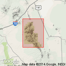
Extended without query as basal formation of Naco Group to Big Hatchet Mountains, NM (see Zeller, 1958), in the Pedregosa basin. The basal 93 ft are Chester or Morrow, the overlying 237 ft are probably Morrow, and the remainder is Derry, Des Moines, Missouri, Virgil, and Wolfcamp. The highest beds are late Wolfcamp. Contains a rich and varied fauna--fusulinids, brachiopods, gastropods, cephalopods, bryozoans, corals, crinoids, pelecypods, and sponges. Correlated with Magdalena Group, Hueco Formation. Is a marine unit. Measured sections described in SW1/4 sec 28, T31S, R14W to SW1/4 NW1/4 sec 5, T32S, R14W where 3,245 ft measured, in secs 11, 10 and 15, T31S, R15W where 3,520 ft measured, and in sec 27, T31S, R15W where 2,257 ft measured.
Source: GNU records (USGS DDS-6; Denver GNULEX).
- Usage in publication:
-
- Horquilla Limestone*
- Modifications:
-
- Areal extent
- Overview
- AAPG geologic province:
-
- Basin-and-Range province
- Pedregosa basin
Summary:
Used in Whetstone Mountains, AZ in the Pedregosa basin and Basin-and-Range province. Section in NW1/4 sec 24 and SE1/4 sec 11, T18S, R18E, Pima Co, 993 ft thick and in NW1/4 sec 23, T19S, R19E, Cochise Co, 1,231 ft thick described. Is of Middle and Late Pennsylvanian age.
Source: GNU records (USGS DDS-6; Denver GNULEX).
- Usage in publication:
-
- Horquilla Limestone*
- Modifications:
-
- Age modified
- Biostratigraphic dating
- AAPG geologic province:
-
- Basin-and-Range province
Summary:
Only the basal 60 ft studied in the Klondike Hills, Grant and Luna Cos., NM in southeastern part of the Basin-and-Range province. Overlies Paradise Formation with sharp to undulating unconformable contact. Basal sandstone contains casts and molds of logs and branches of "Lepidodendron" and impressions of leaves. Fusulinid microfauna from limestones yields tentative Morrow (Early Pennsylvanian) age.
Source: GNU records (USGS DDS-6; Denver GNULEX).
- Usage in publication:
-
- Horquilla Limestone*
- Modifications:
-
- Areal extent
- AAPG geologic province:
-
- Basin-and-Range province
Summary:
Extended to Santa Rita Mountains, Pima Co, AZ in Basin-and-Range province. Overlies Escabrosa Limestone (Mississippian); overlain by Earp Formation (Pennsylvanian and Permian). Is of Middle and Late Pennsylvanian age.
Source: GNU records (USGS DDS-6; Denver GNULEX).
- Usage in publication:
-
- Horquilla Limestone
- Modifications:
-
- Overview
- AAPG geologic province:
-
- Pedregosa basin
- Basin-and-Range province
Summary:
In many places [not specified] where the Black Prince Limestone was not recognized, includes strata of Morrowan age. On the basis of fusulinid and lithologic studies, the Horquilla contains many unconformities within it. Represents repeated advances and retreats of shallow sea from south. Is of Pennsylvanian (Morrowan and Virgilian) age.
Source: GNU records (USGS DDS-6; Denver GNULEX).
- Usage in publication:
-
- Horquilla Formation
- Modifications:
-
- Areal extent
- Redescribed
- AAPG geologic province:
-
- Basin-and-Range province
- Black Mesa basin
Summary:
Extended to Mogollon Rim area, AZ in the Basin-and-Range province and Black Mesa basin, to replace all or much of Naco Formation. Is of Pennsylvanian (Derryanian and Virgilian) age.
Source: GNU records (USGS DDS-6; Denver GNULEX).
- Usage in publication:
-
- Horquilla Limestone*
- Modifications:
-
- Areal extent
- AAPG geologic province:
-
- Basin-and-Range province
Summary:
Extended to Patagonia Mountains, Santa Cruz Co, AZ in Basin-and-Range province as the basal formation of Naco Group.
Source: GNU records (USGS DDS-6; Denver GNULEX).
- Usage in publication:
-
- Horquilla Limestone*
- Modifications:
-
- Areal extent
- AAPG geologic province:
-
- Pedregosa basin
Summary:
Extended as a formation of Naco Group to Rincon Mountains, Cochise Co, AZ in Pedregosa basin. Is of Middle and Late Pennsylvanian age.
Source: GNU records (USGS DDS-6; Denver GNULEX).
- Usage in publication:
-
- Horquilla Limestone*
- Modifications:
-
- Overview
- AAPG geologic province:
-
- Pedregosa basin
Summary:
Mapped as basal formation of Naco Group in Peloncillo Mountains, Hidalgo Co, NM in Pedregosa basin. Unconformably overlies Paradise Formation (Upper Mississippian). Overlain by Earp Formation (Lower Permian). Is cut by bedding-plane faults and quartz-latite porphyry (Tertiary). Minimum thickness of 450 m. Persistent zone of CHAETETES sp. and rugose corals occurs 30-50 m above the base. Is of Early, Middle, and Late Pennsylvanian age; [apparently on basis of previous work].
Source: GNU records (USGS DDS-6; Denver GNULEX).
- Usage in publication:
-
- Horquilla Limestone
- Modifications:
-
- Redescribed
- AAPG geologic province:
-
- Black Mesa basin
- Basin-and-Range province
Summary:
Horquilla Formation as used by Ross (1973) on Mogollon Rim, AZ in the Black Mesa basin and Basin-and-Range province redescribed as Horquilla Limestone and included in Naco Group. Is of Pennsylvanian (Atokan, Desmoinesian, and Missourian) age.
Source: GNU records (USGS DDS-6; Denver GNULEX).
- Usage in publication:
-
- Horquilla Limestone*
- Modifications:
-
- Revised
- AAPG geologic province:
-
- Pedregosa basin
Summary:
Divided into separately mapped lower and upper members in the central Peloncillo Mountains, NM in the Pedregosa basin. The upper member (of Early Permian age) was included in the lower part of the overlying Earp Formation in the same area by Armstrong and others (1978). [The contact used by Drewes and Thorman probably coincides more closely to that used in other areas.] Is of Pennsylvanian and Early Permian age.
Source: GNU records (USGS DDS-6; Denver GNULEX).
- Usage in publication:
-
- Horquilla Limestone
- Modifications:
-
- Mapped 1:24k
- Dominant lithology:
-
- Limestone
- Shale
- AAPG geologic province:
-
- Pedregosa basin
Summary:
Horquilla Limestone [interpreted here as basal formation of Naco Group; Description of Map Units unclear]. Light-gray, medium-bedded, fine- to medium-grained, cherty, fossiliferous limestone and interbedded pale-reddish-gray shale. Commonly found in small fault blocks. Divided into upper and lower members, separately mapped. Upper member (Lower Permian), about 210 to 240 m thick, light-gray, medium-bedded, chiefly fine-grained, cherty, fossiliferous limestone with 10 to 20 percent interbedded 15-m-thick reddish-gray shale beds. Lower member (Pennsylvanian), about 320 to 350 m thick, light-gray, medium-bedded, chiefly medium-grained, cherty, sparsely fossiliferous limestone and sparse amounts of interbedded reddish-gray siltstone; includes a dark-gray, quartz-chip-bearing shale or phyllite conglomerate marker bed, 1 to 2 m thick. Age is Pennsylvanian and Early Permian.
Source: Publication.

- Usage in publication:
-
- Horquilla Limestone*
- Modifications:
-
- Mapped 1:24k
- Dominant lithology:
-
- Limestone
- Shale
- Siltstone
- AAPG geologic province:
-
- Pedregosa basin
Summary:
Horquilla Limestone. Mapped in Big Hatchet Mountains, Hidalgo County, southwestern New Mexico. Light-gray, thin- to medium-bedded, fine- to medium-grained, cherty limestone; upper part contains some thin, reddish-gray shale and siltstone. Thickness about 3,250 to 3,450 feet (1,000 to 1,060 m). Conformably underlies Earp Formation (Lower Permian); disconformably underlies Paradise Formation (Upper Mississippian). Fossiliferous (large and small fusulines, fenestrellid bryozoans, CHATETES sponges). Age is Pennsylvanian and Early Permian.
Source: Publication.
For more information, please contact Nancy Stamm, Geologic Names Committee Secretary.
Asterisk (*) indicates published by U.S. Geological Survey authors.
"No current usage" (†) implies that a name has been abandoned or has fallen into disuse. Former usage and, if known, replacement name given in parentheses ( ).
Slash (/) indicates name conflicts with nomenclatural guidelines (CSN, 1933; ACSN, 1961, 1970; NACSN, 1983, 2005, 2021). May be explained within brackets ([ ]).