

- Usage in publication:
-
- Hachita formation
- Modifications:
-
- First used
- Dominant lithology:
-
- Limestone
- AAPG geologic province:
-
- Basin-and-Range province
Summary:
Shown as a formation of Escabrosa Group in Tres Hermanos Mountains, NM in the Basin-and-Range province on columnar section. Neither intent to name nor type locality stated. [Apparently the first published use of name.] Represented in the lower 360 ft of map unit as a light-gray, massive, crinoidal and cherty limestone. Only upper part exposed. Is above Fusselman Dolomite and below Paradise? Formation. Is of Mississippian age.
Source: GNU records (USGS DDS-6; Denver GNULEX).
- Usage in publication:
-
- Hachita Formation
- Modifications:
-
- Named
- Dominant lithology:
-
- Limestone
- AAPG geologic province:
-
- Pedregosa basin
Summary:
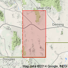
Named as top formation in Escabrosa Group. Derivation of name not given. Type section S1/2 sec 20, T26 [16] S, R30E, Cochise Co, at south end of Blue Mountain, Chiricahua Mountains, AZ in the Pedregosa basin. Occurs also in Big Hatchet Mountains and Klondyke Hills, NM in the Basin-and-Range province and in central Cochise Co, AZ. Consists of massive encrinite; crinoid remains usually broken and plates abraded, cemented by either sparry calcite or microcrystalline ooze or combination of both. Lower two-thirds white to light gray, almost devoid of bedding, but with some interfingering lenses of coarse-grained crinoid fragments which grade into zones of very fine grained abraded crinoid fragments and microcrystalline calcite; contains some white to light-gray nodular chert. Upper third dark-gray, primarily encrinite; but contains higher proportion of brachiopods, bryozoans, and endothyrid fragments, and shows wider variety of limestone types. Highest beds composed of coquinite and calcarenite. Is 250 to 380 ft thick. Overlies Keating Formation--nature of contact is questioned. Overlain conformably by Paradise Formation in type section. Highest beds of Hachita are 20-30 ft below [above?] lowest shale of Paradise. Black Prince Limestone (revised) considered member at top. Assigned to middle Osagean through late Meramecian on basis of fossil corals, foraminifers, blastoids, and brachiopods (Early and Late Mississippian).
Source: GNU records (USGS DDS-6; Denver GNULEX).
- Usage in publication:
-
- Hachita Formation
- Modifications:
-
- Not used
Summary:
Of Armstrong (1962), not a useful mapping unit. The formation is rejected in the Big Hatchet Mountains area in the Pedregosa basin. Mississippian Escabrosa Limestone divided into lower, middle and upper members used instead of Escabrosa Group.
Source: GNU records (USGS DDS-6; Denver GNULEX).
- Usage in publication:
-
- Hachita Formation*
- Modifications:
-
- Overview
- AAPG geologic province:
-
- Basin-and-Range province
Summary:
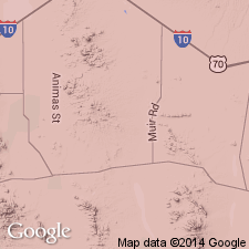
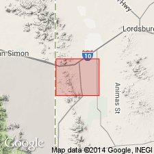
Adopted. Is upper formation (of two) of Escabrosa Group in the Klondike Hills, Grant and Luna Cos, NM in southeastern part of Basin-and-Range province. Overlies Keating Formation of Escabrosa with gradational contact. Underlies Paradise Formation with gradational contact. Is more than 300 ft thick. Fossils include crinoid debris, bryozoans brachiopods, and foraminifers. On basis of fossils, age is considered to be both Early (Osage) and Late (Meramec) Mississippian.
Source: GNU records (USGS DDS-6; Denver GNULEX).
- Usage in publication:
-
- Hachita Formation*
- Modifications:
-
- Overview
- AAPG geologic province:
-
- Pedregosa basin
Summary:
Is top formation of Escabrosa Group; mapped in central Peloncillo Mountains, Hidalgo Co, NM in Pedregosa basin. Overlies Keating Formation of Escabrosa Group. Overlain by Paradise Formation [Drewes and Thorman (1980), mapping in same area, described a member of Escabrosa Limestone that is possibly correlative with Hachita Formation]. Is 44 m thick. Is of Early and Late Mississippian age; [apparently on basis of previous work].
Source: GNU records (USGS DDS-6; Denver GNULEX).
- Usage in publication:
-
- Hachita Formation*
- Modifications:
-
- Areal extent
- Biostratigraphic dating
- AAPG geologic province:
-
- Pedregosa basin
Summary:
Areally extended to Pedregosa Mountains, AZ in the Pedregosa basin. Is upper formation of Escabrosa Group. Assigned to part of GNATHODUS BILINEATUS (Koike, 1967) conodont zone (Meramecian) and to Mamet's microfossil Zones 8-9 (Osagean), 10 (Osagean and Meramecian), and 11-15 (Meramecian). Osagean conodonts noted near base. Considered to be both Osagean (Early Mississippian) and Meramecian (Late Mississippian) in age.
Source: GNU records (USGS DDS-6; Denver GNULEX).
- Usage in publication:
-
- Hachita Formation
- Modifications:
-
- Not used
Summary:
Not recognized in central Peloncillo Mountains, NM in the Pedregosa basin where previously mapped by Armstrong and others (1978) as the lower formation of Escabrosa Group. Rather, the Escabrosa Limestone is described as containing an upper member possibly correlative with Hachita Formation. Is of Mississippian age.
Source: GNU records (USGS DDS-6; Denver GNULEX).

- Usage in publication:
-
- Hachita Member*
- Modifications:
-
- Mapped 1:24k
- Revised
- Dominant lithology:
-
- Limestone
- AAPG geologic province:
-
- Pedregosa basin
Summary:
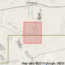
Hachita Member of Escabrosa Limestone (very local). Mapped at a few localities in Big Hatchet Mountains, Hidalgo County, southwestern New Mexico. Light-gray, thick-bedded, slightly cherty, crinoidal, coarse-grained limestone. Thickness about 364 feet (110 m). Conformably overlies Keating Member (revised locally) of Escabrosa; conformably underlies Paradise Formation. Age is Early and Late Mississippian.
Source: Publication.
For more information, please contact Nancy Stamm, Geologic Names Committee Secretary.
Asterisk (*) indicates published by U.S. Geological Survey authors.
"No current usage" (†) implies that a name has been abandoned or has fallen into disuse. Former usage and, if known, replacement name given in parentheses ( ).
Slash (/) indicates name conflicts with nomenclatural guidelines (CSN, 1933; ACSN, 1961, 1970; NACSN, 1983, 2005, 2021). May be explained within brackets ([ ]).