The National Geologic Map Database is migrating to a new infrastructure. We apologize for any service disruptions during this process.
|
|---|


- Usage in publication:
-
- Graham formation
- Modifications:
-
- Biostratigraphic dating
- AAPG geologic province:
-
- Bend arch
- Fort Worth syncline
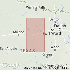
Summary:
The lower Cisco beds are included in what has been termed Graham formation by F.B. Plummer and R.C. Moore [in press]. Contain a prolific fauna which is very closely related to Wewoka formation of southern Oklahoma. Uppermost shale member of Graham is remarkably fossiliferous and one of the most distinctive horizons in the Cisco, and has been traced from Jack County into Brown County, north-central Texas. The succeeding beds of the Cisco are not so abundantly fossiliferous and the faunas which have been observed cannot be confused with those forms from the Graham. The fauna which is here [Glenn's Burkburnett well ms.] reported by Doctor Girty appears to be more nearly comparable to the known fauna of the Graham. Age is Pennsylvanian.
Source: Publication; US geologic names lexicon (USGS Bull. 896, p. 848).

- Usage in publication:
-
- Graham formation
- Modifications:
-
- Principal reference
- Dominant lithology:
-
- Sandstone
- Limestone
- Shale
- AAPG geologic province:
-
- Bend arch
- Fort Worth syncline
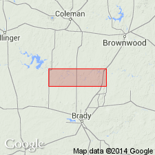
Summary:
Pg. 18-42; [Univ. Texas Bull., no. 2132, p. 125+]. Graham formation. Basal formation of Cisco group. Thickness 100 feet to south; 500 to 600 feet to north. In Brazos River region disconformably underlies Avis sandstone member of Thrifty formation and disconformably overlies Home Creek limestone member of Caddo Creek formation. Distinguished from underlying beds by its very clastic character and thinner limestones, and from overlying beds by its prolific and characteristic fauna. Divided into following members (descending): Wayland shale, Gunsight limestone, South Bend shale, Bunger limestone, Gonzales Creek shale, Jacksboro limestone, and Finis shale. The older or lower members are present only to north, pinching out southward and being overlapped by younger members. [Age is Pennsylvanian.]
Named from Graham, the county seat of Young Co., [Brazos River region], central northern TX.
Source: US geologic names lexicon (USGS Bull. 896, p. 848).

- Usage in publication:
-
- Graham formation
- Modifications:
-
- Revised
- AAPG geologic province:
-
- Bend arch
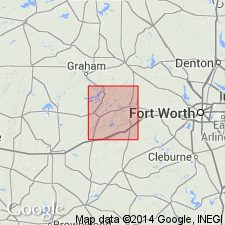
Summary:
Pg. 104. Redefined Graham formation by transferring to the underlying Caddo Creek formation the Jacksboro limestone and Finis shale of Brazos River region, central northern Texas. [Age is Pennsylvanian.]
Source: US geologic names lexicon (USGS Bull. 896, p. 848).
- Usage in publication:
-
- Graham formation
- Modifications:
-
- Areal extent
- AAPG geologic province:
-
- Bend arch
- Fort Worth syncline
Summary:
Pg. 197+. Graham formation of Colorado River area [central Texas] includes all beds between top of Speck Mountain limestone down to top of Home Creek limestone. In Brazos River region [central northern Texas] it includes all beds below Avis sandstone member and above Home Creek limestone member. The Avis sandstone of Brazos River region is same as Parks Mountain sandstone of Colorado River region. [Age is Pennsylvanian.]
Source: US geologic names lexicon (USGS Bull. 896, p. 848).
- Usage in publication:
-
- Graham formation
- Modifications:
-
- Principal reference
- AAPG geologic province:
-
- Bend arch
Summary:
Pg. 61-62. Graham formation was named by Plummer and Moore and made to include all strata from top of Home Creek limestone up to base of Avis sandstone. Total thickness 400+/- feet, but only lower 125 feet is exposed in Palo Pinto County, Brazos River region, central northern Texas, where it is divided into following members (descending): Bunger limestone, 6 feet; Gonzales Creek shale, 116 feet; Eastland sandstone (new name), 10 to 15 feet; and Finis shale, 50 feet. [Age is Pennsylvanian.]
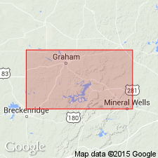
Type locality: bluff on Salt Creek, west of Graham, Young Co., [Brazos River region], central northern TX.
Source: US geologic names lexicon (USGS Bull. 896, p. 848).

- Usage in publication:
-
- Graham formation
- Modifications:
-
- Overview
- AAPG geologic province:
-
- Bend arch
- Fort Worth syncline
Summary:
[See also entry under Nickell, 1938, Univ. Texas Bur. Econ. Geol. Pub. 3801.] Wallace Lee and C.O. Nickell (report completed and soon to be published by Texas Geol. Survey). Graham formation of Brazos River area includes all beds below Avis sandstone member and above Home Creek limestone member. The Graham formaton of Colorado River region includes all beds below Bellerophon limestone of Drake and above Home Creek limestone. The Speck Mountain limestone lies in Thrifty formation, considerable above its base. [This definition of Graham formation has been adopted by the USGS.]
Source: US geologic names lexicon (USGS Bull. 896, p. 848).
- Usage in publication:
-
- Graham formation
- Modifications:
-
- Revised
- AAPG geologic province:
-
- Bend arch
- Fort Worth syncline
Summary:
[Synopsized from Lee's "Stratigraphy of the Cisco group of the Brazos basin," p. 12-53, and from Nickell's "Stratigraphy of the Canyon and Cisco groups on Colorado River in Brown and Coleman Cos., Texas," p. 118-122].
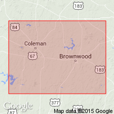
Graham formation, in Brazos River Valley, Texas, comprises (ascending) channel deposits, Salem School limestone member, shale and sandstone, Gonzales limestone member, shale and sandstone, Bunger limestone member, shale with numerous channels and unconformities, and Wayland shale member. Thickness at least 590 feet, not counting channel deposits (Kisinger channel) at base. Interval from top of Bunger limestone to top of formation are referred to as post-Bunger deposits or post-Bunger cycles. Nine cycles discussed. Group of limestones in No. 8 post-Bunger cycle is herein named Rocky Mound limestone member. Gunsight member, which at its type locality is overlain by Wayland shale, has not been identified in Stephens County, Texas. Underlies Avis sandstone member of Thrifty formation. In Colorado River basin, Texas, formation is divided into (descending) Wayland shale, Gunsight limestone, and Bluff Creek members. Thickness 243 feet from top of Home Creek limestone of northern Brown County, Texas, up to base of Bellerophon bed of Drake (1893, Texas Geol. Survey 4th Ann. Rpt., pt. 1). [Age is Late Pennsylvanian.]
Source: US geologic names lexicon (USGS Bull. 1200, p. 1557-1558).

- Usage in publication:
-
- Graham group
- Modifications:
-
- Revised
- AAPG geologic province:
-
- Bend arch
- Fort Worth syncline
Summary:
Pg. 66 (fig. 1), 90. Graham group. Rank raised to group. Includes following formations (ascending): Gonzales, North Leon, Bunger, post-Bunger cycles 1-7, Gunsight limestone, and Wayland shale. Underlies Thrifty group; overlies Caddo Creek group. [Age is Late Pennsylvanian.]
Source: US geologic names lexicon (USGS Bull. 1200, p. 1557-1558).
- Usage in publication:
-
- Graham group
- Modifications:
-
- Areal extent
- AAPG geologic province:
-
- Bend arch
Summary:
Fig. 4. Graham group. Generalized columnar section shows that group comprises (ascending) Salem School limestone, Bunger limestone, Number 3 limestone, Upper Gunsight limestone, Rocky Mound limestone, Wayland shale, Number 9 limestone, Avis sandstone, Ivan limestone, Blach Ranch limestone, Breckenridge limestone. [Age is Late Pennsylvanian.]
Source: US geologic names lexicon (USGS Bull. 1200, p. 1557-1558).
- Usage in publication:
-
- Graham formation
- Modifications:
-
- Areal extent
- AAPG geologic province:
-
- Bend arch
Summary:
Graham formation. Composite section of Brown and Coleman Counties, Texas, shows formation comprises (ascending) Bluff Creek shale, Gunsight limestone, Wayland shale, and Ivan limestone. Underlies Thrifty formation; overlies Caddo Creek formation. Thickness about 260 feet. [Age is Late Pennsyvlanian.]
Source: US geologic names lexicon (USGS Bull. 1200, p. 1557-1558).
- Usage in publication:
-
- Graham formation*
- Modifications:
-
- Revised
- AAPG geologic province:
-
- Bend arch
Summary:
Pg. 58 (table 1), 68-69, pl. 27. Boundary between Graham and Thrifty formations has been defined as base of Avis sandstone member (Sellards, 1933, Univ. Texas Bull., no. 3232; Lee and Nickell, 1938), a prominent sandstone in Brazos River Valley. In Colorado River Valley [this report], this boundary is not mappable because only discontinuous lenses of sandstone are present at stratigraphic position of Avis. Also, the Ivan limestone member which overlies the Avis is discontinuous. Recommended that base of Speck Mountain limestone, a persistent member throughout Colorado River Valley and probably equivalent to Blach Ranch limestone in Brazos River Valley, be designated boundary between Thrifty and Graham formations. In areas where Speck Mountain limestone member has been replaced by channel-fill conglomeratic sandstone, as by Parks Mountain sandstone member in southeastern Coleman County, boundary between the Graham and the Thrifty is considered base of sandstone. Thickness of Graham, as herein defined, is about 265 feet in southeastern Coleman County and about 290 feet in northern Brown County. Comprises (ascending) Bluff Creek shale, Gunsight limestone, Wayland shale, and Ivan limestone members. Overlies Caddo Creek formation of Canyon group. [Age is Late Pennsylvanian.]
Source: US geologic names lexicon (USGS Bull. 1200, p. 1557-1558).

- Usage in publication:
-
- Graham Formation
- Modifications:
-
- Areal extent
- AAPG geologic province:
-
- Fort Worth syncline
Summary:
Pamphlet [p. 10-11]. Thrifty and Graham Formations, [undifferentiated], of Cisco Group. Mudstone, shale, limestone, and sandstone; mostly mudstone and shale in units 5 to 30 feet thick, light-gray, weather to greenish-gray and tan, poorly exposed; laminated and cross-laminated calcareous sandstone in platy thin beds throughout; fine-grained sheet sandstone 2 to 4 feet thick locally in interval between Lower Gunsight and Bunger Limestones [unranked], calcareous, in part conglomeratic with limestone clasts, laminated, locally bioturbated. Limestone, ls1, [probably = ls unit of Markley Formation of Bowie Group], locally comprises two limestone units separated by gray shale 4 feet thick; upper limestone, gray to tan, fine-grained, sandy, argillaceous, sparsely fossiliferous, single thin bed 4 to 8 inches thick, becomes sandier westward; lower limestone present in eastern outcrops, gray, medium- to coarse-grained, bioclastic, thin and irregular beds; thickness 1 to 3 feet. The contact between the Thrifty and Graham Formations, [undifferentiated] and the Markley is marked by a stratigraphic cutoff that coincides with a local overlap of Cretaceous rocks (Antlers Sand) in northeastern Jack and southwestern Montague Counties. [Middle and upper parts of Thrifty and Graham Formations, undifferentiated = lower part of Markley (below ss6) exposed along western edge of map sheet in Lake Amon G. Carter area.] Thrifty and Graham Formations, [undifferentiated] lies above Colony Creek Shale of Canyon Group. Thickness less than 200 feet. Age is Late Pennsylvanian (Virgilian).
[Mapped in Jack and Wise Cos., central northern TX; western edge of map sheet. Rocks previously (1967 ed. of map) included in "Permian rocks above Graham Formation" and "Graham and Caddo Creek Formations, undivided." See also Hentz, 1988, and adjacent Wichita Falls-Lawton sheet, Texas Geol. Atlas, 1987.]
Source: Publication.
For more information, please contact Nancy Stamm, Geologic Names Committee Secretary.
Asterisk (*) indicates published by U.S. Geological Survey authors.
"No current usage" (†) implies that a name has been abandoned or has fallen into disuse. Former usage and, if known, replacement name given in parentheses ( ).
Slash (/) indicates name conflicts with nomenclatural guidelines (CSN, 1933; ACSN, 1961, 1970; NACSN, 1983, 2005, 2021). May be explained within brackets ([ ]).