

- Usage in publication:
-
- Fuson formation*
- Modifications:
-
- Named
- Dominant lithology:
-
- Sandstone
- Shale
- AAPG geologic province:
-
- Chadron arch
- Williston basin
Summary:
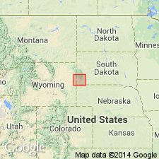
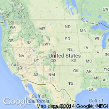
Very fine grained sandstones and massive shales and clay; of white, gray, buff, purple, and maroon colors. Thickness 30-100 ft. Underlies Dakota sandstone as here revised; overlies Minnewaste limestone. Included in Dakota sandstone of previous reports. Striking exposures in Fuson Canyon [on east side of Black Hills, SD], for which it is named. Area is in Meade and Lawrence Cos in the Williston basin, and Pennington, Custer, and Fall River Cos on the Chadron arch. Type section not given. Assigned to the Cretaceous.
Source: GNU records (USGS DDS-6; Denver GNULEX).
- Usage in publication:
-
- Fuson formation*
- Modifications:
-
- Overview
- AAPG geologic province:
-
- Williston basin
Summary:
Fuson formation of Early Cretaceous age in the Black Hills area, SD, Williston basin, resembles a clay assigned to upper part of Cloverly formation, a new unit named in the Bighorn uplift. A new name--Cloverly--defined in the uplift, rather than use of older term Fuson, due to lack of evidence as to the equivalency of the two clays. Correlation diagram.
Source: GNU records (USGS DDS-6; Denver GNULEX).
- Usage in publication:
-
- Fuson shale*
- Modifications:
-
- Revised
Summary:
Made part of the Lower Cretaceous Inyan Kara group (new).
Source: GNU records (USGS DDS-6; Denver GNULEX).
- Usage in publication:
-
- Fuson shale*
- Modifications:
-
- Areal extent
- AAPG geologic province:
-
- Williston basin
- Chadron arch
Summary:
In subsurface, extended into the Cedar Creek anticline, southeastern MT and southwestern ND, Williston basin and Chadron arch. Is an interval of shale and sandy shale that overlies Lakota sandstone and underlies Fall River sandstone. Age is Early Cretaceous.
Source: GNU records (USGS DDS-6; Denver GNULEX).
- Usage in publication:
-
- Fuson shale*
- Modifications:
-
- Overview
Summary:
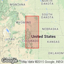
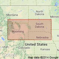
Correlation with other Cretaceous units in Powder River basin, northeast WY, Wind River basin, central WY and Denver basin, southeast WY, northeast and south-central CO shown on fig 19.
Source: GNU records (USGS DDS-6; Denver GNULEX).
- Usage in publication:
-
- Fuson member*
- Modifications:
-
- Revised
- Areal extent
- Overview
- AAPG geologic province:
-
- Chadron arch
Summary:
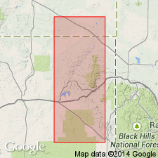
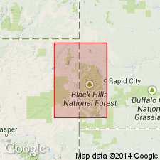
Fuson shale is reduced to member status in redefined Lakota formation. Type section (base not exposed) measured in a cliff at apex of sharp bend in Dry Creek, Fuson Canyon, in SE/4 NE/4 SW/4 sec. 36, T. 5 S., R. 6 E., Custer Co., SD, on the Chadron arch. Suggests use of name in limited area where underlying Minnewaste limestone is present. Member is 92 feet thick in an incomplete section measured at the type locality in Fuson Canyon and consists of siltstone, claystone, and sandstone. Is separated from overlying Fall River sandstone by a transgressive unconformity. Minnewaste limestone is not present at type locality. Age is Early Cretaceous.
Source: GNU records (USGS DDS-6; Denver GNULEX).
- Usage in publication:
-
- Fuson member*
- Modifications:
-
- Reference
- Overview
- AAPG geologic province:
-
- Chadron arch
Summary:
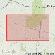
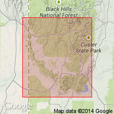
Reference section on east bank of Cheyenne River, in SW/4 NW/4 sec. 2, T. 9 S., R. 4 E., Cascade Springs quadrangle, Fall River Co., SD, on the Chadron arch. At the reference section unconformably overlain by Fall River Formation, and overlies Minnewaste Limestone member of Lakota Formation. Overlaps underlying parts of Lakota Formation northwestward in the Black Hills. Characteristically variegated claystone and siltstone, particularly in the southern and northern Black Hills. White, speckled with red, massive argillaceous fine-grained sandstone commonly in the middle of the member, and a thin, bright-green, clayey sandstone at many localities in the middle of the member. Channel sandstone that is locally conglomeratic comprises much of lower Fuson along the western side of the Black Hills, and cross-bedded conglomeratic sandstone also fills a channel scoured from the top of Fuson part or all the way through the mudstone and massive argillaceous sandstone facies in the southern Black Hills. Polished, well-rounded pebbles of pink quartzite, quartz, and chert are diagnostic of Fuson. Overlaps underlying Chilson Member of Lakota Formation and rests directly on Morrison Formation in the northwestern Black Hills. Assigned to the Early Cretaceous.
Source: GNU records (USGS DDS-6; Denver GNULEX).
- Usage in publication:
-
- Fuson Member*
- Modifications:
-
- Overview
- AAPG geologic province:
-
- Chadron arch
- Williston basin
- Powder River basin
Summary:
Summarizes lithologic variations and shows distribution of Fuson, upper of three members of Lakota Formation (ascending): Chilson, Minnewaste Limestone, and Fuson Members. Subdivided into six informal units, of which four are mapped and two others shown on a restored section. Discusses variations in the lithology of the member and shows distribution in several 7 1/2 min quads in the southern Black Hills, Fall River and Custer Cos, SD, and Weston Co, WY in Williston and Powder River basins and on Chadron arch. Assigned to the Early Cretaceous.
Source: GNU records (USGS DDS-6; Denver GNULEX).
For more information, please contact Nancy Stamm, Geologic Names Committee Secretary.
Asterisk (*) indicates published by U.S. Geological Survey authors.
"No current usage" (†) implies that a name has been abandoned or has fallen into disuse. Former usage and, if known, replacement name given in parentheses ( ).
Slash (/) indicates name conflicts with nomenclatural guidelines (CSN, 1933; ACSN, 1961, 1970; NACSN, 1983, 2005, 2021). May be explained within brackets ([ ]).