

- Usage in publication:
-
- Ericson sandstone*
- Modifications:
-
- Named
- Dominant lithology:
-
- Sandstone
- AAPG geologic province:
-
- Green River basin
Summary:
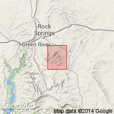
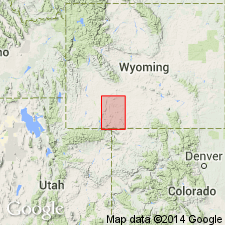
Named as one of four formations of the Mesaverde group for the old Ericson ranch on Salt Wells Creek, sec 31, T16N, R102W, Sweetwater Co, WY in the Greater Green River basin. No type locality designated. Overlies Rock Springs formation (formerly Rock Springs coal group) of the Mesaverde, and underlies Almond formation (formerly Almond coal group) of the Mesaverde. Consists of 800 to 1,000 ft of white sandstone. Cross section. Not mapped. Stratigraphic table. Intertongues with Mancos shale at south end of Rock Springs uplift. Late Cretaceous age.
Source: GNU records (USGS DDS-6; Denver GNULEX).
- Usage in publication:
-
- Ericson formation
- Modifications:
-
- Redescribed
- Dominant lithology:
-
- Sandstone
- Siltstone
- Shale
- AAPG geologic province:
-
- Green River basin
Summary:
Within study area of Rock Springs uplift, Sweetwater Co, WY, Greater Green River basin, Ericson ranges from 428-680 ft thick. Consists of prominent, cliff-forming upper and lower sandstone units separated by less resistant "Rusty Zone." North of U.S. Highway 30 sandstones are generally massive and cross-bedded and individual grains are fine-grained to conglomeratic with quartz and chert pebbles up to 12 mm. in diameter in northern subsurface section. To south Ericson is less conglomeratic, and massive cross-bedding is gradually replaced by true bedding. Rusty zone commonly forms a strike valley separating cliff-forming sandstones. Rusty zone consists of thin-bedded yellow to brown fine-grained sandstone, thin lenticular beds of coal, and carbonaceous siltstone and shale; sideritic concretions and nodules are common. Ericson has many similar features as Castlegate sandstone in north central Wasatch plateau of UT; correlates with Iles formation of Mesaverde to southeast in Vermilion Creek area, CO. Ericson is assigned to Mesaverde group of author's Montana group [the same rank should not be used for both the unit as a whole and to a part of it]; overlies Rock Springs formation; underlies Almond formation, both of Mesaverde. Cross sections; geologic map. Tentatively assigned an early Pierre age though diagnostic fossils are lacking.
Source: GNU records (USGS DDS-6; Denver GNULEX).
- Usage in publication:
-
- Ericson Formation
- Modifications:
-
- Revised
- AAPG geologic province:
-
- Green River basin
Summary:
Is formation in Mesaverde Group in Rock Springs uplift area, southwestern WY, in the Greater Green River basin. Component members named by Smith (1961) are redefined as "zones". Trail Member (lower member) changed to "Trail Zone". Canyon Creek Member (upper member) changed to "Canyon Creek Zone". [No explanation given for redefinition.] "Rusty Zone" is retained for middle member, apparently following Smith (1961). Overlies Rock Springs Formation east of Church Buttes anticline, Adaville Formation west of anticline, and Hilliard Shale on crest of anticline where strata is missing at the Moxa erosion surface (new). Underlies Almond Formation (east) and Lance Formation (west). Age is Late Cretaceous. [The misuse of the rank term "zone" as applied to the lower and upper members has proliferated in subsequent published reports by Roehler and others, usually citing Smith (1961) as the source. However, Smith actually ranked the units as members.]
Source: GNU records (USGS DDS-6; Denver GNULEX).

- Usage in publication:
-
- Ericson Sandstone*
- Modifications:
-
- Overview
- AAPG geologic province:
-
- Green River basin
Summary:
Is the third from base of four formations of Mesaverde Group on the Rock Springs uplift, Greater Green River basin, WY. Is of late Campanian age. Correlation with other units of the same Late Cretaceous age in south-central WY shown on table 1.
Source: GNU records (USGS DDS-6; Denver GNULEX).
- Usage in publication:
-
- Ericson Sandstone*
- Modifications:
-
- Overview
- Areal extent
- AAPG geologic province:
-
- Green River basin
Summary:
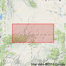
Is formation in Mesaverde Group in Washakie basin, Sweetwater Co, WY and northwest and north-central part of Sand Wash basin, Moffat Co, CO (both basins part of Greater Green River basin). Is divided into (ascending): Trail Member of Smith (1961), Rusty zone of Roehler (1965), and Canyon Creek Member of Smith (1961). Gradual southeastward facies change from coastal-plain fluvial and delta-plain deposits of Ericson to delta-plain, delta-front, prodelta, and shelf deposits of the Iles and Williams Fork Formations depicted on interpretive correlation diagram. Ericson is areally extended in subsurface into northwest CO on basis of electric-log correlations. Approximate geographic boundary of nomenclature change located between gas well (station 6, sec 13, T10N, R94W) and dry oil and gas drillhole (station 7, sec 13, T8N, R93W) in Moffat Co, CO. Unconformably overlies Gottsche Tongue (Smith, 1965) of Rock Springs Formation in outcropping part of Washakie basin; conformably overlies prodelta and shelf deposits of Mancos Shale in downdip subsurface. Underlies Almond Formation. Late Cretaceous in age.
Source: GNU records (USGS DDS-6; Denver GNULEX).
For more information, please contact Nancy Stamm, Geologic Names Committee Secretary.
Asterisk (*) indicates published by U.S. Geological Survey authors.
"No current usage" (†) implies that a name has been abandoned or has fallen into disuse. Former usage and, if known, replacement name given in parentheses ( ).
Slash (/) indicates name conflicts with nomenclatural guidelines (CSN, 1933; ACSN, 1961, 1970; NACSN, 1983, 2005, 2021). May be explained within brackets ([ ]).