


- Usage in publication:
-
- Elkins Fork shales
- Modifications:
-
- Original reference
- Dominant lithology:
-
- Shale
- AAPG geologic province:
-
- Appalachian basin
Summary:
Pg. 296, 297. The name Elkins Fork shales is proposed for the shales exposed opposite Elkins Fork school in northern Pike County, eastern Kentucky. Thickness 10 feet. The known fossiliferous portion of the shales is only 8.5 feet thick; is blue and argillaceous, and lies only 3 feet above creek level. Fauna (listed) chiefly species of PRODUCTUS. By barometer the shales lie 50 feet below Kendrick shales; and they lie 45 feet above Dwale shales. Nothing further is known concerning the geographic distribution of these lower shales. Age is Pennsylvanian.
Source: US geologic names lexicon (USGS Bull. 896, p. 671).
- Usage in publication:
-
- Elkins Fork shale
- Modifications:
-
- Revised
- AAPG geologic province:
-
- Appalachian basin
Summary:
Pg. 82. Elkins Fork shale. Marine shale in Breathitt formation. Probably equivalent to marine Seth limestone, West Virginia. Age is Pennsylvanian.
Source: US geologic names lexicon (USGS Bull. 1200, p. 1234).
- Usage in publication:
-
- Elkins Fork shale member
- Modifications:
-
- Revised
- Dominant lithology:
-
- Shale
- AAPG geologic province:
-
- Appalachian basin
Summary:
Breathitt Formation is informally elevated to group rank and subdivided into the following eight informal formations: Pocahontas, Bottom Creek, Alvy Creek, Grundy, Pikeville, Hyden, Four Corners, and Princess formations. Elkins Fork and Dwale are informal shale members assigned to the upper part of the Pikeville. The Elkins Fork is a marine shale overlying the Upper Elkhorn No. 3 1/2 (Darby?) coal bed, while the Dwale underlies it. [Revisions made in this paper are strongly contested by C. Rice and other USGS scientists who work in this area (oral commun., 9/3/93).]
Source: GNU records (USGS DDS-6; Reston GNULEX).

- Usage in publication:
-
- Elkins Fork shale*
- Modifications:
-
- Areal extent
- AAPG geologic province:
-
- Appalachian basin
Summary:
Elkins Fork shale (informal, unranked) in Breathitt Formation. (= Elkins Fork Shale of Morse, 1931; and Campbell Creek Limestone of White, 1885, in Big Sandy district, eastern Kentucky.) Marine unit in lower part of Breathitt Formation below Kendrick Shale Member and above Crummies Member. Lies below the Amburgy, Cannel City, Creech, Gun Creek, Klondike, Lower Pioneer, Sterling, or Williamson coals; lies above the Cedar Grove, Elk Gap, Little Caney, Nosben, Thacker, Tom Cooper, Upper Elkhorn No. 3, or Van Lear coals. Age is Middle Pennsylvanian.
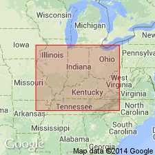
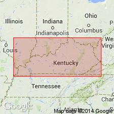
Recognized in Licking River, Hazard, Southwestern, and Big Sandy districts, eastern KY.
Source: Publication.

- Usage in publication:
-
- Elkins Fork shale
- Modifications:
-
- Areal extent
- AAPG geologic province:
-
- Appalachian basin
Summary:
Corr. chart. Elkins Fork shale (informal, unranked) in Pikeville Formation of Breathitt Group (KY); Elkins Fork shale (informal, unranked) in Indian Bluff Formation (TN). Shale and/or mudstone. In Kentucky is an informal, unranked unit above Dwale shale (informal, unranked) in upper part of Pikeville Formation; lies below Kendrick Shale Member of Hyden Formation. In Tennessee is an informal, unranked unit above the Dwale shale, in upper part of Indian Bluff Formation. Correlates with Campbell Creek Limestone (unranked) in Kanawha Formation of Pottsville Group of West Virginia. Carries marine fossils. Age is Middle Pennsylvanian (Westphalian; Atokan). [Peppers (1996, GSA Memoir 188, p. 9, pl.) placed the Indian Bluff Formation in Westphalian B, MICRORETICULATISPORITES NOBILIS-FLORINITES JUNIOR (NJ) miospore assemblage zone of western Europe.]
Source: Publication.
For more information, please contact Nancy Stamm, Geologic Names Committee Secretary.
Asterisk (*) indicates published by U.S. Geological Survey authors.
"No current usage" (†) implies that a name has been abandoned or has fallen into disuse. Former usage and, if known, replacement name given in parentheses ( ).
Slash (/) indicates name conflicts with nomenclatural guidelines (CSN, 1933; ACSN, 1961, 1970; NACSN, 1983, 2005, 2021). May be explained within brackets ([ ]).