The National Geologic Map Database is migrating to a new infrastructure. We apologize for any service disruptions during this process.
|
|---|


- Usage in publication:
-
- Earp formation*
- Modifications:
-
- Original reference
- Dominant lithology:
-
- Limestone
- Shale
- AAPG geologic province:
-
- Pedregosa basin
Summary:
Pg. 18-23. Earp formation of Naco group. Base of formation arbitrarily taken where thin shaly limestones and reddish shales become dominant over more massive limestones characteristic of Horquilla formation (new). Much shale, a little sandstone, and a few beds of limestone and shale conglomerate occur somewhat higher in section and in turn give way upward to more massive limestone with a few conspicuous beds of dolomite, 1 to 5 or 6 feet thick, that weather to briliiant orange or red. Dolomites commonly cross-bedded and somewhat cherty, and associated with a few thin sandstones. Topmost dolomite bed taken as top of formation. Underlies Colina limestone (new). Broken sequences exposed west of Dragoon Camp (Pearce quadrangle) suggest thickness of 600 feet. Formation may thicken abruptly toward north. Age is Late Pennsylvanian and possibly Permian.
Type section: extends from saddle south of Earp Hill up to conspicuous mottled, pink and gray limestone, and then (to avoid faulting at this locality) is completed by exposed section above this mottled bed about 0.5 mi to east on the same slope. Named from Earp Hill in sec. 5, T. 21 S., R. 23 E., on whose slope lower part of formation is well exposed, central Cochise Co, southeastern AZ. There is no continuous, unfaulted section of entire formation in area of northern Mule Mountains, Tombstone Hills, or Dragoon Mountains, included in Pearce and Benson quadrangles, AZ.
Source: US geologic names lexicon (USGS Bull. 1200, p. 1199-1200).
- Usage in publication:
-
- Earp formation*
- Modifications:
-
- Overview
- AAPG geologic province:
-
- Pedregosa basin
Summary:
Earp formation of Naco group. Overlies Horquilla limestone and underlies Colina limestone. Thickness 577 feet. Age is Carboniferous and Permian. Report includes geologic map.
Measured section: on spur southwest of Golden Rule mine, Dragoon Mountains, Cochise Co., AZ.
Source: Modified from GNU records (USGS DDS-6; Denver GNULEX).
- Usage in publication:
-
- Earp formation
- Modifications:
-
- Areal extent
- AAPG geologic province:
-
- Pedregosa basin
Summary:
Earp formation of Naco group. Present in northern Chiricahua Mountains, Cochise County, Arizona. Overlies Horquilla limestone and underlies Colina limestone, both of Naco group. Correlates with part of Supai formation. Fossiliferous (fusulinids, corals, brachiopods). Age is Pennsylvanian and Permian (Virgil to Wolfcamp).
Measured sections: (1) lower part of fm, Dunn Spring Mountain, in SE/4 sec. 23, T. 15 S., R. 30 E., 650 ft; (2) upper part of fm, south side of Indian Creek, in NW/4 sec. 17, T. 16 S., R. 30 E., 1,840 ft; and (3) 2 mi northwest of Portal, in E/2 sec. 21, T. 17 S., R. 32 E., about 2,700 ft.
Source: Modified from GNU records (USGS DDS-6; Denver GNULEX).
- Usage in publication:
-
- Earp formation
- Modifications:
-
- Age modified
- Areal extent
- AAPG geologic province:
-
- Pedregosa basin
Summary:
Extended to central Peloncillo Mountains, Hidalgo Co, NM in Pedregosa basin. Geologic map included. Section measured in NW1/4 sec 3, T25S, R21W. Fusulinid identified indicate an early Permian (Wolfcamp) age for the Earp. Was considered Late Pennsylvanian and Permian? in earlier reports.
Source: GNU records (USGS DDS-6; Denver GNULEX).
- Usage in publication:
-
- Earp(?) formation
- Modifications:
-
- Areal extent
- AAPG geologic province:
-
- Basin-and-Range province
Summary:
Tentatively identified in Rincon Mountains, Arizona (Basin-and-Range province) on basis of fossils and lithology.
Source: Modified from GNU records (USGS DDS-6; Denver GNULEX).
- Usage in publication:
-
- Earp Formation
- Modifications:
-
- Areal extent
- AAPG geologic province:
-
- Pedregosa basin
Summary:
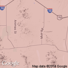
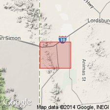
Extended to Animas Mountains, Hidalgo Co., NM in Pedregosa basin. Lumped in mapping with overlying Colina Limestone. Rests on Horquilla Limestone with erosional unconformity. Is of Permian age.
Source: GNU records (USGS DDS-6; Denver GNULEX).
- Usage in publication:
-
- Earp Formation
- Modifications:
-
- Biostratigraphic dating
- AAPG geologic province:
-
- Pedregosa basin
Summary:
Virgilian beds in lower part of formation grade laterally into beds at top of underlying Horquilla Limestone along eastern base of Chiricahua Mountains, AZ in the Pedregosa basin. Is of Pennsylvanian and Permian (Virgilian and Wolfcampian) age.
Source: GNU records (USGS DDS-6; Denver GNULEX).

- Usage in publication:
-
- Earp formation*
- Modifications:
-
- Overview
- AAPG geologic province:
-
- Pedregosa basin
Summary:
Is distinctive lithologically (heterogeneous mixture of shale, calcareous sandstone, marl, and a few conspicuous beds of tan- or orange-weathering dolomite) from underlying Horquilla limestone and overlying Colina limestone. No evidence of sedimentologic or paleontologic break. Measured section in sec 33, T15S, R23E, described. Geologic map. Assigned to the Late Pennsylvanian and Early Permian in quad, Pedregosa basin. Belongs to Naco group.
Source: GNU records (USGS DDS-6; Denver GNULEX).
- Usage in publication:
-
- Earp Formation
- Modifications:
-
- Areal extent
- AAPG geologic province:
-
- Pedregosa basin
Summary:
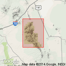
Extended without query as a formation of Naco Group to Big Hatchet Mountains, NM (see Zeller, 1958), in the Pedregosa basin. Is of Permian (Wolfcamp or Leonard) age. Fossils rare; ostracods and gastropods, and footprints of a small reptile identified. Measured section in SE1/4 NW1/4 sec 26, T31S, R15W, 997 ft thick described. Formation conformably overlies Horquilla Limestone and underlies Colina Limestone. Probably correlates with Abo and Supai Formations.
Source: GNU records (USGS DDS-6; Denver GNULEX).
- Usage in publication:
-
- Earp Formation*
- Modifications:
-
- Areal extent
- AAPG geologic province:
-
- Pedregosa basin
- Basin-and-Range province
Summary:
Used in Whetstone Mountains, AZ in the Pedregosa basin and Basin-and-Range province. Section 724 ft thick measured and described in NW1/4 sec 24, T18S, R18E, Pima Co, AZ, Basin-and-Range province, and a section 801 ft thick in sec 22, T19S, R19E, Cochise Co, AZ, Pedregosa basin. Is of Late Pennsylvanian and Early Permian age.
Source: GNU records (USGS DDS-6; Denver GNULEX).
- Usage in publication:
-
- Earp Formation*
- Modifications:
-
- Areal extent
- AAPG geologic province:
-
- Pedregosa basin
- Basin-and-Range province
Summary:
Extended as a formation of Naco Group to Mustang Mountains in Santa Cruz Co, in the Basin-and-Range province, and the Huachuca Mountains, Cochise Co, AZ in the Pedregosa basin. Estimated to be 400 ft thick in Huachuca Mountains and 600-800 ft thick in Mustang Mountains. Is of Late Pennsylvanian and Early Permian age.
Source: GNU records (USGS DDS-6; Denver GNULEX).
- Usage in publication:
-
- Earp Formation
- Modifications:
-
- Areal extent
- AAPG geologic province:
-
- Pedregosa basin
- Basin-and-Range province
Summary:
Isopach map shows formation outcrops in Pima, Santa Cruz, Cochise, Graham, and Greenlee Cos, AZ and Hidalgo Co, NM in the Pedregosa basin and Basin-and-Range province. Is of Pennsylvanian and Permian (Virgilian and Wolfcampian) age.
Source: GNU records (USGS DDS-6; Denver GNULEX).
- Usage in publication:
-
- Earp Formation*
- Modifications:
-
- Areal extent
- AAPG geologic province:
-
- Basin-and-Range province
Summary:
Extended to Santa Rita Mountains, Pima Co, AZ in Basin-and-Range province. Is of Early Permian age.
Source: GNU records (USGS DDS-6; Denver GNULEX).
- Usage in publication:
-
- Earp Formation*
- Modifications:
-
- Areal extent
- AAPG geologic province:
-
- Basin-and-Range province
Summary:
Extended as a formation of Naco Group to Sierrita Mountains, Pima Co, AZ in the Basin-and-Range province. Is of Late Pennsylvanian and Early Permian age.
Source: GNU records (USGS DDS-6; Denver GNULEX).
- Usage in publication:
-
- Earp Formation
- Modifications:
-
- Areal extent
- AAPG geologic province:
-
- Basin-and-Range province
- Black Mesa basin
Summary:
Extended to Mogollon Rim area, AZ in the Basin-and-Range province and Black Mesa basin, to replace parts of Naco or Supai Formations of earlier workers. Intertongues with overlying Supai Formation and underlying Horquilla Formation. Is of Pennsylvanian (Virgilian) age.
Source: GNU records (USGS DDS-6; Denver GNULEX).
- Usage in publication:
-
- Earp Formation*
- Modifications:
-
- Areal extent
- AAPG geologic province:
-
- Basin-and-Range province
Summary:
Extended as a formation of Naco Group to Patagonia Mountains, Santa Cruz Co, AZ in Basin-and-Range province. Is of Late Pennsylvanian and Early Permian age.
Source: GNU records (USGS DDS-6; Denver GNULEX).
- Usage in publication:
-
- Earp Formation*
- Modifications:
-
- Areal extent
- AAPG geologic province:
-
- Pedregosa basin
Summary:
Extended as a formation of Naco Group to Rincon Mountains, Cochise Co., AZ in the Pedregosa basin. Is of Late Pennsylvanian and Early Permian age.
Source: GNU records (USGS DDS-6; Denver GNULEX).
- Usage in publication:
-
- Earp Formation*
- Modifications:
-
- Overview
- AAPG geologic province:
-
- Pedregosa basin
Summary:
Mapped as formation of Naco Group in Peloncillo Mountains, Hidalgo Co, NM in the Pedregosa basin. Conformably overlies Horquilla Limestone (Pennsylvanian) of Naco Group. Conformably overlain by Colina Limestone (Lower Permian) of Naco. Is probably more than 600 m thick. Is of Early Permian (Wolfcampian) age [apparently on basis of previous work].
Source: GNU records (USGS DDS-6; Denver GNULEX).
- Usage in publication:
-
- Earp Formation*
- Modifications:
-
- Revised
- AAPG geologic province:
-
- Pedregosa basin
Summary:
Contact raised from that used in same area by Armstrong and others (1978). The lower part of the Earp of Armstrong and others (1978) here included in upper member of underlying Horquilla Limestone. [The contact used by Drewes and Thorman probably coincides more closely to that used in other areas.] Age of Earp in mapped area, Pedregosa basin, is only Early Permian. Earp is at least 200 m thick. Formation overlies Lower Permian and Pennsylvanian Horquilla Limestone and underlies Lower Permian Colina Limestone. Cross sections.
Source: GNU records (USGS DDS-6; Denver GNULEX).
- Usage in publication:
-
- Earp Formation*
- Modifications:
-
- Mapped 1:24k
- Dominant lithology:
-
- Marlstone
- Shale
- Limestone
- AAPG geologic province:
-
- Pedregosa basin
Summary:
Earp Formation of Naco Group. Light-colored, thin-bedded, weakly indurated marlstone, shale, and some limestone. Metamorphosed in many places to slabby-weathering, yellowish-brown hornfels and very light-gray marble. Includes a red jasper pebble and granule conglomerate marker bed. Thickness about 300 m. Age is Early Permian.
Source: Publication.

- Usage in publication:
-
- Earp Formation*
- Modifications:
-
- Mapped 1:24k
- Dominant lithology:
-
- Siltstone
- Marlstone
- Limestone
- AAPG geologic province:
-
- Pedregosa basin
Summary:
Earp Formation. Mapped in Big Hatchet Mountains, Hidalgo County, southwestern New Mexico. Siltstone, marlstone, and some limestone. Mainly reddish-gray, light-gray, or very pale orange, poorly indurated beds. Includes some dolomitic siltstone, mudstone, and beds with calcareous nodules. Thickness about 1,000 feet (310 m). Conformably underlies Colina Limestone (Lower Permian); conformably overlies Horquilla Limestone (Pennsylvanian and Lower Permian). Fossiliferous; conifer wood, fish scales, and theropod footprints (Zeller, 1965). Age is Early Permian.
Source: Publication.
For more information, please contact Nancy Stamm, Geologic Names Committee Secretary.
Asterisk (*) indicates published by U.S. Geological Survey authors.
"No current usage" (†) implies that a name has been abandoned or has fallen into disuse. Former usage and, if known, replacement name given in parentheses ( ).
Slash (/) indicates name conflicts with nomenclatural guidelines (CSN, 1933; ACSN, 1961, 1970; NACSN, 1983, 2005, 2021). May be explained within brackets ([ ]).