- Usage in publication:
-
- Eagle Ford shales*
- Modifications:
-
- Original reference
- Dominant lithology:
-
- Shale
- AAPG geologic province:
-
- Ouachita folded belt
Summary:
Pg. 298. Eagle Ford shales. Argillaceous shales, varying from blue at top to yellow in middle and blue at base, with marked faunal zones. Overlies Timber Creek group [Woodbine sand] and underlies Dallas limestone [Austin chalk]. Age is Late Cretaceous (Gulf).
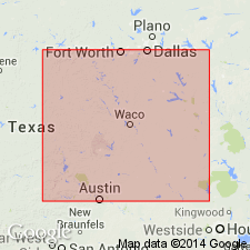
Named from exposures at Eagle Ford, Dallas Co., northeastern TX.
Source: US geologic names lexicon (USGS Bull. 896, p. 650).

- Usage in publication:
-
- Eagle Ford group*
- Modifications:
-
- Revised
Summary:
Pg. 425-426. Eagle Ford group. Divided into (ascending) Tarrant, Britton, and Arcadia Park formations. Names credited W.L. Moreman. [Age is Late Cretaceous (Gulf).]
Source: US geologic names lexicon (USGS Bull. 1200, p. 1194-1195).

- Usage in publication:
-
- Eagle Ford shale*
- Eagle Ford clay*
- Modifications:
-
- Overview
- AAPG geologic province:
-
- Gulf Coast basin
- Arkla basin
- East Texas basin
- Strawn basin
- Ouachita folded belt
- Permian basin
- Fort Worth syncline
- South Oklahoma folded belt
Summary:
Eagle Ford shale (also clay). Recognized in Texas, western Louisiana, and southeastern Oklahoma. In most early reports the name Eagle Ford clay was used to include Bonham clay and Blossom sand of present [ca. 1938] nomenclature, but it is now restricted to the beds beneath Ector tongue of Austin chalk. According to L.W. Stephenson (AAPG Bull., v. 13, Oct. 1912), the Eagle Ford is unconformable with overlying Austin chalk and with underlying Woodbine sand. Age is Late Cretaceous (Gulf).
Source: US geologic names lexicon (USGS Bull. 896, p. 650).
- Usage in publication:
-
- Eagle Ford formation*
- Modifications:
-
- Overview
- AAPG geologic province:
-
- Ouachita folded belt
Summary:
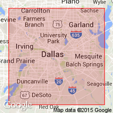
Pg. 17-42, pls. 1, 3. Eagle Ford formation. Moreman's subdivisions not recognized in area of this report [Dallas County]. Underlies Austin formation. Chiefly clay-shale. Average thickness 475 feet. [Age is Late Cretaceous (Gulf).]
Source: US geologic names lexicon (USGS Bull. 1200, p. 1194-1195).
- Usage in publication:
-
- Eagle Ford shale*
- Modifications:
-
- Areal extent
- AAPG geologic province:
-
- East Texas basin
- Fort Worth syncline
- Gulf Coast basin
- Ouachita folded belt
- Permian basin
- Strawn basin
Summary:
Chart 9. Shown on correlation chart as Eagle Ford shale. Overlies Woodbine sand; underlies Austin chalk. [Recognized notably in Texas. Age is Late Cretaceous (Gulfian).]
Source: US geologic names lexicon (USGS Bull. 1200, p. 1194-1195).
- Usage in publication:
-
- Eagle Ford formation
- Modifications:
-
- Revised
- AAPG geologic province:
-
- Strawn basin
Summary:
Pg. 472, 473, 474, 475, 477, 480 (correlation chart). Eagle Ford formation of Woodbine group (surface and subsurface). Includes Tarrant member. Overlies Lewisville formation with unconformity; underlies Ector chalk of Austin group with unconformity. [Age is Late Cretaceous (Gulf).]
Source: US geologic names lexicon (USGS Bull. 1200, p. 1194-1195).
- Usage in publication:
-
- Eagle Ford shale*
- Modifications:
-
- Areal extent
- AAPG geologic province:
-
- Ouachita folded belt
Summary:
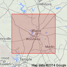
Pg. 58. Eagle Ford shale unconformably overlies Pepper shale member of Woodbine formation at type section of Pepper shale. [Age is Late Cretaceous (Gulf).]
Source: US geologic names lexicon (USGS Bull. 1200, p. 1194-1195).
- Usage in publication:
-
- Eagle Ford shale*
- Modifications:
-
- Mapped 1:500k
Summary:
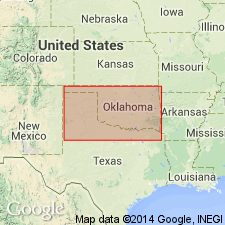
Mapped as Eagle Ford shale.
Source: US geologic names lexicon (USGS Bull. 1200, p. 1194-1195).
- Usage in publication:
-
- Eagle Ford Formation
- Modifications:
-
- Mapped 1:250k
- Dominant lithology:
-
- Shale
- Sandstone
- Limestone
- Sand
- Tuff
- AAPG geologic province:
-
- Ouachita folded belt
Summary:
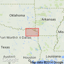
Eagle Ford Formation. At western edge of sheet, shale, bituminous, selenitic, calcareous concretions and septaria, medium- to dark-gray; a few thin platy beds of sandstone and sandy limestone, most abundant near middle; marine megafossils; thickness 350 feet. Near Lamar-Red River County line, grades mostly to quartz sand, fine- to coarse-grained, some cross-bedding, light-gray, near middle some tuff, conglomerate locally at base; thickness 60 feet, feathers out eastward. Lies above Woodbine Group, undivided, and below Bonham Formation. Age is Late Cretaceous.
[Mapped in northwestern part of map sheet, south of Red River, in Fannin, Lamar, and Red River Cos., northeastern TX.]
Source: Publication.
- Usage in publication:
-
- Eagle Ford Group
- Modifications:
-
- Mapped 1:250k
- AAPG geologic province:
-
- Permian basin
- Ouachita folded belt
Summary:
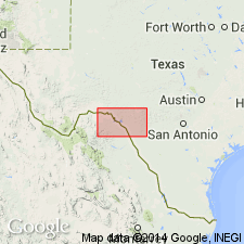
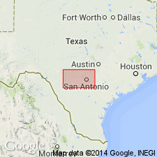
Is Upper Cretaceous unit mapped in southeastern Val Verde Co, TX (southern part of Permian basin) and central Kinney and east-central Uvalde Cos, TX (Ouachita tectonic belt province). Facies change westward is gradual from Eagle Ford Group to Boquillas Flags; nomenclature change arbitrarily placed at Devils River, Val Verde Co. Overlies Buda Limestone; overlain by Austin Chalk. Map unit described as shale, siltstone, and limestone; upper part, limestone and shale, limestone light yellowish-brown, flaggy; lower part, siltstone and very fine grained sandstone, light-yellow to gray, laminated, flaggy, some limestone, silty, medium-brown, laminated; thickness 75-200 ft, thins northeastward.
Source: GNU records (USGS DDS-6; Denver GNULEX).
- Usage in publication:
-
- Eagle Ford Group
- Modifications:
-
- Mapped 1:250k
- Dominant lithology:
-
- Shale
- Siltstone
- Limestone
- AAPG geologic province:
-
- Ouachita folded belt
Summary:
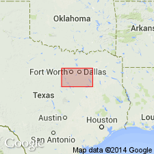
Pamphlet [p. 5]. Eagle Ford Group, undivided. Shale, siltstone, and limestone; upper part limestone and shale, limestone light-yellowish brown, flaggy; lower part siltstone and very fine-grained sandstone, light-yellow to gray, laminated, flaggy, some limestone, silty, medium-brown, laminated. Thickness 30 to 75 feet; thickest in western Uvalde County. Lies above Buda Limestone and below Austin Chalk. Age is Late Cretaceous.
[Mapped in Uvalde, Medina, Bexar, Comal, and Hays Cos., TX.]
Source: Publication.
- Usage in publication:
-
- Eagle Ford Group
- Modifications:
-
- Mapped 1:250k
- Dominant lithology:
-
- Shale
- Sandstone
- Limestone
- AAPG geologic province:
-
- Fort Worth syncline
- Ouachita folded belt
- Strawn basin
Summary:
Eagle Ford Group undivided. North of Hill County, eastern Texas, shale, sandstone, and limestone; shale, bituminous, selenitic, with calcareous concretions and large septaria; sandstone and sandy limestone in upper and middle parts, platy, burrowed, medium to dark gray; in lower part bentonitic; hard limestone bed marks base in Ellis and Johnson Counties; locally forms low cuesta. Thickness 200 to 300 feet. Lies above Woodbine Formation and below Austin Chalk. Age is Late Cretaceous.
[Mapped in Dallas, Denton, Ellis, Hill, Johnson, and Tarrant Cos., eastern TX.]
Source: Publication.
- Usage in publication:
-
- Eagle Ford Group*
- Modifications:
-
- Biostratigraphic dating
- AAPG geologic province:
-
- Ouachita folded belt
- Strawn basin
Summary:
Collections from lower part at USGS Mesozoic localities 14583 and 24510, Johnson Co, TX and 11740 and D12626, Tarrant Co, TX in Strawn basin yield ammonite TARRANTOCERAS SELLARDSI. Tarrant Formation of Eagle Ford Group near Round Rock, Williamson Co, TX in Ouachita tectonic belt province yields holotype of T. SELLARDSI. Fauna is assignable to late middle Cenomanian (Late Cretaceous) CUNNINGTONICERAS AMPHIBOLUM AMPHIBOLUM subzone of C. AMPHIBOLUM zone. Britton Formation of Eagle Ford Group in Ellis Co, TX in Ouachita tectonic belt province yields SUMITOCERAS CONLINI and is thus assignable to middle late Cenomanian (Late Cretaceous) SCIPONOCERAS GRACILE zone.
Source: GNU records (USGS DDS-6; Denver GNULEX).

- Usage in publication:
-
- Eagle Ford Formation
- Modifications:
-
- Mapped 1:250k
- Dominant lithology:
-
- Shale
- Sandstone
- Limestone
- AAPG geologic province:
-
- Fort Worth syncline
- Ouachita folded belt
- South Oklahoma folded belt
Summary:
Pamphlet [p. 3]. Eagle Ford Formation. In Texas, shale, medium- to dark-gray, selenitic, bituminous, calcareous concretions and septaria common, some thin platy beds of sandstone and sandy limestone in middle and upper parts, marine megafossils, thickness 300 to 400 feet. Lies above Woodbine Formation and below Austin Group. Age is Late Cretaceous.
In Oklahoma, only lower 25 feet of formation is exposed; composed of limestone, bluish-gray, weathers to yellow, silty, thin-bedded, flaggy, thin beds of blue calcareous siltstone and blue silty shale.
[Mapped in eastern half of map sheet, in Collin, Denton, Fannin, and Grayson Cos., northeastern TX, and Bryan Co., southeastern OK.
Source: Publication.
For more information, please contact Nancy Stamm, Geologic Names Committee Secretary.
Asterisk (*) indicates published by U.S. Geological Survey authors.
"No current usage" (†) implies that a name has been abandoned or has fallen into disuse. Former usage and, if known, replacement name given in parentheses ( ).
Slash (/) indicates name conflicts with nomenclatural guidelines (CSN, 1933; ACSN, 1961, 1970; NACSN, 1983, 2005, 2021). May be explained within brackets ([ ]).

