The National Geologic Map Database is migrating to a new infrastructure. We apologize for any service disruptions during this process.
|
|---|


- Usage in publication:
-
- Decorah shale
- Modifications:
-
- Original reference
- Dominant lithology:
-
- Shale
- AAPG geologic province:
-
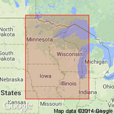
- Iowa shelf
Summary:
Pg. 60, 84. Decorah (Green) shale. Very calcareous green shale, with numerous bands and nodules of limestone, 25 to 30 feet thick, forming top shaly member of Platteville stage. Overlies Platteville limestone (lower formation of Platteville stage) and underlies Galena limestone. Within city of Decorah [Winneshiek Co., IA] and vicinity is everywhere very calcareous. Age is Middle Ordovician.
[Type locality: Decorah, Winnishiek Co., northeastern IA.]
Source: US geologic names lexicon (USGS Bull. 896, p. 583).

- Usage in publication:
-
- Decorah shale*
- Modifications:
-
- Overview
Summary:
Decorah shale. Adopted by USGS in 1910 as a distinct formation, overlying Platteville limestone restricted and underlying Galena dolomite. It was understood to have been included in Platteville limestone as originally defined, and to include "glass rock" of miners and here and there a thin layer of "oil rock," but that main "oil rock" of miners was in overlying Galena dolomite; also that it is "Green shales" of early Minnesota reports. Fauna considered by E.O. Ulrich (1923) to be of late Black River age.
Source: US geologic names lexicon (USGS Bull. 896, p. 583).
- Usage in publication:
-
- Decorah formation
- Modifications:
-
- Revised
Summary:
Divided Decorah formation into 3 members, named (descending) Ion member, Guttenberg member, and Spechts Ferry member, the latter said to include the "glass rock." (See descriptions of these members.) Kay stated upper 2 members are of Trenton age and lower member of latest Black River age; also that his Guttenberg member is the "oil rock" at base of the Galena in northwestern Illinois. This seems to mean a restriction of Galena and an expansion of Decorah of previous reports. In 1931 (Jour. Geol., v. 39, p. 370) Kay redefined the Spechts Ferry member of Decorah formation by excluding the "glass rock." In 1932 (Jour. Geol., v. 40, no. 3, p. 259-269) V.T. Allen proposed drawing line between Platteville and Decorah at base of a 1- to 3-inch layer of metabentonite, which he reported as present 12 to 18 inches above base of Decorah in Minnesota, Iowa, and Wisconsin.
Source: US geologic names lexicon (USGS Bull. 896, p. 583).
- Usage in publication:
-
- Decorah formation
- Modifications:
-
- Revised
Summary:
Pg. 98-99, 101. Decorah formation. Continued to include Kay's Spechts Ferry member in the Decorah and to classify it as of late Black River age and rest of Decorah as of Trenton age. They stated that Platteville as defined by Bain did not include Ion and Guttenberg members of Kay.
Source: US geologic names lexicon (USGS Bull. 896, p. 583).
- Usage in publication:
-
- Decorah formation
- Modifications:
-
- Revised
Summary:
Pg. 286-287, 295. Also restricted Decorah formation by transferring to the Platteville his Spechts Ferry member restricted and the underlying "glass rock" (which he included in his newly named McGregor member of the Platteville), leaving Decorah formation near Platteville as composed wholly of his Guttenberg member. But on p. 288 he stated that in Minnesota and northern Iowa it is "more convenient to consider the Spechts Ferry as a lowest member of Decorah formation." Kay stated (p. 286) his restricted Spechts Ferry member includes a thin bed of metabentonite 18 inches above its base. On p. 295 he showed an unconformity between his Guttenberg and Spechts Ferry members in Minnesota and Illinois.
Source: US geologic names lexicon (USGS Bull. 896, p. 584).
- Usage in publication:
-
- Decorah shale
- Modifications:
-
- Revised
Summary:
Fig. 1 [opp. p. 18]. Treated Galena as a group, all of Trenton age, and included in it Decorah shale (restricted to beds above the basal or Spechts Ferry member of Kay, which they included in Platteville limestone). Page 64, however, excluded all of Decorah formation from the Galena, but included it in the Trenton, and transferred Kay's Spechts Ferry member to the Platteville.
Source: US geologic names lexicon (USGS Bull. 896, p. 583-584).
- Usage in publication:
-
- Decorah shale
- Modifications:
-
- Overview
Summary:
The USGS has for many years followed the definitions of Decorah shale and Platteville limestone that include the "glass rock" in Decorah shale. Its present age designation of Decorah shale is late Black River and early Trenton. The shale separating Plattin and Kimmswick limestones in Missouri, southwestern Illinois, and central western Illinois has for several years been called Decorah shale. This shale is now said to correspond to only the Spechts Ferry member of Kay. If so, and Kay's Spechts Ferry member is transferred to Platteville limestone, Decorah is no longer an appropriate name for the shale separating Plattin and Kimmswick limestones.
Source: US geologic names lexicon (USGS Bull. 896, p. 584).
- Usage in publication:
-
- Decorah member
- Modifications:
-
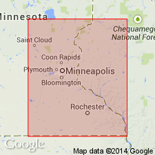
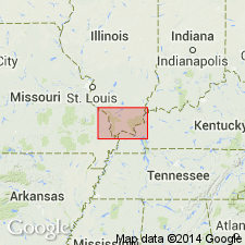
- Areal extent
- AAPG geologic province:
-
- Iowa shelf
Summary:
Pg. 9 (geol. column), 72, 81, 82-86. Decorah member of Galena formation. Considered member of Galena formation in southeastern Minnesota. Underlies Prosser member; overlies Spechts Ferry member of Platteville formation. Includes Guttenberg and Ion submembers. Thickness 27 to 46 feet.
Source: US geologic names lexicon (USGS Bull. 1200, p. 1064).
- Usage in publication:
-
- Decorah formation
- Modifications:
-
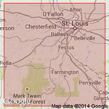
- Areal extent
Summary:
Pg. 2064-2066. Decorah formation. In southeastern Missouri, underlies Kimmswick limestone and overlies Macy formation (new) of Plattin group. Spechts Ferry member traced from type locality into Missouri where it is lower shale-bearing part of formation. Thicknesses: 25 feet in Lincoln County; 18 feet in St. Louis County; 15 feet in Jefferson County; 20 feet in Perry County, Spechts Ferry member absent.
Source: US geologic names lexicon (USGS Bull. 1200, p. 1064).
- Usage in publication:
-
- Decorah formation
- Modifications:
-
- Areal extent
- AAPG geologic province:
-
- Iowa shelf
Summary:
Pg. 759-763. Decorah formation. Overlies Carimona member (new) of Platteville formation and underlies Cummingsville member (new) of Galena formation. Thickens from about 20 feet at Iowa line to nearly 90 feet at Twin Cities. Spechts Ferry, Guttenberg, and Ion members not recognizable units in Minnesota.
Source: US geologic names lexicon (USGS Bull. 1200, p. 1064-1065).
- Usage in publication:
-
- Decorah formation
- Modifications:
-
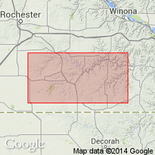
- Areal extent
Summary:
Pg. 1029 (fig. 1), 1033-1036, pl. 1. Decorah formation. Described in Fillmore County, Minnesota, where it is not differentiated into members. Here, and in adjacent exposures, formation is a shale, grayish yellow green to greenish gray, calcareous, generally fissile, but more massive and blocky where coquinoid layers are absent or sparse. Numerous limestone layers concentrated near base and top of subordinately near middle. A 1- to 2-inch bentonite present near base; this seam is the "putty layer" of Twin City section and is continuous with Spechts Ferry bentonite. Thickens northwestward across county from 22 to 46 feet. Underlies Galena formation, Cummingsville member; overlies Platteville formation, Carimona member. Most fossiliferous unit in Minnesota Ordovician.
Source: US geologic names lexicon (USGS Bull. 1200, p. 1065).
- Usage in publication:
-
- Decorah formation*
- Modifications:
-
- Overview
Summary:
Pg. 8 (fig. 2), 11 (fig. 3), 14-17. Formation described in upper Mississippi Valley zinc-lead district (WI, IL, IA) where it is about 40 feet thick; includes three members: a basal green-shale member (Spechts Ferry) that thickens toward northwest, a thin-bedded pinkish-buff sublithographic limestone and interbedded carbonaceous brown-shale member (Guttenberg), and a medium-bedded gray dolomite or limestone member (Ion) that has thin greenish-shale partings. Disconformably overlies Platteville formation and grades upward into Galena dolomite.
Source: US geologic names lexicon (USGS Bull. 1200, p. 1065).

- Usage in publication:
-
- Decorah Formation*
- Decorah subgroup [informal]
- Modifications:
-
- Areal extent
- AAPG geologic province:
-
- Iowa shelf
- Wisconsin arch
- Illinois basin
Summary:
Decorah Formation and /Decorah subgroup [informal]. According to Ross and others (1982), basal Decorah Formation (in Iowa, Minnesota, and Wisconsin) or basal Decorah subgroup (in Illinois) correlates with Tyrone Limestone of north-central Tennessee.
["Subgroup" not recognized as a formal stratigraphic rank term (CSN, 1933; ACSN, 1961, 1970; NACSN, 1983, 2005, 2021). Considered informal and should not be capitalized.]
Source: Modified from GNU records (USGS DDS-6; Denver GNULEX).
- Usage in publication:
-
- Decorah Formation*
- Decorah Subgroup†
- Modifications:
-
- Revised
- AAPG geologic province:
-
- Iowa shelf
- Ozark uplift
- Wisconsin arch
Summary:
Pg. 16. Decorah Formation. Includes (ascending) Castlewood Limestone Member [type in Missouri], Carimona Limestone Member [type in Minnesota], Spechts Ferry Shale Member, Guttenberg Limestone Member, and Ion Shale Member. Deicke K-bentonite Bed (I-1 bentonite of Mossler and Hayes, 1966) occurs near base. Use of /Decorah subgroup [informal] discontinued.
["Subgroup" not recognized as a formal stratigraphic rank term (CSN, 1933; ACSN, 1961, 1970; NACSN, 1983, 2005, 2021).]
Source: Publication.
- Usage in publication:
-
- Decorah Formation
- Modifications:
-
- Revised
- AAPG geologic province:
-
- Illinois basin
Summary:
Geologists variously classify Decorah as a formation (Decorah Shale), a subgroup (Templeton and Willman, 1963), or a group (Thompson, 1991). In and near this study area, Ordovician (Mohawkian) Decorah Formation is only 40 to 60 feet thick and cannot be subdivided except in unusually good exposures. Most mappers in southeastern Missouri combined Decorah and Plattin Limestone or didn't distinguish Decorah at all. In this report, Decorah Formation is used instead of Decorah Shale because limestone is a major constituent. In cores from northern part of Thebes 7.5-min quadrangle, a few miles south of study area, Decorah consists of 8 to 17 feet of light- to medium-brownish-gray, fossiliferous, shaly lime mudstone and skeletal wackestone with thin interbeds of light-greenish-gray to brownish-gray, slightly calcareous, fissile shale. Bedding is wavy, contorted, and nodular. Common fossils include trepostome, bifoliate, and fistuliporid bryozoans; brachiopods, including RAFINESQUINA and HEBERTELLA; and gastropods, rugose corals, and echinoderm fragments. Contact with underlying Plattin Limestone is gradational in these cores. Contact with overlying Kimmswick Limestone is sharp and probably disconformable. In wells lacking cores, Decorah is distinguished from Plattin and Kimmswick by its greater clay content. Threefold division cited by Thompson (1991) can be recognized in wells for which good sample studies and geophysical logs are available. A lower argillaceous limestone (Castlewood) is overlain by a fossiliferous shale (Glencoe) and an upper argillaceous or silty limestone (Kings Lake). Only Glencoe can be identified on most geophysical logs. In and near Jonesboro 15-min quadrangle, Decorah is about 40 to 60 feet thick.
Source: GNU records (USGS DDS-6; Reston GNULEX).
- Usage in publication:
-
- Decorah Formation
- Modifications:
-
- Revised
- AAPG geologic province:
-
- Illinois basin
- Ozark uplift
- Upper Mississippi embayment
Summary:
Ordovician (Champlainian) Decorah Formation is a thin unit combined with Pecatonica and Plattin Formations on geologic map. Although Thompson (1991) classifies Decorah as a group in Missouri, and Kolata and others (1986) classify it as a subgroup in Illinois, unit is barely thick enough to be a formation in southeastern Missouri. On several source maps, is combined with Plattin. In southeastern Missouri, consists of interbedded argillaceous limestone and calcareous shale, commonly divisible into three units. Lower unit (Castlewood ) is gray to brown, slightly argillaceous lime mudstone to fine grainstone with thin wavy bedding. Overlying shale unit (Glencoe) is green to brown and contains thin interbeds of dark-gray to purple, highly fossiliferous limestone. Upper limestone unit (Kings Lake) is argillaceous, silty, and dolomitic, finely crystalline, and occurs in thin slabby beds. Contains abundant brachiopods, including SOWERBYELLA PUNCTOSTRIATA, RAFINESQUINA TRENTONENSIS, PIONODEMA SUBAEQUATA, and DOLEROIDES GIBBOSUS (Thompson, 1991). Includes two regionally mappable K-bentonite beds: Deicke K-bentonite Bed at base of Decorah and younger Millbrig K-bentonite Bed. Tracking these beds southward shows that Decorah changes from shale to limestone. In parts of Scott and southern Cape Girardeau Counties, Missouri, Decorah is difficult to distinguish from Plattin. Thickness is 10 to 30 feet; thins southward as lower part grades to limestone similar to Plattin.
Source: Modified from GNU records (USGS DDS-6; Reston GNULEX).

- Usage in publication:
-
- Decorah Group*
- Modifications:
-
- Areal extent
- AAPG geologic province:
-
- Illinois basin
- Ozark uplift
Summary:
Used as Decorah Group in MO and IL in St. Louis area. Mapped undivided, but includes Spechts Ferry Formation, Kings Lake Limestone, and Guttenberg Limestone. [Author follows usage of Thompson (1991).]
Source: GNU records (USGS DDS-6; Reston GNULEX).

- Usage in publication:
-
- Decorah Formation*
- Modifications:
-
- Areal extent
- AAPG geologic province:
-
- Illinois basin
- Ozark uplift
Summary:
Ordovician (Mohawkian, Rocklandian) Decorah Formation thins from 35 ft in northwestern part of study area to a feather edge in central part. Composed of thin-bedded, argillaceous, highly fossiliferous limestone intercalated with greenish-gray calcareous shale. Upper contact with Kimmswick Formation is disconformable.
Source: GNU records (USGS DDS-6; Reston GNULEX).

- Usage in publication:
-
- Decorah Group*
- Modifications:
-
- Areal extent
- AAPG geologic province:
-
- Upper Mississippi embayment
Summary:
Middle Ordovician (Mohawkian) Decorah Group mapped undivided with Plattin Group and Pecatonica Formation (cross sections and drill logs only) in Upper Mississippi embayment of MO and IL. Decorah consists of medium-gray, fossiliferous, shaly limestone; and interbedded pastel-green, fossiliferous, calcareous shale.
Source: GNU records (USGS DDS-6; Reston GNULEX).
For more information, please contact Nancy Stamm, Geologic Names Committee Secretary.
Asterisk (*) indicates published by U.S. Geological Survey authors.
"No current usage" (†) implies that a name has been abandoned or has fallen into disuse. Former usage and, if known, replacement name given in parentheses ( ).
Slash (/) indicates name conflicts with nomenclatural guidelines (CSN, 1933; ACSN, 1961, 1970; NACSN, 1983, 2005, 2021). May be explained within brackets ([ ]).