- Usage in publication:
-
- Crystal Falls limestone lentil
- Modifications:
-
- Original reference
- Dominant lithology:
-
- Limestone
- AAPG geologic province:
-
- Bend arch
Summary:
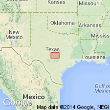
Pg. 161-164. Crystal Falls limestone lentil of Harpersville formation. Lowermost limestone of Harpersville formation. Lies 40 to 80 feet above base of the Harpersville. Consists of yellow or gray limestone, nodular, weathering locally red or purple, with average thickness of 2 or 3 feet. Lies 60 to 80 feet below Belknap limestone lentil of Harpersville. Age is Pennsylvanian.
[Plummer and Moore distinctly showed 3 other limestones in interval between Crystal Falls limestone and Belknap limestone, one of which is so-called "Upper Crystal Falls limestone" of subsequent reports.]
Source: US geologic names lexicon (USGS Bull. 896, p. 550-551).
- Usage in publication:
-
- Crystal Falls limestone member
- Modifications:
-
- Original reference
- Dominant lithology:
-
- Limestone
- AAPG geologic province:
-
- Bend arch
Summary:
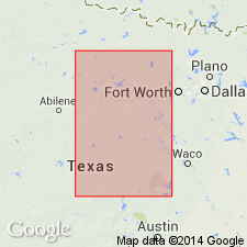
Pg. 24, 31, 39. Crystal Falls limestone member, in lower part of Harpersville formation of Cisco group. Age is Pennsylvanian.
Occurs in vicinity of Crystal Falls, Stephens Co., Brazos River region, central northern TX.
Source: US geologic names lexicon (USGS Bull. 896, p. 550-551).

- Usage in publication:
-
- Crystal Falls limestone member*
- Modifications:
-
- Overview
- AAPG geologic province:
-
- Bend arch
Summary:
The geologic maps of Coleman, Shackelford, and Stephens Counties issued by Texas Bur. Econ. Geol. in Feb., May, and June, 1929, applied "Lower Crystal Falls limestone" to the Crystal Falls limestone of Plummer and Moore, and called a limestone lying 10 to 20 feet above that limestone the "Upper Crystal Falls limestone." They gave the thickness of the lower limestone as 5 to 10 feet and of the upper limestone as 5 feet. E.H. Sellards, 1933 (Univ. Texas Bull., no. 3232), adhered to Crystal Falls limestone of Plummer and Moore, which is present approved definition of the USGS.
Source: US geologic names lexicon (USGS Bull. 896, p. 550-551).
- Usage in publication:
-
- Crystal Falls limestone member
- Modifications:
-
- Revised
- AAPG geologic province:
-
- Bend arch
Summary:
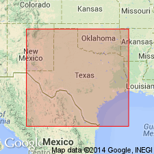
Pg. 64-65, 66-67. Crystal Falls limestone member of Harpersville formation. Consists of lower limestone, gray, finely crystalline, 1 foot thick; shale, 1.5 feet; and light-yellowish to buff limestone, 1 foot thick. Overlies shale and limestone in lower part of formation; separated by shale interval from limestone referred to by some writers as "Upper Crystal Falls limestone."
Source: US geologic names lexicon (USGS Bull. 1200, p. 996-998).
- Usage in publication:
-
- Lower Crystal Falls limestone
- Upper Crystal Falls limestone
- Modifications:
-
- Areal extent
- AAPG geologic province:
-
- Bend arch
Summary:
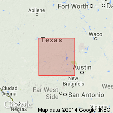
Pg. 6-20, figs., pls. Lower Crystal Falls limestone overlies Quinn clay (new). Curry clay (new) occurs between the lower and upper Crystal Falls limestone layers, just above Quinn clay in areas where sandstone deposits of Park Mountain and its probable equivalent, the Cisco Lake sandstone, do not occur. [Age is Late Pennsylvanian.]
Source: US geologic names lexicon (USGS Bull. 1200, p. 996-998).
- Usage in publication:
-
- Crystal Falls limestone
- Modifications:
-
- Areal extent
- AAPG geologic province:
-
- Bend arch
Summary:
[Pg. 13], fig. 4. Crystal Falls limestone of Thrifty group. Shown on columnar section as limestone in Thrifty group. [Age is Late Pennsylvanian.]
Source: US geologic names lexicon (USGS Bull. 1200, p. 996-998).
- Usage in publication:
-
- Crystal Falls
- Modifications:
-
- Principal reference
- Dominant lithology:
-
- Limestone
- AAPG geologic province:
-
- Bend arch
Summary:
Pg. 7 (fig. 2), 8 (fig. 3), 23-26, pls. 1, 3. Crystal Falls limestone member of Harpersville formation. Plummer and Moore [1922] stated that the Crystal Falls limestone "occurs 40 to 80 feet above the base of the Harpersville formation," which is top of Breckenridge limestone. The Crystal Falls was described as "yellow or gray limestone, weathering locally red or purple, with an average thickness of 2 or 3 feet." A section accompanying type description (idem, p. 163) was measured along Clear Fork of Brazos River west of Crystal Falls, Stephens County. However, this section does not include an unnamed limestone 23 feet above the Breckenridge designated "C1" by Bradish (1937, geol. map of Stephens County, revised) and discussed by Lee (Univ. Texas Bull., no. 3801, 1938). Cyrstal Falls limestone has been called "Lower Crystal Falls" by Bradish (1937) and some other writers. Plummer and others (Univ. Texas Bull., no. 4915, 1949) showed sections of Crystal Falls type area. Difference in interpretation may be noted by comparing section by Plummer and others (fig. 18) at Crystal Falls type locality (fig. 6 of present report) and their sections 23, 24, and 25, with sections 9, 10, and 11, respectively, of present report. In general, present report agrees with Lee's stratigraphic description for section between the Breckenridge and "Upper Crystal Falls" limestone in northern Stephens County. Type section of Crystal Falls herein redescribed. Type Crystal Falls composed of an upper 1-foot limestone bed separated by about 1 foot of shale from a lower limestone bed that is 1 to 3.5 feet thick. Limestone weathers from gray to yellowish orange; upper surface is ferruginous, commonly dark red or purple. Upper surface uneven and has wave or "mound-like" undulations with amplitudes up to 5 feet. Overlies Quinn clay member; underlies Curry clay member which in turn underlies unit termed "Upper Crystal Falls member." Area of report is northern Stephens County. [Age is Late Pennsylvanian.]
Type section in Stephens Co., central northern TX: measured from shale beneath Breckenridge limestone to top of "Upper Crystal Falls" limestone. Beds 1-4 of section (fig. 6 and pl. 2, A) crop out on State land and beds 4-14 on property of Truman Robertson of Crystal Falls. Breckenridge limestone crops out in bed of Clear Fork of Brazos River from dam beneath bridge on Farm Road 578, down stream to first bend. Lower part of section (fig. 6, beds 1-7C) was measured southwestward from first bed below dam (pl. 2, A), across the dam and old bridge road to good exposure of railroad cut no. 1; upper part of Quinn clay (bed 5) is well exposed at clay exposure no. 1. The interval from the top of Crysal Falls limestone to coal in Curry clay was described at clay exposure no. 2 (beds 7C-11), about 25 yds southwest of railroad cut no. 1; the offset is along bed 7C. Upper part of section (beds 11-14D) was described in railroad cut no. 2 to west; offset correlated with coal (bed 11).
Source: US geologic names lexicon (USGS Bull. 1200, p. 996-998).
- Usage in publication:
-
- Crystal Falls limestone
- Lower Crystal Falls limestone
- Upper Crystal Falls limestone
- Modifications:
-
- Not used
- AAPG geologic province:
-
- Bend arch
Summary:
Pg. 72, 74, pl. 27. Bed here correlated with Breckenridge is shown on geologic map of Coleman County (Hudnall and Pirtle, 1929, revised 1937) as "Lower Crystal Falls limestone." The generally persistent upper part of Chaffin limestone member of Thrifty formation has been variously called Breckenridge limestone (Plummer and Moore, [1922], Bullard and Cuyler, 1935, Univ. Texas Bull., no. 3501), "Upper Crystal Falls limestone" (Hudnall and Pirtle, 1929, revised 1937), Crystal Falls limestone (Cheney, 1950, Abilene Geol. Soc. Gdbk. Nov. 2-4), and Chaffin limestone (Sellards, 1933, Univ. Texas Bull., no. 3232; Nickell, 1938; Cheney and Eargle, 1951, Geol. map of Brown County).
Source: US geologic names lexicon (USGS Bull. 1200, p. 996-998).
- Usage in publication:
-
- Crystal Falls Limestone
- Modifications:
-
- Revised
- AAPG geologic province:
-
- Bend arch
Summary:
Mapped as a single line and as an unranked unit in the lower part of the Markley Formation (new) of the Bowie Group (new) in south and south-central Young Co, TX on the Bend arch. Consists of gray to light-brown, red-brown, coarse-grained, platy to thin-bedded, marine, fossiliferous (crinoids, brachiopods, algae) limestone 1 to 2 ft thick. Forms discontinuous outcrops. Overlies and underlies unnamed parts of the Markley. Of Virgil age.
Source: GNU records (USGS DDS-6; Denver GNULEX).
For more information, please contact Nancy Stamm, Geologic Names Committee Secretary.
Asterisk (*) indicates published by U.S. Geological Survey authors.
"No current usage" (†) implies that a name has been abandoned or has fallen into disuse. Former usage and, if known, replacement name given in parentheses ( ).
Slash (/) indicates name conflicts with nomenclatural guidelines (CSN, 1933; ACSN, 1961, 1970; NACSN, 1983, 2005, 2021). May be explained within brackets ([ ]).

