

- Usage in publication:
-
- Corbin conglomerate lentil*
- Modifications:
-
- Original reference
- Dominant lithology:
-
- Conglomerate
- Sandstone
- AAPG geologic province:
-
- Appalachian basin
Summary:
Corbin conglomerate lentil of Lee formation. Coarse pink sandstone or conglomerate, 90 feet thick, forming topmost member of Lee formation in Richmond quadrangle. Overlain by Irvine formation (Neocene?). [Age is Pennsylvanian.]
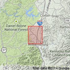
[Named from Corbin, Whitley Co., central KY.]
Source: US geologic names lexicon (USGS Bull. 896, p. 520).

- Usage in publication:
-
- Corbin conglomerate lentil
- Modifications:
-
- Overview
- AAPG geologic province:
-
- Appalachian basin
Summary:
Corbin conglomerate lentil. Later studies [post-1898] by D. White show that top of Lee formation properly belongs at top of Rockcastle conglomerate member and that Corbin conglomerate lentil and the shales separating the Corbin and Rockcastle properly belong to horizon of Sewell formation and are probably to be correlated with Sharon conglomerate member of Pottsville formation. Age is Pennsylvanian.
Named from Corbin, Whitley Co., central KY.
Source: US geologic names lexicon (USGS Bull. 896, p. 520).

- Usage in publication:
-
- Corbin conglomerate [unranked]
- Modifications:
-
- Revised
- AAPG geologic province:
-
- Appalachian basin
Summary:
Pg. 686, Chart no. 6 (column 18, northern Tennessee, collated by H.R. Wanless). Corbin conglomerate [unranked], prominent in Kentucky, extends into northern Tennessee, where it is included in basal part of Briceville formation. Age is [Middle Pennsylvanian]; Kanawha [Atokan]; earliest Westphalian B (Katharina bed = base of Westphalian B).
Source: Publication; US geologic names lexicon (USGS Bull. 1200, p. 938).
- Usage in publication:
-
- Corbin Sandstone Tongue*
- Modifications:
-
- Revised
- AAPG geologic province:
-
- Appalachian basin
Summary:
Corbin Sandstone Member of Lee Formation renamed Corbin Sandstone Tongue in the Wofford and nearby quadrangles (Whitley Co., KY).
Source: GNU records (USGS DDS-6; Reston GNULEX).

- Usage in publication:
-
- Corbin Sandstone
- Modifications:
-
- Revised
- AAPG geologic province:
-
- Appalachian basin
Summary:
Corbin raised to formation rank and assigned to Breathitt Group. Lee Formation is "dropped" from usage. As used in this study the Corbin Sandstone consists of a series of local sandstone bodies that interfinger laterally with the Grundy Formation (new). These sandstone bodies are much smaller in extent than the Bee Rock, Sewanee, and Warren Point Sandstones, also assigned here to Breathitt Group. Corbin forms a northeast-southwest-trending belt approximately 40 mi wide and reaches a maximum thickness of 105 m. Most of northwestern edge has been eroded.
[According to the text, the Corbin is restricted to the northern and northwestern part of the study area. On large cross sections, plates 2-6, unit is shown only in KY. On plate 7, a collection of generalized dip and strike sections, Corbin is shown in WV, along the Catlettsburg dip section, as well as in KY. Fig. 11, illustrating the distribution of Corbin, shows unit and laterally equivalent lithologies extending from TN to southern OH and western WV. Fig. 5, a stratigraphic framework, shows Corbin only in northern TN. Until further clarification, GNU records will carry Corbin only in KY and TN.]
Source: GNU records (USGS DDS-6; Reston GNULEX).

- Usage in publication:
-
- Corbin Sandstone Member*
- Modifications:
-
- Areal extent
- AAPG geologic province:
-
- Appalachian basin
Summary:
Corbin Sandstone Member of Lee Formation. Sandstone in upper part of Lee Formation above the Gray Hawk or Mine Fork coal bed. In Licking River and Hazard districts, eastern Kentucky, lies below the Van Cleave coal bed; in Southwestern district, eastern Kentucky, lies below the Colony, Horse Creek, Lily, Manchester, River Gem, Swamp Angel, or Zachariah coal bed. Age is early Middle Pennsylvanian.
Source: Publication.

- Usage in publication:
-
- Corbin Sandstone
- Modifications:
-
- Areal extent
- AAPG geologic province:
-
- Appalachian basin
Summary:
Corr. chart. Corbin Sandstone (unranked) in Grundy Formation of Breathitt Group. Sandstone. Occurs in upper and middle parts of Grundy Formation in eastern Kentucky. Capped by Manchester (Zachariah, Clintwood, Williamson) coal bed. Age is Early Pennsylvanian (Westphalian; Morrowan).
[Corbin Sandstone Member of Grundy Formation of Breathitt Group recognized in Princess, Licking River, Southwestern, Hazard, and Big Sandy districts, eastern KY. See Chesnut, 1997 (revised Oct. 12, 1999), Stratigraphy of the coal-bearing strata of the Eastern Kentucky coal field, available online through the Kentucky Geol. Survey (http://www.uky.edu/KGS/coal/coalcorrel.htm) and geologic descriptions of stratigraphic units in the Kentucky Geological Survey database (http://kgs.uky.edu/kgsmap/KGSLitho/lithoSearch.asp#).]
Source: Publication.
For more information, please contact Nancy Stamm, Geologic Names Committee Secretary.
Asterisk (*) indicates published by U.S. Geological Survey authors.
"No current usage" (†) implies that a name has been abandoned or has fallen into disuse. Former usage and, if known, replacement name given in parentheses ( ).
Slash (/) indicates name conflicts with nomenclatural guidelines (CSN, 1933; ACSN, 1961, 1970; NACSN, 1983, 2005, 2021). May be explained within brackets ([ ]).