- Usage in publication:
-
- Chadron formation*
- Modifications:
-
- Original reference
- Dominant lithology:
-
- Clay
- Gravel
- AAPG geologic province:
-
- Denver basin
- Chadron arch
Summary:
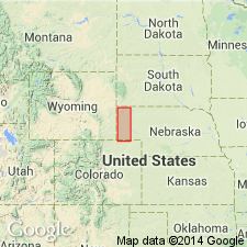
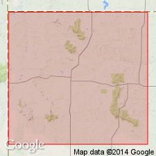
Pg. 736, 759, pl. 82. Chadron formation of White River group. Rocks known as "Titanotherium beds" in earlier reports (because of the occurrence of bones and teeth) are assigned to Chadron formation, lower formation of White River group, in this report. Shown on geologic map as a narrow outcrop zone extending across northern portion of state in Sioux County, Nebraska, Denver basin, and in Dawes and Sheridan Counties, Nebraska, on the Chadron arch. Is also exposed along North Platte River near the Wyoming state line. Known to underlie parts of Colorado and South Dakota, but does not extend very far east in Nebraska. Is absent along Republican River. Consists of a thin sheet of light green-gray sandy clay and dark red gravel beds. Thickness varies from 30 to 60 feet in outcrops along foot of Pine Ridge, but thickens considerably in vicinity of Adelia, where there are included some masses of dark-gray and buff sandstone of coarse texture. Overlies Pierre shale or clay. Underlies Brule clay (new). Age is Tertiary. Report includes many sketches of stratigraphic sections and photographs.
According to GNC records (US geologic names lexicon, USGS Bull. 896, p. 392), Mr. Darton stated (personal commun. April 8, 1931) that he named this formation for exposures at Chadron, NE.
[According to GNU records: Intent to name, derivation of name, and type locality not stated.]
Source: US geologic names lexicon (USGS Bull. 896, p. 392); supplemental information (in brackets) from GNU records (USGS DDS-6; Denver GNULEX).
- Usage in publication:
-
- Chadron formation
- Modifications:
-
- Revised
- AAPG geologic province:
-
- Wind River basin
- Green River basin
Summary:
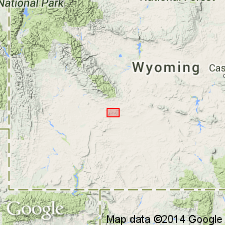
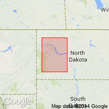
Basal member of Chadron formation of White River group revised. The basal conglomerate formerly called Sweetwater member is renamed Beaver Divide conglomerate member; name Sweetwater preoccupied. Mapped in Fremont County, in the Wind River basin, and in Sweetwater County, in the Greater Green River basin. Beaver Divide overlain by an unnamed upper part of Chadron; is about 68+/- feet thick. The upper part of Chadron is about 450 feet thick. Beaver Divide conglomerate member disconformably overlies Continental Peak formation (new). Age is Oligocene. Report includes geologic map, cross section, stratigraphic table.
Source: Modified from GNU records (USGS DDS-6; Denver GNULEX).
- Usage in publication:
-
- Chadron formation
- Modifications:
-
- Principal reference
- Revised
- AAPG geologic province:
-
- Williston basin
Summary:
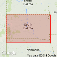
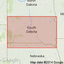
Pg. 197. Chadron formation. In Big Badlands area, South Dakota, subdivided into newly named Ahearn, Crazy Johnson, and Peanut Peak members; these replace the informal lower, middle and upper members, respectively, of Clark (1937). Standard section designated. [White River group not used.] Age is early Oligocene.
Standard [Principal reference] section: in Big Badlands, on south fork of Indian Creek, from sec. 34, T. 3 S., R. 12 E., to sec. 10, T. 4 S., R. 12 E., Pennington Co., SD, Williston basin.
[GNU reocrds (USGS DDS-6; Denver GNULEX) state the definitions of the members named in this report are considered inadequate (explanation not given).]
Source: US geologic names lexicon (USGS Bull. 1200, p. 703); supplemental information (in brackets) from GNU records (USGS DDS-6; Denver GNULEX).
- Usage in publication:
-
- Chadron formation
- Modifications:
-
- Contact revised
- AAPG geologic province:
-
- Williston basin
Summary:
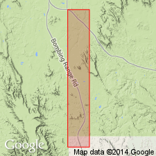
Upper contact of Chadron formation of White River group revised. Now underlies the newly named Scenic member of the Brule formation of White River group, in the Big Badlands area, south of Scenic, Pennington County, South Dakota, in the Williston basin. Lower part of Scenic member is 36 feet thick; described as a nodular, brown-gray weathering "zone" of pink-gray, fossiliferous clay that overlies the limestones and clays of the Chadron. Chadron age is Oligocene.
Source: Modified from GNU records (USGS DDS-6; Denver GNULEX).
- Usage in publication:
-
- Chadron formation
- Modifications:
-
- Revised
- AAPG geologic province:
-
- Williston basin
Summary:
Revised in that the lower 39 ft formerly included in the Chadron is removed from the Chadron and named Slim Buttes formation in the area of Slim Buttes, Harding Co, SD in the Williston basin. These rocks now assigned to the Slim Buttes are the predominately white sandstone that have a Duchnesean or basal Oligocene vertebrate fauna and that on the basis of heavy mineral studies were determined as derived from igneous rocks probably in the Big Horn Mountains. No true Chadron known in the northern Slim Buttes or the report area. Chadron is early Oligocene age which author distinguishes from basal Oligocene. Term White River group not mentioned.
Source: GNU records (USGS DDS-6; Denver GNULEX).
- Usage in publication:
-
- Chadron Formation
- Modifications:
-
- Contact revised
- AAPG geologic province:
-
- Williston basin
Summary:
In western North Dakota (Williston basin), lower contact of the Oligocene Chadron Formation, basal formation of the White River Group, is revised. Unconformably overlies the newly named Camels Butte Member of Golden Valley Formation (called "upper member" in previous reports). Lower Chadron described as an arkosic, fine- to coarse-grained, angular, non-calcareous, somewhat tuffaceous sandstone. The grains are mostly quartz and feldspar. Conglomerate lenses in the sandstone contain clasts that range from granules to cobbles of volcanics (welded tuff, quartz latite porphyry, and rhyolite) transported from the Absaroka volcanic field of northwest Wyoming. Other constituents in the conglomerate are granite, chert, petrified wood, crystalline rocks, and some granules of clinker. In some places, reworked Golden Valley material is present in lower Chadron, thus the contact is difficult to select. The underlying upper Camels Butte has been leached and oxidized to depth of 7 to 30 m beneath the unconformity. Brilliant colors developed in the zone of weathering. Chadron Formation underlies Brule Formation of the White River Group. On accompanying geologic map, White River Group (mapped undivided) is as much as 76 m thick; underlies Arikaree Formation. Report includes correlation chart, geologic map.
Source: Modified from GNU records (USGS DDS-6; Denver GNULEX).
- Usage in publication:
-
- Chadron Formation
- Modifications:
-
- Overview
- AAPG geologic province:
-
- Williston basin
- Sioux uplift
Summary:
Rests on Slim Buttes Formation unconformably and underlies Brule Formation unconformably in Williston basin and Sioux uplift. Includes Ahearn Member, a volcanic ash at base which has an age of 37.2 +/-0.7 m.y. date. Has popcorn-weathered surface. Is largely claystone breccia. Some sandstone channels. Has numerous paleosols. Most of formation in Pinnacles area of the Park is probably equivalent to Peanut Peak Member of Chadron farther west. Climate was probably humid and subtropical to subhumid and warm temperate. Root traces indicate a woodland area. Deposited on floodplains. Vertebrate fossils from stream and near stream deposits. Fossil root traces. Is of early Oligocene age.
Source: GNU records (USGS DDS-6; Denver GNULEX).
- Usage in publication:
-
- Chadron Formation
- Modifications:
-
- Age modified
- Geochronologic dating
- AAPG geologic province:
-
- Wind River basin
Summary:
40Ar/39Ar dates on biotite from the "Purple White Layer" (PWL) yielded a mean age of 33.91 +/-0.06 Ma (latest Eocene). PWL is an ash that marks boundary between Chadron Formation and overlying Orella Member of Brule Formation and marks the Chadronian-Orellan North American Land Mammal "Age" boundary and the Eocene-Oligocene boundary. Thus, the Chadronian and Chadron are now latest Eocene age and the Orellan and lower part of Brule are earliest Oligocene age. Ash samples taken from Flagstaff Rim section in Natrona Co, south-central WY, Wind River basin. Tables of isotopic dates.
Source: GNU records (USGS DDS-6; Denver GNULEX).
- Usage in publication:
-
- Chadron Formation*
- Modifications:
-
- Mapped 1:250k (Scottsbluff quad, NE)
- Dominant lithology:
-
- Claystone
- Mudstone
- AAPG geologic province:
-
- Denver basin
- Chadron arch
Summary:
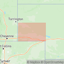
Mapped as upper Eocene formation in western NE (Denver basin). Chadron is lower formation of White River Group (lower Oligocene and upper Eocene). Chadron described as claystone and mudstone, gray, greenish-gray, and pink; bentonitic. Underlies almost all of quad but crops out only in very small area near northwest corner of quad; lower part not exposed. Drill-hole data reveal fine- to coarse-grained sandstone, claystone, and mudstone in paleovalleys. Is oldest unit mapped in quad; underlies Brule Formation (lower Oligocene) of White River. Exposed thickness is 25 ft; maximum thickness in subsurface is about 270 ft.
Source: GNU records (USGS DDS-6; Denver GNULEX).
For more information, please contact Nancy Stamm, Geologic Names Committee Secretary.
Asterisk (*) indicates published by U.S. Geological Survey authors.
"No current usage" (†) implies that a name has been abandoned or has fallen into disuse. Former usage and, if known, replacement name given in parentheses ( ).
Slash (/) indicates name conflicts with nomenclatural guidelines (CSN, 1933; ACSN, 1961, 1970; NACSN, 1983, 2005, 2021). May be explained within brackets ([ ]).

