The National Geologic Map Database is migrating to a new infrastructure. We apologize for any service disruptions during this process.
|
|---|


- Usage in publication:
-
- Cawood sandstone member*
- Modifications:
-
- Original reference
- Dominant lithology:
-
- Sandstone
- AAPG geologic province:
-
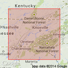
- Appalachian basin
Summary:
Pg. 31, 33, 37, 120, 158. Cawood sandstone member of Hance formation of Pottsville group. Sandstone, 80 to 100 feet thick, in Hance formation, lying 250 feet below top of the Hance. Age is Pennsylvanian.
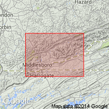
[Named from Cawood, Bell Co. (now in Harlan Co.), southeastern KY. Extends into northeastern TN.]
Source: US geologic names lexicon (USGS Bull. 896, p. 379).
- Usage in publication:
-
- Cawood sandstone member*
- Modifications:
-
- Areal extent
- AAPG geologic province:
-
- Appalachian basin
Summary:
Pg. 65, 66, 67, 69, 77, 138. Cawood sandstone member of Hance formation. Massive sandstone about 200 feet above base of formation. [Age is Pennsylvanian.]
Forms massive bluffs along Martins Fork of Cumberland River at Cawood, Harlan Co., southeastern KY.
Source: US geologic names lexicon (USGS Bull. 1200, p. 682).

- Usage in publication:
-
- Caywood [Cawood] Sandstone Member*
- Modifications:
-
- Areal extent
- AAPG geologic province:
-
- Appalachian basin
Summary:
Caywood [Cawood] Sandstone Member of Breathitt Formation. Sandstone. Lies beneath the Imboden or Path Fork coal zone, below Crummies Member, and lies above Betsie Shale Member; all of Breathitt Formation. Correlative with the Grayson sandstone bed (informal) of Lee Formation of Whittington and Fern (1967) in Princess district, eastern Kentucky. (Shown higher in section than the Frozen Sandstone Member of Breathitt Formation in Hazard district, eastern Kentucky, which is at same level in section as the Wheelersburg and Dixie coals.) Age is Middle Pennsylvanian.
Recognized in Upper Cumberland River district, southeastern KY.
Source: Publication.

- Usage in publication:
-
- Caywood [Cawood] sandstone member
- Modifications:
-
- Areal extent
- AAPG geologic province:
-
- Appalachian basin
Summary:
Corr. chart. Caywood [Cawood] sandstone member (informal) of Pikeville Formation of Breathitt Group. Sandstone. [Recognized locally in Upper Cumberland River district, southeastern Kentucky.] Lies in lower part of Pikeville Formation between Crummies Member above and Betsie Shale Member below. Capped by Phoebe coal bed. Equivalent to Frozen Sandstone Member of Pikeville [in Hazard district, eastern Kentucky]; upper part equivalent to the Lower Petros Sandstone, an unranked unit in Slatestone Formation of Tennessee. Age is late Early Pennsylvanian (Westphalian; early, but not earliest Atokan).
[See also Chesnut, 1997 (revised Oct. 12, 1999), Stratigraphy of the coal-bearing strata of the Eastern Kentucky coal field, available online through the Kentucky Geol. Survey (http://www.uky.edu/KGS/coal/coalcorrel.htm).]
Source: Publication.
For more information, please contact Nancy Stamm, Geologic Names Committee Secretary.
Asterisk (*) indicates published by U.S. Geological Survey authors.
"No current usage" (†) implies that a name has been abandoned or has fallen into disuse. Former usage and, if known, replacement name given in parentheses ( ).
Slash (/) indicates name conflicts with nomenclatural guidelines (CSN, 1933; ACSN, 1961, 1970; NACSN, 1983, 2005, 2021). May be explained within brackets ([ ]).