The National Geologic Map Database is migrating to a new infrastructure. We apologize for any service disruptions during this process.
|
|---|


- Usage in publication:
-
- Carlile shale
- Modifications:
-
- Original reference
- Dominant lithology:
-
- Shale
- AAPG geologic province:
-
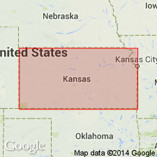
- Denver basin
Summary:
Pg. 565. Carlile shale. Chiefly medium gray shale; at top a thin purplish limestone or a thicker yellow sandstone. Thickness in Arkansas Valley region, eastern Colorado, 175 to 200 feet. Top formation of Benton group. Underlies Timpas limestone and overlies Greenhorn limestone. Age is Late Cretaceous.
Named from Carlile Spring and Carlile Station, 21 mi. west of Pueblo, eastern CO.
Source: US geologic names lexicon (USGS Bull. 896, p. 347-348).
- Usage in publication:
-
- Carlile shale*
- Modifications:
-
- Revised
- AAPG geologic province:
-
- Central Kansas uplift
Summary:
Pg. 16, 40. Carlile shale. In Russell County, north-central Kansas, comprises Faiport chalky member (new) in basal part and Blue Hill shale member above. Overlies Greenhorn limestone; underlies Fort Hayes limestone member of Niobrara formation. Age is Late Cretaceous. Report includes geologic map, columnar section.
Source: US geologic names lexicon (USGS Bull. 1200, p. 635-636); supplemental information from GNU records (USGS DDS-6; Denver GNULEX).
- Usage in publication:
-
- Carlile shale*
- Modifications:
-
- Revised
- AAPG geologic province:
-
- Powder River basin
- Williston basin
Summary:
Pg. 4 (table). Carlile shale of Colorado group. On western side of Black Hills, Wyoming, and southeastern Montana, Carlile shale restricted; upper 250+ feet of shales transferred to Niobrara formation and called Sage Breaks shale member. As restricted, includes (ascending) unnamed member, 75 to 125 feet thick, and Turner sandy member (new), 150 to 200 feet thick. Overlies Greenhorn formation. Age is Late Cretaceous.
Source: US geologic names lexicons (USGS Bull. 1200, p. 635-636; USGS Bull. 896, Sage Breaks entry p. 1867).

- Usage in publication:
-
- Carlile shale*
- Modifications:
-
- Overview
Summary:
Carlile shale of Colorado group. The Niobrara and Benton are not now [ca. 1938] treated as groups, the borader term Colorado group, which includes them both, being considered the more useful group name. Where the Niobrara deposits and Benton deposits are not subdivided, they are called Niobrara limestone and Benton shale, respectively. (See also under Niobrara limestone.)
Source: US geologic names lexicon (USGS Bull. 896, p. 347-348).
- Usage in publication:
-
- Carlile shale
- Modifications:
-
- Not used
- AAPG geologic province:
-
- Green River basin
Thomas, H.D., 1936, Frontier-Niobrara contact in Laramie basin, Wyoming: American Association of Petroleum Geologists Bulletin, v. 20, no. 9, p. 1189-1197.
Summary:
Carlile shale. Upper Cretaceous shale which has been called Carlile in Laramie basin, southeastern Wyoming, overlies Frontier formation and is, in turn, overlain by the chalky beds of the Niobrara. Fauna of the upper part of the Frontier is of same age as that of the upper type Carlile of Colorado, whereas the fauna of the "Carlile" of Laramie basin is of Niobrara age. It is believed, therefore, that use of name Carlile should be discontinued in the Laramie basin and the name Niobrara extended downward to embrace the beds erroneously called Carlile. This basal Niobrara shale is correlated with the Sage Breaks shale member of the Niobrara of the Black Hills, and the name Sage Breaks is here substituted for the abandoned name Carlile.
Source: Publication; US geologic names lexicon (USGS Bull. 1200, p. 635-636).
- Usage in publication:
-
- Carlile shale*
- Modifications:
-
- Areal extent
- AAPG geologic province:
-
- Denver basin
Summary:
Pg. 15 (fig. 7), 17. Carlile shale. In eastern Colorado comprises (ascending) Fairport chalky shale, Blue Hill shale, and Codell sandstone members. Overlies Greenhorn limestone; underlies Niobrara formation. Age is Late Cretaceous.
Source: US geologic names lexicon (USGS Bull. 1200, p. 635-636).
- Usage in publication:
-
- Carlile shale
- Modifications:
-
- Revised
- AAPG geologic province:
-
- San Juan basin
- Paradox basin
- Orogrande basin
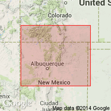
Summary:
Pg. 7, 12, measured sections. Carlile shale of Colorado group. Thickness 243 to 722 feet. Underlies Niobrara formation. Contains Juana Lopez sandstone member (new) near top in northern New Mexico. Age is Late Cretaceous.
Source: US geologic names lexicon (USGS Bull. 1200, p. 635-636); supplemental information from GNU records (USGS DDS-6; Denver GNULEX).
- Usage in publication:
-
- Carlile shale
- Modifications:
-
- Areal extent
- AAPG geologic province:
-
- Iowa shelf
Summary:
Carlile shale of Benton group (text); Carlile shale of Colorado group (cross section, map). Discussion of geology of Missouri Valley in South Dakota. Text refers to Benton group as comprising Graneros shale, Greenhorn limestone, and Carlile shale. Outcrop of Carlile present between Westfield and Sioux City along east bluffs of Big Sioux River in Plymouth and Woodbury Counties, Iowa. Age is Late Cretaceous.
Source: US geologic names lexicon (USGS Bull. 1200, p. 635-636).
- Usage in publication:
-
- Carlile shale member*
- Modifications:
-
- Areal extent
- AAPG geologic province:
-
- San Juan basin
Summary:
Carlile shale member of Mancos shale. Classed as member of Mancos shale in Rio Arriba County, New Mexico. Contains two subdivisions in this area. Lower, about 200 feet thick, consists largely of dark to black shale containing in basal 50 to 60 feet a group of six bentonitic clay beds. Upper, chiefly dark to black shale, weathering light brownish gray with numerous beds of hard dark-colored platy sandy limestone or calcareous sandstone. Estimated thickness about 600 feet in vicinity of El Vado. Overlies Greenhorn limestone member; underlies Niobrara calcareous shale member. Age is Late Cretaceous.
Source: US geologic names lexicon (USGS Bull. 1200, p. 635-636).
- Usage in publication:
-
- Carlile shale*
- Modifications:
-
- Revised
- Biostratigraphic dating
- AAPG geologic province:
-
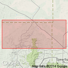
- Williston basin
- Powder River basin
Summary:
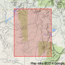
Pg. 2187-2192, 2197 (fig. 2). Carlile shale. Discussion of Colorado shale of central and northwestern Montana and equivalent rocks on north flank of Black Hills. Carlile shale in Black Hills region is 550 to 650 feet thick. Divisible into (ascending): (1) a basal unnamed dark-gray shale member 75 to 155 feet thick, SCAPHITES LARVAEFORMIS-COLLIGNONICERAS WOOLLGARI to SCAPHITES CARLILENSIS-COLLIGNONICERAS HYATTI faunal zones; (2) Turner sandy member, 185 to 260 feet thick, SCAPHITES WARRENI-PRIONOCYCLUS MACOMBI into SCAPHITES CARVENSIS-PRIONOCYCLUS aff. P. REESIDEI faunal zones; and (3) Sage Breaks member, 105 to 305 feet thick, SCAPHITES CARVENSIS-PRIONOCYCLUS aff. P. REESIDEI faunal zone. Overlies Greenhorn formation; underlies Niobrara formation. Age is Late Cretaceous (Turonian). Report includes fossil lists.
Source: Publication; US geologic names lexicon (USGS Bull. 1200, p. 635-636).
- Usage in publication:
-
- Carlile shale member*
- Modifications:
-
- Revised
- Mapped
- AAPG geologic province:
-
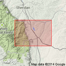
- Powder River basin
- Central Montana uplift
Summary:
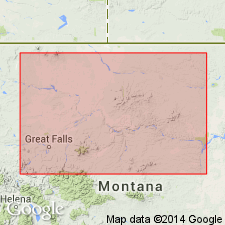
Carlile shale member of Cody shale. In Hardin area, Big Horn and Yellowstone Counties, Montana, Carlile classified as member of Cody shale. Underlies Niobrara shale member; overlies Greenhorn calcareous member. Mostly dark-gray shale. Thickness 280 feet. Age is Late Cretaceous. Map includes measured section (sheet 2).
Source: US geologic names lexicon (USGS Bull. 1200, p. 635-636); supplemental information from GNU records (USGS DDS-6; Denver GNULEX).
- Usage in publication:
-
- Carlile shale
- Modifications:
-
- Not used
- AAPG geologic province:
-
- Powder River basin
- Central Montana uplift
Summary:
Carlile shale. Suggested that term Carlile shale be discontinued in southern Montana and term Frontier formation be redefined to include all rocks between top of Mowry shale and base of Niobrara formation.
Source: US geologic names lexicon (USGS Bull. 1200, p. 635-636).
- Usage in publication:
-
- Carlile shale*
- Modifications:
-
- Areal extent
- AAPG geologic province:
-
- Las Vegas-Raton basin
Summary:
Benton formation in northwestern Mora County, New Mexico, is represented by equivalents of Graneros shale, Greenhorn limestone, and Carlile shale.
Source: US geologic names lexicon (USGS Bull. 1200, p. 635-636).
- Usage in publication:
-
- Carlile shale*
- Modifications:
-
- Areal extent
- AAPG geologic province:
-
- Las Vegas-Raton basin
Summary:
Carlile shale of Colorado group. Report covers La Veta area, Huerfano County, Colorado. Consists of a shale unit, about 225 feet thick, and overlying Codell sandstone member, 5 to 10 feet thick. Overlies Greenhorn limestone; underlies Fort Hays limestone member of Niobrara formation. Age is Late Cretaceous.
Source: US geologic names lexicon (USGS Bull. 1200, p. 635-636).
- Usage in publication:
-
- Carlile shale
- Modifications:
-
- Overview
Summary:
Carlile shale of Colorado group. Comprises (ascending) Fairport chalk, Blue Hill shale, and Codell sandstone members. Overlies Greenhorn limestone; underlies Fort Hays limestone members of Niobrara chalk. Age is Late Cretaceous.
Source: US geologic names lexicon (USGS Bull. 1200, p. 635-636).
- Usage in publication:
-
- Carlile shale member*
- Modifications:
-
- Areal extent
- AAPG geologic province:
-
- Powder River basin
Summary:
Carlile shale member of Cody shale. Described in Buffalo-Lake De Smet area, Wyoming, where it is classified as member of Cody shale. Thickness about 156 feet. Overlies Greenhorn calcareous member; underlies Niobrara shale member. Age is Late Cretaceous.
Source: US geologic names lexicon (USGS Bull. 1200, p. 635-636).
- Usage in publication:
-
- Carlile shale*
- Modifications:
-
- Revised
- Mapped
- AAPG geologic province:
-
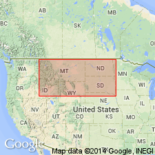
- Powder River basin
- Williston basin
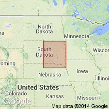
Summary:
Divided into (ascending) Pool Creek shale (new), Turner sandy, and Sage Breaks shale members. Members are separately mapped. Occurs in western and eastern Crook Co, WY, Powder River basin and west-central and southwestern Butte Co, SD, Williston basin. Assigned to Colorado group. Consists mainly of gray shale, with some sandy beds and abundant concretionary nodules of calcareous, ferruginous, and phosphatic materials, and few very thin beds of bentonite. Fossiliferous. Measured sections of members; geologic map; columnar section. Overlies Greenhorn formation; underlies Niobrara formation. Late Cretaceous age.
Source: GNU records (USGS DDS-6; Denver GNULEX).

- Usage in publication:
-
- Carlile Shale Member*
- Modifications:
-
- Overview
Summary:
USGS currently [ca. 1966] classifies the Carlile as a member of the Colorado Shale in Winnett-Mosby area, Montana.
Source: US geologic names lexicon (USGS Bull. 1200, p. 635-636).
- Usage in publication:
-
- Carlile Shale*
- Modifications:
-
- Revised
- AAPG geologic province:
-
- Williston basin
Summary:
Carlile Shale. †Warm Creek Shale of Collier and Cathcart (1922, p. 172) and Knechtel (1959, p. 740-741) in north-central Montana abandoned. Rocks reallocated to (ascending) Belle Fourche Shale, Greenhorn Formation, Carlile Shale, Niobrara Formation, and Telegraph Creek Formation.
Source: Changes in stratigraphic nomenclature, 1975 (USGS Bull. 1422-A, p. A66-A67).
- Usage in publication:
-
- Carlile Shale*
- Modifications:
-
- Biostratigraphic dating
- AAPG geologic province:
-
- Powder River basin
Summary:
Occurs from surface to 163 m in cored borehole in Osage oilfield on west flank of Black Hills, SWNW sec 30, T46N, R63W, Weston Co, WY, Powder River basin. Carlile divided into (ascending) Pool Creek, Turner Sandy, and Sage Breaks Members. Carlile consists of calcareous shale in Pool Creek; interbedded fine- to very fine grained sandstone, siltstone, and noncalcareous shale with sandy or silty limestone concretions in Turner; and calcareous and noncalcareous shale with scattered limestone concretions in Sage Breaks. Fig. 1 shows ranges of bivalves and ammonites from cores. Fossils representing zones COLLIGNONICERAS WOOLLGARI (middle Turonian) in Pool Creek; SCAPHITES WARRENI to S. NIGRICOLLENSIS (upper Turonian) in Turner; and S. CORVENSIS (upper Turonian) to CREMNOCERAMUS? WALTERSDORFENSIS (lower Coniacian) in Sage Breaks are found in cores of Carlile. Overlies Greenhorn Formation. Fossil list.
Source: GNU records (USGS DDS-6; Denver GNULEX).
For more information, please contact Nancy Stamm, Geologic Names Committee Secretary.
Asterisk (*) indicates published by U.S. Geological Survey authors.
"No current usage" (†) implies that a name has been abandoned or has fallen into disuse. Former usage and, if known, replacement name given in parentheses ( ).
Slash (/) indicates name conflicts with nomenclatural guidelines (CSN, 1933; ACSN, 1961, 1970; NACSN, 1983, 2005, 2021). May be explained within brackets ([ ]).