The National Geologic Map Database is migrating to a new infrastructure. We apologize for any service disruptions during this process.
|
|---|


- Usage in publication:
-
- Brassfield limestone
- Modifications:
-
- Named
- Dominant lithology:
-
- Limestone
- AAPG geologic province:
-
- Cincinnati arch
Summary:
Pg. 10, 27; also 1905, Kentucky Geol. Survey Bull., no. 6, p. 145. Brassfield limestone. Fossiliferous limestone, 13 to 19 feet thick, usually consisting in lower part of several rather thick and massive layers (commonly unfossiliferous), and in upper part of more numerous thinner bedded layers (commonly fossiliferous); toward top thin layers of clay are often interbedded. Called Clinton limestone in earlier reports. Overlies Ordovician and underlies Indian Fields formation, basal formation of Silurian in Kentucky.
Type section: exposures along Louisville and Nashville RR between Brassfield and Panola, Madison Co., KY.
[GNC remark (ca. 1930, US geologic names lexicon, USGS Bull. 896, p. 253-254): [Brassfield] has generally been considered to be of Albion age (pre-Clinton), although W. Stout and R.E. Lamborn (1924, Ohio Geol. Survey, 4th ser., Bull. no. 28, chart opp. p. 358) correlated it with Wolcott limestone member of Clinton formation, and W. Stout (person communication, Feb. 7, 1930) still adhered to this correlation. See also C. Schuchert, 1914, GSA Bull., v. 25, p. 278. In southwest Ohio it underlies Dayton limestone. In Indiana it disconformably underlies Osgood formation. In central northern Arkansas it underlies St. Clair limestone and overlies Cason shale.]
Source: US geologic names lexicon (USGS Bull. 896, p. 253-254); supplemental information from GNU records (USGS DDS-6; Reston GNULEX).
- Usage in publication:
-
- Brassfield limestone
- Modifications:
-
- Overview
- AAPG geologic province:
-
- Cincinnati arch
Summary:
Designated Brassfield limestone. Described as a coarsely crystalline limestone in layers 6 inches thick or less. The rock is characteristically mottled white, grayish, greenish gray, salmon, brown and pink. Unconformably overlies the Saluda limestone or the Hitz limestone member of the Saluda limestone. Unconformably underlies the Osgood formation. Age is Silurian.
Source: GNU records (USGS DDS-6; Reston GNULEX).
- Usage in publication:
-
- Brassfield member
- Modifications:
-
- Overview
- AAPG geologic province:
-
- Cincinnati arch
Summary:
Brassfield member [formation affiliation not clearly stated] is composed of limestone, with thin partings of shale in places. Varies from very massive to thin bedded. Color varies from very light gray, nearly white, through darker shades of gray, buff, and pink to brownish red. Marine fossils are abundant. Is from 20 to 60 feet thick with average about 30 feet.
Source: GNU records (USGS DDS-6; Reston GNULEX).
- Usage in publication:
-
- Brassfield limestone
- Modifications:
-
- Areal extent
- AAPG geologic province:
-
- Cincinnati arch
Summary:
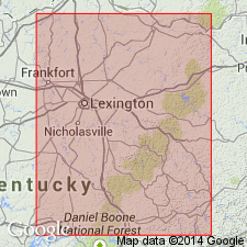
Pg. 239-244. Brassfield limestone. Northwestward across central Tennessee, the Brassfield becomes dolomitic and in Perry County and vicinity develops basal zone of coarse-grained limestone. Commonly cherty and glauconitic. Lies between overlying Osgood formation or Chattanooga shale, and underlying Mannie or Fernvale formations, or Leipers formation where the [Upper Ordovician (Richmondian)] formations are absent as in parts of Columbia quadrangle. Thickness 20 to 50 feet. Fossils (corals). [Age is Early Silurian.]
Source: US geologic names lexicon (USGS Bull. 1200, p. 456-457).
- Usage in publication:
-
- Brassfield limestone
- Modifications:
-
- Overview
- AAPG geologic province:
-
- Cincinnati arch
Summary:
Designated Brassfield limestone. Lithologically the Brassfield presents two distinct phases. The lower part of the formation is massively and evenly bedded, whereas the upper part is thinly and irregularly bedded. The upper part of the formation is also extremely fossiliferous. Ranges in thickness from 25 to 43 feet. Overlies Ordovician strata; underlies Dayton limestone of Niagara group.
Source: GNU records (USGS DDS-6; Reston GNULEX).
- Usage in publication:
-
- Brassfield Limestone
- Modifications:
-
- Overview
- AAPG geologic province:
-
- Cincinnati arch
Summary:
Designated Brassfield Limestone by the Indiana Geological Survey. In Indiana is generally a medium- to coarse-grained fossiliferous limestone having numerous irregular blebs and stringers of shale scattered throughout. Small amounts of fine-grained dolomite are present in most sections. Color variable; yellowish brown to salmon pink is common. Generally less than 4 feet thick along the outcrop belt except near the north end, where the maximum exposed thickness of 14 feet is found. Present in subsurface in most of state west and north of outcrop area. Assigned to Silurian System, Alexandrian Series. Age is late Llandovery.
Source: GNU records (USGS DDS-6; Reston GNULEX).
- Usage in publication:
-
- Brassfield Limestone*
- Modifications:
-
- Areal extent
- AAPG geologic province:
-
- Upper Mississippi embayment
Summary:
Brassfield Limestone mapped with Lafferty and St. Clair Limestones in northeast Arkansas.
Source: GNU records (USGS DDS-6; Reston GNULEX).
- Usage in publication:
-
- Brassfield Dolomite*
- Brassfield Formation*
- Modifications:
-
- Revised
- AAPG geologic province:
-
- Cincinnati arch
Summary:
Comprehensive description of the outcropping Brassfield on the western side of the Cincinnati Arch in Kentucky. Brassfield Formation used in northern part; Brassfield Dolomite used in southern. Ranges in thickness from 0 to at least 27 feet.
Source: GNU records (USGS DDS-6; Reston GNULEX).
- Usage in publication:
-
- Brassfield Member*
- Modifications:
-
- Revised
- AAPG geologic province:
-
- Cincinnati arch
Summary:
Brassfield reduced in rank to Brassfield Member of Drowning Creek Formation in exposure area on east side of Cincinnati Arch in Kentucky. Traced northward, the top loses its identity and the Brassfield becomes indistinguishable as a separate unit near the Ohio River.
Source: GNU records (USGS DDS-6; Reston GNULEX).
- Usage in publication:
-
- Brassfield Formation*
- Modifications:
-
- Age modified
- Biostratigraphic dating
- AAPG geologic province:
-
- Cincinnati arch
Summary:
Used as Brassfield Formation. In the du Pont Geohydrological Survey Well, near Waverly, Humphreys County, central Tennessee, both conodont OULODUS KENTUCKYENSIS at 831.2 to 832 feet and distomodid ramiform elements found at 829.9 to 831 feet indicate Llandoverian to early Wenlockian age. A sample about 40 feet higher at 789.3 to 790.3 feet contains ICRIODELLA sp. indet., confirming age range for Brassfield.
Source: GNU records (USGS DDS-6; Reston GNULEX).
- Usage in publication:
-
- Brassfield Member*
- Modifications:
-
- Areal extent
- AAPG geologic province:
-
- Appalachian basin
Summary:
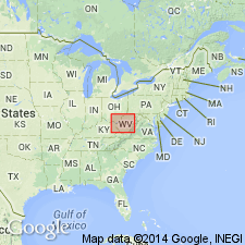
Geographically extended the Brassfield Member of the Drowning Creek Formation into the subsurface of West Virginia (Ohio-West Virginia hinge zone) in section F-F'. Overlies the Juniata Formation and underlies the "Clinton" sandstone of O'Brien (1970).
Source: GNU records (USGS DDS-6; Reston GNULEX).
For more information, please contact Nancy Stamm, Geologic Names Committee Secretary.
Asterisk (*) indicates published by U.S. Geological Survey authors.
"No current usage" (†) implies that a name has been abandoned or has fallen into disuse. Former usage and, if known, replacement name given in parentheses ( ).
Slash (/) indicates name conflicts with nomenclatural guidelines (CSN, 1933; ACSN, 1961, 1970; NACSN, 1983, 2005, 2021). May be explained within brackets ([ ]).