The National Geologic Map Database is migrating to a new infrastructure. We apologize for any service disruptions during this process.
|
|---|


- Usage in publication:
-
- Brad formation
- Modifications:
-
- Original reference
- Dominant lithology:
-
- Limestone
- Shale
- Sandstone
- AAPG geologic province:
-
- Bend arch
- Fort Worth syncline
- Llano uplift
Summary:
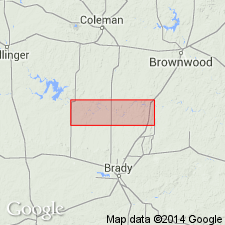
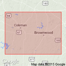
Pg. 24-31, 35; see also Univ. Texas Bull., no. 2132, p. 107-116. Brad formation. Notable exposures in Jack, Palo Pinto, Brown, and McCulloch Counties, Texas; 225 feet thick to north, about 200 feet thick to south. Underlies Hog Creek shale member of Caddo Creek formation and overlies Adams Branch limestone member of Graford formation. In Colorado River Valley divided into (descending): Ranger limestone member, 10 to 50 feet; Placid shale, 30 to 50 feet; Clear Creek limestone, 10 to 25 feet; and Cedarton shale and sandstone, 20 to 80 feet. In Brazos River Valley divided into (descending) Ranger limestone member and Seaman Ranch shale member. Age is Pennsylvanian.
Named from Brad, Palo Pinto Co., Brazos River region, TX.
Source: US geologic names lexicon (USGS Bull. 896, p. 246); supplemental information from GNU records (USGS DDS-6; Denver GNULEX).

- Usage in publication:
-
- Brad formation
- Modifications:
-
- Revised
- AAPG geologic province:
-
- Bend arch
- Llano uplift
Summary:
Pg. 104, 112. Brad formation. Defined Brad formation of Colorado River Valley as consisting of Ranger limestone member (above) and Placid shale member (below), and transferred to underlying Graford formation the Clear Creek limestone and older members originally included in Brad formation. He stated that in Wise County the Adams Branch limestone is absent and that the shales and sandstones from Devils Den limestone up to Ranger limestone have been named Ventioner beds. [Age is Pennsylvanian.]
Source: US geologic names lexicon (USGS Bull. 896, p. 246).
- Usage in publication:
-
- Brad formation
- Modifications:
-
- Revised
- AAPG geologic province:
-
- Llano uplift
Summary:
Pg. 197+. Divided Brad formation of McCulloch County, Colorado River region, Texas, into the following members (descending), Ranger limestone, Placid shale, Clear Creek limestone, and Cedarton shale, and stated (p. 205): Clear Creek limestone is also known as Merriman limestone. They drew base of Brad formation at top of Adams Branch limestone member of Graford formation.
Source: US geologic names lexicon (USGS Bull. 896, p. 246).
- Usage in publication:
-
- Brad formation
- Modifications:
-
- Revised
- AAPG geologic province:
-
- Bend arch
Summary:
Pg. 47-55. Brad formation. Named by Plummer and Moore and made to include the strata from top of limestone capping the escarpment west of Graford (here called Merriman limestone member of Graford formation, but previously misidentified as the older Adams Branch limestone) up to top of Ranger limestone. The Brad of Palo Pinto County, Texas, is divided into 2 members, Ranger limestone (45 feet thick) above and Seaman Ranch beds (135 feet thick) below.
Type locality is the outcrop north of Brad, Palo Pinto County, Texas.
Source: US geologic names lexicon (USGS Bull. 896, p. 246).

- Usage in publication:
-
- Brad formation*
- Modifications:
-
- Overview
- AAPG geologic province:
-
- Bend arch
- Llano uplift
Summary:
The definition of Brad formation that has recently been adopted by the USGS (based on report of Wallace Lee soon to be published by Texas Geol. Survey) draws line between Brad formation and underlying Graford formation in midst of Placid shale member of Plummer and Moore, the upper or shaly part of their Placid shale being included in Brad formation and the lower or limestone-bearing part being included in Graford formation.
Source: US geologic names lexicon (USGS Bull. 896, p. 246).

- Usage in publication:
-
- Brad formation
- Modifications:
-
- Revised
- AAPG geologic province:
-
- Bend arch
Summary:
Pg. 108-115. Brad formation of Canyon group. As redefined herein, formation consists of shale member at base and overlying Ranger limestone member (Drake's Home Creek of the type locality). Cedarton shale and Winchell member (including Clear Creek limestone of Drake and lower or limestone-bearing part of Placid shale member of Plummer and Moore) are included in typical Graford formation of Brazos River basin. Beds included in "shale member" represent upper part of Placid shale of Plummer and Moore, some sandstone, and the Cherty limestone of Drake. Underlies Caddo Creek formation. [Age is Late Pennsylvanian.]
Source: US geologic names lexicon (USGS Bull. 1200, p. 448-449).

- Usage in publication:
-
- Brad group
- Modifications:
-
- Revised
- AAPG geologic province:
-
- Bend arch
Summary:
Pg. 66 (fig. 1), 88. Brad group. Rank raised to group. Includes Ranger limestone and Placid shale. Underlies Caddo Creek group; overlies Graford group. [Age is Late Pennsylvanian.]
Source: US geologic names lexicon (USGS Bull. 1200, p. 448-449).
- Usage in publication:
-
- Brad formation*
- Modifications:
-
- Revised
- AAPG geologic province:
-
- Bend arch
Summary:
Pg. 51. Shown on composite section of Brown and Coleman Counties, central Texas, as Brad formation in Canyon goup. Thickness about 125 feet. Includes Ranger limestone and Placid shale members. Underlies Caddo Creek formation; overlies Winchell limestone. [Age is Late Pennsylvanian.]
Source: US geologic names lexicon (USGS Bull. 1200, p. 448-449).
- Usage in publication:
-
- Brad formation*
- Modifications:
-
- Revised
- AAPG geologic province:
-
- Bend arch
Summary:
Pg. 66-67, pl. 27. Brad formation of Canyon group. In Brown and Coleman Counties, comprises (ascending) Placid shale member and Ranger limestone member. Overlies Winchell limestone; underlies Caddo Creek formation. Thickness about 130 feet in southwestern Brown County; about 105 feet in central Brown County; not completely exposed northeast of Pecan Bayou. [Age is Late Pennsylvanian.]
Source: US geologic names lexicon (USGS Bull. 1200, p. 448-449).
- Usage in publication:
-
- Brad formation
- Modifications:
-
- Not used
- AAPG geologic province:
-
- Bend arch
Summary:
Brad Formation (of Eargle, 1960) not used in this report (Brown County, Colorado River Valley area, Texas). Placid shale and Ranger limestone, formerly members of Brad, are raised to formation rank. Placid shale overlies Winchell limestone; Ranger limestone underlies Colony Creek shale member of "Caddo Creek" [Formation]. [Age is Late Pennsylvanian] (Canyon age).
[Author does not capitalize rank terms; however, units are considered formal.]
Source: Modified from GNU records (USGS DDS-6; Denver GNULEX).

- Usage in publication:
-
- Brad Formation
- Modifications:
-
- Not used
- AAPG geologic province:
-
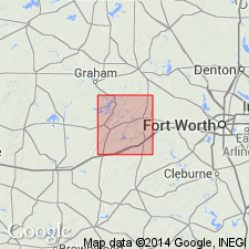
- Fort Worth syncline
Summary:
[Brad Formation. Rocks mapped as Brad Formation (Pennsylvanian) along western edge of map sheet, just west of Lake Bridgeport, in Jack and Wise Cos., central and northern TX, on previous edition of map (1967), are reallocated to Ranger Limestone and Ventioner Formation (both of Canyon Group) on the revised 1991 edition. See entries under Ranger and Ventioner.]
Source: Publication.
For more information, please contact Nancy Stamm, Geologic Names Committee Secretary.
Asterisk (*) indicates published by U.S. Geological Survey authors.
"No current usage" (†) implies that a name has been abandoned or has fallen into disuse. Former usage and, if known, replacement name given in parentheses ( ).
Slash (/) indicates name conflicts with nomenclatural guidelines (CSN, 1933; ACSN, 1961, 1970; NACSN, 1983, 2005, 2021). May be explained within brackets ([ ]).