

- Usage in publication:
-
- "Bluff sandstone"
- Modifications:
-
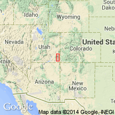
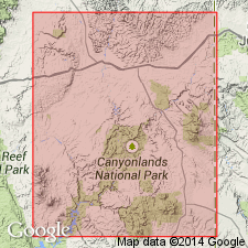
- Areal extent
- Dominant lithology:
-
- Sandstone
- AAPG geologic province:
-
- Paradox basin
Summary:
Pg. 21. "Bluff sandstone." At Bluff, San Juan County, southeastern Utah, the lower part of Morrison formation is composed of thin red and gray sandstone that forms cliffs along San Juan River and is locally known as "Bluff sandstone."
Source: US geologic names lexicon (USGS Bull. 896, p. 223).
- Usage in publication:
-
- Bluff sandstone member*
- Modifications:
-
- Principal reference
Summary:
Pg. 58, pl. 15. Bluff sandstone member of Morrison formation. White to gray-brown, massive or thick-bedded, cross-bedded sandstone; in places thin-bedded; includes quartz aggregates, clay balls, and mudstones. Thickness 100(?) to 350 feet. Is basal member of Morrison formation. Underlies Recapture shale member (new); overlies Summerville(?) formation. Age is Late Jurassic.
Is outstanding topographic feature on both sides of the San Juan River at town of Bluff, San Juan Co., southeastern UT.
Source: US geologic names lexicons (USGS Bull. 896, p. 223; USGS Bull. 1200, p. 403-404).
- Usage in publication:
-
- Bluff sandstone member*
- Modifications:
-
- Overview
- AAPG geologic province:
-
- Paradox basin
Summary:
As a member of the Morrison formation thought to be equivalent to Junction Creek sandstone member of Morrison of southwestern Colorado.
Source: GNU records (USGS DDS-6; Denver GNULEX).
- Usage in publication:
-
- Bluff sandstone*
- Modifications:
-
- Revised
- AAPG geologic province:
-
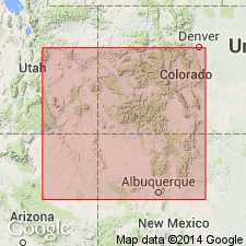
- Black Mesa basin
- Paradox basin
Summary:
Pg. 3 (fig. 2), 42-43, pls. 1, 3. Bluff sandstone of San Rafael group. In this report [Navajo country], Bluff sandstone believed to be tongue of Cow Springs sandstone, extending northward from main mass of Cow Springs, but, because of its homogeneous and mappable character and its areal extent (notably Mexican Water area, Arizona), it is considered a separate formation and assigned to upper part of San Rafael group. Ranges in thickness from few feet to about 300 feet. Age is Late Jurassic.
Source: Publication; US geologic names lexicon (USGS Bull. 1200, p. 403-404).
- Usage in publication:
-
- Bluff Sandstone Member*
- Modifications:
-
- Revised
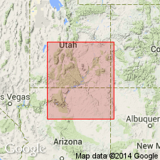
- Areal extent
- AAPG geologic province:
-
- Paradox basin
- Black Mesa basin
Summary:
Removed from San Rafael Group, reduced in stratigraphic rank from formation to member of Morrison Formation. Is recognized throughout southeast UT from north of Whiskers Draw and south of the Abajo Mountains where it tongues into the lower member of the Morrison, south to Bluff, San Juan Co in the Paradox basin. Is present south to Red Mesa and Garnet Ridge in northern Navajo and Apache Cos, AZ in the Black Mesa basin. Cross sections. Separated from the underlying Wanakah Formation of San Rafael Group by an unconformity. Coarse grains are abundant everywhere in basal part of the Bluff. Underlies Salt Wash Member of Morrison. Assigned to the Late Jurassic.
Source: GNU records (USGS DDS-6; Denver GNULEX).
- Usage in publication:
-
- Bluff Sandstone Member*
- Modifications:
-
- Areal extent
- AAPG geologic province:
-
- Paradox basin
Summary:
In southeastern UT, between Monticello and Bluff, in the Paradox basin, Tidwell Member of Morrison Formation is replaced laterally by Bluff Sandstone Member. Is of Late Jurassic age.
Source: GNU records (USGS DDS-6; Denver GNULEX).
- Usage in publication:
-
- Bluff Sandstone Member*
- Modifications:
-
- Revised
- AAPG geologic province:
-
- Black Mesa basin
Summary:
As the basal member of the Upper Jurassic Morrison Formation overlies Horse Mesa Member (new) of Wanakah Formation on northwest edge of study area at Toh Atin Mesa and Tsitah Wash, Apache Co, AZ, Black Mesa basin. Is a correlative of the B unit of the Junction Creek Sandstone. Name Bluff has been incorrectly applied in NM to older sandstone now known to be older than Bluff at Bluff, UT and separated from Bluff by an unconformity. Is a Paradox basin name not recognized in northwest NM.
Source: GNU records (USGS DDS-6; Denver GNULEX).
- Usage in publication:
-
- Bluff Sandstone Member*
- Modifications:
-
- Overview
- AAPG geologic province:
-
- Paradox basin
Summary:
Cross-bedding dip vectors in Bluff Sandstone Member of Morrison Formation measured 5 km north of Bluff, San Juan Co, UT in Paradox basin, dip N 81 deg E suggesting that direction of cross-bedding dip provides a helpful method of distinguishing Cow Springs Member (new rank) of Entrada Sandstone from eolian sandstones of Morrison. Dip vectors in Cow Springs are southeast, south, southwest, and west. Of Late Jurassic age.
Source: GNU records (USGS DDS-6; Denver GNULEX).
- Usage in publication:
-
- Bluff Sandstone Member*
- Modifications:
-
- Areal extent
- AAPG geologic province:
-
- Paradox basin
- Black Mesa basin
Summary:
Is the basal member of Upper Jurassic Morrison Formation. Shown as extending from Bluff, San Juan Co, UT in Paradox basin south beyond Tsitah Wash, Apache Co, AZ in Black Mesa basin. Pinches out in Apache Co, AZ west of Beclabito Dome, San Juan Co, NM.
Source: GNU records (USGS DDS-6; Denver GNULEX).
- Usage in publication:
-
- Bluff Sandstone
- Modifications:
-
- Not used
Summary:
Term Bluff Sandstone no longer used in the southeast part of the San Juan basin. The lower of two sandstones formerly assigned to the Bluff is named Mesita Member of Wanakah Formation. The upper of two sandstones formerly assigned to the Bluff is assigned as the eolian facies of the Recapture Member of the Morrison Formation.
Source: GNU records (USGS DDS-6; Denver GNULEX).
For more information, please contact Nancy Stamm, Geologic Names Committee Secretary.
Asterisk (*) indicates published by U.S. Geological Survey authors.
"No current usage" (†) implies that a name has been abandoned or has fallen into disuse. Former usage and, if known, replacement name given in parentheses ( ).
Slash (/) indicates name conflicts with nomenclatural guidelines (CSN, 1933; ACSN, 1961, 1970; NACSN, 1983, 2005, 2021). May be explained within brackets ([ ]).