The National Geologic Map Database is migrating to a new infrastructure. We apologize for any service disruptions during this process.
|
|---|


- Usage in publication:
-
- Bluff Creek bed
- Modifications:
-
- Original reference
- Dominant lithology:
-
- Clay
- Sandstone
- AAPG geologic province:
-
- Bend arch
- Llano uplift
Summary:
Pg. 387, 400. Bluff Creek bed in Canyon division. Bluish or yellowish sandy clay, 10 to 75 feet thick, with 2 to 25 feet of sandstone near top. Fossiliferous (foraminifers, brachiopods, corals, gastropods, and cephalopods). Member of Canyon division, near top [Canyon is 3rd from top of 5 Carboniferous divisions of Cummins, 1891]. Underlies CAMPOPHYLLUM bed and overlies Home Creek bed. Age is Pennsylvanian.
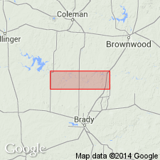
[Named from Bluff Creek, McCulloch Co., Colorado River region, central TX.]
Source: Publication; US geologic names lexicon (USGS Bull. 896, p. 223-224).

- Usage in publication:
-
- Bluff Creek shale
- Modifications:
-
- Revised
- AAPG geologic province:
-
- Bend arch
- Llano uplift
Summary:
Pg. 24, 31; Univ. Texas Bull., no. 2132, p. 127, 130-137. Bluff Creek shale. Sandy clay and thin calcareous sandstones 74 feet thick to north, 30 or 40 feet thick to south. In places a thin yellow limestone has been mapped in middle portion of the shale, and this may be = Bunger limestone of Young and Stephen Counties, Texas. The Bluff Creek bed is lower member of Graham formation in Colorado River Valley, central Texas. Upper part is in places very fossiliferous and fauna is similar to that of Wayland shale at Gunsight. Overlies Home Creek limestone member of Caddo Creek formation and underlies Gunsight limestone member (= CAMPOPHYLLUM bed of Drake). Age is Pennsylvanian. Report includes measured sections, stratigraphic chart.
Source: US geologic names lexicon (USGS Bull. 896, p. 223-224); supplemental information from GNU records (USGS DDS-6; Denver GNULEX).
- Usage in publication:
-
- Bluff Creek
- Modifications:
-
- Revised
- AAPG geologic province:
-
- Llano uplift
Summary:
Pg. 197, 221-225. Bluff Creek of Drake is here (McCulloch County, central Texas, Colorado River region) divided into (descending): (1) Upper Bluff Creek shale, 50 to 70 feet; (2) Bunger limestone lentil, 23+/- feet; (3) shale, 15 to 20 feet; (4) White Ranch limestone (new), 2 to 3.5 feet; and (5) Lower Bluff Creek shale, 35 to 45 feet. The latter rests on Home Creek limestone. Age is Pennsylvanian.
Source: US geologic names lexicon (USGS Bull. 896, p. 223-224).

- Usage in publication:
-
- Bluff Creek shale member*
- Modifications:
-
- Areal extent
- AAPG geologic province:
-
- Bend arch
Summary:
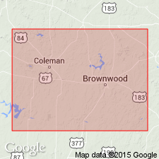
Pg. 118-119. Bluff Creek shale member of Graham formation of Cisco group. Bluff Creek shale member was defined by Drake as including shale interval from top of his Home Creek limestone to base of his CAMPOPHYLLUM beds, the name being derived from locality south of Colorado River, where his term "Home Creek limestone" was used consistently. Name was used by Plummer and Moore [1922] to include beds from top of their Home Creek limestone (a higher limestone than Home Creek limestone on Home Creek) to base of Gunsight limestone, and that usage is followed in this report [Brown and Coleman Counties, central Texas]. Thickness 47 feet. Overlies Home Creek limestone member of Caddo Creek formation. [Age is Late Pennsyvlanian.]
Source: Publication; US geologic names lexicon (USGS Bull. 1200, p. 404-405).
- Usage in publication:
-
- Bluff Creek shale member*
- Modifications:
-
- Areal extent
- AAPG geologic province:
-
- Bend arch
Summary:
Pg. 50. Bluff Creek shale member of Graham formation of Cisco group. Shown on columnar section, Brown and Coleman Counties, central Texas, below Gunsight limestone and above Home Creek limestone member of Caddo Creek formation. Thickness about 90 feet. Consists of shale, limestone, and sandstone; shale is gray and very fossiliferous above upper limestone, with ammonoids, gastropods, brachiopods, pelecypods abundant, CONULARIA and shark teeth rare. Upper limestone is gray, oolitic, foraminiferal, and massive and contains fusulinids, "seaweed" structures, and fossil fragments; called Bunger limestone by Bullard and Cuyler (Univ. Texas Bull., no. 3501, 1935). Lower limestone thinner, ferruginous, foraminiferal, and fusulinid-bearing. Sandstones near base lenticular and channel filling near Colorado River. [Age is Late Pennsylvanian.]
Source: Publication; US geologic names lexicon (USGS Bull. 1200, p. 404-405).
- Usage in publication:
-
- Bluff Creek shale member*
- Modifications:
-
- Areal extent
- AAPG geologic province:
-
- Bend arch
- Llano uplift
Summary:
Pg. 69-70, pl. 27. Bluff Creek shale member of Graham formation of Cisco group. Was first described by Drake (1893) as Bluff Creek bed from exposures along tributary of Colorado River in McCulloch County. Plummer and Moore [1922] called the member Bluff Creek shale and stated that a thin yellow limestone in middle of unit may be equivalent to Bunger limestone member in Young and Stephens Counties, central northern Texas. Bullard and Cuyler (Univ. Texas Bull., no. 3501, 1935) retained name Bunger for bed in McCulloch County that they said is unlikely to be continuous with one at type locality in Young County but occupies same stratigraphic position. The shale above this Bunger they termed Upper Bluff Creek shale and the shale below, Lower Bluff Creek shale. They named a persistent ferruginous limestone bed lying 15 to 20 feet below their Bunger limestone and 35 feet above base of their Lower Bluff Creek shale the White Ranch limestone. Hudnall and Pirtle (1929, Geologic map of Coleman County) called a limestone unit in this interval in Brown County the North Leon limestone, believing it to be correlative with bed in Eastland County named North Leon by Reeves (1922). Cheney (1950, Abilene Geol. Soc. [Gdbk.] Nov. 2-4) and Cheney and Eargle (1951, Geologic map of Brown County) added North Leon and Gonzales to list of limestones in lower part of Graham formation in Brown County. As many as six thin limestone units in lower part of Bluff Creek shale member are traceable for considerable distances across Brown and Coleman Counties [this report], but most of these are discontinuous. Lenticular beds of sandstone are also found in several stratigraphic positions. Exact correlation of the limestones in lower part of Bluff Creek could not be determined because of abrupt changes in intervals of shale between them. Hence formal usage of individual names for these beds whose type localities are chiefly in Brazos River Valley is not recommended for Colorado River Valley until more definite correlations can be established. Bluff Creek shale of present report ranges in thickness from about 90 feet along Colorado River to about 140 feet in north-central Brown County. Underlies Gunsight limestone member; overlies Home Creek limestone member of Caddo Creek formation. [Age is Late Pennsylvanian.]
Source: Publication; US geologic names lexicon (USGS Bull. 1200, p. 404-405).
- Usage in publication:
-
- Bluff Creek Shale [unranked]
- Modifications:
-
- Areal extent
- AAPG geologic province:
-
- Bend arch
Summary:
Bluff Creek Shale [unranked] in Cisco Group. Not described. Shown on schematic cross section above Home Creek Limestone of Canyon Group and below North Leon Limestone [unranked] in Cisco Group. Included in Graham Formation by earlier workers. Age is Late Pennsylvanian (Virgilian).
Source: Publication.
For more information, please contact Nancy Stamm, Geologic Names Committee Secretary.
Asterisk (*) indicates published by U.S. Geological Survey authors.
"No current usage" (†) implies that a name has been abandoned or has fallen into disuse. Former usage and, if known, replacement name given in parentheses ( ).
Slash (/) indicates name conflicts with nomenclatural guidelines (CSN, 1933; ACSN, 1961, 1970; NACSN, 1983, 2005, 2021). May be explained within brackets ([ ]).