- Usage in publication:
-
- Betsie Shale Member*
- Modifications:
-
- Original reference
- Dominant lithology:
-
- Shale
- Siltstone
- AAPG geologic province:
-
- Appalachian basin
Summary:
Named Betsie Shale Member of Breathitt Formation in KY and TN, of Kanawha Formation in WV, and of Wise Formation in VA. Identified as an upward-coarsening bay-fill sequence. Commonly dark-gray clay shale in basal part, coarsening upward and becoming siltstone. May contain flaggy sandstones in upper part. Marine fossils rarely occur in basal shale. 140 ft thick at type section; commonly ranges from 50 to 150 ft thick. Widely distributed in subsurface in central Appalachian basin. Basal shales distinctive on gamma ray logs, which form excellent marker bed useful for deciphering stratigraphy of Middle Pennsylvanian rocks.
Source: GNU records (USGS DDS-6; Reston GNULEX).
- Usage in publication:
-
- Betsie Shale Member
- Modifications:
-
- Revised
- Age modified
- AAPG geologic province:
-
- Appalachian basin
Summary:
Breathitt Formation is informally elevated to group rank and subdivided into the following eight informal formations: Pocahontas, Bottom Creek, Alvy Creek, Grundy, Pikeville, Hyden, Four Corners, and Princess formations. Betsie Shale Member is assigned to the base of Pikeville formation. Overlies the Manchester coal bed and the Corbin Sandstone Member of the Lee Formation. A sandstone in the upper part of the Betsie has been mapped informally as the Frozen sandstone. According to Fig. 1, Betsie is assigned a Morrowan (Early Pennsylvanian) age. [Revisions made in this paper are strongly contested by C. Rice and other USGS scientists who work in this area (oral commun., 9/3/93).]
Source: GNU records (USGS DDS-6; Reston GNULEX).
- Usage in publication:
-
- Betsie Shale Member
- Modifications:
-
- Revised
- AAPG geologic province:
-
- Appalachian basin
Summary:
Pikeville Formation of Breathitt Group is formally named in this report. Betsie Shale Member occurs at its base in KY, TN, VA, and WV. Overlies formally named Grundy Formation and underlies variously named coal beds throughout its extent. According to the author, formal nomenclature presented in this report for units occurring in KY has been accepted by the Kentucky Stratigraphic Nomenclature Committee. Units that occur largely outside KY are considered informal. Report includes correlation charts, cross sections, and measured sections.
Source: GNU records (USGS DDS-6; Reston GNULEX).
- Usage in publication:
-
- Betsie Shale Member*
- Modifications:
-
- Reference
- AAPG geologic province:
-
- Appalachian basin
Summary:
Reference section for Betsie Shale Member of Kanawha Formation is near Chapmanville, Logan Co., where it is exposed at road level for more than 0.25 mi in first road cut south of Chapmanville, along US Hwy 119, on west side of Guyandotte River. Was named by Rice and others (1987) to replace miscorrelated Eagle Limestone of White (1891). The Eagle was named for exposures of fossiliferous limestone near Eagle, about 1.5 mi southeast of Montgomery, Fayette Co., WV. Hennen and Reger (1914) in an attempt to extend the Eagle from Kanawha River valley to Tug Fork valley in Mingo Co. incorrectly assigned the name to a stratigraphically lower unit below Matewan coal bed, probably the Dorothy Limestone and Shale of Krebs and Teets (1916). Hennen and Reger also miscorrelated the actual stratigraphic position of the Eagle in Tug Fork valley; in its place they show the younger Cannelton ("Stockton") Limestone of White (1885). This incorrect usage of Cannelton was extended into KY by Huddle and Englund (1966) and the same error is found in many U.S. Geological Survey Geologic Quadrangle Maps in KY. Subsequently, because of Hennen and Reger's usage of Cannelton, the name Eagle was misapplied to older strata of these same reports. Because the name Eagle was preoccupied by several other formal formations in North America, the unit was formally renamed Betsie Shale Member of Breathitt Formation in KY and TN, of Wise Formation in VA, and of Kanawha Formation in WV (based on continuity of Betsie with Eagle Limestone of White (1891) in WV).
Source: GNU records (USGS DDS-6; Reston GNULEX).
- Usage in publication:
-
- Betsie Shale Member*
- Modifications:
-
- Areal extent
- AAPG geologic province:
-
- Appalachian basin
Summary:
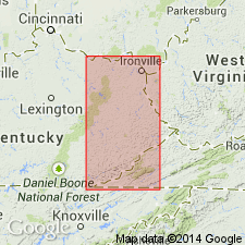
Betsie Shale Member of Breathitt Formation. Marine unit up to 150 feet thick in basal part of Breathitt Formation. Includes a thin shale at base that is readily identifiable in geophysical logs. [Includes beds = Eagle Limestone of White, 1891.] Lies below the Crummies (Cannelton Limestone of White, 1885), Caywood [Cawood], or Frozen Sandstone Member of Breathitt Formation; in Princess district lies below the Grayson sandstone bed (informal) of Lee Formation. Lies above Corbin Sandstone Member of Lee Formation; in Upper Cumberland River district, lies above Yellow Creek Sandstone Member of Breathitt Formation. Lies between several coals (all in Breathitt Formation): underlies the Dixie, Little Eagle, and Wheelersburg coals; overlies Bennetts Fork, Bingham, Colony, Hance, Horse Creek, Lily, Manchester, Puckett Creek, River Gem, Swamp Angel, and Zachariah coals. Age is Middle Pennsylvanian.
Source: Publication.
- Usage in publication:
-
- Betsie Shale Member
- Modifications:
-
- Areal extent
- AAPG geologic province:
-
- Appalachian basin
Summary:
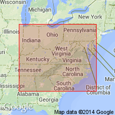
Corr. chart. Betsie Shale Member of Pikeville Formation of Breathitt Group (KY); Betsie Shale Member of Slatestone Formation (TN); Betsie Shale Member of Kanawha Formation of Pottsville Group (WV). Shale and/or mudstone. In eastern and southeastern Kentucky is basal member of Pikeville Formation; lies above Grundy Formation of Breathitt Group and below Crummies Member of Pikeville. [In Hazard district of eastern Kentucky, underlies Frozen Sandstone Member, and in Upper Cumberland River district of southeastern Kentucky, underlies informal Cawood sandstone member; all in Pikeville.] In Tennessee is a member of Slatestone Formation; lies above the Coal Creek coal and below the Petros coal. In West Virginia is a member of Kanawha Formation of Pottsville Group; lies above Bolt Mountain Member and below Crummies Member (both in Kanawha). Correlative with "Cannelton shale (limestone)" in Wise Formation of southwestern Virginia (J.A. Lovett, VDMME, unpub. data, 2006; Nolde, 1994). Carries marine fossils. Age is late Early Pennsylvanian (Westphalian; earliest Atokan).
[Betsie Shale Member lies between Eagle and Mason coals, which Peppers, 1996 (GSA Memoir 188, pl.) placed in basal part of Westphalian B, MICRORETICULATISPORITES NOBILIS-FLORINITES JUNIOR (NJ) miospore assemblage zone of western Europe. Eble and others, 2009 (Kentucky Geol. Survey, ser. XII, Spec. Pub. 10, figs. 5.1, 5.2) placed the Betsie Shale Member at the Langsettian/Duckmantian (Westphalian A/B) boundary, in uppermost part of the underlying RADIIZONATES ALIGERENS (RA) miospore assemblage zone of western Europe.]
[See also Chesnut, 1997 (revised Oct. 12, 1999), Stratigraphy of the coal-bearing strata of the Eastern Kentucky coal field, available online through the Kentucky Geol. Survey (http://www.uky.edu/KGS/coal/coalcorrel.htm).]
Source: Publication.
For more information, please contact Nancy Stamm, Geologic Names Committee Secretary.
Asterisk (*) indicates published by U.S. Geological Survey authors.
"No current usage" (†) implies that a name has been abandoned or has fallen into disuse. Former usage and, if known, replacement name given in parentheses ( ).
Slash (/) indicates name conflicts with nomenclatural guidelines (CSN, 1933; ACSN, 1961, 1970; NACSN, 1983, 2005, 2021). May be explained within brackets ([ ]).

