The National Geologic Map Database is migrating to a new infrastructure. We apologize for any service disruptions during this process.
|
|---|


- Usage in publication:
-
- Bend series
- Modifications:
-
- Original reference
- Dominant lithology:
-
- Limestone
- Shale
- Coal
- AAPG geologic province:
-
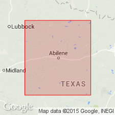
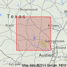
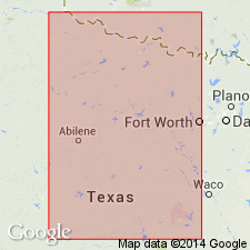
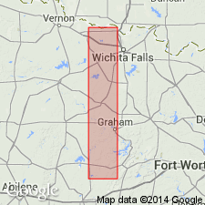
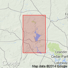
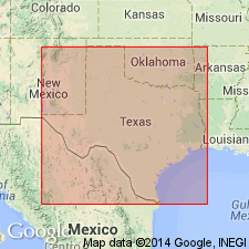
- Llano uplift
Summary:
Pl. 3, p. lxv. Bend series. Limestones and shales forming basal Carboniferous deposits in central Texas [Llano, Burnet, and Mason Counties]. Probably includes Subcarboniferous and coal measures. Contains one or more coal beds. In places seems to show unconformity with overlying Richland sandstone (undoubted Carboniferous).
Well exposed at McAnnelly's Bend [of Colorado River], San Saba Co., central Texas, for which it is named.
Source: US geologic names lexicon (USGS Bull. 896, p. 158-161).

- Usage in publication:
-
- Bend division
- Modifications:
-
- Areal extent
- AAPG geologic province:
-
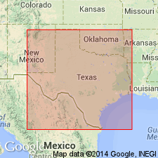
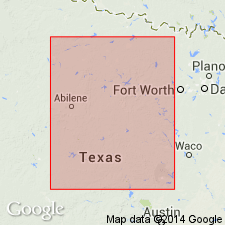
- Bend arch
Summary:
Bend division is present in only central area of northern Texas. Consists of 140 feet of shales underlain by 220 feet of limestones. Is basal division of Coal Measures [Pennsylvanian].
Source: US geologic names lexicon (USGS Bull. 896, p. 158-161).
- Usage in publication:
-
- Bend series
- Modifications:
-
- Biostratigraphic dating
- AAPG geologic province:
-
- Llano uplift
Summary:
Section on paleo. and corr. by G.H. Girty, p. 8: Typical Bend series of Texas Survey is divisable into 3 portions --an upper and lower shale separated by a series of limestones. The lower division [Barnett shale] I am referring to Mississippian. According to canons at present used for determining the Pennsylvanian by paleontologic evidence the middle [called Marble Falls limestone in folio] and upper [called Smithwick shale in folio] divisions would be called Pennsylvanian. I feel no hesitation in recognizing Marble Falls limestone as middle division of typical Bend of Texas Survey, and although I did not see or collect fossils from the shale at Marble Falls, it seems a fairly safe inference that this [Smithwick shale] is upper division. It seems somewhat doubtful whether the lowest division is represented in Burnet and Llano quadrangles, central Texas.
Source: US geologic names lexicon (USGS Bull. 896, p. 158-161).
- Usage in publication:
-
- Bend series
- Modifications:
-
- Overview
Summary:
Pg. 732 (Carboniferous of older geologists, and the Mississippian Period, Chapter XL). Included Bend in Pennsylvanian, without specifying subdivisions.
Source: US geologic names lexicon (USGS Bull. 896, p. 158-161).

- Usage in publication:
-
- Bend series
- Modifications:
-
- Revised
- Age modified
Summary:
Pg. 41-43. Bend series. Divided into (descending) Smithwick shale, Marble Falls limestone, and Lower Bend shale, and stated: The age of the Bend may be Late Mississippian (St. Louis-Chester age), as thought by J.P. Smith, but it will here be described under Pennsylvanian heading. It is unconformably overlain by Strawn formation. Lower Bend shale is 0 to 50 feet thick, and contains some layers of dark limestone. [The 1919 edition of this bulletin stated: "The age of the Bend is probably early Pennsylvanian."]
Source: US geologic names lexicon (USGS Bull. 896, p. 158-161).

- Usage in publication:
-
- Bend formation
- Modifications:
-
- Revised
Summary:
Assigned Bend formation, as he called it, to Mississippian, and divided it into (descending): (1) Smithwick shale (fauna possibly extremely early Pennsylvanian but more probably extremely late Mississippian); (2) Marble Falls limestone (fauna not more recent than St. Louis-Chester and not older than Kinderhook): (3) Bend formation (200 to 300 feet of black shale, black limestones and sandstones, carrying fauna not more recent than early or middle Mississippian and not older than extremely Late Devonian).
Source: US geologic names lexicon (USGS Bull. 896, p. 158-161).
- Usage in publication:
-
- Bend series
- Modifications:
-
- Revised
Summary:
Pg. 71-81, 418-420. Bend series. Expressed opinion basal Bend shale is Mississippian and Marble Falls limestone and Smithwick shale are Pennsylvanian. Also that a thin limestone of Mississippian age had been included in base of Marble Falls limestone of some authors; that lower part of this Mississippian limestone is absent at Marble Falls, but that upper part of it may or may not be represented at Marble Falls. He included this thin Mississippian limestone in his basal Bend shale. He also stated that important unconformity and faunal change exists between Marble Falls limestone and underlying shale of Mississippian age.
Source: US geologic names lexicon (USGS Bull. 896, p. 158-161).
- Usage in publication:
-
- Bend series
- Modifications:
-
- Revised
Summary:
Pg. 169-211. Assigned Bend series (including the same 3 formations, Smithwick shale, Marble Falls limestone, and Lower Bend shale) to Mississippian.
Source: US geologic names lexicon (USGS Bull. 896, p. 158-161).

- Usage in publication:
-
- Bend series
- Modifications:
-
- Revised
- Age modified
Summary:
Pg. 217+. Assigned Bend series to early Pennsylvanian, and stated that all fossils of basal black shale are common to overlying beds in lower part of Marble Falls limestone.
Source: US geologic names lexicon (USGS Bull. 896, p. 158-161).
- Usage in publication:
-
- Bend formation
- Bend series
- Modifications:
-
- Revised
- AAPG geologic province:
-
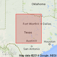
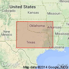
- Bend arch
- Llano uplift
Summary:
Pg. 132-145. Assigned Bend formation or Bend series, as he called it, to lower Pennsylvanian, and included in it Smithwick shale, Marble Falls limestone, and Lower Bend shale. [Central Mineral region, Llano, Burnett, San Saba, Lampasas, McCulloch and Mason Counties, north-central Texas.]
Source: US geologic names lexicon (USGS Bull. 896, p. 158-161).
- Usage in publication:
-
- Bend series
- Modifications:
-
- Revised
Summary:
Pg. 34-38. Divided Bend series, as he called it, into (descending): Smithwick shale (few feet to 700+/- feet); Marble Falls limestone (200 to 400+/- feet); and Lower Bend shale (few feet to 150 feet); age uncertain (whether all Pennsylvanian, or all Mississippian, or part Pennsylvanian and part Mississippian).
Source: US geologic names lexicon (USGS Bull. 896, p. 158-161).
- Usage in publication:
-
- Bend series†
- Modifications:
-
- Abandoned
- AAPG geologic province:
-
- Bend arch
- Chautauqua platform
- Llano uplift
Summary:
Bend series. Assigned true Marble Falls limestone to Pennsylvanian and called the 20 to 50 feet of black Mississippian limestone "Lower Bend" limestone and underlying black shale "Lower Bend" shale, and reported an unconformity at base of Marble Falls limestone and at base of "Lower Bend limestone." The Bend series being thus subdivided into Pennsylvanian and Mississippian formations the name was in 1920 discarded by the USGS.
Source: US geologic names lexicon (USGS Bull. 896, p. 158-161).

- Usage in publication:
-
- Bend group
- Modifications:
-
- Revised
- Age modified
- AAPG geologic province:
-
- Bend arch
- Llano uplift
Summary:
Pg. 25-26; [see also Univ. Texas Bull., no. 2132, p. 23-58]. Bend group. In north-central Texas, includes (ascending) Barnett shale (new), Marble Falls limestone, and Smithwick shale. Authors replaced "Lower Bend shale" of Udden and others (1916) with Barnett shale, which they tentatively referred to Mississippian. In Univ. Texas Bull. 2132, 1922, they continued to use Bend group (as it is "one of most widely known geological units of the southwest."), classified it as Pennsylvanian, and included in it Barnett shale. They also stated that Barnett shale included at top a thin limestone that contains fossils of "Mississippian aspect," and that the Barnett appears to writers to belong to Pennsylvanian, but that it may prove to be upper Mississippian. Overlies Ordovician Ellenburger limestone. Underlies Millsap formation of Strawn group in Brazos River area, and Strawn group (undifferentiated) in Colorado River area.
Source: US geologic names lexicon (USGS Bull. 896, p. 158-161); supplemental information from GNU records (USGS DDS-6; Denver GNULEX).

- Usage in publication:
-
- Bendian series
- Modifications:
-
- Revised
Summary:
Pg. 353, 357, 358, 368. Stated: Bendian series includes Smithwick shales, 0 to 1,000 feet; Marble Falls limestone, 200 to 700 feet; and Lower shales. Asigned to Pennsylvanian, although considered older than usual type Pennsylvanian fauna.
Source: US geologic names lexicon (USGS Bull. 896, p. 158-161).
- Usage in publication:
-
- Bend group
- Modifications:
-
- Revised
- AAPG geologic province:
-
- Bend arch
Summary:
Pg. 461-462. Restricted Bend group to Pennsylvanian (Smithwick shale and Marble Falls limestone) and assigned Barnett shale to Mississippian, as did M.G. Cheney, 1929 (Univ. Texas Bull., no. 2913). R.C. Moore, 1929 (AAPG Bull., v. 13, p. 894), however, continued to include Barnett in Bend. But J.P. Bowen and J.F. Gibbs, 1932 (AAPG Bull., v. 16, no. 2, p. 181), restricted Bend group to Pennsylvanian.
Source: US geologic names lexicon (USGS Bull. 896, p. 158-161).
- Usage in publication:
-
- Bend series
- Modifications:
-
- Revised
Summary:
Pg. 279. Bend series. Divided the Pennsylvanian "system" of Midcontinent field into 4 "series," to which he applied following names (descending): Virgil, Pottawatomie, Des Moines, and Bend. He defined latter as follows: "The Bend series, at base of system, consists predominantly of marine beds containing a distinctive fauna that shows strong relationship with uppermost Mississippian faunas. A distinct and widespread unconformity marks top of the series."
Source: US geologic names lexicon (USGS Bull. 896, p. 158-161).

- Usage in publication:
-
- [Bend series]
- Modifications:
-
- Revised
- Age modified
Summary:
Pg. 248. Included in Bend the Smithwick shale, Marble Falls limestone, and Barnett shale, and assigned its upper part to Pottsville time and its lower part to a period of pre-Pottsville Pennsylvanian time "not represented by deposits in Appalachian region, Kansas, Nebraska, or Illinois, but corresponding to lower part of Namurian of Europe."
Source: US geologic names lexicon (USGS Bull. 896, p. 158-161).

- Usage in publication:
-
- Bend group
- Modifications:
-
- Revised
- Age modified
- AAPG geologic province:
-
- Bend arch
- Llano uplift
Summary:
Pg. 99-100. Included in Bend group only Smithwick shale and Marble Falls limestone, and assigned both to Pennsylvanian.
Source: US geologic names lexicon (USGS Bull. 896, p. 158-161).
- Usage in publication:
-
- Bendian sandstone
- Modifications:
-
- Revised
- AAPG geologic province:
-
- South Oklahoma folded belt
Summary:
Pg. 579. Bendian sandstone. Used as a time term for Pennsylvanian rocks underlying Pottsville of "standard" classification; but this constitutes a restriction of Pottsville, which, according to established classification, includes the oldest Pennsylvanian sediments in America. The Marble Falls limestone was in 1924 pronounced by G.H. Girty to be of Pottsville age.
Source: US geologic names lexicon (USGS Bull. 896, p. 158-161).
- Usage in publication:
-
- Bendian period
- Modifications:
-
- Revised
- Areal extent
- AAPG geologic province:
-
- Bend arch
- Llano uplift
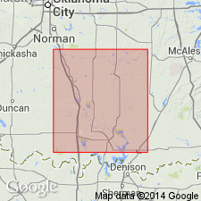
- South Oklahoma folded belt
Summary:
Pg. 1018-1049. Bendian period. Used as a time term separating Pennsylvanian (restricted) "period" from Mississippian "period," and showed unconformities at top and base of rocks assigned to his Bendian period. He divided his Bendian period into paleontologic subdivisions called Upper Bendian, Middle Bendian, and Lower Bendian, and assigned to it various names formations of western Texas, central Texas (the typical Bend region), Arbuckle Mountain and Ouachita Mountain regions of Oklahoma, and also northeast Oklahoma and northeast Arkansas. In Bend region he assigned to his Bendian period the Smithwick shale, Marble Falls limestone, and what appears to be upper part of Barnett shale, which he showed (p. 1020) as separated from Marble Falls limestone by a great hiatus, and as separated from what appears to be Barnett shale restricted by another hiatus.
Source: US geologic names lexicon (USGS Bull. 896, p. 158-161).

- Usage in publication:
-
- Bend group
- Modifications:
-
- Adopted
Summary:
The USGS in 1935 adopted Bend group as defined by Texas Geol. Survey in 1933, i.e., to include the two formations of Pennsylvanian age (Smithwick shale above and Marble Falls limestone below) that are present in Bend region. F.B. Plummer and J. Hornberger, Jr., 1936 (Univ. Texas Survey Bull., no. 3534, p. 65) also included in Bend group (Pennsylvanian) the Smithwick and Marble Falls formations and assigned the Barnett to Mississippian.
Source: US geologic names lexicon (USGS Bull. 896, p. 158-161).
- Usage in publication:
-
- Bend group
- Modifications:
-
- Mapped
Summary:
Bend group. As mapped includes Marble Falls limestone and Smithwick shale. [Age is Early and Middle Pennsylvanian.]
Source: US geologic names lexicon (USGS Bull. 1200, p. 298).

- Usage in publication:
-
- Bend series
- Bend group
- Modifications:
-
- Not used
- AAPG geologic province:
-
- Bend arch
Summary:
Pg. 66 (fig. 1), 82-83. Marble Falls and Smithwick deposits as seen at outcrop form natural unit structurally that has been referred to as Bend series or Bend group. When studied regionally, [in subsurface], these beds are divisible into three lesser groups. In this report, these groups are termed Marble Falls, Big Saline (new), and Smithwick. Big Saline and Smithwick are groups in Lampasas series (new), and Marble Falls is group in Morrow series. Term group has broad meaning and wide application without regard to series boundaries; hence continued use, when needed, of term Bend group does not appear inconsistent with usage of these lesser group names proposed here.
Source: US geologic names lexicon (USGS Bull. 1200, p. 298).
- Usage in publication:
-
- Bend group
- Bend series
- Modifications:
-
- Not used
Summary:
Pg. 185-186. Bend group or Bend series. Report proposes that term Atoka formation be elevated to Atoka series and defined to include all beds from top of Morrow series to base of Des Moines series. This would include the Marble Falls and Smithwick. Term Atoka is preferred to redefinition of Lampasas series or of older term Bend group or series.
Source: US geologic names lexicon (USGS Bull. 1200, p. 298).
- Usage in publication:
-
- Bend series
- Modifications:
-
- Revised
- AAPG geologic province:
-
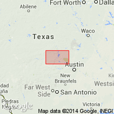
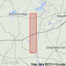
- Fort Worth syncline
Summary:
Pg. 70. Bend series, as presently recognized, includes Smithwick formation and Marble Falls, exclusive of that part of Marble Falls which may be of Morrowan age.
[Report area in Parker County, central Texas.]
Source: US geologic names lexicon (USGS Bull. 1200, p. 298).
For more information, please contact Nancy Stamm, Geologic Names Committee Secretary.
Asterisk (*) indicates published by U.S. Geological Survey authors.
"No current usage" (†) implies that a name has been abandoned or has fallen into disuse. Former usage and, if known, replacement name given in parentheses ( ).
Slash (/) indicates name conflicts with nomenclatural guidelines (CSN, 1933; ACSN, 1961, 1970; NACSN, 1983, 2005, 2021). May be explained within brackets ([ ]).