The National Geologic Map Database is migrating to a new infrastructure. We apologize for any service disruptions during this process.
|
|---|


- Usage in publication:
-
- Bead Mountain bed
- Modifications:
-
- Original reference
- Dominant lithology:
-
- Limestone
- AAPG geologic province:
-
- Bend arch
Summary:
Pg. 421, 426. Bead Mountain bed in Albany division. Largely dark-colored, hard, brittle, slightly shaly limestone, alternating with softer light-gray limestone. Thickness 6 to 50 feet. Member of Albany division [Albany is uppermost of 5 Carboniferous divisions of Cummins, 1891]. Underlies Bed No. 12 (12 to 75 feet of clay) and overlies Valera bed, which rests on Jagger Bend bed. Age is possibly Permian.
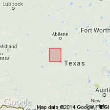
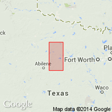
[Named from Bead Mountain, south of Gulf, Colorado and Santa Fe RR, (Lat. 31 deg. 44 min. 41 sec. N., Long. 99 deg. 35 min. 06 sec. W., Bead Mountain 7.5-min quadrangle), Coleman Co., Colorado River region, central TX.]
Source: Publication; US geologic names lexicon (USGS Bull. 896, p. 131-132).
- Usage in publication:
-
- Bead Mountain formation
- Modifications:
-
- Revised
- AAPG geologic province:
-
- Bend arch
- Permian basin
Summary:
Map and section, p. 12-13, 18, 21. Bead Mountain formation in Wichita stage. [Cross section shows following downward succession: Grape Creek limestone, Bead Mountain formation, Valera shale, Jagger Bend limestone. They also gave detailed section of Wichita formation in southwest Coleman County and stated]: It seems that No. 5 of this section was regarded as base of Drake's Bead Mountain beds, but there are at least 2 limestones and 2 shale beds below it which might be included in the section. Beginning with top of Jagger Bend beds, which is second formation below this section, the worm tubes and reefs set in along Colorado River. It seems probable that Beds Nos. 5 to 36, inclusive, constitute Drake's Bead Mountain beds. They have a thickness of 55 feet 6 inches, which is practically the thickness he ascribed to the formation. The rocks from top of Jagger Bend beds to top of Bead Mountain beds form a striking paleontological unit along Colorado River in southwest Coleman County and southwest Runnels County and probably should be included in a single formation. Through entire thickness of these rocks the dominating fossils are worm remains. Worm tubes are characteristic fossils of Bead Mountain formation, the oldest beds exposed in Runnels County. The Bead Mountain formation is overlain by Grape Creek formation. [This would include Bed No. 12 in Bead Mountain formation.] Age is Permian.
Source: US geologic names lexicon (USGS Bull. 896, p. 131-132).

- Usage in publication:
-
- Bead Mountain limestone member
- Modifications:
-
- Revised
- AAPG geologic province:
-
- Bend arch
Summary:
Pg. 195, 198. Bead Mountain limestone is top member of Belle Plains formation (middle formation of Wichita group) in Colorado River Valley, central Texas. Overlies Valera shale member of Belle Plains and underlies Grape Creek shale and limestone bed, the basal member of overlying Clyde formation. [Age is Permian.]
Source: US geologic names lexicon (USGS Bull. 896, p. 131-132).

- Usage in publication:
-
- Bead Mountain formation
- Modifications:
-
- Revised
- AAPG geologic province:
-
- Bend arch
Summary:
Pg. 66 (fig. 1). Bead Mountain formation of Belle Plains group. Rank raised to formation in the Belle Plains herein redefined and given group status. Includes Beaverburk member. Overlies Valera shale and anhydrite; underlies Grape Creek formation of Clyde group. [Age is Permian.]
Source: US geologic names lexicon (USGS Bull. 1200, p. 248).

- Usage in publication:
-
- Bead Mountain limestone member*
- Modifications:
-
- Revised
- Mapped
- AAPG geologic province:
-
- Bend arch
Summary:
Sheet 2. Bead Mountain limestone member of Belle Plains formation. Described in Colorado River Valley (notably Coleman County) as uppermost member of Belle Plains formation. Consists of hard, dark blue-gray, fine-grained foraminiferal limestone beds separated by thin shales. Overlies Valera shale member; underlies Grape Creek limestone member of Clyde formation; boundary somewhat arbitrarily defined. Age is considered Early Permian (Leonard?).
Source: Publication; US geologic names lexicon (USGS Bull. 1200, p. 248).
- Usage in publication:
-
- Bead Mountain limestone member*
- Modifications:
-
- Areal extent
- AAPG geologic province:
-
- Bend arch
Summary:
Pg. 274, pls. 11, 12. Bead Mountain limestone member of Belle Plains formation. Forms prominent escarpment in Brazos River drainage area. Consists of alternating beds of limestone and shale; limestone beds range in thickness from 1 to about 15 feet, and shale beds range in thickness from less than 1 foot to 65 feet. Overlies Valera shale member; underlies unnamed shale member at base of Clyde formation. [Age is Permian.]
Source: US geologic names lexicon (USGS Bull. 1200, p. 248).

- Usage in publication:
-
- Bead Mountain Formation
- Modifications:
-
- Mapped
- AAPG geologic province:
-
- Bend arch
Summary:
Bead Mountain Formation of Albany Group. Shale and limestone, 150 to 200 feet thick. Includes (descending) Rendham and Beaverburk Limestones [unranked]. Equivalent to lower part of Waggoner Ranch Formation (new) of Wichita Group. Underlies Grape Creek Formation of Albany Group. Overlies Jagger Bend and Valera Formations of Albany Group, and towards northeast, Petrolia Formation (new) of Wichita Group. Earlier workers included these rocks in Belle Plains and Clyde Formations. Fossils. Age is Early Permian (Leonard).
Geographic extent arbitrarily placed along North Fork of Little Wichita River; [notable exposures south of Wichita River, in Baylor and Throckmorton Cos.]
Source: Publication.
For more information, please contact Nancy Stamm, Geologic Names Committee Secretary.
Asterisk (*) indicates published by U.S. Geological Survey authors.
"No current usage" (†) implies that a name has been abandoned or has fallen into disuse. Former usage and, if known, replacement name given in parentheses ( ).
Slash (/) indicates name conflicts with nomenclatural guidelines (CSN, 1933; ACSN, 1961, 1970; NACSN, 1983, 2005, 2021). May be explained within brackets ([ ]).