- Usage in publication:
-
- Alvy Creek formation
- Modifications:
-
- Informally named
- Dominant lithology:
-
- Coal
- Shale
- Siltstone
- Sandstone
- AAPG geologic province:
-
- Appalachian basin
Summary:
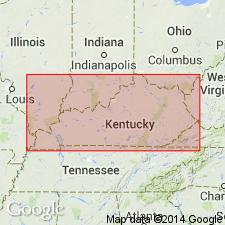
Breathitt Formation is informally elevated to group rank and subdivided into the following eight informal formations: Pocahontas, Bottom Creek, Alvy Creek, Grundy, Pikeville, Hyden, Four Corners, and Princess formations. Alvy Creek formation includes the informally named Coal Cliff member and the laterally equivalent Hensley Member, reassigned from the Lee Formation. The lower part of the Coal Cliff consists of 0 to 8 ft of calcareous sandstone with marine fossil debris, while the upper part of the unit is 60 to 70 ft of silty shale and siltstone. Shale contains abundant siderite nodules, marine fossils, and burrows. Siltstone is laminated, with no observed fossils or nodules. Above the Coal Cliff, lies the Beaver Creek coal bed of the Alvy Creek, or the Rockcastle Sandstone member of the Lee Formation. Below lies the Stearns No. 2 coal bed, shale member A, and Stearns No. 1 coal bed. [Revisions made in this paper are strongly contested by C. Rice and other USGS scientists who work in this area (oral commun., 9/3/93).]
Source: GNU records (USGS DDS-6; Reston GNULEX).

- Usage in publication:
-
- Alvy Creek formation
- Modifications:
-
- Informally named
- AAPG geologic province:
-
- Appalachian basin
Summary:
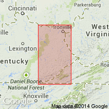
Alvy Creek formation of Breathitt Group, is informally named in this report for outcrops near Alvy Creek in Big A Mountain quad, VA. The Breathitt is formally raised to group rank in this report. Alvy Creek is composed of typical Breathitt lithologies--sandstone, shale, siltstone, and coal. In parts of VA and WV includes the Upper Seaboard coal bed at its base. In KY, the Hensley Member of the Lee Formation is reassigned to the base of the Alvy Creek and the Lee is dropped from usage. Separated from underlying informal Bottom Creek formation of similar composition by the Sewanee Sandstone. Underlies Bee Rock Sandstone in KY and parts of VA and WV. Elsewhere in VA and WV underlies Kennedy coal bed, at the base of the Grundy Formation (new). Northwestward, unit is interbedded with and progressively grades into the Bee Rock and Sewanee Sandstones. Reaches maximum thickness of 260 m. Equivalent to the non-quartzose coal-bearing lithologies in the upper half of the New River Formation. The Alvy Creek is equivalent to the Fentress Formation in TN.
[Not adopted by the VA and WV Geol. Surveys. Rocks incl. in Lee Formation of VA, and New River Formation of WV.]
Source: GNU records (USGS DDS-6; Reston GNULEX).

- Usage in publication:
-
- Alvy Creek formation
- Alvy Creek unit
- Modifications:
-
- Not used
- AAPG geologic province:
-
- Appalachian basin
Summary:
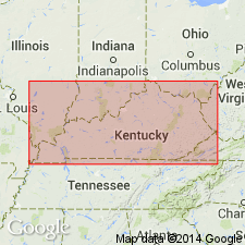
Alvy Creek formation (informal) of Breathitt Group of Chesnut (1992); Alvy Creek unit (informal) in Breathitt Formation of Rice and others (1994, GSA Spec. Paper, p. 117, citing Chesnut, 1989). Not used. [Rocks assigned to the Alvy Creek formation by Chesnut (1992) = Hensley Member of Lee Formation in Upper Cumberland River district, southeastern Kentucky, and = Stearns No. 1 through No. 3 coal beds of Breathitt Formation in Southwestern district, eastern Kentucky. See also Chesnut, 1997 (revised Oct. 12, 1999), Stratigraphy of the coal-bearing strata of the Eastern Kentucky coal field, available online through the Kentucky Geol. Survey (https://www.uky.edu/KGS/coal/coal-bedname-correlations-eky/coalcorrel.php).]
Source: Publication.

- Usage in publication:
-
- Alvy Creek formation
- Modifications:
-
- Areal extent
- AAPG geologic province:
-
- Appalachian basin
Summary:
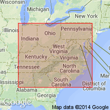
Corr. chart. Alvy Creek formation (informal) of Breathitt Group. Sandstone, siltstone, shale, and/or mudstone. Recognized in eastern and southeastern Kentucky where [in most areas] it is comprised entirely of the Hensley Member. (In Virginia, the Hensley Member is incl. in the Lee Formation.) In eastern Kentucky [Southwestern district] includes Stearns No. 1 through No. 3 coal zones; in southeastern Kentucky [Upper Cumberland River district] includes the Tunnel (Raven) coal bed. Lies below Bee Rock Sandstone and above Sewanee Sandstone, both of Breathitt Group. Equivalent to Whitwell Shale of Crab Orchard Mountains Group of Tennessee and Council Sandstone Member of New River Formation of southwestern Virginia. Age is Early Pennsylvanian (Westphalian; Morrowan).
[Eble and others (2009, Kentucky Geol. Survey, ser. XII, Spec. Pub. 10, figs. 5.2, 5.3) placed beds approx. = Alvy Creek (btw. Bradshaw and Castle coal beds) in middle part of Langsettian (middle part of Westphalian A) on basis of miospores.]
[See also Chesnut, 1997 (revised Oct. 12, 1999), Stratigraphy of the coal-bearing strata of the Eastern Kentucky coal field, available online through the Kentucky Geol. Survey (https://www.uky.edu/KGS/coal/coal-bedname-correlations-eky/coalcorrel.php) and geologic descriptions of stratigraphic units in the Kentucky Geological Survey database (https://kgs.uky.edu/kgsmap/KGSLitho/lithoSearch.asp).]
Source: Publication.
For more information, please contact Nancy Stamm, Geologic Names Committee Secretary.
Asterisk (*) indicates published by U.S. Geological Survey authors.
"No current usage" (†) implies that a name has been abandoned or has fallen into disuse. Former usage and, if known, replacement name given in parentheses ( ).
Slash (/) indicates name conflicts with nomenclatural guidelines (CSN, 1933; ACSN, 1961, 1970; NACSN, 1983, 2005, 2021). May be explained within brackets ([ ]).

