

- Usage in publication:
-
- Almond coal group
- Modifications:
-
- Original reference
- Dominant lithology:
-
- Sandstone
- Shale
- Clay
- Coal
- AAPG geologic province:
-
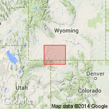
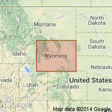
- Green River basin
Summary:
Almond coal group. Soft white and brown sandstones, sandy shale and clay, with many beds of coal and bituminous shale. Thickness 700 to 950 feet. Top subdivision of Mesaverde formation in Rock Springs uplift, Sweetwater County. Separated from underlying Rock Springs coal group (basal subdivision of Mesaverde formation) by 800 to 1,000 feet of massive white and yellowish sandstone, the upper third of which is conglomeratic, with fine black and gray quartz pebbles. Overlain by Lewis shale. [Age is Late Cretaceous.]
Source: US geologic names lexicon (USGS Bull. 896, p. 36).
- Usage in publication:
-
- Almond formation*
- Modifications:
-
- Revised
- AAPG geologic province:
-
- Green River basin
Summary:
Pg. 20, pl. 5. Almond formation of Mesaverde group. In this report the Almond and Rock Springs coal groups are given rank of formations, and intervening body of white sandstone, 800 to 1,100 feet thick, is named Ericson sandstone, from excellent exposure near old Ericson ranch, on Salt Wells Creek, sec. 31, T. 16 N., R. 102 W., in Baxter basin, Sweetwater County, Wyoming. [In ascending order], the Blair, Rock Springs, Ericson, and Almond formations compose Mesaverde group in Baxter basin, but the Blair and Rock Springs formations are = in time to upper part of Mancos shale of Moffat County, Colorado. [Age is Late Cretaceous.]
Source: US geologic names lexicon (USGS Bull. 896, p. 36).
- Usage in publication:
-
- Almond formation*
- Modifications:
-
- Areal extent
- AAPG geologic province:
-
- Green River basin
Summary:
Almond formation. Consists of white and brown soft sandstone, gray sandy shale, coal, and carbonaceous shale. Overlies Ericson sandstone and underlies Lewis shale.
Source: US geologic names lexicon (USGS Bull. 1200, p. 59-60).

- Usage in publication:
-
- Almond Formation*
- Modifications:
-
- Revised
- Reference
- Dominant lithology:
-
- Sandstone
- Shale
- AAPG geologic province:
-
- Green River basin
Summary:
Almond Formation, upper formation of the Mesaverde Group (revised). Exposed in Hanna basin, Carbon County, and Rock Springs uplift, Sweetwater County, Wyoming; extends east in subsurface through Great Divide and Washakie basins. A sandstone and shale sequence with minor amount of coal. Sandstone, making up a third to half of formation, is yellow, fine-grained, thin-bedded, and contains OPHIOMORPHA, which indicates a shallow-water marine environment. The shale can be gray to black, carbonaceous to coaly, with abundant ironstone concretions, oysters, and brackish-water fossils, or be dark-gray with limestone concretions containing marine fossils, and devoid of ironstone concretions. Thickness varies; greatest thickness is in southern Haystack Mountains where it is 600 feet. At reference sections, overlies Pine Ridge Sandstone and underlies Lewis Shale. Age is Late Cretaceous (late Campanian). Table 1 shows correlation with other units of the same age in south-central Wyoming.
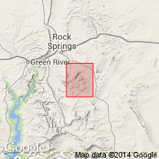
No type locality or measured type section has been described by previous workers. Name assumed to have been derived from Almond Stage Station near Point of Rocks, in SW/4 sec. 27, T. 20 N., R. 101 W., Sweetwater Co., WY
Reference sections in Carbon Co., WY: (1) in SW/4 SE/4 SW/4 and SW/4 NE/4 sec. 12, T. 22 N., R. 85 W.; and (2) in SE/4 SW/4 sec. 3, T. 20 N., R. 85 W.
Source: Modified from GNU records (USGS DDS-6; Denver GNULEX).
- Usage in publication:
-
- Almond Formation*
- Modifications:
-
- Areal extent
- AAPG geologic province:
-
- Green River basin
Summary:
Almond Formation, uppermost formation of Mesaverde Group. Recognized in subsurface of north-central to northwestern part of Sand Wash basin, Moffat County, northwest Colorado on basis of electric-log correlations. Gradual southeastward facies change from coastal-swamp and lagoon deposits of Almond to lagoon and delta-plain deposits of upper part of Williams Fork Formation depicted on interpretive correlation diagram. Approximate geographic boundary of nomenclature change located between gas well (station 6, sec. 13, T. 10 N., R. 94 W.) and dry oil and gas drillhole (station 7, sec. 13, T. 8 N., R. 93 W.) in Moffat County, Colorado. Overlies Canyon Creek Member of Ericson Sandstone; locally interpreted to overlie Pine Ridge Sandstone in vicinity of facies and nomenclature change. Underlies nearshore marine deposits of Lewis Shale. Age is Late Cretaceous.
Source: Modified from GNU records (USGS DDS-6; Denver GNULEX).
For more information, please contact Nancy Stamm, Geologic Names Committee Secretary.
Asterisk (*) indicates published by U.S. Geological Survey authors.
"No current usage" (†) implies that a name has been abandoned or has fallen into disuse. Former usage and, if known, replacement name given in parentheses ( ).
Slash (/) indicates name conflicts with nomenclatural guidelines (CSN, 1933; ACSN, 1961, 1970; NACSN, 1983, 2005, 2021). May be explained within brackets ([ ]).