The National Geologic Map Database is migrating to a new infrastructure. We apologize for any service disruptions during this process.
|
|---|


- Usage in publication:
-
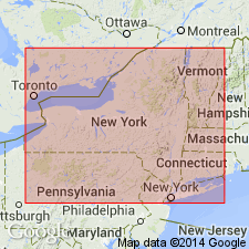
- Utica slate
- Modifications:
-
- Named
- Dominant lithology:
-
- Shale
- AAPG geologic province:
-
- Appalachian basin
Summary:
Name Utica slate used to refer to black shaly mass, 75 ft thick, underlying Lorraine shales and overlying Trenton limestone.
Source: GNU records (USGS DDS-6; Reston GNULEX).

- Usage in publication:
-
- Utica shale*
- Modifications:
-
- Overview
- AAPG geologic province:
-
- Appalachian basin
Summary:
In 1911 (New York State Mus. Bull., no. 149, p. 10-12), J.M. Clarke separated, under name Canajoharie shale, the lower part of black shale previously included in Utica shale of Hudson and Mohawk Valleys, which he stated thins out westward, does not reach meridian of Utica and contains a Trenton fauna. In 1912, (New York State Mus. Bull., no. 162), R. Ruedemann stated that true Utica shale is absent in the Hudson River region, but that it is overlain by true Frankfort shale in Utica region.
Source: US geologic names lexicon (USGS Bull. 896, p. 2224).
- Usage in publication:
-
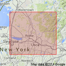
- Utica shale
- Modifications:
-
- Areal extent
- Dominant lithology:
-
- Shale
- AAPG geologic province:
-
- Appalachian basin
Summary:
Utica shale. Underlies Lorraine group and overlies Trenton limestone in Utica basin, and overlies Canajoharie shale [of lower Trenton age] in middle Mohawk Valley. Is 70 to 1,000 feet thick in Utica basin, being nearly 800 feet thick at Utica, but only upper 250 feet is exposed.
[GNC remark (ca. 1936, US geologic names lexicon, p. 2224): The presently generally accepted definition of Utica shale is for the beds beneath the Lorraine and above the Trenton.]
Source: US geologic names lexicon (USGS Bull. 896, p. 2224).
- Usage in publication:
-
- Utica shale*
- Modifications:
-
- Overview
Summary:
The present [ca. 1936] generally accepted definition of Utica shale is for the beds beneath the Lorraine and above the Trenton. Recognized in New York, Michigan, and Ontario. Age is Late Ordovician.
Source: US geologic names lexicon (USGS Bull. 896, p. 2224).
- Usage in publication:
-
- Utica shale
- Modifications:
-
- Overview
- AAPG geologic province:
-
- Appalachian basin
Summary:
Nomenclature of Utica shale is complex and confusing. At type locality, the Utica is probably wholly upper Utica, but in sections a few mi east of the city, the formation is separable into three faunal divisions. Lower two are probably of Cobourg age, but upper seems equivalent to Deer River and Atwater Creek shales of northwestern NY and to Collingwood and Gloucester formations of Ontario. Thus, a single member of the Utica, when traced laterally, becomes equivalent to two formations. It is confusing to consider the zones of the Utica as members of the formation. Nowadaga member has been defined as "Lower Utica or zone of CLIMACOGRAPTUS TYPICALIS (Hall). Loyal Creek member has been defined as "middle Utica, or zone of DICRANOGRAPTUS NICHOLSONI" Hopkinson. Holland Patent member is "upper Utica, or zone of CLIMACOGRAPTUS PYGMEUS" and GLOSSOGRAPTUS QUADRIMUCRONATUS TIMIDUS of Ruedemann. Overlies Canajoharie. [Members later abandoned by Fisher (1977).]
Source: GNU records (USGS DDS-6; Reston GNULEX).
- Usage in publication:
-
- Utica Shale
- Modifications:
-
- Areal extent
- Overview
- Age modified
- AAPG geologic province:
-
- Appalachian basin
- Cincinnati arch
- Michigan basin
Summary:
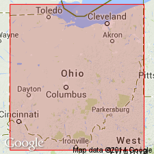
Utica Shale is one of the geographically most widely recognized lower Paleozoic stratigraphic units in the eastern Midcontinent. Present investigation centers on the unit in northern OH where it was first recognized by Orton (1888). Lower Utica here has been mapped previously as Cynthiana or Point Pleasant Formations. Graptolites show that in OH and IN, unit ranges from late Middle Ordovician to middle Late Ordovician. A tongue of the Utica extends westward and can be traced into the lower Maquoketa Group in the Upper Mississippi Valley, but the main distribution area of the Utica lithofacies is east of the WI-MI and IL-IN borders. Shows considerable age differences locally and regionally. In Seneca Co., where thickness varies from less than 100 ft to about 350 ft, unit is Cincinnatian (middle Edenian to middle-upper Maysvillian). Contact with underlying Trenton Limestone is disconformable and graptolite evidence indicates that missing strata corresponds to the lower Edenian and possibly upper Mohawkian. Utica is stratigraphically most extensive in the Sebee Trough in southwestern OH and southeastern IN.
Source: GNU records (USGS DDS-6; Reston GNULEX).
- Usage in publication:
-
- Utica Shale*
- Modifications:
-
- Age modified
- AAPG geologic province:
-
- Appalachian basin
Summary:
In section C-C' the Utica Shale is of Middle Ordovician, Shermanian age based on correlations to PA. [This refutes the Late Ordovician, Edenian age assigned to the Utica by Ryder (1992, USGS Misc. Inv. Series Map, I-2264; 1992, USGS Bull.1839-G, p. G1-G25).]
Source: GNU records (USGS DDS-6; Reston GNULEX).
- Usage in publication:
-
- Utica Shale*
- Modifications:
-
- Areal extent
- Age modified
- AAPG geologic province:
-
- Appalachian basin
Summary:
In cross section E-E', in the subsurface of eastern OH, Utica Shale is used for dark-gray to black shale and argillaceous, micritic limestone that correlates with the upper part of the Trenton Group. Includes Cynthiana Formation of Calvert (1964). Utica preferred over Cynthiana because it more closely resembles black shale beds of the Utica in PA and NY. Age is Late Ordovician (Edenian) based on fossils. [This age assignment subsequently refuted by Ryder and others, 1992, USGS Bull.1839-K, p. K1-K32.]
Source: GNU records (USGS DDS-6; Reston GNULEX).
- Usage in publication:
-
- Utica Shale
- Modifications:
-
- Revised
- Figure
- AAPG geologic province:
-
- Appalachian basin
Summary:
The Utica Shale is divided in the Mohawk Valley into upper and lower parts by a tongue of the Dolgeville Formation and these parts are here assigned member names. The lower portion of the Utica is named the Flat Creek Member and the upper, the Indian Castle Member. These lithostratigraphic units replace earlier names such as the Canajoharie Shale, which are primarily biostratigraphic. Revised stratigraphic correlations based on reinterpretation of graptolites and K-bentonites in the area suggest that the lower part of the Utica Shale is the lateral equivalent of a large part of the lower Trenton Group and is older than the Denley Limestone, with which it has been previously equated. The Flat Creek Member overlies the early to middle Kirkfieldian Kings Falls Limestone of the Trenton Group at Canajoharie Creek and interfingers with the Sugar River Limestone of the Trenton Group to the west. The Trenton-Utica succession is a transgressive sequence. Westward, the Dolgeville grades into the lower Denley and the Utica (equivalent to only the upper Utica of the east) disconformably overlies the Denley and Steuben Limestones of the Trenton Group. The Utica underlies the Frankfort Formation throughout the study area. Age of the Utica between Chuctanunda Creek and Caroga Creek, ranges from Kirkfieldian (Mohawkian) to Edenian (Cincinnatian). Formation youngs westward and at Trenton Falls the entire unit is shown as Maysvillian (Cincinnatian). The following figure is adapted from Fig. 14 of Goldman and others (1994). Their cross-section shows age and facies relationships of the Utica Shale, Trenton Group, and adjacent units. The columns shown here were extracted from that diagram in an attempt to show the time transgressive nature of the Utica and the stratigraphic position of its newly named members. Ages and relationships are approximate. Dashed lines are used where contacts are gradational or interfingering. [Sorry folks, I have not yet included GNU's figure --came over from cd-rom as gibberish. For time being, please see fig. 14 of Goldman and others (1994)]
Source: GNU records (USGS DDS-6; Reston GNULEX).

- Usage in publication:
-
- Utica Shale*
- Modifications:
-
- Overview
- AAPG geologic province:
-
- Appalachian basin
Summary:
Nautiloid fauna of Clays Ferry Formation of KY and of Kope Formation of IN and OH are most similar to those of coeval Utica Shale in NY and Whitby Formation in southern Ontario.
Source: GNU records (USGS DDS-6; Reston GNULEX).
For more information, please contact Nancy Stamm, Geologic Names Committee Secretary.
Asterisk (*) indicates published by U.S. Geological Survey authors.
"No current usage" (†) implies that a name has been abandoned or has fallen into disuse. Former usage and, if known, replacement name given in parentheses ( ).
Slash (/) indicates name conflicts with nomenclatural guidelines (CSN, 1933; ACSN, 1961, 1970; NACSN, 1983, 2005, 2021). May be explained within brackets ([ ]).