The National Geologic Map Database is migrating to a new infrastructure. We apologize for any service disruptions during this process.
|
|---|


- Usage in publication:
-
- Woodman formation*
- Modifications:
-
- Original reference
- Dominant lithology:
-
- Sandstone
- Limestone
- AAPG geologic province:
-
- Great Basin province
Summary:
Pg. 421-432. Woodman formation. Lower part is dominantly calcareous sandstone and upper part sandy limestone. The sandstone is 200+/- feet thick, generally purplish or reddish brown, fine-grained, and contains small amount of calcite as cement. Thin lenses of limestone and shale are interbedded with the sandstone. Greater part of upper division is dark-gray to almost black sandy limestone that weathers to light brown to pinkish. Nodules of dark-gray to black chert are abundant, many of them a foot in diameter. Interbedded with the limestones are calcareous sandstones. A few beds of relatively pure limestone are also present. Thickness 1,500+/- feet. Contains upper Mississippian fossils. Overlies Madison limestone and underlies Ochre Mountain limestone.
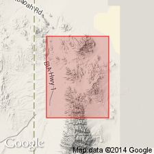
Named for fact it underlies Woodman Peak, on south end of Dutch Mountain, Gold Hill region, western UT.
[See also USGS Prof. Paper 177, 1934.]
Source: US geologic names lexicon (USGS Bull. 896, p. 2367).
- Usage in publication:
-
- Woodman formation*
- Modifications:
-
- Overview
- AAPG geologic province:
-
- Great Basin province
Summary:
Lower part of the Woodman Formation is dominantly calcareous sandstone and the upper part is sandy limestone. The sandstone is approximately 200 ft. thick, generally purplish or reddish brown, fine-grained, and contains small amounts of calcite as cement. Thin lenses of limestone and shale are interbedded with the sandstone. The greater part of the upper division is dark-gray to almost black sandy limestone that weathers to light brown to pinkish. Nodules of dark-gray to black chert are abundant, many of them a foot in diameter. Interbedded with the limestones are calcareous sandstones. A few beds of relatively pure limestone are also present. Thickness is approximately 1500 ft. Contains Late Mississippian fossils. Overlies the Madison limestone and underlies the Ochre Mountain limestone. Named for the fact that it underlies Woodman Peak, on the south end of Dutch Mountain, Gold Hill region. (B896)
Source: GNU records (USGS DDS-6; Menlo GNULEX).
- Usage in publication:
-
- Woodman formation*
- Modifications:
-
- Areal extent
- AAPG geologic province:
-
- Great Basin province
Summary:
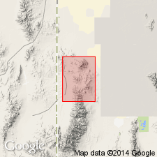
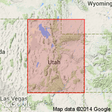
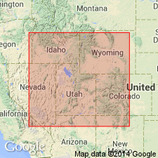
Geographically extended from Gold Hill district (Nolan, 1935) to northern part of Dugway Range, Tooele Co, UT in the Great Basin province. Occurs only in extreme northern part of mapped area. Section 786 ft thick measured on north side of Buckhorn Canyon where formation overlies Madison limestone equivalent and underlies Ochre Mountain limestone. Consists of reddish-brown calcareous siltstone in lower half and light-gray silty limestone in upper half. Base placed at base of lowest siltstone and top placed at top of uppermost silty limestone. Rocks above and below Woodman are limestone and do not contain any siltstone. Coral and brachiopod fossils collected (listed). Of Late Mississippian age. Geologic map.
Source: GNU records (USGS DDS-6; Denver GNULEX).
- Usage in publication:
-
- Woodman Formation*
- Modifications:
-
- Revised
- Overview
- AAPG geologic province:
-
- Great Basin province
Summary:
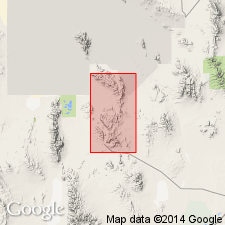
Lower part of Woodman Formation described in Buckhorn Canyon, Dugway Range, Tooele Co, UT, Great Basin province. Divisible into a lower phosphatic member and overlying Needle Siltstone Member (adopted). Phosphatic member overlies Joana Limestone. A phosphatic hardground forms Joana-phosphatic member contact. This lower member is a dark organic-rich starved-basin deposit laid down in Deseret starved basin west of a westward-prograding carbonate platform beginning in late Tournaisian time. Phosphatic member is composed of phosphorite, phosphatic shale and siltstone, bedded spiculitic and radiolarian chert, chertified phosphorite, and micritic limestone. Lower member is continuous into Deseret Limestone, Chainman Shale, Little Flat, Woodman and Deep Creek Formation. Overlying Needle Siltstone Member (adopted) is a bioturbated distal-flysch unit deposited as a result of lowering sea level as floods of clastic sediments swept east from the nearly filled trough across a shallow submarine rise. These younger sediments intertongued with and overwhelmed the starved basin sediments. Of late Tournaisian and early Visean (Osagean and Meramecian) age. Conformably overlain by Skunk Spring Limestone Bed. Cross section. Paleogeographic representations.
Source: GNU records (USGS DDS-6; Denver GNULEX).
- Usage in publication:
-
- Woodman Formation*
- Modifications:
-
- Revised
- Overview
- AAPG geologic province:
-
- Great Basin province
Summary:
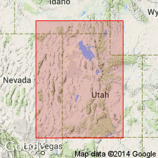
Divided into (ascending order): Delle Phosphatic Member (new) of Osagean and Meramecian age, Needle Siltstone Member, and thin-bedded limestone member of Meramecian age in the Lakeside Mountains (location of type Delle), Tooele Co, and at Woodman Peak in the Deep Creek Mountains, Juab and Tooele Cos, UT in Great Basin province. Woodman lies in the foreland basin. Delle was called phosphatic member in earlier reports. Woodman overlies Joana Limestone at Woodman Peak and Woodhurst Member of Lodgepole Limestone in South Lakeside Mountains. Basal contact is a hardground developed on the Joana and Woodhurst. Woodman underlies Ochre Mountain Limestone at Woodman Peak and Great Blue Limestone in South Lakeside Mountains. Delle also assigned as basal member of Aspen Range, Little Flat and Deep Creek Formations, and of Chainman Shale, Deseret Limestone, and Brazer Dolomite at other localities. Correlation of Woodman with other lithostratigraphic units in Great Basin province and on Wasatch uplift, UT, and in Snake River basin, ID, shown on correlation chart.
Source: GNU records (USGS DDS-6; Denver GNULEX).
- Usage in publication:
-
- Woodman Formation*
- Modifications:
-
- Age modified
- Areal extent
- AAPG geologic province:
-
- Great Basin province
Summary:
Unit is geographically extended (as its Needle Siltstone Member) into the South Lakeside Mountains (Late Mississippian), and the Silver Island Mountains (Early and Late Mississippian). Specifically, age is revised in both the Dugway Range and northern Deep Creek Mountains from Late Mississippian to: Early and Late Mississippian. Overall unit age is revised from Late Mississippian to: Early and Late Mississippian based on fossils [conodonts].
Source: GNU records (USGS DDS-6; Menlo GNULEX).
For more information, please contact Nancy Stamm, Geologic Names Committee Secretary.
Asterisk (*) indicates published by U.S. Geological Survey authors.
"No current usage" (†) implies that a name has been abandoned or has fallen into disuse. Former usage and, if known, replacement name given in parentheses ( ).
Slash (/) indicates name conflicts with nomenclatural guidelines (CSN, 1933; ACSN, 1961, 1970; NACSN, 1983, 2005, 2021). May be explained within brackets ([ ]).