

- Usage in publication:
-
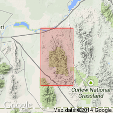
- Wells formation*
- Modifications:
-
- Named
- Dominant lithology:
-
- Sandstone
- Limestone
- Quartzite
- AAPG geologic province:
-
- Wasatch uplift
Summary:
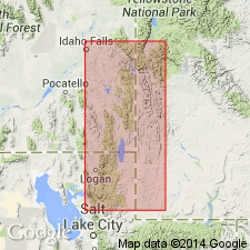
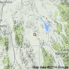
Named for Wells Canyon, T10S, R45E, Caribou Co, ID on the Wasatch uplift. Type locality designated as section 2,400 ft thick that was measured on north side of Wells Canyon. Consists of: red, white sandstone that may be fine grained, calcareous to quartzitic, and cross-bedded; brown to dark gray limestone that may be sandy and cherty; white, laminated and cross-bedded quartzite; and blue gray chert at type where it overlies undesignated upper Mississippian limestone. Is older than Phosphoria formation (new). Divisible into a lower sandy and cherty limestone series, middle sandy series, and upper calcareous sandstone or siliceous limestone series, but exact correspondence of these series to Morgan, Weber, and Park City formations not known. Fossils listed--brachiopods, corals, mollusks. Of Pennsylvanian or Carboniferous age.
Source: GNU records (USGS DDS-6; Denver GNULEX).
- Usage in publication:
-
- Wells formation*
- Modifications:
-
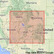
- Areal extent
- AAPG geologic province:
-
- Green River basin
Summary:
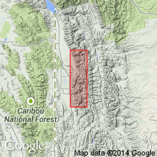
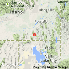
Extended eastward from Wells Canyon, Caribou Co, ID. Mapped (reconnaissance map) in the Salt River Range, northern Lincoln Co, WY in the Greater Green River basin where it overlies Brazer limestone and underlies Phosphoria formation. Is more than 2,000 ft thick. Composed of massive cherty limestone at base that is more siliceous than underlying Brazer or Madison, and a middle portion of sandstone that locally is a quartzite, and an upper 50-200 ft ledge-forming limestone at top. Lower beds have brachiopod, bryozoan, etc. fossils. Of Pennsylvanian, Carboniferous age. [Name Weber quartzite applied to the rocks in earlier reports.]
Source: GNU records (USGS DDS-6; Denver GNULEX).
- Usage in publication:
-
- Wells formation*
- Modifications:
-
- Revised
- AAPG geologic province:
-
- Snake River basin
- Wasatch uplift
- Yellowstone province
Summary:
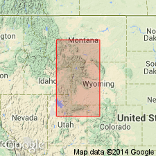
Upper siliceous limestone of Mansfield's (1927) Wells is assigned to Grandeur tongue of Park City. Wells as restricted consists of sandstone, red beds and carbonate beneath Grandeur. Restricted Wells occurs in southeast ID (Snake River basin, Wasatch uplift) and northern UT (Wasatch uplift). Contains beds of Pennsylvanian and Early Permian age.
Source: GNU records (USGS DDS-6; Denver GNULEX).
- Usage in publication:
-
- Wells formation
- Modifications:
-
- Revised
- AAPG geologic province:
-
- Great Basin province
- Snake River basin
Summary:
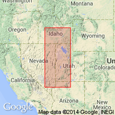
Divided into (ascending order): Calder Creek, Heglar Canyon, Sublett, and Indian Fork members (all new) of the Wells formation in Sublett Mountains, ID in the Great Basin province and Snake River basin. Overlies Milligen formation; underlies Grandeur member of Park City formation. New members shown only on chart, no description or definition included for any of them. [Member names should be considered invalid.]
Source: GNU records (USGS DDS-6; Denver GNULEX).
- Usage in publication:
-
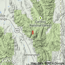
- Wells Formation*
- Modifications:
-
- Revised
- AAPG geologic province:
-
- Snake River basin
Summary:
Overlies newly named Monroe Canyon Limestone of Chesterfield Range Group in Bannock Co, ID in the Chesterfield Range, Snake River basin, replacement terms for Brazer Limestone. Contains marine fossils of late Early or Middle Pennsylvanian age.
Source: GNU records (USGS DDS-6; Denver GNULEX).
- Usage in publication:
-
- Wells Formation
- Modifications:
-
- Revised
- AAPG geologic province:
-
- Great Basin province
- Snake River basin
Summary:
Divided into Calder Creek Member (Springeran and Morrowan), Helgar Canyon Member (Derryan), Sublett Member (Desmoinesian, Missourian, Virgilian), and Indian Fork Member (Wolfcampian). Indian Fork underlies Hudspeth Cutoff Sandstone a new unit in Sublett Range, ID, Great Basin province and Snake River basin. [These members were first used by Bissell (1960). No definition of them has been published.]
Source: GNU records (USGS DDS-6; Denver GNULEX).
- Usage in publication:
-
- Wells Formation
- Modifications:
-
- Not used
Summary:
Authors state (p. A5) that Wells used at one time in the mountain ranges south of Yellowstone in WY as a unit "equivalent to the Amsden Formation of central WY" or to "the underlying Brazer Limestone." Brief historical account of usage for Lincoln and Sublette Cos, northern Greater Green River basin from 1942 to 1958 given. Section C-C' on Plate 11, for example, shows sequence in southwest WY as Madison Group (base), Amsden Formation, and Tensleep Sandstone (top). Term Wells Formation not used in WY. [Regional aspect of areal restriction of Wells, despite its use on many geologic maps of Lincoln and Sublette Cos, not discussed. No correlation chart included showing relationship of Wells and Amsden.] Wells shown at one station on section B-B', Plate 11 as a unit of Atokan [and younger?] age unconformably above Monroe Canyon Limestone.
Source: GNU records (USGS DDS-6; Denver GNULEX).
- Usage in publication:
-
- Wells Formation*
- Modifications:
-
- Overview
- Areal extent
- AAPG geologic province:
-
- Snake River basin
- Green River basin
Summary:
Names applied to Pennsylvanian sequence in thrust belt of southwest WY, Greater Green River basin shown differently on two correlation charts in this chapter. Figure 3 (ascending): upper part of Ranchester Limestone Member (Morrowan) of Amsden Formation and Tensleep Sandstone (Atokan and younger Pennsylvanian). In contrast, figure 10 shows (ascending): Round Valley Limestone (Morrowan and Atokan) [a name not previously used in thrust belt; name Amsden used by most geologists for these rocks] and lower member of Wells Formation (Atokan to Virgilian). Pennsylvanian sequence in Chesterfield Range, ID, Snake River basin represented only by post-Atokan Pennsylvanian Wells Formation. Late Pennsylvanian fusulinids found in Wells in thrust belt (p. U32). Text states Pennsylvanian rocks of mountain ranges of southwest WY are assigned to the lower member of the Wells Formation, and that some of the "Lower Pennsylvanian" could be Round Valley or Ranchester. Pennsylvanian rocks described as sandy dolomite and dolomitic limestone interbedded with sandstone and mudstone that grade upward into thick- to medium-bedded limestone. [Reason for presentation of two different sequences in same area not stated.]
Source: GNU records (USGS DDS-6; Denver GNULEX).
- Usage in publication:
-
- Wells Formation
- Modifications:
-
- Not used
Summary:
Rocks formerly assigned to the Wells Formation by Bissell (1960) and by Cramer (1971) in Oneida and Cassia Cos, ID reassigned to Oquirrh Group because of their lithologic similarity to the Oquirrh. Rocks formerly called Calder Creek Member, basal member of Wells, are redesignated basal Oquirrh Group, an unnamed informal unit designation. The Heglar Canyon Member of Wells is raised in stratigraphic rank to Heglar Canyon Formation and is assigned to the Oquirrh Group. The Sublett Member of the Wells is abandoned. Sublett is equivalent to Tussing Formation of this report. Indian Fork Member of Wells is abandoned. Indian Fork is equivalent to part of the Tussing and the overlying Trail Canyon Formation of this report. The Trail Canyon and Hudspeth Cutoff Members of the Wells are raised in stratigraphic rank to formation and are reassigned to Oquirrh Group. Nomenclature chart. Geologic map. Columnar section.
Source: GNU records (USGS DDS-6; Denver GNULEX).
- Usage in publication:
-
- Wells Formation*
- Modifications:
-
- Revised
- AAPG geologic province:
-
- Wasatch uplift
Summary:
Revised in that Wells Formation unconformably overlies the newly named Aspen Range Formation in North Georgetown Canyon, Aspen Range, Bear Lake Co, ID on the Wasatch uplift. Rocks called Aspen Range in this report were assigned to Deseret equivalent and to Brazer Limestone in earlier reports. Of Pennsylvanian and Permian age. Correlation chart. Cross section.
Source: GNU records (USGS DDS-6; Denver GNULEX).
- Usage in publication:
-
- Wells Formation*
- Modifications:
-
- Age modified
- AAPG geologic province:
-
- Wasatch uplift
Summary:
The basal part [upper part not discussed] of the Wells Formation is dated as late Chesterian, Late Mississippian age on basis of presence of PRIMUS Zone conodont fossils. Late Mississippian part of Wells present in Crawford Mountains, Laketown Canyon, UT and Aspen Range, ID on the Wasatch uplift. Correlation charts.
Source: GNU records (USGS DDS-6; Denver GNULEX).
For more information, please contact Nancy Stamm, Geologic Names Committee Secretary.
Asterisk (*) indicates published by U.S. Geological Survey authors.
"No current usage" (†) implies that a name has been abandoned or has fallen into disuse. Former usage and, if known, replacement name given in parentheses ( ).
Slash (/) indicates name conflicts with nomenclatural guidelines (CSN, 1933; ACSN, 1961, 1970; NACSN, 1983, 2005, 2021). May be explained within brackets ([ ]).