

- Usage in publication:
-
- Wallace formation*
- Modifications:
-
- First used
- Dominant lithology:
-
- Shale
- Sandstone
- Limestone
- AAPG geologic province:
-
- Northern Rocky Mountain region
Summary:
Intent to name not stated. Is well exposed at town of Wallace [source of name], particularly at Northern Pacific RR station, T48N, R4E, Shoshone Co, ID in Northern Rocky Mountain region. No type locality designated. Is widespread in Coeur d'Alene district. Occurs along Beaver Creek and along southern border of the district. Is a heterogeneous unit composed dominantly of thin-bedded green shale, impure limestone, blue-gray argillite, and calcareous quartzite. Nearly all the beds contain calcite, dolomite, and siderite that give yellowish tint to weathered exposures. Rocks highly fissile and have a waxy luster. Sequence is green argillite (base) followed by alternating thin beds of sandstone, limestone, and shale, with thin-bedded sandy shale (top). Is 2,500 +/-ft thick. Shallow water features--ripple marks, etc--common. Overlies St. Regis formation (first used). Underlies Striped Peak formation (first used). Of Algonkian age. No fossils have been found.
Source: GNU records (USGS DDS-6; Denver GNULEX).
- Usage in publication:
-
- Wallace limestone
- Modifications:
-
- Revised
- AAPG geologic province:
-
- Northern Rocky Mountain region
Summary:
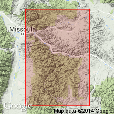
A name from the Coeur d'Alene district, northern ID, that is recognized in the Missoula area, Missoula Co, MT in the Northern Rocky Mountain region. Underlies Miller Peak formation (first published use) of Missoula group (first published use) of Belt series. Considered to be a correlative (correlation chart) of: 1) Siyeh limestone of Mission Range and Glacier Park, MT, Purcell Range, ID and MT, and of areas east of Missoula near Blackfoot Canyon, MT; 2) Helena limestone of Belt Mountains area, MT; and 3) Newland limestone of Phillipsburg area, Granite Co, MT. Of Algonkian age.
Source: GNU records (USGS DDS-6; Denver GNULEX).
- Usage in publication:
-
- Wallace formation*
- Modifications:
-
- Areal extent
- Overview
- AAPG geologic province:
-
- Northern Rocky Mountain region
Summary:
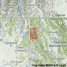
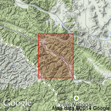
Name used in Libby quad, MT, Northern Rocky Mountain region as a formation of the Belt series, rather than Newland formation, because it can be correlated with the Wallace of the Coeur d'Alene district. Correlation chart. Geologic map. Overlies Ravalli formation. Underlies Striped Peak formation. Estimated as 12,000 ft thick. Considered heterogeneous lithologically; lithologic content described in detail. Has molar-tooth structures in its dolomite and dolomitic limestone. Shallow-water environment features in Wallace include ripple marks, sun cracks, cross-beds. Of pre-Cambrian age.
Source: GNU records (USGS DDS-6; Denver GNULEX).
- Usage in publication:
-
- Wallace formation*
- Modifications:
-
- Contact revised
- AAPG geologic province:
-
- Northern Rocky Mountain region
Summary:
Upper contact revised in that Wallace formation of Belt series underlies newly named Spruce formation of Missoula group of Belt series. Upper contact marked by a lithologic change from interbedded quartzite, argillite, and carbonate of the Wallace to very thin and even-bedded, light-green quartzose argillite alternating with medium-green, very fine grained, thin-bedded quartzite of the Spruce. Occurs extensively in the central-east and southwest part of map. Geologic map. Is about 10,000 ft thick. Mapped area lies in the Northern Rocky Mountain region. Overlies St. Regis formation of the Belt series. Of Precambrian age.
Source: GNU records (USGS DDS-6; Denver GNULEX).

- Usage in publication:
-
- Wallace Formation
- Modifications:
-
- Areal extent
- Overview
- AAPG geologic province:
-
- Northern Rocky Mountain region
Summary:
Middle Belt carbonate (Precambrian) above the Ravalli Group and beneath the Missoula Group changes facies from almost pure dolomite (Helena Formation) in the east one-third of the Belt basin to clastic carbonatic rock (Wallace Formation) in the west part of the basin, Northern Rocky Mountain region. Helena replaces Siyeh Limestone; extends from Whitefish Range to Highland Mountains, MT; underlies Snowslip Formation. Wallace underlies Miller Peak Formation in middle area and Striped Peak Formation in west area (ID, WA). Helena and Wallace are equivalent to Kitchener Formation of the Purcell Supergroup of Canada. See figs. 4 and 5 for correlation with other formations.
Source: GNU records (USGS DDS-6; Denver GNULEX).

- Usage in publication:
-
- Wallace Formation*
- Modifications:
-
- Geochronologic dating
- AAPG geologic province:
-
- Idaho Mountains province
Summary:
Pg. 16, geologic time scale (inside front cover). Wallace Formation [Middle Proterozoic] of Belt Supergroup. Gabbro sample from coarse-grained dike intruding formation, in roadcut on Bluff Creek, Simmon Peak 15-min quadrangle, Shoshone County, Idaho, yielded a K-Ar age of 5,190 +/-940 Ma (plagioclase). Calculated age is spurious; actual age probably Cretaceous or Paleocene. Lamprophyre sample from dike intruding formation, in roadcut at confluence of St. Joe River and North Fork of St. Joe River [just east of Avery], Wallace 15-min quadrangle, [Shoshone] County, Idaho, yielded a K-Ar age of 57.5 +/-2.0 Ma (hornblende), apparent age of dike [Paleocene, based on time scale of Berggren, 1972, Lethaia, v. 5, no. 2, p. 195-215]. Ages calculated using decay constants of Steiger and Jager, 1977 (Earth Planet. Sci. Letters, v. 36, p. 359-362).
Source: Publication.
For more information, please contact Nancy Stamm, Geologic Names Committee Secretary.
Asterisk (*) indicates published by U.S. Geological Survey authors.
"No current usage" (†) implies that a name has been abandoned or has fallen into disuse. Former usage and, if known, replacement name given in parentheses ( ).
Slash (/) indicates name conflicts with nomenclatural guidelines (CSN, 1933; ACSN, 1961, 1970; NACSN, 1983, 2005, 2021). May be explained within brackets ([ ]).