The National Geologic Map Database is migrating to a new infrastructure. We apologize for any service disruptions during this process.
|
|---|


- Usage in publication:
-
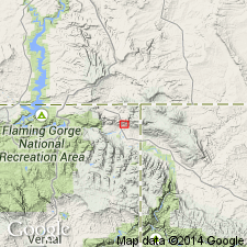
- Uinta Mountain group
- Modifications:
-
- Revised
- AAPG geologic province:
-
- Southern Rocky Mountain region
Summary:
Divided into two formations--the Mutual quartzite at base and Red Pine shale (new) at top--in western Uinta Mountains, Summit Co, UT in the Southern Rocky Mountain region. Red Pine of this report was called "Ophir" in earlier reports. A new member 820 ft thick at the top of the Mutual named Box Canyon member. Overlies an unnamed yellow and buff quartzite and brown micaceous sequence of pre-Cambrian age. Unconformably underlies the Cambrian Tintic quartzite. Columnar section. Geologic map. Of pre-Cambrian age.
Source: GNU records (USGS DDS-6; Denver GNULEX).

- Usage in publication:
-
- Uinta Mountain Group*
- Modifications:
-
- Geochronologic dating
- AAPG geologic province:
-
- Southern Rocky Mountain region
Summary:
Rb/Sr whole rock age of 952 +/-5 m.y. obtained from Red Pine Shale cutting from the Shell Oil Dahlgreen Creek Government Well No. 1 (SE1/4 NE1/4 NW1/4 sec 9, T2N, R14E) Summit Co, UT in the Southern Rocky Mountain region. Red Pine Shale is upper formation of Uinta Mountain Group. The K-Ar dates of 1,520 to 1,550 m.y. on Red Creek Quartzite beneath the Uinta Mountain Group provide limits of 1,400 to 950 for the group. These limits suggest equivalency to Belt Supergroup of MT and Big Cottonwood Formation of UT. Age changed from Precambrian to Precambrian Y.
Source: GNU records (USGS DDS-6; Denver GNULEX).
- Usage in publication:
-
- Uinta Mountain Group*
- Modifications:
-
- Overview
- AAPG geologic province:
-
- Southern Rocky Mountain region
Summary:
Name and rank changed from original and invalid Uinta sandstone. Has not been subdivided in CO. Provisionally dated at 950 to 1,400 m.y. (Precambrian Y). Used in Uinta Mountains in the Southern Rocky Mountain region.
Source: GNU records (USGS DDS-6; Denver GNULEX).
- Usage in publication:
-
- Uinta Mountain Group*
- Modifications:
-
- Age modified
- AAPG geologic province:
-
- Southern Rocky Mountain region
Summary:
Assigned a Middle Proterozoic age [a replacement term for Precambrian Y] where it crops out in Moffat Co, CO, and in Daggett Co, UT, both in the Southern Rocky Mountain region. Is about 7,000 m thick. Consists of red, cross-bedded, locally pebbly sandstone, and locally gray, green and red silty shale. Red Pine Shale present in upper part at west edge of map. Considered younger than the Red Creek Quartzite of Early Proterozoic and Late Archean age. Is older than the Lodore Formation of Late Cambrian age.
Source: GNU records (USGS DDS-6; Denver GNULEX).
- Usage in publication:
-
- Uinta Mountain Group
- Modifications:
-
- Revised
- AAPG geologic province:
-
- Southern Rocky Mountain region
Summary:
Revised to include sandstone and arkosic rocks named Mount Watson Formation (new) in southwest Summit Co, western Uinta Mountains, northern UT, in the Southern Rocky Mountain region. Is bounded by informally designated units: formation of Hades Pass (upper contact) and formation of Red Castle or Moosehorn Lake (lower contacts), all described by Wallace (1972) in an unpublished PhD thesis. Group correlated with Big Cottonwood Group of Wasatch Mountains area. Is Precambrian Y in age.
Source: GNU records (USGS DDS-6; Denver GNULEX).
- Usage in publication:
-
- Uinta Mountain Group
- Modifications:
-
- Revised
- AAPG geologic province:
-
- Southern Rocky Mountain region
Summary:
Revised to contain basal sandy, conglomeratic unit named Jesse Ewing Canyon Formation (new) in eastern Uinta Mountains, northeast Daggett Co, northeast UT in the Southern Rocky Mountain region. Nonconformably overlies Red Creek Quartzite. Is Middle Proterozoic in age.
Source: GNU records (USGS DDS-6; Denver GNULEX).
- Usage in publication:
-
- Uinta Mountain Group*
- Modifications:
-
- Areal extent
- Overview
- AAPG geologic province:
-
- Southern Rocky Mountain region
Summary:
Composed of quartzite, sandstone, conglomerate, and subordinate shale, predominately red, 7+ km thick. Lies unconformably on highly metamorphosed and deformed Red Creek Quartzite and on Early Proterozoic and Archean gneisses. Has age range of 925 to 1,100 m.y. from Rb-Sr whole-rock method on shale. Thought to be correlative with Belt Supergroup of MT, Big Cottonwood Group of UT, and upper part of Grand Canyon Supergroup of AZ. Forms core of Uinta Mountains and is known in subsurface to east at least to longitude of Craig, CO and to west on south flank of Uinta Mountains in the Southern Rocky Mountain region. Is of fluvial origin to east; shallow-water marine to south. Was deposited in a subsiding fault bounded trough of east-west trend.
Source: GNU records (USGS DDS-6; Denver GNULEX).
- Usage in publication:
-
- Uinta Mountain Group
- Modifications:
-
- Paleomagnetics
- AAPG geologic province:
-
- Southern Rocky Mountain region
Summary:
Chuar Group of Grand Canyon Supergroup correlates with Uinta Mountain Group. The correlation between the two includes a westward shift in pole position near top of both. This is also in agreement with correlation of microbiotas from Red Pine Shale of Uinta Mountain Group and from Kwagunt Formation of Chuar. Lies in the Southern Rocky Mountain region of northeast UT.
Source: GNU records (USGS DDS-6; Denver GNULEX).

- Usage in publication:
-
- Uinta Mountain Group*
- Modifications:
-
- Age modified
- AAPG geologic province:
-
- Southern Rocky Mountain region
Summary:
Exposed in Uinta Mountains in an area 200 km and 40 m wide, 7.3 km thick (east), 4 km thick (west) in Southern Rocky Mountain region. Has a westerly pole position in sandstone beneath Red Pine Shale, upper formation of Uinta Mountain Group. Red Pine has been correlated with Kwagunt Formation, upper formation of Chuar Group of Grand Canyon Supergroup. Age modified from Middle Proterozoic to early Late Proterozoic on basis of presence of CHUARIA-bearing acritarchs and vase-shaped chitinozoan-like microfossils and paleomagnetic evidence. The fossils have been found in the Red Pine Shale and in the Kwagunt Formation, and they predate Windermere Supergroup. Correlation chart. Paleomagnetic and paleontologic information support correlation of Chuar and Uinta Mountain Groups; these two groups have coincident paleomagnetic poles--a normal polarity for the lower part of each group and a westward polar shift of some reversely polarized rocks in the upper part of both groups. Uinta Mountain may have been deposited on the north margin of the shallow Chuar sea or saline Chuar lake. Deposition could have begun about 900 Ma or less if it was deposited as a single uninterrupted unit.
Source: GNU records (USGS DDS-6; Denver GNULEX).
For more information, please contact Nancy Stamm, Geologic Names Committee Secretary.
Asterisk (*) indicates published by U.S. Geological Survey authors.
"No current usage" (†) implies that a name has been abandoned or has fallen into disuse. Former usage and, if known, replacement name given in parentheses ( ).
Slash (/) indicates name conflicts with nomenclatural guidelines (CSN, 1933; ACSN, 1961, 1970; NACSN, 1983, 2005, 2021). May be explained within brackets ([ ]).