

- Usage in publication:
-
- Todilto formation*
- Modifications:
-
- Named
- Dominant lithology:
-
- Limestone
- AAPG geologic province:
-
- San Juan basin
- Black Mesa basin
Summary:
Named as the middle formation of La Plata group for Todilto Park, T20N, R20W, McKinley Co, NM in the San Juan basin. No type locality designated. Caps Wingate sandstone. Is older than Navajo sandstone. Ranges from 2 to 200 ft thick. Two measured sections. Geologic map. Mapped into adjoining Apache and Navajo Cos, AZ in the Black Mesa basin. Consists of blue-gray, dense, resistant limestone overlain and underlain by white calcareous sandstone at one locality in Apache Co, and of limestone conglomerate separated by calcareous shale and sandstone beds in Navajo Co. Navajo-Todilto contact usually conformable. Well worn fragments of black, gray, and white chert found near top in sufficient quantities to form irregular bands embedded in the limestone. Middle part of La Plata (Todilto?) thickens northward and changes in that more sandstone and shale are found. Dinosaur tracks found at two localities. Assigned to Jurassic.
Source: GNU records (USGS DDS-6; Denver GNULEX).
- Usage in publication:
-
- Todilto(?) formation*
- Modifications:
-
- Overview
- AAPG geologic province:
-
- Paradox basin
Summary:
Rocks called Todilto? in this report were assigned to Wingate sandstone by Emery (1918). Name applied questionably in San Rafael Swell. Correlation with type in northwest NM and with beds assigned to Todilto in area between (San Juan River, San Juan Co, UT to Henry Mountains, Garfield Co, UT) uncertain. In San Rafael Swell, beds called Todilto? range from 44 to 240 ft thick and are composed of well-laminated, red and green shale, red brown sandstone and conglomerate. Limestone occurs locally. Overlies Wingate sandstone; underlies Navajo sandstone. Has scoured and filled channels. Has mudcracks. Was laid down probably by rapidly shifting currents in rivers or a tidal channel. Dinosaur tracks and pelecypod fossils found. Assigned to the Jurassic?.
Source: GNU records (USGS DDS-6; Denver GNULEX).
- Usage in publication:
-
- Todilto(?) formation*
- Modifications:
-
- Revised
- Areal extent
- AAPG geologic province:
-
- Plateau sedimentary province
Summary:
Is the middle formation of the Glen Canyon group (named). Mapped with Wingate sandstone in the Waterpocket Fold area of Garfield Co, UT, Paradox basin, and Kane Co, UT, Plateau sedimentary province. Mapped with the underlying Wingate sandstone and overlying Navajo sandstone of the Glen Canyon group on both sides of the Paria river at west side of geologic map. Identification questioned in report area because of uncertainty about equivalence of this map unit with Todilto at its type which is a limestone and calcareous, generally less than 10 ft thick. Todilto? of report area is a maroon and red-brown calcareous sandstone with varying amount of shale and limestone. Is 150 to 220 ft thick along Waterpocket Fold. Is very distinctive from both Wingate and Navajo. Assigned to the Jurassic?.
Source: GNU records (USGS DDS-6; Denver GNULEX).
- Usage in publication:
-
- Todilto limestone*
- Modifications:
-
- Overview
- AAPG geologic province:
-
- San Juan basin
Summary:
Thought to correlate with the Pony Express limestone member (revised) of Morrison formation of the San Juan and Paradox basins.
Source: GNU records (USGS DDS-6; Denver GNULEX).
- Usage in publication:
-
- Todilto limestone member*
- Modifications:
-
- Areal extent
- AAPG geologic province:
-
- Las Vegas-Raton basin
- Palo Duro basin
Summary:
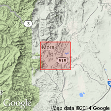
Mapped as basal member of Upper Jurassic Morrison formation. Mapped in very narrow strip from south of Sapello south to near southeast edge of map of foothills of Sangre de Cristo Mountains. Study area within Mora and San Miguel Cos, NM, Las Vegas-Raton and Palo Duro basins. Overlies Wingate sandstone; underlies unnamed upper part of Morrison. Cross sections.
Source: GNU records (USGS DDS-6; Denver GNULEX).
- Usage in publication:
-
- Todilto gypsum member*
- Modifications:
-
- Areal extent
- AAPG geologic province:
-
- San Juan basin
Summary:
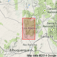
Mapped as the basal member of the Upper Jurassic Morrison formation. Overlies Upper Triassic Chinle formation. Consists of two thin- to platy-bedded, fetid limestone beds and an intervening thick bed of white gypsum. Overlain by the upper member of the Morrison. Mapped in a thin strip in the west part of the map, Sandoval Co, NM in the San Juan basin. Geologic map; cross sections.
Source: GNU records (USGS DDS-6; Denver GNULEX).
- Usage in publication:
-
- Todilto limestone*
- Modifications:
-
- Revised
- AAPG geologic province:
-
- Black Mesa basin
- Paradox basin
- San Juan basin
Summary:
Pg. 38-39, 40 (fig. 26), pls. 1, 3. Todilto limestone of San Rafael group. Described in Navajo country where it is considered of formational rank and included in San Rafael group. At type locality, consists of (ascending) 16 feet of mudstone, 4 feet of limestone, and 5 feet of mudstone. In this area, lower and upper contacts are sharp and irregular. Underlies Summerville formation; overlies Entrada. Near Ysidro, New Mexico (outside area of this report) formation includes section of gypsum 111 feet thick. Extends into southwestern Colorado. Age is Late Jurassic.
Source: Publication; US geologic names lexicon (USGS Bull. 1200, p. 3904-3905).
- Usage in publication:
-
- Todilto Limestone*
- Modifications:
-
- Revised
- Overview
- AAPG geologic province:
-
- Palo Duro basin
Summary:
Mapped in thin, north-south strip along eastern part of map within San Miguel Co, NM, Palo Duro basin. Locally absent south of Montezuma. Rank raised [though no discussion; unit had been mapped in Sangre de Cristo Mountains as basal member of Morrison Formation]. Overlies Entrada Sandstone; underlies Morrison Formation. Assigned Late Jurassic age.
Source: GNU records (USGS DDS-6; Denver GNULEX).
- Usage in publication:
-
- Todilto Limestone*
- Modifications:
-
- Areal extent
- Overview
- AAPG geologic province:
-
- Las Vegas-Raton basin
Summary:
Mapped about 4 mi south of La Cueva, Mora Co, NM, Las Vegas-Raton basin in southeastern part of study area. [Baltz and O'Neill (in press, IN New Mexico Geological Society Field Conference Guidebook) state that this is northernmost occurrence of known outcrops of Todilto in southeastern Sangre de Cristo Mountains area]. Outcrops are very localized and consist of 10 ft-thick gray bituminous limestone with thin to fissile and contorted bedding. Conformably overlies Entrada Sandstone; conformably underlies Morrison Formation. Assigned Middle Jurassic age.
Source: GNU records (USGS DDS-6; Denver GNULEX).

- Usage in publication:
-
- Todilto Formation
- Modifications:
-
- Revised
- Areal extent
- AAPG geologic province:
-
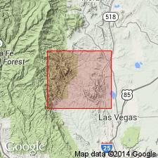
- Sierra Grande uplift
- Las Vegas-Raton basin
- Palo Duro basin
Summary:
Revised in that "Formation" used as the rank term and lower contact is with the Exeter Sandstone Member (restricted stratigraphically; rank changed) of Entrada Sandstone (extended areally into report area). Todilto is of limited areal extent. Present mainly in Union Co, NM on the Sierra Grande uplift and adjoining Las Animas Co, CO and Colfax Co, NM in the Las Vegas-Raton basin. Crops out also near Bull Canyon and Luciano Mesa east of Santa Rosa, Guadalupe Co, and at Romeroville, San Miguel Co, in the Palo Duro basin. Ranges from 0 to 13+ m thick. Variation in thickness resulted from relief on underlying Entrada dunes. Includes finely laminated petroliferous limestone, the upper part of which is brecciated and microfolded at Romeroville near Las Vegas, gray-white gypsum, and some gray and green cross-bedded sandstone. Distribution and facies map. Cross sections. Other lacustrine lithologies are peripheral to and between three major areas of limestone and gypsum deposition. Lower contact with main body of Entrada Sandstone (called Exeter Sandstone by other workers) is sharp. Deposited in shallow, low-energy water body. Fossils: neoptergyian fishes, ostracods, insect, worm burrows. Probably middle Callovian, Middle Jurassic age. Has some of same fossils as those found in Sundance Formation. Environment of deposition discussed. Shown as pinching out into Exeter Member (restricted to upper part of former Exeter) of Entrada and as overlain by Bell Ranch Formation (correlation chart).
Source: GNU records (USGS DDS-6; Denver GNULEX).
- Usage in publication:
-
- Todilto Limestone Member*
- Modifications:
-
- Revised
- Reference
- AAPG geologic province:
-
- San Juan basin
- Black Mesa basin
Summary:
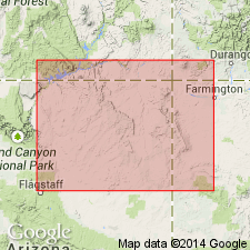
Reduced in rank from formation to member. Assigned to Wanakah Formation as basal member. Recognized throughout NM part of San Juan basin; also in Chama basin, NM and Black Mesa basin, AZ. Reference section established on Horse Mesa extends from sec 17, T38N, R31E, Apache Co, AZ, Black Mesa basin, to secs 26, 27, T29N, R21W, San Juan Co, NM, San Juan basin. Is 125 ft (38 m) thick at reference section and consists of limestone, gypsum, anhydrite, and minor amounts of sandstone and siltstone. Limestone is gray, laminated, structureless, and may contain algal structures, ostracods, and fish scales. White gypsum at or near surface, and anhydrite (mostly) in subsurface overlies limestone in part of basin (fig. 5). Near west margin of basin, limestone grades laterally into calcareous sandstone and siltstone of Beclabito Member (new) of Wanakah. May have been deposited in fresh- to saline-inland lake or restricted marine basin (author prefers second interpretation). Pinches out to north at Beclabito Dome and to south at Navajo, McKinley Co. Its northward equivalent in CO is Pony Express Limestone Member of Wanakah. Reassignment of Todilto to Wanakah makes base of Wanakah consistent in both states. NM-CO State line is used as separation point for use of Todilto-Pony Express. Overlies Entrada Sandstone; underlies Beclabito Member (new) of Wanakah. Assigned Middle Jurassic age. Areal limits of anhydrite-gypsum facies shown on fig 11.
Source: GNU records (USGS DDS-6; Denver GNULEX).
- Usage in publication:
-
- Todilto Limestone Member*
- Modifications:
-
- Areal extent
- AAPG geologic province:
-
- San Juan basin
Summary:
As the basal member of the Wanakah Formation, the Todilto pinches out under the Gallup Sag, McKinley Co, NM, San Juan basin, and the Beclabito Member of the Wanakah grades into the Cow Springs Sandstone. Todilto and Beclabito thicken eastward along the south side of the basin.
Source: GNU records (USGS DDS-6; Denver GNULEX).
- Usage in publication:
-
- Todilto Limestone Member
- Modifications:
-
- Overview
- AAPG geologic province:
-
- San Juan basin
Summary:
Todilto Limestone Member, basal member of Wanakah Formation in the San Juan basin and equivalent rocks --Todilto Limestone or Todilto Formation in east-central NM and the Pony Express Limestone Member of Wanakah in southwest CO --were deposited in a restricted marine embayment with an ephemeral connection to the Curtis-Summerville sea. Late in its development, the embayment became a completely enclosed body of gypsiferous water. The embayment extended 300 mi E-W and 250 mi N-S. The embayment was in the area of trade winds at a lat of 15-16 degrees N. Todilto carbonates have not been traced into marine sediments. The deposits are part of a shoaling upward sequence in a tidal environment in a hot, arid climate; the marine waters fluctuated from brackish to gypsiferous. Areal extent map shows the limestone and gypsiferous units in northern NM, southwest CO, and small area of easternmost AZ. Regionally, Todilto divisible into a lower limestone unit and an upper gypsum unit. The limestone unit can be subdivided into (ascending) platy zone, crinkly zone, and massive zone. The gypsum unit (0-110 ft thick) was deposited east of the study area in center of basin during its final phase. Only the limestone phase which is thin (5-25 ft thick) and extensive is present in the study area, the Grants district in San Juan basin of NM. Five measured sections in McKinley and Cibola Cos where Todilto overlies Entrada Sandstone and underlies Beclabito Member of Wanakah. Fossils: Marine calcareous algae indicate short periods of near-normal marine water; ostracods that lived in ephemeral gypsiferous ponds.
Source: GNU records (USGS DDS-6; Denver GNULEX).
For more information, please contact Nancy Stamm, Geologic Names Committee Secretary.
Asterisk (*) indicates published by U.S. Geological Survey authors.
"No current usage" (†) implies that a name has been abandoned or has fallen into disuse. Former usage and, if known, replacement name given in parentheses ( ).
Slash (/) indicates name conflicts with nomenclatural guidelines (CSN, 1933; ACSN, 1961, 1970; NACSN, 1983, 2005, 2021). May be explained within brackets ([ ]).