The National Geologic Map Database is migrating to a new infrastructure. We apologize for any service disruptions during this process.
|
|---|


- Usage in publication:
-
- Tintic quartzite*
- Modifications:
-
- Revised
- Overview
- AAPG geologic province:
-
- Great Basin province
Summary:
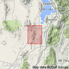
Is the oldest formation mapped (geologic map) in the Tintic mining district. Occurs on west side of map in Juab Co, UT in the Great Basin province. South of Mammoth Gulch, in southwest part of map, the grayish-white to very pale pink, even-grained, quartz sandstone is represented by numerous inclusions of sandstone in Tertiary monzonite. Three joint systems recognized. Correlated with other Cambrian quartzites. Assigned to the Early Cambrian. Revised in that it underlies the newly named Ophir formation.
Source: GNU records (USGS DDS-6; Denver GNULEX).
- Usage in publication:
-
- Tintic quartzite*
- Modifications:
-
- Areal extent
- Overview
- AAPG geologic province:
-
- Great Basin province
Summary:
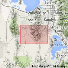
Mapped northwest of Ophir, north of the Tintic district in Tooele Co, UT in the Great Basin province. Geologic map. Is the oldest unit mapped (geologic map). Underlies Lower and Middle Cambrian Ophir formation, a contact considered gradational in this report. Consists almost entirely of white (fresh), rusty (weathered) quartzite 300+ ft thick. Is made up of well-rounded quartz grains, poorly sorted and well cemented. Occurs in beds one-half inch to 6 ft thick. Some beds cross-bedded. Thin argillaceous layers are schistose. Assigned to the Early Cambrian on basis of stratigraphic position. Stratigraphic table; cross section.
Source: GNU records (USGS DDS-6; Denver GNULEX).
- Usage in publication:
-
- Tintic quartzite*
- Modifications:
-
- Mapped 1:25k
- Overview
- Dominant lithology:
-
- Quartzite
- AAPG geologic province:
-
- Wasatch uplift
Summary:
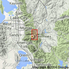
Mapped in southwestern and western part of study area in Wasatch Mountains of north-central UT, Salt Lake and Utah Cos, Wasatch uplift. Consists almost entirely of quartzite, though includes some conglomerate near base and some thin beds and shale partings mainly in upper part. Quartzite is white or faintly flesh-tinted and of medium to coarse texture; cross-bedding is common. Cross sections; measured sections; generalized section. Exposed thickness is about 800 ft. Equivalent to lower part of Brigham quartzite of northeastern UT. Overlies Cambrian? tillite and pre-Cambrian rocks in places with a distinct angular unconformity; underlies Ophir shale. Assigned Early Cambrian age based on correlation and stratigraphic position.
Source: GNU records (USGS DDS-6; Denver GNULEX).
- Usage in publication:
-
- Tintic quartzite
- Modifications:
-
- Revised
- AAPG geologic province:
-
- Uinta uplift
Summary:
Name applied in the western Uinta Mountains, Summit Co, UT on the Uinta uplift, to a cliff-forming 350 to 450 ft thick yellow to light-brown-weathering quartzitic sandstone formerly called Pine Valley quartzite. Pine Valley was thought to be younger than Ophir shale. Geologic relationships show that: 1) the quartzitic sandstone unconformably overlies a brown, gray micaceous shale of the newly named pre-Cambrian Red Pine shale, upper formation of the Uinta Mountain group; and 2) a thin (20 ft), brown, micaceous shale that has trilobite fragments and interbedded quartzite above the Tintic is the Cambrian Ophir shale. Geologic map. Columnar section. Assigned to the Cambrian.
Source: GNU records (USGS DDS-6; Denver GNULEX).

- Usage in publication:
-
- Tintic quartzite*
- Modifications:
-
- Overview
- AAPG geologic province:
-
- Wasatch uplift
- Great Basin province
Summary:
Extensively exposed and present in subsurface in mine workings in East Tintic Mountains, Utah and Juab Cos, UT on the Wasatch uplift and Great Basin provinces respectively. Is 2,300 to 3,200 ft thick. Underlies Packard quartz latite. Detailed lithologic description. Section 2517 ft thick measured in E1/2 sec 3, T10S, R3W (lower half) and NE1/4 sec 11, T10S, R3W where it overlies Big Cottonwood formation unconformably and underlies Ophir formation. Unfossiliferous in district. Early Cambrian age established in area to east.
Source: GNU records (USGS DDS-6; Denver GNULEX).
- Usage in publication:
-
- Tintic Quartzite*
- Modifications:
-
- Overview
- AAPG geologic province:
-
- Paradox basin
Summary:
Represents a transgressive clastic deposit at base of Cambrian section in Paradox Basin in central UT. Basal clastic unit is referred to as Tintic in central UT, Ignacio Quartzite in southwestern CO, and as Tapeats Sandstone in northern AZ. Boundary between Tintic and Ignacio is undefined and arbitrary. Tintic is present over most of eastern UT, though is not exposed anywhere in Paradox basin; Ignacio is exposed on southeast side of Paradox Basin. Isopach map of combined Tintic-Ignacio (plate 7); stratigraphic charts; cross sections. Is thickest along zones oriented southwest-northeast along a line connecting Monument upwarp with Naturita, CO, and along a northern trough that extends through Moab, UT. To northwest, Tintic ranges between 100-170 ft on and adjacent to the San Rafael Swell. Unconformably overlies Precambrian rocks; conformably underlies Ophir Formation. In the western Paradox Basin where name Tintic is used, basal unit has been dated as Early and Middle Cambrian; in east, where name Ignacio is used, basal clastic unit is considered Late Cambrian age.
Source: GNU records (USGS DDS-6; Denver GNULEX).
For more information, please contact Nancy Stamm, Geologic Names Committee Secretary.
Asterisk (*) indicates published by U.S. Geological Survey authors.
"No current usage" (†) implies that a name has been abandoned or has fallen into disuse. Former usage and, if known, replacement name given in parentheses ( ).
Slash (/) indicates name conflicts with nomenclatural guidelines (CSN, 1933; ACSN, 1961, 1970; NACSN, 1983, 2005, 2021). May be explained within brackets ([ ]).