

- Usage in publication:
-
- Sussex sandstone member*
- Modifications:
-
- Named
- Dominant lithology:
-
- Sandstone
- AAPG geologic province:
-
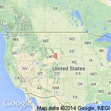
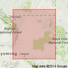
- Powder River basin
Summary:
Pg. 3-11. Sussex sandstone member of Cody shale. Surface and subsurface. Known primarily in subsurface; recognized on electric logs for 75 miles on west and south margins of Powder River basin. Light-gray, fine-grained, glauconitic marine sandstone about 40 feet thick where best developed in Sussex and North Meado Creek oil fields. Occurs above Shannon sandstone member and below Parkman sandstone member. Fossils; shark teeth reported from cored section in Sussex field. Age is Late Cretaceous. Report includes E-log cross section, nomenclature char.
Present in Powder River basin. Exposed at surface near Salt Creek oil field [Natrona Co., WY].
Source: US geologic names lexicon (USGS Bull. 1200, p. 867-3782-3783); supplemental information from GNU records (USGS DDS-6; Denver GNULEX).

- Usage in publication:
-
- Sussex Sandstone Member*
- Modifications:
-
- Overview
- Dominant lithology:
-
- Sandstone
- AAPG geologic province:
-
- Powder River basin
Summary:
Divided into 9 units in the Powder River basin. Two of these units are formal. The Shannon Sandstone Member contains a baculite restricted to rocks of late Eagle age. The Sussex Sandstone Member has a baculite of very late Eagle age. Steele ranges in age from late Santonian to early Campanian at the base to early Campanian to late Campanian at the top. Correlation of Shannon and Sussex Members with other units in south-central WY shown on Table 1.
Source: GNU records (USGS DDS-6; Denver GNULEX).
- Usage in publication:
-
- Sussex Sandstone [Member]
- Modifications:
-
- Revised
- Overview
- AAPG geologic province:
-
- Powder River basin
Summary:
Within Triangle U field, Campbell Co, WY, Powder River basin, Sussex Sandstone [Member] of Cody Shale divided [informally] into an upper "A" sandstone (main producing sandstone of Triangle U) which has a maximum gross thickness of 10 ft; a middle shale about 20 ft thick; and a lower "B" sandstone about 20 ft thick (correlates with producing sandstone of House Creek field). A distinctive bentonite marker bed ("Sussex bentonite marker") occurs 15 ft above "A" sandstone. Between bentonite marker and "A" sandstone is an interval of shale described as very dark gray, hard, brittle, silty, poker chip, and micaceous. "A" sandstone is thin, narrow, and persistent along strike; thins both updip and downdip and is replaced laterally by shale; porosities range up to 17 percent in one of four cores taken in field. Middle shale is very dark gray with thin siltstone beds and abundant "blebs" of siltstone to sandstone; also contains dark gray mudstone. "B" sandstone is poorly developed in Triangle U with porosities generally less than 10 percent. "A" and "B" sandstones were deposited in middle to outer shelf in water depths of 100-200 ft or deeper. Underlies Sharon Springs Shale [Member] of Cody; overlies unnamed shale member of Cody. Core descriptions. Cross sections.
Source: GNU records (USGS DDS-6; Denver GNULEX).
- Usage in publication:
-
- Sussex Sandstone Member*
- Modifications:
-
- Not used
Summary:
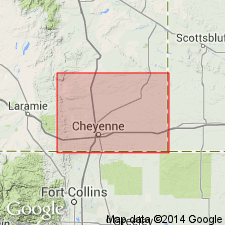
Nomenclature applied to divisions of the Pierre Shale in exposures at Francis Ranch, secs 7-10 and 15-16, T14N, R69W and in subsurface in Apache Corp. 1 Polo Ranch, sec 14, T14N, R68W, Laramie Co, WY, Denver basin modified. Term: 1) Gammon Ferruginous Member replaces use of lower transition zone; 2) Mitten Black Shale Member replaces use of rusty zone; 3) Hygiene replaces use of the subsurface Sussex; 4) Rocky Ridge, Larimer, and Richard Sandstone Members replace use of the subsurface Parkman. Terry Sandstone Member of Pierre in the Fort Collins, CO area is equivalent to the subsurface Sussex and is not present at Francis Ranch or in the Apache Corp. well. Use of Shannon, Sussex, and Parkman is discontinued in the Denver basin because the sandstones of the Denver basin are not time-equivalents or time-transgressive facies of the Shannon, Sussex, or Parkman of the Powder River basin. As modified, divisions of Pierre are (ascending): Gammon, Sharon Springs, Mitten, Hygiene Members, unnamed interval, Rocky Ridge Sandstone Member, unnamed interval, Larimer Sandstone Member, unnamed interval, Richard Sandstone Member, unnamed interval, units A, B, C, unnamed interval. Pierre overlies Niobrara Formation and underlies Fox Hills Sandstone. Of Campanian age. Measured section; nomenclature chart.
Source: GNU records (USGS DDS-6; Denver GNULEX).
- Usage in publication:
-
- Sussex Sandstone Bed*
- Modifications:
-
- Revised
- AAPG geologic province:
-
- Powder River basin
Summary:
Reduced in rank and assigned to Steele Member (revised) of Cody Shale (revised). Shown on stratigraphic chart of Upper Cretaceous rocks in subsurface of western part of Powder River basin, WY (fig 3). Shale of Steele directly overlies and underlies Sussex. Parkman Sandstone Member of Mesaverde Formation overlies shale above Sussex; Shannon Sandstone Beds (revised) of Steele underlies shale below Sussex. Assigned Campanian age. [Author provides no discussion of stratigraphic reassignments.]
Source: GNU records (USGS DDS-6; Denver GNULEX).

- Usage in publication:
-
- Sussex Sandstone Member*, Bed*
- Modifications:
-
- Revised
- Areal extent
- AAPG geologic province:
-
- Powder River basin
Summary:
Pierre Shale identified in subsurface of eastern Powder River basin in WY in Niobrara, Weston, eastern Campbell, and Crook Cos, and in MT in Powder River and eastern Big Horn Cos. Pierre divided (ascending) into Gammon Ferruginous, Mitten and Red Bird Silty Members, and an unnamed upper part. Pierre overlies Niobrara Formation and underlies Fox Hills Sandstone. To west, name Pierre replaced by (ascending) Steele Shale (and its Ardmore Bentonite-newly assigned--in lower part, Sussex and Shannon Sandstone Members which are separated by, overlain and underlain by unnamed parts of Steele), Mesaverde Formation (and its Parkman Sandstone Member, at base, unnamed middle part, Teapot Sandstone Member at top), and Lewis Shale (and its unnamed upper and lower parts separated by Teckla Sandstone Member). Sussex and Shannon Members of Steele continue eastward under basin, and they become (new assignment) Sussex and Shannon Sandstone Beds of Gammon Member. Ardmore also continues eastward where it becomes (new assignment) a bed at or near base of Mitten. Red Bird is equivalent to Parkman, basal member of Mesaverde to west. Of Late Cretaceous age. [This nomenclature shown on 22 cross sections in this OC series.]
Source: GNU records (USGS DDS-6; Denver GNULEX).
For more information, please contact Nancy Stamm, Geologic Names Committee Secretary.
Asterisk (*) indicates published by U.S. Geological Survey authors.
"No current usage" (†) implies that a name has been abandoned or has fallen into disuse. Former usage and, if known, replacement name given in parentheses ( ).
Slash (/) indicates name conflicts with nomenclatural guidelines (CSN, 1933; ACSN, 1961, 1970; NACSN, 1983, 2005, 2021). May be explained within brackets ([ ]).