

- Usage in publication:
-
- Straight Cliffs sandstone*
- Modifications:
-
- Original reference
- Dominant lithology:
-
- Sandstone
- AAPG geologic province:
-
- Plateau sedimentary province
- Paradox basin
Summary:
Straight Cliffs sandstone. Very massive beds of light-yellowish or buff-brown fine- to medium-grained sandstone. Most of the hard massive beds are 3 to 10 feet thick, but some exceed 60 feet. In several parts of Kaiparowits Plateau region contains workable beds of coal. In some districts thin streaks of carbonaceous shale and poor coal occur almost from bottom to top of formation, but in other districts there is no coal. The chief coal zone is in middle third of formation, where beds 15 to 20 feet thick occur. Thickness 900 to 1,250 feet. Conformably overlies Tropic shale and conformably underlies Wahweap sandstone. The long line of nearly rectilinear cliffs fronting toward Escalante Valley is made by this formation and suggests the name Straight Cliffs, which has been applied to it. Age is Late Cretaceous (uppermost Colorado).
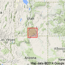
[Present in Kaiparowitz Plateau, central southern UT.]
Source: US geologic names lexicon (USGS Bull. 896, p. 2074).
- Usage in publication:
-
- Straight Cliffs Formation*
- Modifications:
-
- Revised
- AAPG geologic province:
-
- Plateau sedimentary province
Summary:
Divided into four newly named members--Tibbet Canyon (base), Smoky Hollow, John Henry, and Drip Tank Members (described in measured sections). Was deposited in marine and nonmarine environments on the southwest side of Late Cretaceous Western Interior seaway in Plateau sedimentary province. Fossil evidence indicates it ranges from middle Turonian to early Campanian, Late Cretaceous age.
Source: GNU records (USGS DDS-6; Denver GNULEX).
- Usage in publication:
-
- Straight Cliffs Formation*
- Modifications:
-
- Biostratigraphic dating
- AAPG geologic province:
-
- Plateau sedimentary province
Summary:
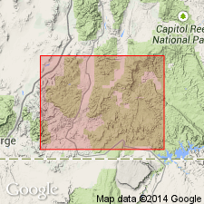
Is Upper Cretaceous formation present in vicinity of the Markagunt Plateau, Kane Co, southwestern UT (Plateau sedimentary province). In the study area is informally divided into a lower and an upper unit. The lower unit is the lithostratigraphic equivalent of the Tibbet Canyon Member of the Straight Cliffs Formation of the Kaiparowits Plateau and may be partly older. The upper unit is lithostratigraphically equivalent to the Smoky Hollow and John Henry Members of the Straight Cliffs Formation in the Kaiparowits Plateau, although evidently it is not as young as the John Henry Member. The palynoflora of the lower unit includes about 15 taxa of pollen and spores, all of which are present also in the upper unit of the Straight Cliffs, and 7 or more dinocyst taxa, which are not present in the upper unit. This assemblage is not age-definitive, but falls within the NYSSAPOLLENITES ALBERTENSIS Interval Zone of Cenomanian through Turonian age. The palynoflora of the upper unit of the Straight Cliffs includes about 45 taxa of pollen and spores and no dinocysts. Several species in this assemblage are suggestive of the PROTEACIDITES RETUSUS Interval Zone and indicate an age of early Coniacian.
Source: GNU records (USGS DDS-6; Denver GNULEX).
For more information, please contact Nancy Stamm, Geologic Names Committee Secretary.
Asterisk (*) indicates published by U.S. Geological Survey authors.
"No current usage" (†) implies that a name has been abandoned or has fallen into disuse. Former usage and, if known, replacement name given in parentheses ( ).
Slash (/) indicates name conflicts with nomenclatural guidelines (CSN, 1933; ACSN, 1961, 1970; NACSN, 1983, 2005, 2021). May be explained within brackets ([ ]).