- Usage in publication:
-
- Stony Gap sandstone
- Modifications:
-
- Named
- Dominant lithology:
-
- Sandstone
- AAPG geologic province:
-
- Appalachian basin
Summary:
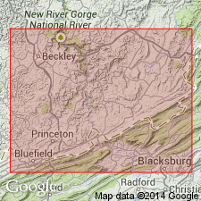
Named Stony Gap sandstone. Light gray or white, massive, coarse, and extremely hard and quartzitic sandstone, usually varying in thickness from 35 to 85 ft. Almost totally devoid of pebbles. Cliff former. Is basal unit of Hinton group. Underlain by the Bluefield group of Mauch Chunk Series; overlain by the Lower Bellepoint shale.
Source: GNU records (USGS DDS-6; Reston GNULEX).
- Usage in publication:
-
- Stony Gap Sandstone Member*
- Modifications:
-
- Overview
- AAPG geologic province:
-
- Appalachian basin
Summary:
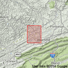
Used as Stony Gap Sandstone Member is basal unit of Hinton Formation. Consists of white to very light gray, very fine to medium-grained, thin- to thick-bedded, resistant quartzose ridge-forming sandstone in most places; very thin and possibly absent locally. Thickness ranges from about 1 to 100 ft. Underlain by Bluefield Formation; overlain by unnamed member of Hinton Formation.
Source: GNU records (USGS DDS-6; Reston GNULEX).
- Usage in publication:
-
- Stony Gap Sandstone Member*
- Modifications:
-
- Overview
- AAPG geologic province:
-
- Appalachian basin
Summary:
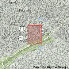
Mapped as Stony Gap Sandstone Member of Pennington Formation. Consists largely of sandstone, light-to very light gray, locally very light greenish gray; very fine to fine grained, very quartzose to somewhat clayey; silica cemented, strongly consolidated, faintly laminated, cross stratified; weathers blocky and forms thick ledges and prominent cliffs; basal contact generally sharp and conformable, locally intertongued, locally disconformable. Upper half locally includes tongue of silty clay shale, variegated grayish red and light olive gray with some medium gray, even- to wavy-laminated; shale locally grades into siltstone having similar colors and sedimentary structural features, may contain a few thin lenticular beds of limestone; more than 100 feet thick on northeastern end of Pine Mountain front, thins markedly southwestward and may pinch out locally west of Blowing Rock Gap. Thickness of Stony Gap Member is 260 to 340 ft. Underlain by Newman Limestone; overlain by Little Stone Gap Member of Pennington Formation.
Source: GNU records (USGS DDS-6; Reston GNULEX).
- Usage in publication:
-
- Stony Gap Sandstone Member
- Modifications:
-
- Revised
- AAPG geologic province:
-
- Appalachian basin
Summary:
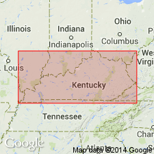
Pennington Group in eastern KY is divided into (ascending) Bluefield Formation, Hinton Formation, Princeton Sandstone, and Bluestone Formation. Stony Gap Sandstone Member occurs at the base of the Hinton, while Little Stone Gap Member occurs near the top of the Hinton. Stony Gap is referred to as "Maxon sand" by drillers. Varies from siliceous to calcareous sandstone and in places is interbedded with shales. Age is Late Mississippian.
Source: GNU records (USGS DDS-6; Reston GNULEX).
- Usage in publication:
-
- Stony Gap Member*
- Modifications:
-
- Overview
- AAPG geologic province:
-
- Appalachian basin
Summary:
Lower unnamed member of Pennington Formation is approximately equivalent to Stony Gap Member of Hinton Formation in other parts of Appalachian basin.
Source: GNU records (USGS DDS-6; Reston GNULEX).
- Usage in publication:
-
- Stony Gap Sandstone Member
- Modifications:
-
- Overview
- AAPG geologic province:
-
- Appalachian basin
Summary:
Hinton Formation is divided into seven distinct lithologic members in the report area: the Stony Gap Sandstone Member at the base, the middle red member, the Little Stone Gap Member, the middle shale member of Englund (1968), the Tallery Sandstone Member, the Pratter Shale Member, and the upper shale member of Englund (1968). The Stony Gap, also known as the "Maxon" or "Middle Maxon" by drillers, consists of light-gray to white, fine-grained sandstone with interbedded medium-gray siltstone and shale. In some areas in central and northwestern Buchanan, Dickenson, and Wise Cos, the member grades laterally to siltstone. Thickness ranges from 0 to 180 ft. Age is Late Mississippian (Chesterian).
Source: GNU records (USGS DDS-6; Reston GNULEX).
For more information, please contact Nancy Stamm, Geologic Names Committee Secretary.
Asterisk (*) indicates published by U.S. Geological Survey authors.
"No current usage" (†) implies that a name has been abandoned or has fallen into disuse. Former usage and, if known, replacement name given in parentheses ( ).
Slash (/) indicates name conflicts with nomenclatural guidelines (CSN, 1933; ACSN, 1961, 1970; NACSN, 1983, 2005, 2021). May be explained within brackets ([ ]).

