

- Usage in publication:
-
- Stingy Creek Member*
- Modifications:
-
- Named
- Dominant lithology:
-
- Limestone
- Siltstone
- AAPG geologic province:
-
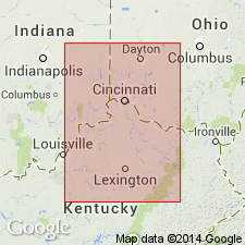
- Cincinnati arch
Summary:
Named Stingy Creek Member of Ashlock Formation (Weir and others, 1965). Composed of "...silty limestone and limy siltstone... limestone is chiefly medium light gray, fine to medium grained, and silty...obscurely thin bedded, partly in lenticles about an inch thick and a few inches long, and contains abundant brachiopods and bryozoans. The limy siltstone is chiefly light bluish gray and is gradational with the limestone with which it is interbedded. The Stingy Creek Member ranges from about 5 to 15 feet in thickness...". Underlain by Gilbert Member; overlain by Terrill Member.
Source: GNU records (USGS DDS-6; Reston GNULEX).

- Usage in publication:
-
- Stingy Creek Member*
- Modifications:
-
- Overview
- AAPG geologic province:
-
- Cincinnati arch
Summary:
The Stingy Creek Member of the Ashlock Formation in south-central KY consists of gray, thin-bedded, limy siltstone and silty limestone that contains abundant brachiopods and bryozoans. Thickness is 5 to 15 feet. Overlies the Tate Member and underlies the Gilbert Member, both of the Ashlock Formation. The environment of deposition is interpreted to be wave-agitated shoals on a sloping shelf.
Source: GNU records (USGS DDS-6; Reston GNULEX).
- Usage in publication:
-
- Stingy Creek
- Modifications:
-
- Not used
- AAPG geologic province:
-
- Cincinnati arch
Summary:
The Cincinnatian Series is divided into five depositional sequences in this report, which correspond to lithostratigraphic units. The following stratigraphic names in KY should be abandoned as they have been applied to bodies of rock already named in downramp areas of OH and IN: Bardstown (=Lower Whitewater), Reba (=Oregonia), Stingy Creek (=Mount Auburn), Calloway Creek (=Bellevue), and Clays Ferry (=Fairview). The following units in KY, OH, and IN lump dissimilar facies and straddle sequence boundaries and therefore should be abandoned: Drakes, Ashlock, Dillsboro, Tanners Creek, and Bull Fork. Grant Lake has been defined in several different ways and consequently should be abandoned. Several units will be redefined at a later date, including the Upper Whitewater and the "Sunset" and "Saluda" of OH and IN. Formal naming of new lithostratigraphic units will follow further study.
Source: GNU records (USGS DDS-6; Reston GNULEX).
For more information, please contact Nancy Stamm, Geologic Names Committee Secretary.
Asterisk (*) indicates published by U.S. Geological Survey authors.
"No current usage" (†) implies that a name has been abandoned or has fallen into disuse. Former usage and, if known, replacement name given in parentheses ( ).
Slash (/) indicates name conflicts with nomenclatural guidelines (CSN, 1933; ACSN, 1961, 1970; NACSN, 1983, 2005, 2021). May be explained within brackets ([ ]).